
Geichlingen
| coat of arms | Germany map | |
|---|---|---|

|
Coordinates: 49 ° 57 ' N , 6 ° 16' E |
|
| Basic data | ||
| State : | Rhineland-Palatinate | |
| County : | Eifel district Bitburg-Prüm | |
| Association municipality : | South Eifel | |
| Height : | 330 m above sea level NHN | |
| Area : | 5.32 km 2 | |
| Residents: | 415 (Dec. 31, 2019) | |
| Population density : | 78 inhabitants per km 2 | |
| Postal code : | 54675 | |
| Area code : | 06566 | |
| License plate : | BIT, PRÜ | |
| Community key : | 07 2 32 040 | |
| Association administration address: | Pestalozzistraße 7 54673 Neuerburg |
|
| Website : | ||
| Local Mayor : | Erwin Kaufmann | |
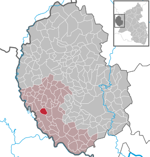
| Location of the local community Geichlingen in the Eifelkreis Bitburg-Prüm | ||
  |
||


Geichlingen is a municipality in the Eifelkreis Bitburg-Prüm in Rhineland-Palatinate . It belongs to the community of southern Eifel .
geography
location
Geichlingen is 35 kilometers northwest of Trier , a few kilometers from the border with Luxembourg and the Luxembourg border town Vianden .
Geichlingen is situated on the western edge of the southern Eifel and also on the edge of the Gutland , which borders the Islek in the north and - like the southern Eifel - the Ösling in the west. The village is also located in the Südeifel Nature Park , the German part of the German-Luxembourg Nature Park .
Geichlinger Bach, local structure, local development
The Geichlinger Bach , formerly also called Lützergaybach or Litzergay , flows through the narrow forest valley north of Geichlingen, officially called Berscheiderbachtal , which already characterizes the landscape of the Islek , at the end of which the northeastern, lowest-lying district is called Op da Baach [ ɒp] by the locals da baːχ ] (on the / the brook) , and flows 3 km further south near the village of Körperich in the Gaybach .
history
Origin of the place
The first documentary mention of the place comes from the year 1096, when a Gerhard von Vianden entered the Echternach Abbey and he gave his "Hof Geichlingen with all accessories to serfs , farms, churches, mills, lands, hunting and fishing rights". The mention of the place in a papal document for the Echternach Abbey from the year 1069, which has only survived as a copy of the 12th century, probably goes back to a later addition.
Already existing in 1096, Geichlingen could, according to the place name, belong to the -ingen places of the Franconian conquest time . However, since there are no Franconian graves, the place is likely to be an expansion settlement from the Carolingian era , for which a neighboring -ingen-Orten analogous place name was chosen.
Until the French occupation in 1794
Geichlingen was the capital of a dairy farm of the same name in the county of Vianden under Luxembourg sovereignty . In addition to Geichlingen, the administrative and judicial district of the Geichlingen dairy also included the neighboring villages of Gentingen , Hommerdingen , Körperich , Roth and Seimerich as well as the villages of Bettel , Fouhren and Longsdorf, which are now in Luxembourg .
In 1794 French revolutionary troops occupied the Austrian Netherlands , to which the Duchy of Luxembourg belonged, and annexed it in October 1795 . From 1795 to 1814 the place belonged to the canton Vianden in the forest department . Geichlingen was the seat of a Mairie .
Territory and administrative structure since 1815
In 1815, the former Luxembourg area east of the Sauer and Our was assigned to the Kingdom of Prussia at the Congress of Vienna . Thus the place came Geichlingen 1816 Bitburg in Trier in the Grand Duchy of the Lower Rhine , which in 1822 Rheinprovinz opened.
Geichlingen was the seat of a mayor's office from 1816 to 1861 , to which only the municipality of Geichlingen belonged, from 1862 to 1922 it belonged to the mayor's office of Neuerburg-Land , from 1923 to 1972 to the mayor's office of Körperich (renamed to office in 1927) and since 1973 it has belonged to the newly formed association municipality of Neuerburg on.
Since 1946 the village has belonged to the then newly formed state of Rhineland-Palatinate, since 1970 to the newly formed district of Bitburg-Prüm, renamed in 2007 to "Eifelkreis Bitburg-Prüm".
The parish of St. Laurentius Geichlingen belongs to a parish community with the other parishes of Körperich (the pastor's seat), Kruchten and Nusbaum in the deanery of St. Willibrord Westeifel in the diocese of Trier .
- Population development
The development of the population of the municipality of Geichlingen, the values from 1871 to 1987 are based on censuses:
|
|
;_Bev%C3%B6lkerungsentwicklung.jpg)
politics
Municipal council
The municipal council in Geichlingen consists of eight council members, who were elected by a majority vote in the local elections on May 26, 2019 , and the honorary local mayor as chairman.
coat of arms
|
|
Blazon : "Divided by a blue bar and split at the top, horizontally striped red-white-red in front, a red glaive cross in white at the back, a black grate in white at the bottom." |
Culture and sights
Buildings
Village church
The parish church of St. Laurentius is a hall church and consists of the hall, which dates back to 1757 and was extended to the east in 1822, a tower built on the southern long side, the ground floor of which probably dates back to the Middle Ages, and a modern sacristy with a flat roof.
The exterior of the building is stylistically inconsistent, with a baroque portal on the west side and arched windows from the 18th century, a three-wheel in the gable above the portal that was taken over from the previous building and a surrounding window ledge added during the renovation in 1822 . The undivided tower with an eight-sided pointed spire received its current appearance in the 18th or 19th century.
The interior has four bays with cross vaults . The choir in the eastern yoke is raised by one step and otherwise not separated. A high altar with tabernacle and two-sided wooden partition walls, a side altar and a pulpit in Rococo style date from the time it was built and given its present painting at a interior renovation in the 1970s. A round archway leads to the ground floor of the tower, where the confessional is located. On the west side there is a wooden gallery supported by two cast iron columns. The stalls are from the 19th century. In 2008 the church received a positive organ that was temporarily placed in the choir room .
More buildings
The core of the former rectory dates from the late 18th century and was rebuilt in 1830. The current door frame with the name of Pastor Pütz and the rectangular windows date from this time. What is now probably the oldest house in the village was last extensively renovated around 1980.
From the time from the beginning of the 19th century, there are still some partially well-preserved typical regional farmhouses or farms that are listed as cultural monuments.
The former village school with a teacher's apartment, built around 1920/30, is a two-storey hipped roof building with a facade design influenced by reform architecture . With the old school hall on the ground floor, it is now a village community center.
See also: List of cultural monuments in Geichlingen

Events and customs
The biggest of the recurring village and club festivals is the squeeze festival, which has been held on the first weekend in September since 1991, along with a market, entertainment program and dance music. The name refers to the plum cake made from yeast dough, which is called Kuäätschentoat [ kuˈɛːtʃən.ˈtoat ] or -taart [ taːʁt ] in the region .
Local customs are general Catholic customs, the moving of the Möhnen from house to house on Weiberfastnacht, the hut or castle burning on the Sunday after Ash Wednesday, the “egg laying” on Easter Sunday and the setting up of the maypole by the village youth.
dialect
The local dialect, mostly known as Platt , the Eifler dialect , a Moselle-Franconian dialect , is still widespread into the younger generation, as in the entire region.
Economy and Infrastructure
Economy, neighborhood to Luxembourg
Agriculture was the main source of income in the village until the second half of the 20th century. Today the largest company in town is a large furniture store with a joinery, with many employees from the surrounding region.
A large part of the workforce works in the region, many of them as cross-border commuters in Luxembourg. As in the entire border region, the small neighboring country is also an important sales market for local businesses.
For some years now, as a result of the sharp rise in land prices in Luxembourg, more and more Luxembourg citizens have been settling in conveniently located German towns near the border - including Geichlingen.
Infrastructure
Otherwise, Neuerburg, 12 km or 15 minutes away by car, is close to the basic supply .
The closest medium- sized center Bitburg and the federal highway 60 can be reached via the federal highway 50 running through the town in 24 km or 25 minutes by car, in another 5 km from Bitburg the Bitburg-Erdorf train station with connection to the Eifel-Mosel-Express / Eifelbahn railway lines , the nearest regional center Trier is about 50 km or 45 minutes by car, the city of Luxembourg and the international airport Luxembourg -Findel are also about 50 km.
The federal road 50 as well as the district roads 6 and 53 connect Geichlingen with the neighboring villages Berscheid (5 km), Nasingen (4 km), Niedergeckler (4 km), Lahr (3 km) and Obersgegen (3 km).
There are mainly bus connections on weekdays in the Verkehrsverbund Region Trier (VRT) to Neuerburg and Bitburg, among others, geared towards school transport .
literature
- Ernst Wackenroder (arr.): The art monuments of the Bitburg district (= Paul Clemen [Hrsg.]: The art monuments of the Rhine province . Volume 12 / I ). Trier 1983, ISBN 3-88915-006-3 , p. 111 (315 p., With 12 plates and 227 illustrations in the text. Reprinted by the Schwann edition, Düsseldorf 1927).
- Matthias Emil Hubsch: Family book of the parish Sankt Laurentius in Geichlingen 1779-1899, as well as the localities Bauler, Nasingen and Bierendorf (Lahr) until 1801. Cologne 2003, ISBN 3-933364-89-2 .
Web links
- To search for cultural assets of the Geichlingen community in the database of cultural assets in the Trier region .
- On www.region-trier.de , the place name as a search term provides a lot of information, mostly related to monument preservation.
Individual evidence
- ↑ State Statistical Office of Rhineland-Palatinate - population status 2019, districts, communities, association communities ( help on this ).
- ^ A b Ferdinand Pauly : Settlement and parish organization in the old Archdiocese of Trier. Volume 8: The Mersch Country Chapter. Trier 1970, page 69 ff. ( Quoted in Hubsch 2003.)
- ↑ State Statistical Office Rhineland-Palatinate: My village, my city. Retrieved August 6, 2019 .
- ^ The Regional Returning Officer Rhineland-Palatinate: Local elections 2019, city and municipal council elections. Retrieved August 6, 2019 .
- ^ General Directorate for Cultural Heritage Rhineland-Palatinate (ed.): Informational directory of cultural monuments - Eifelkreis Bitburg-Prüm. Mainz 2018, p. 41 f. (PDF; 4.4 MB).
- ↑ 500 residents in sight. In: Trierischer Volksfreund. November 6, 2007, accessed August 6, 2019 .
Affler | Alsdorf | Altscheid | Ammeldingen on the Our | Ammeldingen near Neuerburg | Bauler | Berkoth | Berscheid | Biesdorf | Bollendorf | Castle | Dauwelshausen | Echternacherbrück | Eisenach | Emmelbaum | Ernzen | Ferschweiler | Fischbach-Oberraden | Geichlingen | Gemünd | Gentingen | Gilzem | Heilbach | Autumn Mill | Holsthum | Hommerdingen | Huts | Hüttingen near Lahr | Irrel | Karlshausen | Kaschenbach | Keppeshausen | Body | Koxhausen | Kruchten | Lahr | Leimbach | Menningen | Mettendorf | Minden | Muxerath | Nasingen | Neuerburg | Niedergeckler | Niederraden | Niederweis | Niehl | Walnut tree | Obergeckler | Peffingen | Plascheid | Prümzurlay | Rodershausen | Roth an der Our | Schankweiler | Log basket | Chafing | Sevenig near Neuerburg | Sinspelt | Überisenbach | Uppershausen | Utscheid | Waldhof-Falkenstein | Wallendorf | Weidingen | Doubt decision