
Kruchten
| coat of arms | Germany map | |
|---|---|---|

|
Coordinates: 49 ° 54 ' N , 6 ° 19' E |
|
| Basic data | ||
| State : | Rhineland-Palatinate | |
| County : | Eifel district Bitburg-Prüm | |
| Association municipality : | South Eifel | |
| Height : | 323 m above sea level NHN | |
| Area : | 5.38 km 2 | |
| Residents: | 368 (Dec. 31, 2019) | |
| Population density : | 68 inhabitants per km 2 | |
| Postal code : | 54675 | |
| Primaries : | 06566, 06526 | |
| License plate : | BIT, PRÜ | |
| Community key : | 07 2 32 069 | |
| Association administration address: | Pestalozzistraße 7 54673 Neuerburg |
|
| Website : | ||
| Mayoress : | Franziska Hermes | |
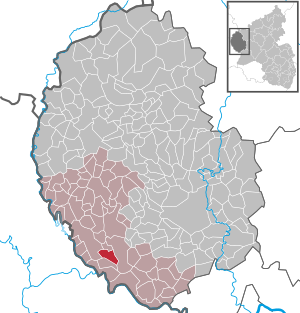
| Location of the local community Kruchten in the Eifelkreis Bitburg-Prüm | ||
  |
||

.jpg)
Kruchten is a municipality in the Eifelkreis Bitburg-Prüm in Rhineland-Palatinate . It belongs to the community of southern Eifel .
geography
The community is located in the South Eifel Nature Park . The hamlets of New Africa and Schwarzenbruch also belong to Kruchten .
history
Finds of stone axes and other objects from the Stone Age prove that Kruchten was already settled in early history. The Romans also left traces, which is evident from the finds of coins and the remains of the wall. From around AD 400, the Romans were ousted by the Franks , as evidenced by grave sites.
The Franks divided the area into Gaue . Around 850 the seat of the count is moved from Trier to Bitburg . The district was henceforth called Bed-Gowe ( Beda-Gau ). The expression "Bekow", which is still popular today, refers to the old Gau, but no longer corresponds to the same area. The first documents about Kruchten date from this time as "Cruten" from the years 751 and 763. Whether these documents mean Kruchten ( Eifel ) or Cruchten ( Luxembourg ) cannot be determined with absolute certainty. The first document definitely referring to Kruchten (Cruten uff dem Ebent) comes from the year 907, in which Count Reginar Langhals returned the "Gut Cruten" to the hospital in Echternach , from which it had been illegally withdrawn before 849.
In the following centuries Kruchten was repeatedly mentioned in documents under different names: 1161 Crufta - 1346 Cruchten - 1547 Crochten - 1570 Cruichten - 1623 Cruchten - 1933 Kruchten
The south-western Eifel region and thus also Kruchten has changed its territorial affiliation several times, but remained Luxembourgish for centuries . In 1443 the whole area came to the House of Burgundy , from 1482 to 1555 it belonged to the House of Habsburg , after which it fell to France. From 1698 to 1715 it was part of the Spanish Netherlands , from 1715 to 1795 it was part of the Duchy of Luxembourg in the county of Vianden and thus part of the Austrian Netherlands . From 1795 to 1814 it was again part of France ( Department of Forests ), then temporarily part of the Generalgouvernement Niederrhein and finally in 1815 it was part of the Kingdom of Prussia and from this in 1822 it was assigned to the Rhine Province , which it remained until 1945. In 1946, the then newly formed state of Rhineland-Palatinate came into being .
- Population development
The development of the population of Kruchten, the values from 1871 to 1987 are based on censuses:
|
|
politics
Municipal council
The municipal council in Kruchten consists of eight council members, who were elected by a majority vote in the local elections on May 26, 2019 , and the honorary local mayor as chairman.
coat of arms
|
|
Blazon : "Angled left divided into white and red with a lily end cross in mixed up colors ." |
Attractions
At the military cemetery in Kruchten-Schwarzenbruch, 88 soldiers from the Second World War found their final resting place. The cemetery is looked after by the Volksbund Deutsche Kriegsgräberfürsorge .
See also: List of cultural monuments in Kruchten
Web links
- To search for cultural assets of the local community Kruchten in the database of cultural assets in the Trier region .
Individual evidence
- ↑ State Statistical Office of Rhineland-Palatinate - population status 2019, districts, communities, association communities ( help on this ).
- ↑ State Statistical Office Rhineland-Palatinate (ed.): Official directory of the municipalities and parts of the municipality. Status: January 2019 [ Version 2020 is available. ] . S. 99 (PDF; 3 MB).
- ↑ State Statistical Office Rhineland-Palatinate: My village, my city. Retrieved July 29, 2019 .
- ^ The Regional Returning Officer Rhineland-Palatinate: Local elections 2019, city and municipal council elections
Affler | Alsdorf | Altscheid | Ammeldingen on the Our | Ammeldingen near Neuerburg | Bauler | Berkoth | Berscheid | Biesdorf | Bollendorf | Castle | Dauwelshausen | Echternacherbrück | Eisenach | Emmelbaum | Ernzen | Ferschweiler | Fischbach-Oberraden | Geichlingen | Gemünd | Gentingen | Gilzem | Heilbach | Autumn Mill | Holsthum | Hommerdingen | Huts | Hüttingen near Lahr | Irrel | Karlshausen | Kaschenbach | Keppeshausen | Body | Koxhausen | Kruchten | Lahr | Leimbach | Menningen | Mettendorf | Minden | Muxerath | Nasingen | Neuerburg | Niedergeckler | Niederraden | Niederweis | Niehl | Walnut tree | Obergeckler | Peffingen | Plascheid | Prümzurlay | Rodershausen | Roth an der Our | Schankweiler | Log basket | Chafing | Sevenig near Neuerburg | Sinspelt | Überisenbach | Uppershausen | Utscheid | Waldhof-Falkenstein | Wallendorf | Weidingen | Doubt decision