
Ferschweiler
| coat of arms | Germany map | |
|---|---|---|

|
Coordinates: 49 ° 52 ' N , 6 ° 24' E |
|
| Basic data | ||
| State : | Rhineland-Palatinate | |
| County : | Eifel district Bitburg-Prüm | |
| Association municipality : | South Eifel | |
| Height : | 345 m above sea level NHN | |
| Area : | 7.41 km 2 | |
| Residents: | 967 (Dec. 31, 2019) | |
| Population density : | 130 inhabitants per km 2 | |
| Postal code : | 54668 | |
| Area code : | 06523 | |
| License plate : | BIT, PRÜ | |
| Community key : | 07 2 32 037 | |
| Association administration address: | Pestalozzistraße 7 54673 Neuerburg |
|
| Website : | ||
| Local Mayor : | Rudolf Schmitt | |
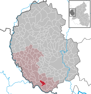
| Location of the local community of Ferschweiler in the Eifel district of Bitburg-Prüm | ||
  |
||

Ferschweiler is a municipality in the Eifelkreis Bitburg-Prüm in Rhineland-Palatinate . It belongs to the Verbandsgemeinde Südeifel . Ferschweiler is a state-approved resort .
geography
The community lies on the Ferschweiler plateau , a sandstone plateau . The Waldhof residential area also belongs to Ferschweiler .
history
Ferschweiler is mentioned for the first time in 751 in a document from the Echternach Abbey as a vilare and suggests remains of Roman settlement after the fall of the Roman Empire . The village was cared for secularly and ecclesiastically from Echternach . In documents from 1069 and 1148 the place is called Wilre , in 1161 an "ecclesia" is mentioned as Vertswiler , and in 1410 a chapel. In 1528 there are nine fireplaces (houses) in Verswiler . From a church built in the late Gothic style in 1538, the tower still stands at the same height, named after St. Lucia Luzienturm .
Since a period of Austrian rule from 1714, the economic expansion and decline of Echternach Abbey and the rule of the French from 1795 to 1814, the population of Ferschweiler increased steadily. Under Prussian administration it belonged to the Ernzen mayor in the Bitburg district, the population rose from 418 in 1816 to 746 20 years later.
Limited agricultural areas and a standstill in agricultural technology caused major waves of emigration in the second half of the 19th century. Only after the First World War was Ferschweiler able to exceed the 1000-inhabitant limit for a few years.
- Population development
The development of the population of Ferschweiler; the values from 1871 to 1987 are based on censuses:
|
|
politics
Municipal council
The municipal council in Ferschweiler consists of twelve council members, who were elected by a majority vote in the local elections on May 26, 2019 , and the honorary local mayor as chairman.
coat of arms
|
|
Blazon : “A blue oblique left bar in silver, covered with a silver sword. Above a green holly branch with four red berries, below a red glaive cross " |
| Founding of the coat of arms: Until the end of the feudal period, Ferschweiler belonged to the sphere of influence of the Echternach Abbey for more than a millennium. The Echternach Abbey had a glaive cross with an oath hand in its coat of arms. The Ferschweiler Plateau is the center of the South Eifel Nature Park, now expanded to become the German-Luxembourg Nature Park. This symbolizes the green ilex branch with four red berries. The respective parish church in Ferschweiler has been under the patronage of St. Lucia for centuries. As an indication of this, her attribute, the sword, in the bar. The colors blue and silver are an indication of the former Luxembourg nationality. |
Culture and sights

- The landmark of Ferschweiler is the Luzienturm from the 15th or 16th century
- The Ferschweiler mill from 1767 is located in the valley of the Weilerbach.
- Today's Catholic parish church of St. Luzia , built after 1826, was rebuilt from 1947 after war damage.
- Rectory from 1840
See also: List of cultural monuments in Ferschweiler
Green spaces and recreation
- Extensive hiking network in the German-Luxembourg Nature Park
- Starting point for hikes to the numerous fire graves and Villa rustica ⊙
- The Nusbaumer woman Bill Cross is about 3 km from the center ⊙
- The Bollendorfer Druidenstein ⊙ is located 3 km west of the village in the forest
- The Bollendorfer Diana monument - a Roman relief located approx. 4 km southwest of the village ⊙
- Youth tent camp Ferschweiler
- Weeping ash natural monument behind Hochstraße 11
See also: List of natural monuments in Ferschweiler
Regular events
- Annual fair or parish fair
- Traditional rattling or rattling on Good Friday and Holy Saturday
- Hut burning on the first weekend after Ash Wednesday (so-called Scheef Sunday)
traffic
The community is accessible through the district roads K 19 , K 20 and K 21 .
literature
- Ernst Wackenroder (arr.): The art monuments of the Bitburg district (= Paul Clemen [Hrsg.]: The art monuments of the Rhine province . Volume 12 / I ). Trier 1983, ISBN 3-88915-006-3 , p. 69, 101–102 (315 p., With 12 plates and 227 illustrations in the text. Reprinted by the Schwann edition, Düsseldorf 1927).
Web links
- Internet presence of the local community Ferschweiler
- To search for cultural assets of the local community Ferschweiler in the database of cultural assets in the Trier region .
- In this country: Schäferstrasse in Ferschweiler. ( Memento from July 20, 2014 in the web archive archive.today ) Landesschau Rheinland-Pfalz, SWR TV, July 16, 2014
Individual evidence
- ↑ State Statistical Office of Rhineland-Palatinate - population status 2019, districts, communities, association communities ( help on this ).
- ↑ State Statistical Office Rhineland-Palatinate (ed.): Official directory of the municipalities and parts of the municipality. Status: January 2019 [ Version 2020 is available. ] . S. 99 (PDF; 3 MB).
- ↑ State Statistical Office Rhineland-Palatinate: My village, my city. Retrieved August 5, 2019 .
- ^ The Regional Returning Officer Rhineland-Palatinate: Local elections 2019, city and municipal council elections. Retrieved August 5, 2019 .
- ↑ Declaration of the coat of arms. (PDF) Retrieved January 14, 2018 .
- ^ Ferschweiler youth camp site. Retrieved February 8, 2018 .
- ↑ Hüttenbrennen in the Eifel. Retrieved May 1, 2016 .
- ↑ Hut Sunday in the Eifel. Retrieved August 10, 2017 .
Affler | Alsdorf | Altscheid | Ammeldingen on the Our | Ammeldingen near Neuerburg | Bauler | Berkoth | Berscheid | Biesdorf | Bollendorf | Castle | Dauwelshausen | Echternacherbrück | Eisenach | Emmelbaum | Ernzen | Ferschweiler | Fischbach-Oberraden | Geichlingen | Gemünd | Gentingen | Gilzem | Heilbach | Autumn Mill | Holsthum | Hommerdingen | Huts | Hüttingen near Lahr | Irrel | Karlshausen | Kaschenbach | Keppeshausen | Body | Koxhausen | Kruchten | Lahr | Leimbach | Menningen | Mettendorf | Minden | Muxerath | Nasingen | Neuerburg | Niedergeckler | Niederraden | Niederweis | Niehl | Walnut tree | Obergeckler | Peffingen | Plascheid | Prümzurlay | Rodershausen | Roth an der Our | Schankweiler | Log basket | Chafing | Sevenig near Neuerburg | Sinspelt | Überisenbach | Uppershausen | Utscheid | Waldhof-Falkenstein | Wallendorf | Weidingen | Doubt decision