
Muxerath
| coat of arms | Germany map | |
|---|---|---|

|
Coordinates: 50 ° 0 ′ N , 6 ° 16 ′ E |
|
| Basic data | ||
| State : | Rhineland-Palatinate | |
| County : | Eifel district Bitburg-Prüm | |
| Association municipality : | South Eifel | |
| Height : | 512 m above sea level NHN | |
| Area : | 4.54 km 2 | |
| Residents: | 37 (Dec. 31, 2019) | |
| Population density : | 8 inhabitants per km 2 | |
| Postal code : | 54673 | |
| Area code : | 06564 | |
| License plate : | BIT, PRÜ | |
| Community key : | 07 2 32 084 | |
| Association administration address: | Pestalozzistraße 7 54673 Neuerburg |
|
| Website : | ||
| Local Mayor : | Rudolf Bretz | |
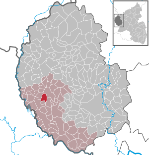
| Location of the local community Muxerath in the Eifelkreis Bitburg-Prüm | ||
  |
||

_01.jpg)
Muxerath is a municipality in the Eifelkreis Bitburg-Prüm in Rhineland-Palatinate . It belongs to the community of southern Eifel .
geography
Muxerath is located at the 535 meter high Muxerather Höhe, around 2 km southwest of Neuerburg . The community also includes the residential areas Ackelshof, Friesbornerhof, Görgenhof, Kreutzdorf and Steinshof.
history
In 1501 the place was first mentioned as Motzerait . The place has a small chapel that belongs to the parish of Neuerburg. Until the occupation of the left bank of the Rhine by French revolutionary troops in 1794 , Muxerath belonged to the Luxembourg rule of Neuerburg , in 1815 it was assigned to the Kingdom of Prussia at the Congress of Vienna . After the First and Second World War temporarily occupied by the French, the town has been part of the then newly formed state of Rhineland-Palatinate since 1946 .
In 1910 the population was 103, since then it has been declining, mainly due to rural exodus.
- Statistics on population development
The development of the population of the municipality of Muxerath, the values from 1871 to 1987 are based on censuses:
|
|
Municipal council
The council in Muxerath consists of six council members, who in the local elections on May 26, 2019 in a majority vote were elected, and the honorary mayor as chairman.
Attractions
In addition to the chapel, the Friesborner Hof and the Steinshof north of the village as well as the old smithy are to be mentioned as monuments. Not far from the village are the remains of a Siegfried Line bunker .
See also: List of cultural monuments in Muxerath
economy
Muxerath is a traditionally agricultural community.
Web links
- To search for cultural assets of the local community Muxerath in the database of cultural assets in the Trier region .
Individual evidence
- ↑ State Statistical Office of Rhineland-Palatinate - population status 2019, districts, communities, association communities ( help on this ).
- ↑ State Statistical Office Rhineland-Palatinate (ed.): Official directory of the municipalities and parts of the municipality. Status: January 2019 [ Version 2020 is available. ] . S. 100 (PDF; 3 MB).
- ↑ State Statistical Office Rhineland-Palatinate: My village, my city. Retrieved August 6, 2019 .
- ^ The Regional Returning Officer Rhineland-Palatinate: Local elections 2019, city and municipal council elections. Retrieved August 6, 2019 .
Affler | Alsdorf | Altscheid | Ammeldingen on the Our | Ammeldingen near Neuerburg | Bauler | Berkoth | Berscheid | Biesdorf | Bollendorf | Castle | Dauwelshausen | Echternacherbrück | Eisenach | Emmelbaum | Ernzen | Ferschweiler | Fischbach-Oberraden | Geichlingen | Gemünd | Gentingen | Gilzem | Heilbach | Autumn Mill | Holsthum | Hommerdingen | Huts | Hüttingen near Lahr | Irrel | Karlshausen | Kaschenbach | Keppeshausen | Body | Koxhausen | Kruchten | Lahr | Leimbach | Menningen | Mettendorf | Minden | Muxerath | Nasingen | Neuerburg | Niedergeckler | Niederraden | Niederweis | Niehl | Walnut tree | Obergeckler | Peffingen | Plascheid | Prümzurlay | Rodershausen | Roth an der Our | Schankweiler | Log basket | Chafing | Sevenig near Neuerburg | Sinspelt | Überisenbach | Uppershausen | Utscheid | Waldhof-Falkenstein | Wallendorf | Weidingen | Doubt decision