
Nieder-Ingelheim
|
Nieder-Ingelheim
Ingelheim-Mitte City of Ingelheim am Rhein
|
|
|---|---|
 |
|
| Height : | 90-135 m above sea level NHN |
| Residents : | 9540 |
| Incorporation : | April 1, 1939 |
| Postal code : | 55218 |
| Area code : | 06132 |
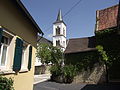
 Nieder-Ingelheim as seen from the Mainzer Berg .
|
|
Nieder-Ingelheim (also Ingelheim-Mitte ) is a district of Ingelheim am Rhein in the Mainz-Bingen district . The once independent municipality developed from the imperial palace of Charlemagne, which was built there in the 8th century. Industrialization at the beginning of the 19th century allowed Nieder-Ingelheim to grow into today's largest district.
geography
The district is located directly at the foot of the Mainzer Berg , from then on the district stretches north to the Rhine. The height of the settlement area above sea level is 90-150 meters. The Boehringer factory is the western border.
It borders the district to the north, separated by the Rhine, Oestrich-Winkel and Eltville am Rhein , to the east Heidesheim am Rhein and Wackernheim . In the inner city, Nieder-Ingelheim borders on Frei-Weinheim to the northwest , Ober-Ingelheim to the south and Ingelheim-West to the west .
geology
In the southeast of the district is the subsurface of the plateau of the Mainz mountain is provided with layers of loess and tertiary limestone that were forested in the high Middle Ages. Today these areas are used for fruit and asparagus growing, the slopes of the Mainz mountain are used for viticulture. In the north lies the river bank of the Rhine, which is characterized by floodplain landscapes with forests and pastures. There are also drift sand zones in the Rhine plain that are also used for agriculture today.
history
The area in the area of Mainzer Straße and François Lachenal- Platz was already settled in Roman times, and there were several villae rusticae . Litter finds and consecration stones also indicate vicus and villa urbana . The Roman Rhine Valley Road also ran past today's town center .

Nieder-Ingelheim, founded as a Franconian settlement in the 6th century, was the location of a Merovingian royal court even before Karl Ingelheim's imperial palace . The village finally gained great importance with the building of Charlemagne's imperial palace in the 8th century. From there the Ingelheim Empire, later Ingelheimer Grund , was ruled. The first visit of Charlemagne dates back to 774 in loco, qui dicitur Ingilinhaim . Charlemagne held the army assembly here in 788, in which Bavarian Duke Tassilo III. was convicted. He also held several farm days in Nieder-Ingelheim . After his death, his son Ludwig the Pious took over the Palatinate, who died on an island on the Rhine near Nieder-Ingelheim. Under Ludwig, the Palatinate became a representative venue for imperial assemblies , court meetings and embassy receptions . During the rule of the Ottonians , imperial synods were held in the Palatinate in 948 , 972 , 980 , 993 and 996 . The last major event was the wedding between King Heinrich III. and Agnes of Poitou , daughter of Duke Wilhelm of Aquitaine. Under Barbarossa , the imperial palace and the village of Nieder-Ingelheim were expanded into a fortress in 1160, probably as a means of pressure against Mainz which he had forced to tear down its city wall . The Archbishop of Mainz Siegfried III. personally took part in a siege of the Nieder-Ingelheim fortress. In 1190 Werner II von Bolanden had a bailiwick, but the Bolandens customs station was destroyed by the Rhenish Association of Cities in 1254 .
Around 1314 Nieder-Ingelheim was pledged with the rest of the Ingelheim property to the Mainz Archbishopric , which was pledged again to the Electoral Palatinate in 1375, thus ending imperial immediacy . With the establishment of the Augustinian canons' monastery in the Aula Regia der Pfalz in 1354 by Charles IV, he brought about the end of the imperial palace. In 1381 the village of Nieder-Ingelheim received market rights. From the 14th century they began settling in the area hall of the imperial palace one, plus also stones were used the Imperial Palace. In 1460 during the feud between the Count Palatine and Electorate of Mainz and in 1504 the village was burned down. In 1488, the best-known Ingelheim son, Sebastian Münster , was born in Nieder-Ingelheim.
The Thirty Years War from 1618 to 1648 and the plague in 1666 caused the population to stagnate. Even before industrialization, the wealth in Nieder-Ingelheim was high due to viticulture and wine trade. The opportunity to invest in agriculture and the good transport connections also prompted some wealthy people to set up their homes here at the beginning of the 19th century.
With the construction of the railway, which went into operation in 1859, Nieder-Ingelheim received a train station in the west of the district, which at that time was only called Ingelheim. With the opening of the railway line, the industrial revolution arrived in Nieder-Ingelheim and found expression in a number of newly founded factories. The pharmaceutical company Boehringer Ingelheim, founded in 1885, is a testament to this period . Industrialization let the population skyrocket and triggered a building boom in Nieder-Ingelheim. Up until the First World War, the development expanded from Grundstraße to the train station further west.
In the 1920s there were first considerations to merge with Ober-Ingelheim, but at that time they still failed. In 1939 Nieder-Ingelheim became part of the new town of Ingelheim am Rhein together with Frei-Weinheim , Ober-Ingelheim and the hamlet of Sporkenheim . In the 1960s, the Ingelheim-West district emerged on the former Nieder-Ingelheim district . In 1982 the New Town Hall on the corner of Gartenfeldstrasse and Binger Strasse in the Nieder-Ingelheim district was inaugurated.
Population development
During the period of the Thirty Years' War from 1618 to 1648 and the plague in 1666, the population stagnated only with industrialization in the 19th century, there was a boom in the population that even led to a housing shortage in the 1920s. Even today the number of inhabitants is still increasing.
| Population development | ||||
| year | Residents | |||
|---|---|---|---|---|
| 1577 | 158 | |||
| 1806 | 1335 | |||
| 1834 | 2130 | |||
| 1905 | 3435 | |||
| 2008 | 9540 | |||
politics
Before Ingelheim became a town in 1939, Nieder-Ingelheim was an independent place.
Mayor before becoming a town
- Johann Philipp Weitzel (1862 to 1882)
- Leonard Muntermann ( DDP , from 1912 to April 7, 1932)
Culture and sights
Buildings

Remigius Church (Catholic)
Romanesque tower of the hall church


The beginnings of the Catholic parish church of St. Remigius go back to the 8th century. It was first mentioned in a document in 741/43. It is a baroque single-nave hall building with a Romanesque bell tower, which is the oldest surviving part of the church. The church was used as a palace chapel during the heyday of the neighboring imperial palace. In June 948 the universal synod of Ingelheim met in ecclesia beati Remigii , chaired by the papal cardinal legate Marinus von Bomarzo, in which King Otto and Ludwig of France also took part.
The hall church (Protestant), built in 997 in Nieder-Ingelheim as the chapel of St. Peter the Imperial Palace. Its current appearance dates from the 12th century. After the fall of the imperial palace, it was preserved like the other buildings in the palace for the first time. During the Reformation the monastery was abolished and the church fell into disrepair. A report from 1638 states that the church collapsed except for the choir and the walls of the transept. Renovation could not begin until the beginning of the 19th century. The reconstruction of the nave was not completed until 1965.
The important Ingelheim imperial palace dates back to the 8th century and served the emperors and kings as a place of residence and government until the 11th century. The Palatinate complex is located in today's Nieder-Ingelheim. Only remains of the former imperial palace are preserved. The greater part of the system is underground as a foundation. The Palatinate has undergone several modifications in its history, until it was gradually demolished after Nieder-Ingelheim's decline due to its insignificance. The former palace chapel, today's hall church, was not affected by the demolition. Today the area of the former Palatinate is being restored and is a listed building. Excavations are still taking place there.

The Aula Regia of the Kaiserpfalz

West side of the Heidesheimer Tor


The Heidesheimer Tor was the easternmost entrance and exit to the imperial palace during the Carolingian era. However, nothing can be seen of the former gate with two towers to the left and right of the archway, as the gate was walled up in the 13th century in the course of the conversion to the medieval defense architecture and the towers were removed.
Sports and clubs
The gymnastics community 1847 Nieder-Ingelheim offers basketball and table tennis as well as other courses. Such as show dance, athletics, taekwondo, badminton, gymnastics and volleyball.
Regular events
Always on the second weekend in August, the Ingelheim Narrenclub organizes the old town festival on the forecourt of the hall church. The Ecumenical Curb in Nieder-Ingelheim takes place on the second weekend of September near the St. Remigius Church. In addition, from April to mid-June, Boehringer Ingelheim organizes the International Days cultural festival in the Old Town Hall. The highlight of this is the Art Night in May, during which the hall area is also integrated with guided tours and illumination of the imperial palace.
Economy and Infrastructure
Established businesses
At the beginning of the 19th century, several industrial companies were established in the formerly agricultural wine village of Nieder-Ingelheim. The only company that still exists today is the pharmaceutical company Boehringer Ingelheim , which still shapes the image of the entire city today. The company founded as Phenomic Game Development is a development studio for computer games. It was taken over by the US publisher Electronic Arts in 2006 and has been called EA Phenomic ever since .
traffic
The A 60 runs north of the urban area and is connected to the district further east at the Ingelheim-Ost junction . The L 419, which was laid out as Route de Charlemagne at the beginning of the 19th century, leads through the district from the city center to Wackernheim and the L 422 to Heidesheim. Frei-Weinheim can be reached with the 611 city bus; line 612 goes to Sporkenheim and Ober-Ingelheim.
In the Nieder-Ingelheim area there is also the Ingelheim train station with connections to Mainz and Bingen.
Public facilities
Since 2010, the Ingelheim police station has been located on the former Maehler & Kaege site. The main station of the fire brigade is located opposite the Nieder-Ingelheim cemetery, but it will also move to the Maehler & Kaege site in the near future. The city hospital is located near the old town hall.
Individual evidence
- ↑ Monument topography: cultural monuments in Rhineland Palatinate, Mainz-Bingen district 18.1 p. 359
- ↑ Monument topography: cultural monuments in Rhineland Palatinate, Mainz-Bingen district 18.1 p. 359
- ↑ Monument topography: cultural monuments in Rhineland Palatinate, Mainz-Bingen district 18.1 p. 360
- ↑ Monument topography: cultural monuments in Rhineland Palatinate, Mainz-Bingen district 18.1 p. 360
- ^ Historical association: Ingelheim p. 65
- ↑ Historical Association: Ingelheim p. 66
- ↑ Monument topography: Cultural monuments in Rhineland Palatinate District Mainz-Bingen 18.1 p. 361
- ↑ [1]
- ^ Excavations near the Imperial Palace
- ^ The excavations in the royal palace Ingelheim, 1909-1914 from the year 1976 Authors: Christian Rauch, Hans Jörg Jacobi, Historischer Verein Ingelheim on 87 pages