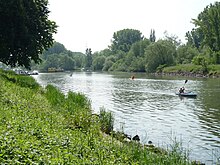
Hessian Ried
The Hessian Ried is part of the north-eastern section of the Upper Rhine Plain in southern Hesse . The Hessian Ried comprises the Hessian Rhine Plain and the Hessian part of the Northern Upper Rhine Lowland ( natural units 225 and 222).
Location and description
The Hessian Ried stretches between the Rhine in the west, the Bergstrasse in the east and from Lampertheim in the south up to Dornheim .
The plains used to be mostly swampy and repeatedly affected by severe flooding from the Rhine and Weschnitz . When it was opened up by the Romans , it was avoided and the street, Strata Montana , was built on the mountain road , i.e. a little higher on the edge of the Odenwald. Later the Lorsch monastery was an important center in the middle of the reed.
Only with the regulation of the Rhine and Weschnitz was it increasingly made usable for arable farming . In addition, there was extensive drainage of agricultural land as a result of the "General Culture Plan" of 1925. Asparagus and tobacco in particular thrive in the mild climate . Due to the proximity to several metropolitan areas ( Rhine-Main area , Rhine-Neckar area ), vegetables and lettuce are increasingly being grown. Due to the low rainfall in the Hessian Ried, artificial irrigation is increasingly necessary.
Heavy groundwater abstractions for the public water supply , for industry and agriculture, especially in dry periods (around 1976 and around 1993), lead to the occurrence of land settlement and damage to buildings and, especially in forests and wetlands , to damage to areas of vegetation that depend on groundwater guided. This led to significant conflicts between water management , landowners, agriculture , forestry and nature conservation associations. These conflicts could be defused through a more flexible management of the groundwater abstraction, which is now based on the groundwater-floor distance. In addition, the Hessisches Ried water association, founded in 1979, enriches the groundwater.
From the late 1990s onwards, the groundwater situation worsened to the extent that, on the one hand, the forests increasingly suffered from a site drift towards drier soils and greater distances from the ground and, on the other hand, water damage to buildings occurred due to the infiltration project in the course of groundwater management from building areas developed during dry periods occurred, in which Rhine water in drinking water quality is returned to the forest. As an additional problem for the forestry, the populations of the cockchafer in the reed forests increased, which increased significantly due to the new, dry and more favorable conditions for the insect and caused damage to the tree tops and roots.
In 2006 the Hessian state government decided, due to a cross-factional state parliament resolution in 2006 and a clear escalation of the conflict between various stakeholder groups in the Ried, to set up a round table at which from 2012 to 2015 new models of forest and groundwater management in two working groups were worked out.
Naming
The name Hessisches Ried probably derives from the once extensive vegetation of the landscape with reeds or reed plants. Due to the frequent flooding - especially by the Rhine and the Weschnitz - the Hessian reed represented an optimal habitat for these plants. Today there are only a few larger coherent reed stands, but especially community names like Groß-Rohrheim or Klein-Rohrheim attest to the distribution . These are usually found in special protected areas.
Another explanation could be that Ried is a clearing name that denotes the clearing of the area for reasons of reclamation .
Partial landscapes

-
Old Rhine
- Kühkopf-Knoblochsaue - nature reserve with the island of Kühkopf and the Knoblochsaue to the north
- Rheininsel Nonnenau near Ginsheim
- Schwarzbachaue near Trebur
- Riedsee near Leeheim
- Riedsee near Biblis
- Lampertheimer Altrhein nature reserve (Biedensand) near Lampertheim
Cities and communities in the Hessian Ried
- The Alsbach-Hähnlein district (Alsbach is on the Bergstrasse)
- The Bensheim districts (Bensheim itself is on Bergstrasse)
- Biblis and the districts
- Biebesheim on the Rhine
- Bürstadt and the districts
- Büttelborn
- Einhausen (Hesse)
- Gernsheim and the districts
- Ginsheim-Gustavsburg
- Groß-Gerau and the districts
- Gross-Rohrheim
- Lampertheim and the districts
- Lorsch
- Nauheim
- Pfungstadt and the districts
- Riedstadt with the districts
- Stockstadt
- Rüsselsheim am Main with the district
- Trebur with the districts
- Weiterstadt
- The Zwingenberg district (Zwingenberg itself is on Bergstrasse )
literature
- Peter Prinz-Grimm and Ingeborg Grimm: Wetterau and Mainebene. Borntraeger, Berlin / Stuttgart 2002, ISBN 3-443-15076-4 (collection of geological guides 93), esp.p. 12.
Web links
- Environmental Atlas Hessisches Ried
- The Hessian Ried between waterlogging and drought: a complex water management problem Part 1 (PDF; 6.3 MB) · Part 2 · 70-page brochure by the Hessian Ministry for the Environment, 2005 (PDF files; 5.6 MB)
Individual references / footnotes
- ↑ Johannes Litschel: One problem - many causes - one solution? Conflict analysis of the cockchafer problem in the Hessian Ried Master's thesis, Freiburg, Germany 2012. Available online at Freidok plus .
- ^ Motion from the parliamentary groups of the SPD, CDU, Bündnis90 / Die Grünen and FDP regarding the rehabilitation of the forests in southern Hesse
- ↑ Working together on solutions (with final report). (No longer available online.) Archived from the original on February 11, 2016 ; Retrieved April 27, 2015 . Info: The archive link was inserted automatically and has not yet been checked. Please check the original and archive link according to the instructions and then remove this notice.

