Lampertheimer Altrhein nature reserve
|
NSG Lampertheimer Altrhein
|
||
|
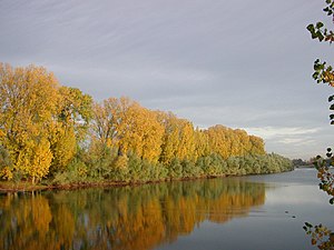
View over the Old Rhine to the nature reserve (2004) |
||
| location | Lampertheim , Bergstrasse district , Hesse , Germany | |
| surface | 5.156 km² | |
| Identifier | 1431002 | |
| WDPA ID | 4397 | |
| Natura 2000 ID |
(FFH and SPA) DE-6316-401 (FFH and SPA) |
|
| FFH area | 5.156 km² | |
| Bird sanctuary | 5.156 km² | |
| Geographical location | 49 ° 36 ' N , 8 ° 26' E | |
|
|
||
| Setup date | August 13, 1937 | |
The Lampertheimer Altrhein nature reserve is located in a former Rhine loop ( Altrhein ) in the west of the city of Lampertheim in the Bergstrasse district . It is around 5.16 km² and one of the largest nature reserves in Hesse . The former Biedensand river island and the grassland- shaped Bonnaue are essential parts of the area .
The area of the nature reserve is identified with the same layout as an FFH area and as an EU bird sanctuary DE-6316-401 Lampertheimer Altrhein . This makes the area part of the European Natura 2000 network of protected areas .
Location and dates
The nature reserve is located approx. 15 km north of Mannheim ( Baden-Württemberg ) and approx. 5 km southeast of Worms ( Rhineland-Palatinate ), in the immediate vicinity of the Hessian town of Lampertheim in the triangle of Hesse-Baden-Württemberg-Rhineland-Palatinate. The entire nature reserve lies east of the Rhine on Hessian territory.
In addition to the Kühkopf-Knoblochsaue nature reserve located approx. 25 km to the north, the area on the Lampertheim Old Rhine is the most important Hessian old Rhine protection area.
There are two lakes in the nature reserve: Welsche Loch and Fretter Loch . The Welsche Loch is a 40 hectare shallow water lake. The entire nature reserve is a breeding area for many, sometimes endangered, bird species. A cormorant colony lives on the Welschen Loch .
history
The origin of the Lampertheim (Alt) Rhine can be traced back to the year 1354. The descriptions of the Rhine at that time mention two small islands in the Rhine, the “Büdensand” and the “long Zeil”. From 1878 to 1879, the Rhine was pierced at Lampertheim to straighten the Rhine, creating the Lampertheim Old Rhine. The plans for the breakthrough came from Johann Gottfried Tulla . The Nackenheim boatman Johann Welsch was the first to pass the new waterway. The Welsche Loch was named after him.
As early as 1926, parts of the Lampertheim Old Rhine were given special protection by police ordinance. In 1937 the area was finally placed under nature protection. In recent years, the water level of the Lampertheim Old Rhine, which has been falling continuously for several years, has given rise to concern among various interest groups, so that dredging of the Old Rhine arm is being discussed.
See also
literature
- 75 years of the “Lampertheimer Altrhein” nature reserve - history, habitats and types of landscape on the Rhine. (PDF) Darmstadt Regional Council, August 2012, accessed on June 25, 2016 (brochure).
- A. Müller: Lampertheimer Altrhein: history and stories. 1st edition, Bergstrasse press office, 2002, ISBN 3-9804689-4-1 .
Web links
Individual evidence
- ↑ DE-6316-401 Lampertheimer Altrhein (FFH area and EU bird sanctuary). Published by the Federal Agency for Nature Conservation . Retrieved March 13, 2017.
- ↑ Historical: Corrections on the Rhine. Mannheim Waterways and Shipping Office , accessed on June 26, 2016 .
- ↑ Clean strategy - clean old Rhine. In: lampertheimer-zeitung.de. November 30, 2014, accessed June 26, 2016 .


