List of cultural monuments in Mayen
The list of cultural monuments in Mayen includes all the cultural monuments of the Rhineland-Palatinate city of Mayen including the districts of Alzheim , Betzing , Hausen , Kürrenberg and Nitztal . The basis is the list of monuments of the state of Rhineland-Palatinate (as of September 25, 2017).
Mayen
Monument zones
| designation | location | Construction year | description | image |
|---|---|---|---|---|
| Monument zone Bachstrasse | Bachstrasse 23–34 (all numbers) Location |
around 1910/20 | Settlement construction; Gable risalit, in the middle a central risalit with hip, the two side risalites with a crooked hip roof, around 1910/20 |

|
| Jewish cemetery monument zone | Waldstrasse location |
1847 | Opened in 1847, 203 gravestones, in some cases only the base preserved, 1860 to 1942 |
 more pictures more pictures
|
| Monument zone Ostbahnhofstrasse 30–42 | Ostbahnhofstrasse 30–42 (even numbers) Location |
1921 | neo-baroque housing estates under hipped mansard roofs, drawn together to two lines, marked 1921; No. 30/32 with a triumphal arch-like gate construction | |
| Monument zone Ostbahnhofstraße 33–45 | Ostbahnhofstrasse 33–45 (odd numbers) location |
around 1900 | uniform row of late-historic houses with tuff square facades and basalt structures; varied gable risalites and gable up to nos. 43 and 45; the front building No. 33 inn with a sophisticated neo-Gothic facade, marked 1903 | |
| Monument zone St. Elisabeth Hospital | Siegfriedstrasse 18, 20 location |
1906-09 | formerly municipal hospital; neo-baroque castle-like tuff square construction under a mansard hipped roof with rear side wings, 1906-09, rebuilt in the 1950s; in front of the chief doctor's villa from 1910 (No. 18), tuff stone |
|
| Monument zone city fortifications | Boemundring, Habsburgring, Veitsstrasse, Wasserpförtchen location |
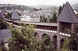
after 1291 | Construction began soon after 1291 (town elevation), 1329 marked as completed, the lower floors of the "Wittbender" and "Upper Gate", the "Mühlen" -, "Vogel" - and "Pützhaus Tower", probably under Archbishop Balduin, elevation of the towers and The wall was raised in the 15th and 16th centuries, almost completely preserved until 1944; circular bering with originally four gates and 16 defense towers; Larger stretches of the wall at Boemund- and Habsburgring, near the water gate and Veitsstrasse, in the north along the Nette as a full wall; next to the Herz-Jesu-Kirche and castle large area marked 1916 (reconstructed); five-storey “ Obertor ”, beginning of the 14th century, expansion in the 15th century; "Wittbendertor" mentioned in 1390, destroyed in 1944, adjacent wall remains; Mauerstraße: remains of the city wall, shell tower; "Mühlenturm" in the northwest and adjacent wall remains; Bridge gate: bridge and the city moat in front of it, beginning of the 14th century, reconstruction with stair tower marked 1599; Wall "Am Wasserpförtchen" behind the stonemasonry school, two construction phases; "Bird Tower" in the northeast: medieval round tower, beginning of the 14th century, increased with the city wall in the 16th century |
 more pictures more pictures
|
| Monument zone Grubenfeld Mayen | northeast of the city (Layerhof) location |
Basalt mining underground and above ground; already documented by finds in prehistoric and early history and in Roman times; Abandoned after the Second World War, production building largely preserved |
 more pictures more pictures
|
Individual monuments
| designation | location | Construction year | description | image |
|---|---|---|---|---|
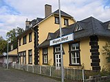
| Mayen West train station | Alkenstrasse 31 location |
around 1900 | Half-hip roof building with single-storey extensions, around 1900 |
|
| Residential building | Alleestraße 4 location |
around 1900 | Rustic building, on the upper floor emphasizing the center with pilasters and triangular gables above the central window, around 1900 | |
| Residential building | Alleestraße 6 / 6a location |
around 1910/20 | Tuff cuboid construction on a basalt base, around 1910/20 |

|
| Residential building | Alleestraße 14 location |
1887 | late classical basalt block construction, marked 1887 |

|
| Grave cross | At the Layerhof location |
1814 | Grave cross, marked 1814 | |
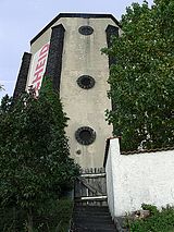
| Water tower | At the water tower location |
pointed tower belonging to the Mayen-Ost train station |
|
|
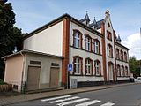
| school | Bachstrasse 22 location |
1899 | today Clemens School; Plaster construction, gable elevation, 1899 |
|
| Dreiser's house | Boemundring 6 layer |
1833 | Basalt quarry stone building, half hip roof, marked 1833 |

|
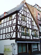
| Residential building | Brückenstrasse 6 location |
17th century | three-storey half-timbered house, partly massive, 17th century, roof and right half of the house from the 19th century |
|
| Catholic parish church of the Sacred Heart of Jesus | Burgfrieden location |
1911/12 | neo-Romanesque column basilica with crossing tower and double tower facade, 1911/12, architect Caspar Clemens Pickel , Düsseldorf |
 more pictures more pictures
|
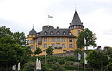
| Genovevaburg | Burgfrieden, Marktplatz location |
1280 | former electoral castle; Construction began in 1280, larger parts completed in 1311, destroyed in 1689, baroque reconstruction and castle-like expansion 1701–11, master builder Philipp Honorius Ravensteyn ; Medieval layout of an irregular square, two corner round towers, keep (so-called Goloturm); former electoral castle, residential building around the courtyard, 1893; Marstall, 1709/10 as well as archway of the lower castle; Bridge over the neck ditch (destroyed in 1944 and rebuilt); in the rock bunker; Wegekreuz in the small courtyard, 1653; Wayside cross, 1726; Signpost, first half of the 19th century; Castle gardens, 26 crosses in the museum park, 16th to 19th centuries; Entire facility with castle hill |
 more pictures more pictures
|
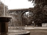
| Railway viaduct | Bürresheimer Strasse location |
before 1904 | Railway viaduct; six-arched, basalt pillars, 1895 or before 1904, rebuilt after bombing in 1945/48 |
|
| Residential building | Gartenstrasse 30 location |
1910 | Art Nouveau house, marked 1910 |

|
| villa | Gerberstrasse 14 location |
around 1920 | Mansard roof villa, around 1920 |

|
| War memorial | Habsburgring location |
War memorial, system with shell niche and block with a soldier's head |

|
|
| school | Habsburgring 2 location |
1907 | former boys' school, today Clemens school; Plastered structure with pilaster strips, 1907 |

|
| Residential and commercial building | Habsburgring 112 location |
1900/10 | neo-baroque tuff stone building, 1900/10 |

|
| niche | Habsburgring, corner Im Möhren Lage |
1888 | neo-Gothic niche, 1888 | |
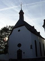
| Holy Spirit Chapel | Hospitalgasse, corner of Stehbach Lage |
1757 | used today as a memorial; Baroque hall building, half-hip roof, marked 1757 |
|
| Jewish school | Im Hombrich 11 location |
1869 | former Jewish school; three-story plastered building, 1869 |

|
| goal | In the bag, at No. 31 position |
1777 | Gate, 1777 |

|
| Residential building | In Keutel 37 location |
1655 | three-storey half-timbered house, partly massive, marked 1655 |

|
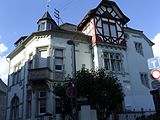
| villa | In carrots 8 layers |
1902 | late historic villa, marked 1902 |
|
| Residential building | In the carrots 18 layer |
1905 | Basalt and tuff cuboid construction dating from the late founding period, mixed forms of neo-Gothic and neo-Renaissance, marked 1905 |

|
| Residential building | In the carrot 25 layer |
1905 | neo-Gothic brick house, basalt structure, marked 1905 |

|
| Fiale | In Trinnel, at No. 9/11 location |
second half of the 19th century | neo-Gothic pinnacle, sculpture of St. Barbara |

|
| War memorial and tombs | Katzenberger Weg, at the cemetery location |
first half of the 20th century | War memorial with cross; Kohlhaas tomb, Art Deco, 1920s; Tomb of the Kirsch family; Grennebach gravestones, Art Nouveau-like, 1907; Hillesheim burial site, around 1910/20; Keuser grave, around 1920/30; Münzel grave, classifying Empire temple, around 1930 | |
| Wayside cross | Katzenberger Weg location |
1834 | Way Cross, 1834 | |
| Association municipality administration | Kelberger Strasse 26 location |
1890 | Cross-square building, stepped gable, marked 1890 |

|
| Catholic Church of St. Clement | Church square location |
from the 12th century | former Augustinian monastery church of St. Maria; South tower, 12th century; three-aisled late Gothic hall, double tower facade, construction started in 1326, mainly from 1360 to 1435, completed in the 15th century, destroyed in 1944/45, reconstruction by 1953, architects Willy Weyres , Cologne, and Otto Vogel , Trier; outside: Man of Sorrows, 19th century |
 more pictures more pictures
|
| Rectory | Kirchplatz 11 location |
20th century | Rectory of St. Clemens Church; Basalt quarry stone building, probably from the 20th century, segmented arched window marked 1847; Grave slab, marked 1756 | |
| relief | Koblenzer Straße, at No. 57a Lage |
1938 | Relief, 1938, by Carl Burger |

|
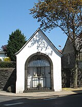
| Anne's Chapel | Koblenzer Strasse, corner of Ettringer Weg location |
1783 | Anne's Chapel, marked 1783; Anna-Selbdritt-Gruppe (copy), around 1500 |
 more pictures more pictures
|
| Market fountain | Marketplace location |
1812 | Classical fountain, 1812, pylon 1938 |

|
| Old Town Hall | Marktplatz 1, Rathausgasse 1 location |
1717 | Hipped mansard roof building with clock tower, marked 1717, extension 1826 |

|
| Department store | Marktplatz 3 location |
three-storey historical building, renaissance bay window |

|
|
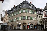
| Residential and commercial building | Marktplatz 6 location |
1900/10 or 1950s | Tuff cuboid construction, mansard hipped roof, 1900/10 or 1950s |
|
| Reliefs | Marktplatz, at No. 30 location |
1930s | two reliefs, 1930s |

|
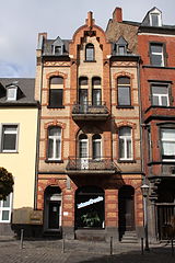
| Residential building | Marktplatz 40 location |
around 1900 | three-story brick house, around 1900 |
|
| Godalminghaus | Marktplatz 55 location |
19th century | three-storey quarry stone building, 19th century |

|
| door | Mühlenweg, at No. 7 location |
1696 | Door, marked 1696 | |
| Residential building | Ostbahnhofstrasse 20 location |
second half of the 19th century | three and a half storey brick building, neo-renaissance | |
| Residential building | Polcher Strasse 42 location |
second half of the 19th century | neo-Gothic plastered building | |
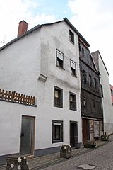
| Residential building | Rosengasse 13/15 location |
17th or 18th century | three-storey half-timbered house, partly massive, half-hip roof, probably from the 17th, possibly also from the 18th century |
|
| special school | St.-Veit-Straße 3 location |
1868 | former high school; three-storey plastered building, marked 1868, extension marked 1908 | |
| Residential building | St.-Veit-Straße 8 location |
around 1900/10 | Residential house, Art Nouveau, around 1900/10 | |
| Old Post School | St.-Veit-Straße 12 location |
1886 | neo-Gothic square building, 1886 | |
| post Office | St.-Veit-Straße 14 location |
1952 | Two-wing hipped roof building, arcades, 1952 | |
| Residential building | St.-Veit-Straße 15 location |
around 1905/10 | Residence, Art Nouveau, around 1905/10 | |
| Residential building | St.-Veit-Straße 15a location |
1901 | Plastered building, corner stand bay, partly half-timbered, marked 1901 | |
| Residential building | St.-Veit-Straße 17 location |
1902 | Plastered building, marked 1902 | |
| villa | St.-Veit-Straße 23 location |
around 1910 | Villa, around 1910 | |
| Catholic Church of St. Vitus | St.-Veit-Straße 25 location |
1953-55 | Saalbau, 1953–55, architect Dominikus Böhm , Cologne; in the west wall a late Gothic, flamboyant-inspired rose window; Campaniles; Complete complex with chapel and park | |
| St. Vitus Chapel | St.-Veit-Straße, at No. 25 location |
1718 | baroque hall, 1718; connected to the church by an intermediate wing | |
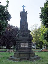
| park | St.-Veit-Straße, at No. 25 location |
1950s | Park with Stations of the Cross from the 1950s; Fountain; War memorial, 1871, obelisk |
|
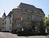
| University of Applied Sciences | St.-Veit-Straße 26 location |
1891 | former district office; Tuff cuboid construction, neo-renaissance, stair tower, hipped roof, 1891 |
|
| Residential building | St.-Veit-Straße 28/30 location |
second half of the 19th century | new baroque double house | |
| District Court | St.-Veit-Straße 38 location |
1908-10 | three-storey plastered building, neo-renaissance, 1908-10 |

|
| Residential building | St.-Veit-Straße 42 location |
around 1905/10 | New baroque tuff stone building, around 1905/10 | |
| jail | Stehbach 31 location |
in the middle of the 19th century | four-storey late classicist building, mid-19th century; the lower ashlar storeys older, the upper plastered storeys from 1907 or 1920 |

|
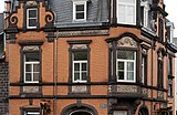
| Residential building | Töpferstrasse 30 location |
around 1900 | Late historical brick corner house, neo-renaissance motifs, around 1900 |
|
| Matthias Chapel | Trier way location |
1687 | also Trier holy house ; Plastered building with shell niche, marked 1687; four sculptures | |
| Steinmetzfachschule | Water gate without number location |
1922 | former stonemason school, founded in 1922; now special school |

|
| Inn | Westbahnhofstrasse 5 location |
1904 | Inn; Basalt block construction, partially plastered, marked 1904 | |
| Helgoland Monastery | north-west of the city (Bürresheimer Strasse without number) location |
chapel integrated into the monastery buildings; Grotto; Overall system |

|
|
| chapel | south of the city at the Kirchershof location |
1862 | Chapel, basalt, 1862; Wayside shrine, 18th century |

|
| bridge | south of the city at the Kirchershof location |
19th century | Bridge, 19th century (?) | |
| Bernardshof | southeast of the city location |
1928 | three-storey horseshoe-shaped facility; Mansard roof building, marked 1928, Architects A. and H. Thoma, Andernach; Overall system | |
| Wayside cross | southwest of the city at the Conder Höfe location |
Path cross fragment | ||
| Geisbüschhof | southwest of the city location |
18th century | Building square around a large rectangular courtyard; Remains of two round towers of the outer bailey; late Gothic gatehouse; Plastered building with gate, inside half-timbered; baroque half-timbered house, partly massive, 18th century; an outbuilding with a late Gothic donkey back (second use), marked 1672; baroque chapel; Wayside cross, marked 1841; Overall system | |
| Geisheckerhof | southwest of the city location |
19th century | Courtyard, 19th century; Half-hip roof building, chapel, basalt rubble |
Former cultural monuments
| designation | location | Construction year | description | image |
|---|---|---|---|---|
| villa | Kelberger Strasse 37 location |
1910 | single-storey mansard roof villa, Heimatstil, 1910; Complete area with garden; Canceled in 2015 |
Alzheimer's disease
Individual monuments
| designation | location | Construction year | description | image |
|---|---|---|---|---|
| Catholic Church of St. Martin | At the church location |
1912 | three-aisled neo-Romanesque basilica, art nouveau elements, 1912, architect Peter Marx , Trier | |
| Wayside chapel | At the Teichwiese, in front of No. 15 Lage |
Path chapel, neo-Gothic plaster Madonna |

|
|
| Wayside cross | At the Teichwiese, corner of the short customer location |
1759 | Wayside cross, marked 1759 | |
| Wayside cross | Lower street, at No. 5 location |
1845 | Way cross, niche type, marked 1845 | |
| Old church | Geringer Strasse, corner of Ackerstrasse Lage |
1810 | former parish church; Hall building, 1810 | |
| Wayside cross | Geringer Strasse, corner of Hohlstrasse Lage |
1735 | Road cross, marked 1735, niche in relief, marked 1629 | |
| Grave cross | east of the village | 1823 | Grave cross, marked 1823 | |
| Wayside cross | east of the village | 1772 | Wayside cross, marked 1772 | |
| Wayside cross | east of the village | 1898 | Wayside cross, marked 1898 | |
| Wayside shrine | south of the village | Wayside shrine fragment | ||
| Wayside cross | southeast of the location |
1517 | Wayside cross, marked 1517 | |
| Wayside cross | southwest of the village on the K 25 | 1598 | Wayside cross, niche mark, inscribed 1598 | |
| Wayside cross | southwest of the village on the K 25 | Wayside cross |
Alzheim-Berresheim
Individual monuments
| designation | location | Construction year | description | image |
|---|---|---|---|---|
| Wayside cross | In the Hostert location |
1738 | Road cross, marked 1738 | |
| War memorial and grave crosses | Mayener Strasse, on the cemetery location |
16th to 20th century | 35 grave crosses, 16th to 18th centuries; War memorial, pillar in relief; Koehl's tomb in 1884, Frank's tomb in 1884 | |
| Village fountain | Mayener Strasse, opposite No. 80 location |
Village well, basalt basin | ||
| Wayside shrine | Mayener Strasse, corner of Im Hostert Lage |
16th or 17th century | Wayside shrine, ladle shape, 16th or 17th century | |
| Wayside shrine | Monrealer Strasse, corner of Im Hostert Lage |
1629 | Wayside shrine, niche painting, inscribed 1629 | |
| Wayside cross | Monrealer Strasse at the corner of Mayener Strasse Lage |
19th century | Way cross, probably from the 19th century | |
| Wayside cross | north of the village on the way towards Mayen Lage |
Path cross fragment | ||
| Wayside cross | southwest of the place on the district boundary | 1817 | Road cross, basalt, marked 1817 | |
| Wayside cross | southwest of the place | 1796 | Road cross, basalt, marked 1796 |
Betzing
Individual monuments
| designation | location | Construction year | description | image |
|---|---|---|---|---|
| Residential building | At the Steufenhaus 11 | 18th century | Half-timbered house, partly solid, plastered, crooked hip roof, probably from the 18th century | |
| Wayside cross | Pastor-Schlink-Strasse at the corner of Talstrasse Lage |
1627 | Way cross, niche type, marked 1627 | |
| Chapel of St. Konrad | To the mill 5 location |
19th century | Hall building, probably from the 19th century | |
| Fountain | To the mill, corner of Talstrasse location |
19th century | Handle pump, cast iron, 19th century | |
| Wayside cross | north of the village on the L 98 location |
17th or 18th century | Wayside cross, 17th or 18th century |
Hausen
Individual monuments
| designation | location | Construction year | description | image |
|---|---|---|---|---|
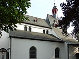
| Catholic Parish Church of St. New Years Eve | On the church hill 4 location |
Late 12th century | Catholic Parish Church of St. Silvester; Originally a two-aisled pillar basilica, end of the 12th century, Gothic choir, side aisles added in 1932 by Willy Weyres, Cologne, extension in the west with a baroque turret with Welscher dome, 1688 |
 more pictures more pictures
|
| Crosses and war memorial | On the church hill, at No. 4 position |
17th to 20th century | Wayside cross, marked 1699; Grave cross and tomb, 1620; War memorial, large complex; Crucifix, 18th century; Our Lady, 19th century |

|
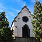
| Wayside chapel | Bahnhofstrasse, at No. 76 location |
Path chapel, neo-Gothic |
|
|
| Fountain | Brunnenstrasse | Pump, pump bridge, neo-Gothic motifs | ||
| Wayside cross | Brunnenstrasse | 1655 | Way cross, niche type, marked 1655 | |
| school | Brunnenstrasse 3/5/7 location |
around 1900 | former school; Basalt quarry stone construction, around 1900 | |
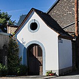
| chapel | Brunnenstrasse, corner of Im Wingert Lage |
Chapel, baroque hall building, baroque door leaf, crucifixion relief |
|
|
| Courtyard | Dorfstrasse 27 location |
17th century | Courtyard area; Solid building with shield gable, 17th century, cellar entrance marked 1507, extension in the 19th century; Chapel; overall structural system | |
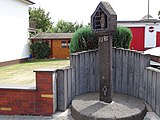
| Wayside shrine | Dorfstraße, corner of Trimbser Weg Lage |
1585 | Wayside shrine, inscribed 1585 |
|
| Residential building | Hausener Landstrasse 16 location |
18th century | A house; Half-hip roof construction, probably from the 18th century | |
| Wayside cross | Hausener Landstrasse, corner of Dorfstrasse Lage |
1662 | Wayside cross, marked 1662; small Vesper picture, beautiful style , around 1400 (copy) | |
| Wayside cross | out of town | 1840 | Way cross, basalt, marked 1840 | |
| Wayside cross | out of town | 1625 | Road cross fragment, allegedly from 1625 | |
| Wayside cross | east of the village on the L 98 | 1614 | Way cross, niche type, marked 1614 | |
| Railway viaduct | south of the village spanning the Nettetal location |
before 1904 | Railway viaduct; Six-arch basalt lava house installation, before 1904 (see also Polch ) | |
| Zährensmühle | south of the village location |
19th century | Plastered building, 19th century |
Kürrenberg
Individual monuments
| designation | location | Construction year | description | image |
|---|---|---|---|---|
| Wayside cross and niche | Main street location |
1677 | Niche with festoon, 1777; Crossroads in the wall, marked 1677 | |
| War memorial | Hauptstrasse, corner of Hochscheidstrasse Lage |
around 1920 | War memorial, warrior in relief | |
| Wayside cross | Hauptstrasse, corner of Hochscheidstrasse Lage |
1805 | Wayside cross, marked 1805 | |
| cross | Hauptstrasse, corner of In den rock gardens location |
1729 | Cross, marked 1729 | |
| Catholic Church of St. Bernhard | Kirchstrasse location |
1900/01 | neo-Romanesque hall construction, 1900/01, building inspector Bruyn, Andernach, and master builder de Witte, Mayen; Complete complex with cemetery |
 more pictures more pictures
|
| Grave crosses | Kirchstrasse, on the cemetery location |
19th and 20th centuries | four grave crosses, 19th and 20th centuries | |
| Crossroads | northwest of the village on the way to St. Jost | Crossroads |
Nitztal
Individual monuments
| designation | location | Construction year | description | image |
|---|---|---|---|---|
| Fountain and wayside cross | Kirchwalder Strasse location |
1709 | Well, including wayside cross, inscribed 1709 |
Remarks
- ↑ Address cannot be identified
literature
- General Directorate for Cultural Heritage Rhineland-Palatinate (Ed.): Informational directory of cultural monuments in the Mayen-Koblenz district (PDF; 5.8 MB). Mainz 2017.
Web links
Commons : Kulturdenkmäler in Mayen - Collection of pictures, videos and audio files