List of cultural monuments in Mendig
The list of cultural monuments in Mendig includes all cultural monuments of the Rhineland-Palatinate city of Mendig with the districts of Niedermendig and Obermendig . The basis is the list of monuments of the state of Rhineland-Palatinate (as of September 25, 2017).
Low-ended
Monument zones
| designation | location | Construction year | description | image |
|---|---|---|---|---|
| Monument zone lava cellar | Brauerstraße, Laacher-See-Straße location |
18th century | Labyrinth of underground basalt chambers located on the northern edge of Niedermendig under the volcano brewery, also used as a beer cellar from 1840 |
 more pictures more pictures
|
| Jewish cemetery monument zone | Anne-Frank-Strasse location |
at the end of the 19th century | 37 gravestones from the 19th and 20th centuries |
 more pictures more pictures
|
Individual monuments
| designation | location | Construction year | description | image |
|---|---|---|---|---|
| War memorial | Location at the train station |
at the end of the 19th century | War memorial 1870/71, obelisk |

|
| Kaiserbahnhof Mendig | At the train station 5 location |
1877 | Basalt block construction, 1877, with stepped gable, battlements and tracery windows |

|
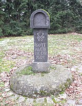
| Wayside shrine | At the Jewish cemetery, opposite No. 19 location |
1628 | Wayside shrine; Niche with a portrait of Christ, inscribed 1628 | |
| Residential building | Bachstrasse 6 location |
18th century | Plastered building, 18th century | |
| Residential building | Bahnstrasse 13 location |
1897 | Late historical tuff block construction, marked 1897 | |
| Residential building | Bahnstrasse 27 location |
1875 | three-storey basalt cuboid building, 1875 | |
| Wayside cross | Way street, at no. 30 position |
1651 | Wayside cross, marked 1651 | |
| Residential building | Brunnenstrasse 6 location |
17th century | Plastered construction, in the core probably from the 17th century | |
| Residential building | Brunnenstrasse 7 location |
in the middle of the 19th century | three-storey neo-baroque hipped mansard roof, cast-iron balcony and veranda, mid-19th century | |
| Protestant church | Heidenstockstraße 45 location |
1892 | neo-Gothic hall, 1892 |
 more pictures more pictures
|
| Wayside shrine | Heidenstockstrasse, corner of Bahnstrasse Lage |
1920s | niche in relief, 1920s | |
| Cross and tomb | Heinrich-Heine-Straße, in the cemetery location |
1735 and 1920s | stately cross, marked 1735; Pastor's tomb, cross-crowned niche, 1920s | |
| Catholic parish church of St. Cyriakus | Kirchberg location |
Late 12th century | Romanesque basilica, end of the 12th century, upper floors of the tower from 1474, late Gothic sacristy, Romanesque portal with Romanized lintel, marked 1717; three-aisled, neo-Gothic basilica built on the north side, 1852–57, architect Vincenz Statz , Cologne; Baroque staircase, marked 1748 |
 more pictures more pictures
|
| Crosses | Kirchberg, at the church location |
16th and 17th centuries | Cemetery cross, 16th century; Wayside cross, marked 1692 | |
| monument | Marketplace location |
19th century | Crucifixion relief, 19th century |

|
| Association municipality administration | Marktplatz 1–3 location |
around 1900/10 | former secondary school; Late historical tuff block construction, around 1900/10 | |
| town hall | Marktplatz 4 location |
second half of the 19th century | Plastered building with arched windows, second half of the 19th century | |
| Community center | Marktplatz 5 location |
in the middle of the 19th century | former school; Basalt quarry stone building, mid-19th century | |
| Wayside cross | Mühlenstrasse, at No. 3a location |
1720 | Wayside cross, marked 1720 | |
| Residential building | Niederstrasse 6 location |
1844 | Half-timbered house, partly solid, plastered, half-hip roof, marked 1844; Quarry stone house, marked 1815 | |
| Courtyard | Pellenzstrasse 1/3 location |
first half of the 19th century | Basalt quarry stone building, first half of the 19th century; Economic tracts, basalt quarry stone construction; Overall system | |
| Wayside shrine | Pellenzstrasse, at No. 50 location |
New renaissance niche with a small sculpture | ||
| Grave cross | Pellenzstrasse, corner of Backeleyenstrasse location |
1713 | Grave cross, marked 1713 | |
| Wayside chapel | Pellenzstrasse, corner of Kaplan-Schlicker-Strasse Lage |
first half of the 19th century | Wayside chapel; gothic basalt quarry stone building, first half of the 19th century; Votive cross, marked 1697 |

|
| Wayside cross | Pellenzstrasse, corner of Schäferspforte Lage |
18th or 19th century | Wayside cross, 18th or 19th century; neo-baroque cross | |
| Courtyard | Saunsstrasse 2 location |
1838 | Courtyard area; stately plastered building, marked 1838 | |
| Residential building | Saunsstrasse 7/9 location |
1741 | Plastered building, marked 1741, possibly older | |
| Residential building | Saunsstrasse 13/15 location |
Plastered construction, in the core probably late medieval | ||
| Residential building | Staffelsweg 1 location |
around 1900 | neo-Gothic tuff block construction, around 1900 | |
| Wayside shrine | Thürer Strasse | 16th or 17th century | Wayside shrine, ladle shape, 16th or 17th century; Wayside cross, marked 1689 | |
| Wayside shrine | outside of town on the L 113 location |
1607 | Wayside shrine, trunk, inscribed 1607 (new niche) |

|
| Calvary | south of the village on the Thürer Berg location |
18th century | Kalvarienberg with high cross; one of the three crosses marked 1507, crucifix from the 18th century; open shelter, 18th century |

|
| Wayside cross | southwest of the village on the K 55 | 1697 | Wayside cross, marked 1697 |
Obermendig
Individual monuments
| designation | location | Construction year | description | image |
|---|---|---|---|---|
| relief | Fallerstrasse | 1920s | Relief "Flight into Egypt", 1920s | |
| Wayside cross | Fallerstrasse | 1659 | Wayside cross, marked 1659 | |
| Catholic Parish Church of St. Genoveva | Fallerstraße 2 location |
Mid 12th century | West tower, Romanesque core, middle of the 12th century and around 1200, upper floor probably from the second half of the 15th century, helmet from 1879; Nave from the second half of the 15th century, originally a three-aisled staggered hall, extension and redesign to the basilica in 1879 |
 more pictures more pictures
|
| Crosses | Fallerstrasse, by the church Lage |
16th to 18th century | Mission cross, possibly baroque; praying in a niche, marked 1669; Mount of Olives Group, around 1500; five crossroads, designated 1653, 1610, 1727, 1647 and 1667; Ways cross fragment; eleven grave crosses, including from 1605, 1717 and 1748 | |
| school | Fallerstrasse 3 location |
around 1865 | former school; Quarry stone construction, around 1865 | |
| Rectory | Fallerstraße 10 location |
1757 | A half-hip roof building, marked 1757 | |
| Wayside shrine | Fallerstrasse, at No. 12 location |
1685 | Wayside shrine, marked 1685, niche relief marked 1934 | |
| Tomb | Fallerstrasse, at the cemetery location |
Hirschbrunn burial place; three cast iron crosses | ||
| Courtyard | Hauptstrasse 20 location |
Plaster construction, essentially late medieval; half-timbered house on the courtyard side, partly solid, half-hip roof, 18th century, modified in the 19th century, extension; Late medieval bust in the wall, 15th century |

|
|
| Inn | Hauptstrasse 22 location |
20th century | Guest house with dance hall; Basalt block construction, 20th century |

|
| Courtyard | Hauptstrasse 28 location |
first half of the 19th century | Hofreite; Basalt block construction, first half of the 19th century, barn marked 1837; overall structural system |

|
| Wayside shrine | Hauptstrasse, corner of Pellenzstrasse location |
1920s | Wayside shrine, 1920s | |
| Wayside cross | In the Mühlwiesen, at No. 24 Lage |
1686 | Wayside cross, marked 1686 | |
| Residential building | Laacher Strasse 19 location |
1672 | Plastered building, marked 1672, extension, partly half-timbered |

|
| Residential building | Laacher Strasse 27 location |
Plastered construction, neo-Gothic tracery window on the gable side |

|
|
| Wayside cross | Molkereistrasse at the corner of Fallerstrasse Lage |
18th century | Wayside cross, 18th century | |
| cross | Oberstrasse, at No. 31 location |
1829 | Cross, inscribed 1829 | |
| Wayside cross | Pellenzstrasse, at No. 156 Lage |
1658 | Wayside cross, marked 1658 | |
| Residential building | Schultheisstrasse 1 location |
1557 | Quarry stone building with stair tower, marked 1557 |

|
| Residential building | Schultheisstrasse 4 location |
Plastered building with shield wall, probably an older core |

|
|
| Fronhof | St.-Florinstraße 6 location |
third quarter of the 18th century | former Fronhof of the St. Florinstift in Koblenz; stately courtyard; two-wing house, third quarter of the 18th century, late Gothic chapel, farm building; Overall system | |
| Maxeimsmühle | west of the village location |
Mill | ||
| Wayside cross | south of the village | 1810 | Wayside cross, marked 1810 | |
| Wayside cross | south of the village | 1646 | Wayside cross, marked 1646 |
literature
- General Directorate for Cultural Heritage Rhineland-Palatinate (Ed.): Informational directory of cultural monuments in the Mayen-Koblenz district (PDF; 5.8 MB). Mainz 2017.
Web links
Commons : Kulturdenkmäler in Mendig - Collection of images, videos and audio files