List of cultural monuments in Münstermaifeld
The list of cultural monuments in Münstermaifeld contains all the cultural monuments of the Rhineland-Palatinate city of Münstermaifeld, including the districts of Keldung , Küttig , Lasserg , Metternich , Mörz and Sevenich . The basis is the list of monuments of the state of Rhineland-Palatinate (as of September 25, 2017).
Münstermaifeld
Monument zones
| designation | location | Construction year | description | image |
|---|---|---|---|---|
| Frankenstrasse monument zone | Frankenstrasse 22–30 (even numbers) location |
around 1900 | Row of residential buildings from the late founding period, around 1900; Plastered buildings with brick structure and double gables, No. 30 with corner tower; No 24 indicates 1903 |

|
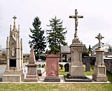
| Monument zone cemetery | Bahnhofstrasse location |
17th to 19th century | five grave crosses, basalt, marked 1661, 1720, 1632, 1593 and 1646; five tombstones, neo-Gothic, four marked 1855, one marked 1862; Obelisk 1834, grave slab 1822; neo-Gothic crucifix, 1862; two grave crosses, one marked 1619; Cross, around 1800; Cemetery cross, neo-Gothic structure, mid-19th century, with five pastor's graves in front of it |
|
| Monument zone in the city center | Bornstrasse 1, Heilig-Geist-Spital 1 and 3/4; Herrenstrasse 1–7 (odd numbers), 2 and 6–24 (even numbers), Martinsstrasse, Michelstrasse, Münsterplatz, Obertorstrasse 1–29 (odd numbers) and 2–38 (even numbers), Stiftsstrasse 1–5 (odd numbers) , 2, 4, 10, 12 and 20–34 (even numbers), Untertorstraße 1–35 (odd numbers) and 2–20 (even numbers) position |
Town center area along and north of Oberstraße and Untertorstraße including the former monastery district; the monument zone covers a large part of the area within the city wall; In this area, the historical urban spatial references can best be understood in the largely closed, albeit in sections, modern, over-shaped buildings between the late Middle Ages and the 19th century. |

|
|
| Monument zone monastery district | Münsterplatz 4–14 (even numbers), Stiftsstrasse 1–5 (odd numbers) and 24–34 (even numbers) location |
Area of the former collegiate immunity including collegiate church, deanery, provost office and canons' houses; the monastery area, which has remained legible in the cadastral plan to the present day, with its existing buildings since the Middle Ages, illustrates the specific historical functional contexts of an important canonical monastery |
Individual monuments
| designation | location | Construction year | description | image |
|---|---|---|---|---|
| city wall | Mid 13th century | Begun in the middle of the 13th century by Archbishop Arnold von Isenburg , initially a circular wall with two gates, in the 14th century with six towers and four gates, neglected since the 16th century, laid down in 1787; Remnants of the wall: at Severusstraße 11, in line with the tower ( ⊙ ); At the Lauffenburg: three-storey powder tower (also owl tower ; ⊙ ), adjoining quarry stone house with shielded gable, half-timbered barn, half-timbered workshop with half-hip roof; Josefstraße: remains of a city wall tower ( ⊙ ); Wall in Josefstrasse ( ⊙ ) and Pilligertorstrasse ( ⊙ ); Hospital garden: Wallgraben ( ⊙ ) |

|
|
| Münstermaifeld station | At the station 1, 3, 5 location |
1915 | New Baroque plastered building, 1915 |

|
| Wayside cross | At the Laufenburg location |
1618 | Wayside cross, marked 1618; Grave cross, marked 1621 | |
| signpost | Bahnhofstrasse, corner of Raiffeisenstrasse location |
19th century | Signpost, small obelisk, 19th century | |
| Schöneck Castle | Bornstrasse 9 location |
in the core Gothic residential tower, heavily reshaped in the 20th century | ||
| garden | Frankenstrasse | walled garden | ||
| villa | Frankenstrasse 15 location |
around 1910 | Mansard roof villa, around 1910 | |
| Residential building | Frankenstrasse 32/34 location |
around 1910 | New baroque mansard roof, around 1910 | |
| Helling's house | Heilig-Geist-Spital-Gasse 3/4 position |
17th to 20th century | Half-timbered house, partly massive, probably medieval core, 18th century; Half-timbered house, partly massive, 19th or 20th century; cast iron pump; Copy of a Gothic Mother of God from the 14th century; Wallgraben: Quarry stone house, 17th or 18th century; Entire facility with Untertorstrasse 27/29 | |
| Stiftsherrenhaus | Herrenstrasse 18 location |
first half of the 18th century | Plastered construction, essentially from the first half of the 18th century, facade structure around 1830/40 | |
| Residential building | Herrenstrasse 24 location |
1734 | nine-axis plastered building, basalt walls, marked 1734, renovated in 1927 | |
| school | Herrenstrasse 26 location |
around 1900 | former school; Hip roof building, neo-renaissance, around 1900 | |
| Garden shed | Kalter Straße, to No. 6 location |
1780 | Garden house, late baroque plastered building with a curved roof and two-armed flight of stairs, marked 1780 | |
| Water tower | Kalter Strasse, corner of Probsteihof Lage |
1915 | Water tower; three-story, quarry stone and brick, 1915 |
 more pictures more pictures
|
| Courtyard | Kirchspielstrasse 1 / 1a / 1b location |
14th Century | Hofreite, supposedly essentially from the 14th century; Half-timbered house, partly solid, 18th century, quarry stone barn; overall structural system | |
| Kurfürst-Balduin-Gymnasium | Kurfürst-Balduin-Straße 10-14 location |
around 1900 | Plastered building with central projection, around 1900 | |
| Villa Weckbecker | Kurfürst-Balduin-Straße 16 location |
first half of the 19th century | so-called castle; Classicist hipped roof building, first half of the 19th century | |
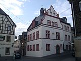
| town hall | Martinstrasse 1 location |
1575 | former district court; Plastered building with cross-frame windows, marked 1575, extensions from the 18th or 19th century |
|
| Grave cross | Metternicher way | 1816 | Grave cross, marked 1816 | |
| Wayside cross | Metternicher way | 1667 | Road cross fragment, marked 1667 | |
| Wayside cross | Metternicher way | 18th century | Wayside cross, 18th century | |
| Wayside cross | Metternicher way | 1853 | Wayside cross, marked 1853 | |
| Catholic parish church of St. Martin and Severus | Münsterplatz location |
first half of the 12th century | former collegiate church; three-aisled basilica, group of three towers, first half of the 12th century, late Romanesque choir, started soon after 1225, nave and transept around 1250, still under construction in 1323; Vestibule with sculptures, around 1330; Preserved from the monastery complex: refectory, chapter house and library, Romanesque core, today's appearance from the 18th century |
 more pictures more pictures
|
| Propstei | Münsterplatz 4/6 location |
Late 18th century | elongated plastered building, end of the 18th century, second plastered building, marked 1820; Overall system |

|
| Catholic rectory | Münsterplatz 14 location |
around 1770 | former deanery; Mansard roof building, around 1770 | |
| Residential and commercial building | Obertorstrasse 5 location |
19th century | Residential and commercial building; Plastered building, 19th century | |
| Residential building | Obertorstrasse 8 location |
1639 | Half-timbered house, partly massive, marked 1639 | |
| Residential and commercial building | Obertorstrasse 10 location |
17th century | Residential and commercial building; three-storey half-timbered house, partly massive, 17th century | |
| House Mönetenich | Obertorstraße 11/13 location |
18th or 19th century | former electoral winery; Plastered building with basalt walls, relief, 18th or 19th century | |
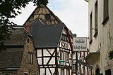
| Residential building | Obertorstrasse 12 location |
1690 | three-storey half-timbered house, partly massive, half hip, marked 1690 |
|
| Residential building | Obertorstrasse 14 location |
1683 | Half-timbered house, partly massive, hipped mansard roof, marked 1683 and 1780 | |
| Residential building | Obertorstrasse 15 location |
19th century | three-storey plastered building, 19th century | |
| Lintel | Obertorstraße, at No. 17 location |
1679 | Lintel, marked 1679 | |
| Residential building | Obertorstraße 19/21 location |
17th century | three-storey solid construction, partly half-timbered, essentially from the 17th century | |
| Residential building | Obertorstrasse 20 location |
second half of the 19th century | neo-Gothic plastered building, shield gable, second half of the 19th century | |
| Residential building | Obertorstrasse 25 location |
1740 | Half-timbered house, partly massive, half hip, marked 1740 | |
| Residential building | Obertorstrasse 38 location |
second half of the 19th century | Half-timbered house, partly massive, plastered facade with arched frieze, second half of the 19th century, late medieval core | |
| Residential building | Obertorstrasse 42 location |
in the middle of the 19th century | Quarry stone building, mid-19th century | |
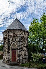
| chapel | Pilligertorstrasse, corner of Josefstrasse Lage |
19th century | Chapel; hexagonal central building, 19th century; Wayside shrine |
|
| former synagogue | Severusstrasse without a number location |
19th century | Ruin, window in Moorish style , 19th century |
 more pictures more pictures
|
| Fountain | Severusstrasse | 1794 | Fountain system with nine basins, version 1794 | |
| tannery | Severusstrasse 15 location |
late 19th century | former tannery; Quarry stone building, late 19th century | |
| chapel | Station path, corner of Raiffeisenstraße Lage |
first half of the 19th century | Chapel; neo-Gothic hexagonal basalt building, first half of the 19th century; Wayside cross, marked 1595 |

|
| school | Stiftsstrasse 5 location |
1714 | former school; Half-timbered building, partly massive, half-hip roof, marked 1714 | |
| Residential building | Stiftsstrasse 8 location |
17th century | Half-timbered house, partly massive, 17th century, half-timbered framework from the 19th century | |
| Residential building | Stiftsstrasse 10 location |
17th century | Half-timbered house, partly massive, 17th century, in the core probably older, roof was added in the 19th or 20th century | |
| Residential building | Stiftsstrasse 14 location |
18th or 19th century | Half-timbered house, plastered, probably from the 18th or 19th century | |
| Residential building | Stiftsstrasse 16 location |
1602 | Half-timbered house, partly massive, marked 1602, several renovations, including in the 18th century | |
| Residential building | Stiftsstrasse 20 location |
first half of the 19th century | Plastered building, first half of the 19th century | |
| House to the grape | Stiftsstrasse 24 location |
1725 | Hipped mansard roof, marked 1725, remodeled in 1819 | |
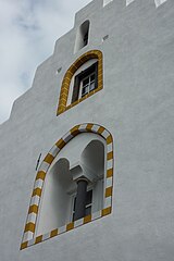
| Stiftsherrenhaus | Stiftsstrasse 26 location |
16th Century | Solid construction, stepped gable, 16th century and essentially Gothic, half-timbered extension in 1609 | |
| Residential building | Stiftsstrasse 28 location |
Solid construction, stepped gable, essentially late medieval, three-storey plastered building facing the street, half-hip roof |
|
|
| Residential building | Stiftsstrasse 32 location |
18th century | Half-timbered house, clad, half-hip roof, 18th century | |
| Stiftsherrenhaus | Stiftsstrasse 34 location |
1772 | Hipped mansard roof, marked 1772 |

|
| Electoral court | Untertorstrasse 10/12 location |
1787 | Half-hip roof building, quarry stone, 1787, barns; overall structural system; Wayside cross, marked 1651 | |
| Holy Spirit Hospital | Untertorstrasse 14/16 location |
13th Century | No. 14 in the core from the 13th century, remodeling in the 19th century; No. 16 quarry stone building with extensions, baroque courtyard gate; Overall system | |
| Residential building | Untertorstrasse 20 location |
17th or 18th century | Quarry stone building, probably from the 17th or 18th century | |
| Residential building | Untertorstrasse 27/29 location |
17th or 18th century | Half-hip roof construction, 17th or 18th century; Half-timbered house, 18th century; Entire facility with Heilig-Geist-Spital 3/4 | |
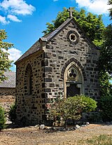
| chapel | north of the city at the Rosenhof location |
19th century | Chapel; neo-Gothic lava stone hall, 19th century |
|
| Wayside shrine | northwest of the city at the intersection of L 82 and K 45 location |
17th or 18th century | Wayside shrine, ladle shape, probably from the 17th or 18th century | |
| signpost | northwest of the city at the intersection of L 82 and K 45 location |
19th century | Signpost, small obelisk, 19th century | |
| Wayside cross | northwest of the city at Kalscher Hof location |
1696 | Road cross fragment, marked 1696 |
Message
Individual monuments
| designation | location | Construction year | description | image |
|---|---|---|---|---|
| Catholic Chapel of St. Stephen | Main street location |
1707 | Choir 1707, Hall 1832, architect Ferdinand Nebel , Koblenz; Complete complex with cemetery | |
| Cemetery architecture | Main street, in the cemetery location |
18th to 20th century | War memorial; ten tombstones, probably from the 19th century; Wayside cross, niche type, marked 1701; One-storey quarry stone building on the cemetery wall, marked 1861 | |
| Fountain | Main street, in front of No. 22a location |
19th century | Handle pump, cast iron, 19th century |
Küttig
Individual monuments
| designation | location | Construction year | description | image |
|---|---|---|---|---|
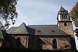
| Catholic Chapel of St. Mary Magdalene | Raiffeisenplatz location |
1922/23 | cruciform system, 1922/23, architect Anton Falkowski , Mainz |
 more pictures more pictures
|
| Kleeburgerhof | east of the village location |
around 1900 | large quarry stone complex, late historic house, around 1900, older economic buildings; Overall system | |
| chapel | northwest of the place at the Nothenmühle location |
1856 | Chapel, plastered building, marked 1856 | |
| War memorial | west of the place on the cemetery location |
around 1920 | War memorial, soldiers' relief, cross | |
| Inscription stone and wayside cross | west of the village in front of the cemetery location |
1721 | Inscription stone; Way cross, niche type, marked 1721 |
Lasserg
Individual monuments
| designation | location | Construction year | description | image |
|---|---|---|---|---|
| Catholic Chapel of St. Benedict | Kirchstrasse location |
1729 | Hall building, in its core Romanesque, marked 1729; Eastern parts and transept-like annex 1936, architect Willy Weyres ; Wayside cross, marked 1701; War memorial belonging to the area | |
| Cross house | Schulstrasse 2 location |
18th or 19th century | Half-timbered transverse house, partly massive, half-hip roof, 18th or 19th century | |
| Wayside shrine | north of the village on the K 39 towards Münstermaifeld Lage |
18th century | Wayside shrine, 18th century | |
| Bischofstein Castle with Paulus Chapel | southeast of the location |
from 1169 | Construction began between 1169 and 1183, destroyed at the end of the 17th century, rebuilt in 1930; Enclosing walls, moat and keep, palas with rectangular tower, single-nave St. Stephen's castle chapel, chapel vault and installation between chapel and palas from 1933; below the Pauluskapelle castle , nave early Romanesque, late Romanesque choir closure, around 1200, raised in the 15th century; Seven footfalls on the footpath, stele type, 17th century; Complete system with mountain |
 more pictures more pictures
|
Metternich
Individual monuments
| designation | location | Construction year | description | image |
|---|---|---|---|---|
| Fountain | Eifelstrasse | Handle pump, basalt basin | ||
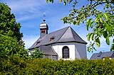
| Catholic Chapel of St. Praxedis | Eifelstrasse location |
1765 | Hall building, marked 1765 |
 more pictures more pictures
|
| Grave crosses | Eifelstrasse, in the cemetery location |
17th and 18th centuries | Grave crosses, 17th and 18th centuries; Wayside cross, marked 1682 | |
| Fountain | Eifelstrasse, at No. 5 location |
at the end of the 19th century | Schwengel pump, Rheinböllener Hütte, late 19th century | |
| Wayside cross | Eifelstrasse, at No. 10 location |
1668 | Wayside cross, marked 1668 | |
| Courtyard | Eifelstrasse 19 location |
1833 | Hofreite; Quarry stone building, half-hip roof, marked 1833; Overall system | |
| Courtyard | Eifelstrasse 29 location |
19th century | Hofreite; Quarry stone building, 19th century; Overall system | |
| Wayside chapel | In the Feils situation |
at the end of the 19th century | Wegekapelle, quarry stone, late 19th century |

|
| Wayside cross | In the Feils, at No. 1 location |
1657 | Wayside cross, marked 1657 | |
| Wayside shrine | In the Feils, at No. 2 position |
16th or 17th century | Wayside shrine, ladle shape, 16th or 17th century |

|
| Wayside cross | north of the village on the K 42 location |
1606 | Way cross, niche type, basalt, marked 1606 | |
| Wayside cross | north of the village location |
1598 | Wayside cross, marked 1598 | |
| Wayside cross | southeast of the place on the L 113 location |
1751 | Wayside cross, marked 1751 |

|
Former cultural monuments
| designation | location | Construction year | description | image |
|---|---|---|---|---|
| door | In der Feils, at No. 1 location |
1756 | Door, marked 1756; deleted from list of monuments |
Mörz
Individual monuments
| designation | location | Construction year | description | image |
|---|---|---|---|---|
| Catholic Chapel of St. Wendelin | Kirchenweg location |
1802 | Hall building, marked 1802 | |
| Tombstones | Kirchenweg, on the cemetery location |
Grave cross, 1810; older tombstones | ||
| Maximiner Hof | Maximinstrasse 3 location |
1774 | Hofreite with a large baroque portal; A half-hip roof building, marked 1774 | |
| Courtyard | Römerstrasse 9 location |
19th century | Courtyard area; Quarry stone building, half hip roof, 19th century | |
| Wayside cross | outside the village at the Gergeshof | 1714 | Wayside cross, marked 1714 | |
| chapel | northwest (?) of the village on the L 82 | 19th century | Chapel; Hall building, quarry stone, 19th century | |
| Wayside cross | northwest (?) of the village on the L 82 | 18th or 19th century | Road cross fragment, 18th or 19th century | |
| signpost | east of the village at the intersection of K 42 and K 43 Lage |
in the middle of the 19th century | Signpost, small obelisk, mid-19th century | |
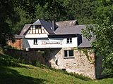
| Hole mill | south of the village (Im Schrumpftal 21) location |
19th century | Quarry stone construction, basalt walls, quarry stone and half-timbered economic wings, 19th century, possibly older; Chapel, small central building; second chapel, quarry stone, 19th century; Overall system |

|
| Stone mill | south of the village (Im Schrumpftal 22a) location |
18th and 19th centuries | Courtyard area; Half-timbered house, partly massive, half-hipped roof, 18th and 19th centuries, timber-frame wing at the rear; Overall system |
|
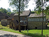
| Weymühle | south of the village (Im Schrumpftal 22b) location |
19th century | Quarry stone building, house marked 1866, stable marked 1843, barn; Overall system |
|
| Wayside cross | southeast of the village on the K 43 towards Kattenes | 1716 | Wayside cross, marked 1716 |
Sevenich
Individual monuments
| designation | location | Construction year | description | image |
|---|---|---|---|---|
| Courtyard | Sevenich 4 location |
1846 | extensive courtyard with two courtyards and a half-timbered barn, late classicist house, dated 1846 | |
| Courtyard | Sevenich 8 location |
1777 | Courtyard area; Quarry stone construction, half-hip roof, marked 1777 | |
| Grave cross | northwest of the village on the K 35 location |
19th century | Grave cross, probably from the 19th century |
Remarks
literature
- General Directorate for Cultural Heritage Rhineland-Palatinate (ed.): Informational directory of cultural monuments: District Mayen-Koblenz (PDF; 5.8 MB). Mainz 2017.
Web links
Commons : Kulturdenkmäler in Münstermaifeld - Collection of pictures, videos and audio files