German volcano road

Starting point of the German Volcano Road shortly before Station 1 with a view of the Laacher See
The German Volcano Road is a 280 kilometer long tourist route from the Rhine to the High Eifel . It connects 39 locations of the Geopark Laacher See and the Geopark Vulkaneifel in the Vulkaneifel , at which geological, cultural and industrial historical natural and cultural monuments on the subject of Eifel volcanism are accessible to tourists.
The project was created in 2008 in cooperation with the districts of Ahrweiler , Bernkastel-Wittlich , Cochem-Zell , Mayen-Koblenz and Vulkaneifel . The selection of the 39 stations was the responsibility of the German Vulcanological Society (DVG).
course
| station | Surname | image |
|---|---|---|
| Station 1 | Parking lot at the Erntekreuz with a view of the Laacher See | |
| Station 2 | Maria Laach Abbey , Glees |
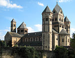
|
| Station 3 | Eppelsberg , slag volcano |

|
| Station 4 | Meurin Roman mine , near Kruft |

|
| Station 5 | Information center Rauschermühle |

|
| Station 6 | German Volcano Museum Mendig - Lava Dome , Mendig |

|
| Station 7 | Wingertsbergwand |

|
| Station 8 | Mayener pit field |

|
| Station 9 | Gleitfalte roof Busch , Glees | |
| Station 10 | Contact Devon-Trass, Kurfürstenbrunnen and Angelika-Quelle | |
| Station 11 | Trass caves |

|
| Station 12 | Bausenberg , horseshoe crater near Niederzissen |

|
| Station 13 | Info center volcano park Brohltal / Laacher See in Niederzissen | |
| Station 14 | Weibern tuff center | |
| Station 15 | Hohe Acht (746.9 m) |

|
| Station 16 | Quarry at Raustert | |
| Station 17 | Mosbruch pond |

|
| Station 18 | Ulmen Maar |

|
| Station 19 | Vulcano platform , Steineberg |

|
| Station 20 | Thermal springs and cheese grotto, Bad Bertrich |

|
| Station 21 | Immerather Maar , Maarsee |

|
| Station 22 | Pulvermaar |

|
| Station 23 | Strohn volcano house |
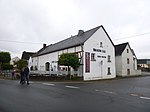
|
| Station 24 | Holzmaar , Maarsee |
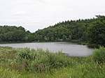
|
| Station 25 | Dürres Maar and Hitsche Maar |
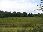
|
| Station 26 | Weinfelder Maar |

|
| Station 27 | Gemündener Maar |

|
| Station 28 | Daun volcano museum |

|
| Station 29 | Dreiser Weiher |

|
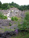
| Station 30 | Arensberg basalt quarry |
|
| Station 31 | Palagonite tuff ring and volcanic garden, Steffeln | |
| Station 32 | Millstone caves in the Rother Kopf (ice) | |
| Station 33 | Papenkaule and Hagelskaule near Gerolstein |

|
| Station 34 | Block heaps, Hundsbachtal | |
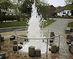
| Station 35 | Cold water geyser " flowing Born " in Wallenborn |
|
| Station 36 | Meerfelder Maar |

|
| Station 37 | Mosenberg series volcano with Hinkelsmaar |

|
| Station 38 | Maarmuseum , Manderscheid |

|
| Station 39 | Rock folds in the basement near Manderscheid .
To be seen on the GEO route Manderscheid "Falbachtal" at the station "Aufschluss" |
literature
- Overview map 1: 100,000 of the State Office for Surveying and Basic Geographic Information Rhineland-Palatinate , ISBN 3-89637-368-4
- d´Hein: National Geopark Vulkanland Eifel. A nature and culture guide. Gaasterland-Verlag, Düsseldorf 2006, ISBN 3-935873-15-8
- Wolfgang Blum, Wilhelm Meyer: German Volcano Road . Görres Verlag, Koblenz 2006, ISBN 3-935690-53-3
