Hinzerath
|
Hinzerath
Association-free municipality of Morbach
|
||
|---|---|---|
| Coordinates: 49 ° 50 '52 " N , 7 ° 10' 44" E | ||
| Height : | 500 m above sea level NHN | |
| Residents : | 300 | |
| Incorporation : | December 31, 1974 | |
| Postal code : | 54497 | |
| Area code : | 06533 | |
|
Location of Hinzerath in Rhineland-Palatinate |
||
Hinzerath is a village in the Hunsrück , part of the municipality Morbach in the district of Bernkastel-Wittlich in Rhineland-Palatinate .
geography
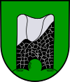
Hinzerath is located on the northern edge of the Idarwald , 1 km north of the village is the Hunsrückhöhenstraße . One kilometer west of the village is Baldenau Castle , one of the few moated castles in the Hunsrück. About two kilometers to the north on a ridge at the meeting of the federal highways B 50 and B 327 ( Hunsrückhöhenstraße ) is the Belginum Archaeological Park on the former Ausoniusstraße and opposite the Stumpfe Turm , a historic watchtower that can also be found in the local coat of arms.
Neighboring places
| Dog home | Wederath | |
| Morbach |

|
Hochscheid |
| Idarwald |
history
Since December 31, 1974, Hinzerath has belonged to the community of Morbach, which is not part of the association.
coat of arms
| Blazon : "A silver-grooved black slate tower stump growing out of a green three-mountain in gold." | |
| Justification of the coat of arms: The stump of the slate tower represents the stump tower from the 14th century standing directly on Hunsrückhöhenstrasse B 327 100 m northeast of the intersection with the B 50 - L 159 . |
traffic
The Hinzerath train station was on the now disused Hunsrück cross line Langenlonsheim - Hermeskeil .
Web links
Individual evidence
- ↑ Official municipality directory 2006 ( Memento from December 22, 2017 in the Internet Archive ) (= State Statistical Office Rhineland-Palatinate [Hrsg.]: Statistical volumes . Volume 393 ). Bad Ems March 2006, p. 187 (PDF; 2.6 MB). Info: An up-to-date directory ( 2016 ) is available, but in the section "Territorial changes - Territorial administrative reform" it does not give any population figures.


