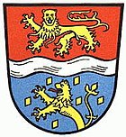
Unterlahnkreis
| coat of arms | Germany map | |
|---|---|---|

|
Coordinates: 50 ° 22 ′ N , 8 ° 1 ′ E |
|
| Basic data (as of 1969) | ||
| Existing period: | 1867-1969 | |
| State : | Rhineland-Palatinate | |
| Administrative region : | Koblenz | |
| Administrative headquarters : | Diez | |
| Area : | 392.86 km 2 | |
| Residents: | 61,974 (Jun 30, 1968) | |
| Population density : | 158 inhabitants per km 2 | |
| License plate : | DIZ | |
| Circle key : | 07 3 33 | |
| Circle structure: | 80 parishes | |
The Unterlahnkreis was a district in Rhineland-Palatinate until 1969 . It was founded in 1867 in the Wiesbaden administrative district of the Prussian province of Hesse-Nassau . Its county seat was Diez .
geography
In early 1969 the district bordered clockwise in the north, beginning with the Unterwesterwaldkreis (in Rhineland-Palatinate), the Limburg and Untertaunuskreis districts (both in Hesse ) and the Loreley district (again in Rhineland-Palatinate).
history
Emergence
After the annexation of the Duchy of Nassau by Prussia in the German war in 1866, the Duchy of Nassau, which is also being incorporated was City Frankfurt and some Hessen-intestine Urban areas due to the Prussian Order of February 22, 1867 the administrative district of Wiesbaden assigned and that in twelve circles divided . The former Nassau offices of Diez , Limburg , Nassau and Nastaeten formed the Unterlahnkreis. The seat of the district office was the city of Diez. In its original delimitation, the district comprised six cities and 115 rural communities and had an area of 618.75 km² with 63,891 inhabitants.
Changes
The Limburg office left the Unterlahnkreis in 1886 and was added to the newly formed Limburg district, whose district town Limburg was raised. Furthermore, the western part of the Nastätten office was assigned to the newly created Sankt Goarshausen district . Only the eastern part around Katzenelnbogen remained in the reduced Unterlahnkreis. The Unterlahnkreis was only 395 km² in size and comprised 43,765 inhabitants in three cities and 80 rural communities.
The municipality of Becheln moved on October 1, 1932 from the Unterlahnkreis to the Sankt Goarshausen district .
During the Second World War from 1943 to 1945, the Unterlahnkreis and the Limburg district were under joint administration, which was based in Limburg.
After the Second World War, the Unterlahnkreis fell to the then newly formed state of Rhineland-Palatinate and, together with the three other Hessian-Nassau districts of Sankt Goarshausen , Unterwesterwaldkreis and Oberwesterwaldkreis , was added to the newly established administrative district of Montabaur . This in turn was merged with the Koblenz administrative district in 1968 .
resolution
In the course of the regional reform of Rhineland-Palatinate , the Unterlahnkreis was merged with the Loreleykreis to form the Rhein-Lahn-Kreis on June 7, 1969, and the town of Bad Ems (formerly part of the Unterlahnkreis) was determined to be its central location.
Population development
| date | Residents |
|---|---|
| 1871 | 67,948 |
| 1900 | 44,359 |
| 1910 | 46,089 |
| 1925 | 46,805 |
| 1933 | 48,451 |
| 1939 | 47,581 |
| 1950 | 55,387 |
| 1960 | 57,300 |
| 1968 | 61,974 |
District administrators
- 1867–1874 Berthold von Nasse
- 1888–1900 Robert Johannes
- 1900–1918 Max Duderstadt
- 1918–1919 Heinrich Thon
- 1919–1932 Ernst Schüsten
- 1936–1944 Hans Oppermann
- 1944–1945 Karl Uerpmann
- 1945 Wilhelm Hartung
- 1945–1946 Bernhard Hasenclever
- 1946–1947 Willi Kratt
- 1947–1950 Wilhelm Hartung
- 1950 Christian Rörig
- 1950–1958 Walther Meyer-Delvendahl
- 1958–1969 Albert Reinhard
Communities
The district recently comprised the following municipalities:
|
|
The municipality of Kalkofen was incorporated into Dörnberg on October 1, 1937, and the municipality of Freiendiez into the city of Diez on April 1, 1938.
License Plate
On July 1, 1956, the district was assigned the distinctive sign DIZ when the vehicle registration number that is still valid today was introduced . It is derived from the former district town of Diez and was issued until June 6, 1969. It has been available in the Rhein-Lahn district since July 8, 2013.
swell
- Peter Brommer, Werner Dommershausen: Directory of the files of the district offices and district committees St. Goarshausen (or Loreley district) in St. Goarshausen (inventory 502) and Unterlahn in Diez (inventory 503). (Publications from archives in Rhineland-Palatinate and Saarland, small series, volume 44), Landesarchivverwaltung Rheinland-Pfalz, Koblenz 1987, ISBN 3-922018-53-X .
literature
- District Committee Diez a. Lahn (ed.): 60 years of the Unterlahn district. 1867-1927. ( dilibri.de ).
- Ferdinand Luthmer : The architectural and art monuments of the Lahn area. Oberlahnkreis, Limburg District, Unterlahnkreis. (The architectural and art monuments of the Wiesbaden administrative district, vol. 3). Frankfurt am Main 1907.
- Alexander Ludwig Maria Mushake: The Unterlahnkreis. A hundred years. 1867-1967. Monograph of a Landscape. Trautheim via Darmstadt 1967.
- Wilhelm Schönhaber: The Unterlahnkreis. Local history of the Unterlahnkreis. 3. Edition. (Diez) 1964.
Individual evidence
- ^ GenWiki: Wiesbaden district
- ↑ Official municipality directory 2006 ( Memento from December 22, 2017 in the Internet Archive ) (= State Statistical Office Rhineland-Palatinate [Hrsg.]: Statistical volumes . Volume 393 ). Bad Ems March 2006, p. 165 (PDF; 2.6 MB). Info: An up-to-date directory ( 2016 ) is available, but in the section "Territorial changes - Territorial administrative reform" it does not give any population figures.
- ^ The communities and manor districts of the province of Hessen-Nassau and their population. Edited and compiled by the Royal Statistical Bureau from the original materials of the general census of December 1, 1871. In: Königliches Statistisches Bureau (Hrsg.): The communities and manor districts of the Prussian state and their population. tape X , 1873, ZDB -ID 1467505-5 ( digital copy ).


