
Langenscheid
| coat of arms | Germany map | |
|---|---|---|

|
Coordinates: 50 ° 21 ' N , 7 ° 57' E |
|
| Basic data | ||
| State : | Rhineland-Palatinate | |
| County : | Rhein-Lahn district | |
| Association municipality : | Diez | |
| Height : | 242 m above sea level NHN | |
| Area : | 8.92 km 2 | |
| Residents: | 499 (Dec. 31, 2019) | |
| Population density : | 56 inhabitants per km 2 | |
| Postal code : | 65558 | |
| Area code : | 06439 | |
| License plate : | EMS, DIZ, GOH | |
| Community key : | 07 1 41 076 | |
| Community structure: | 2 districts | |
| Association administration address: | Louise-Seher-Strasse 1 65582 Diez |
|
| Website : | ||
| Local Mayor : | Ulrich Strutt | |
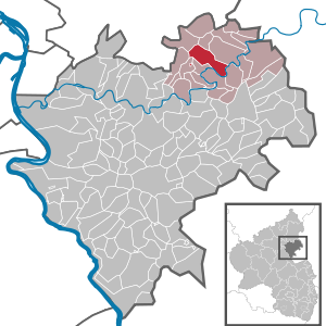
| Location of the local community Langenscheid in the Rhein-Lahn district | ||
  |
||

Langenscheid is a municipality in the Rhein-Lahn district in Rhineland-Palatinate . It belongs to the community of Diez .
geography
The size of the district is 8.92 km², of which 3.43 km² are agricultural land and 5.41 km² are low and high forest. Langenscheid is 242 m above sea level. NN and has about 550 inhabitants. Its district is bounded east by the Daubach, south by the Lahn , west by the Schwarbach and north by the Hirschberg district . The district of Lahntal in the south of the municipality belongs to the municipality. In addition, there is a small part of Hirschberg on the Langenscheid district.
history
Langenscheid was first mentioned in 1298 as Langscheyt . The village on the "long Scheyde" takes its name from the elongated ridge that separates the Daubach and the Schwarbach as tributaries of the Lahn as a watershed . Langenscheid belonged to the county of Holzappel , from 1806 the place was part of the Diez office in the Duchy of Nassau , which was annexed by Prussia in 1866 . Since 1946 the place has been part of the state of Rhineland-Palatinate .
The population developed as follows in the 19th and 20th centuries: 1843: 423 inhabitants, 1927: 540 inhabitants, 1964: 585 inhabitants.
religion
Langenscheid is assigned to the Roman Catholic parish of St. Bonifatius in Holzappel and belongs with it to the pastoral area of Diez , which in turn is incorporated into the Limburg dean's office in the Limburg diocese .
On the Protestant side, the place is parish Langenscheid-Geilnau with Hirschberg in the deanery Diez provost South Nassau in the Evangelical Church in Hessen and Nassau (EKHN) belong.
politics
Municipal council
The local council in Langenscheid consists of twelve council members, who were elected in the local elections on May 26, 2019 in a personalized proportional representation, and the honorary local mayor as chairman.
The distribution of seats in the municipal council:
| choice | SPD | WGR 1 | WGR 2 | total |
|---|---|---|---|---|
| 2019 | - | 8th | 4th | 12 seats |
| 2014 | - | 8th | 4th | 12 seats |
| 2009 | 4th | 8th | - | 12 seats |
| 2004 | 4th | 8th | - | 12 seats |
mayor
Ulrich Strutt is the local mayor of Langenscheid. In the direct election on May 26, 2019, he was re-elected with 83.88% of the vote.
Sons and daughters of the church
- Ludwig Born (1813–1875), member of the Reichstag and Landtag
- Adolf Deißmann (1866–1937), Protestant theologian, papyrologist and ecumenist
- Oskar Wilhelm Koch (1907 – after 1976), district leader of the NSDAP of Worms and the Untertaunuskreis
See also
Web links
- Website of the local community Langenscheid
- Local community Langenscheid on the website of the Verbandsgemeinde Diez
Individual evidence
- ↑ State Statistical Office of Rhineland-Palatinate - population status 2019, districts, communities, association communities ( help on this ).
- ^ The Regional Returning Officer Rhineland-Palatinate: Local elections 2019, city and municipal council elections
- ^ The Regional Returning Officer Rhineland-Palatinate: direct elections 2019. see Diez, Verbandsgemeinde, 18th line of results. Retrieved November 9, 2019 .

Altendiez | Aull | Balduinstein | Birlenbach | Charlottenberg | Cramberg | Diez | Dörnberg | Eppenrod | Geilnau | Gückingen | Hambach | Heistenbach | Hirschberg | Holzappel | Holzheim | Horhausen | Isselbach | Langenscheid | Laurenburg | Scheidt | Steinsberg | Wasenbach

Allendorf | Altendiez | Arzbach | Attenhausen | Auel | Aull | Bad Ems | Balduinstein | Becheln | Mountain | Berghausen | Berndroth | Bettendorf | Biebrich | Birlenbach | Bogel | Bornich | Braubach | Bremberg | Book | Burgschwalbach | Charlottenberg | Cramberg | Dachsenhausen | Dahlheim | Dausenau | Dessighofen | Dienethal | Diethardt | Diez | Dörnberg | Dornholzhausen | Dörscheid | Dörsdorf | Ebertshausen | Honor | Eisighofen | Endlichhofen | Eppenrod | Ergeshausen | Eschbach | Fachbach | Filsen | Flat | Fruit | Geilnau | Geisig | Gemmerich | Gückingen | Gutenacker | Hahnstätten | Hainau | Hambach | Heistenbach | Herald | Himmighofen | Hirschberg | Holzappel | Holzhausen an der Haide | Holzheim | Hömberg | Horhausen | Hunzel | Isselbach | Kaltenholzhausen | Kamp-Bornhofen | Kasdorf | Katzenelnbogen | Kaub | Kehlbach | Kemmenau | Kestert | Klingelbach | Kördorf | Lahnstein | Langenscheid | Laurenburg | Lautert | Liiffer | Lipporn | Lohrheim | Lollschied | Lykershausen | Marienfels | Miehlen | Mielle | Misselberg | Mittelfischbach | Mudershausen | Nassau | Nasta | Netzbach | Niederbachheim | Niederneisen | Niedertiefenbach | Niederwallmenach | Never | Nochern | Oberbachheim | Oberfischbach | Oberneisen | Obernhof | Obertiefenbach | Oberwallmenach | Oberwies | Oelsberg | Osterspai | Patersberg | Pohl | Prath | Reckenroth | Reichenberg | Reitzenhain | Rescue Grove | Rescues | Roth | Ruppertshofen | Sankt Goarshausen | Sauerthal | Scheidt | Schiesheim | Schönborn | Schweighausen | Seelbach | Singhofen | Steinsberg | Strüth | Sulzbach | Wasenbach | Weidenbach | Weinähr | Weisel | World destruction | Weyer | Winches | Winter advertising | Room difference