
Gückingen
| coat of arms | Germany map | |
|---|---|---|

|
Coordinates: 50 ° 23 ' N , 8 ° 0' E |
|
| Basic data | ||
| State : | Rhineland-Palatinate | |
| County : | Rhein-Lahn district | |
| Association municipality : | Diez | |
| Height : | 183 m above sea level NHN | |
| Area : | 2.34 km 2 | |
| Residents: | 1088 (Dec. 31, 2019) | |
| Population density : | 465 inhabitants per km 2 | |
| Postal code : | 65558 | |
| Area code : | 06432 | |
| License plate : | EMS, DIZ, GOH | |
| Community key : | 07 1 41 049 | |
| LOCODE : | DE GG2 | |
| Community structure: | 2 districts | |
| Association administration address: | Louise-Seher-Strasse 1 65582 Diez |
|
| Website : | ||
| Local Mayor : | Thomas Petri | |
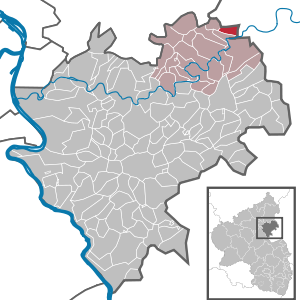
| Location of the local community of Gückingen in the Rhein-Lahn district | ||
  |
||

Gückingen is a municipality in the Rhein-Lahn district in Rhineland-Palatinate . It belongs to the community of Diez .
geography
Geographical location
Gückingen is located about 3 km west of Limburg an der Lahn , about 4 km north of Diez and about 14 km east of Montabaur directly on the border with Hesse . The area of the local community Gückingen is one of the foothills of the Westerwald .
Community structure
The district of Königstein belongs to Gückingen.
history
The first documentary mention is from 1367. In the area of today's town there was an agricultural property that belonged to the Dierstein Monastery, located on the other side of the Lahn in today's Diez . In the 13th and 14th centuries, this farm was mainly used for agriculture , cattle breeding and viticulture . In the course of the Thirty Years' War there was repeated looting and devastation by Swedish and French troops, from which the settlement did not recover for generations, so that in 1720 there were only ten inhabited houses in Gückingen. Viticulture was stopped in the 18th century. The Dierstein Monastery was also badly destroyed in the Thirty Years War and the remains were removed in the years after. In 1676 the Oranienstein Castle was built on the same site . From 1806 the place was part of the Duchy of Nassau , which was annexed by Prussia in 1866 . Gückingen has been part of the state of Rhineland-Palatinate since 1946 .
The population developed as follows in the 19th and 20th centuries: 1843: 141 inhabitants, 1927: 325 inhabitants, 1964: 446 inhabitants.
religion
Gückingen is assigned to the Roman Catholic parish Herz-Jesu in Diez and belongs with it to the pastoral area Diez, which in turn is incorporated into the Limburg district in the Limburg diocese .
On the Protestant side, the place is parish Diez - Altendiez St. Peter in the Dean's Office of the Nassau region provost Rheinhessen and the Nassau region in the Evangelical Church in Hessen and Nassau belong (EKHN).
politics
Municipal council
The council in Gückingen consists of 16 council members, who in the local elections on May 26, 2019 in a majority vote were elected, and the honorary mayor as chairman. In 2009, a personalized proportional representation took place.
mayor
The local mayor of Gückingen is Thomas Petri. In the direct election on May 26, 2019, he was re-elected with 83.36% of the vote.
coat of arms
|
|
Blazon : "In green a resisting silver dove with a golden branch in its beak." |
| Justification of the coat of arms: So the shield in the community seals from 1816 to the 20th century. Colors added. The place belonging to the Principality of Nassau-Diez did not have its own court and therefore did not have any seals before the 19th century. |
traffic
- Gückingen is connected to the regional road network via the district roads K 28 and K 27. The connection point Diez of A 3 is about 5 km away.
- Connection to the regional bus service is provided by bus line 450 (Montabaur - Nentershausen - Diez - Limburg) of the Rhein-Mosel-Bus and line 575 (Nentershausen - Hambach - Diez) from Martin Becker .
- The closest connections to local rail transport are Diez station on the Lahntalbahn (RB 23 and RE 25) and Diez-Ost station on the Unter- and Oberwesterwaldbahn (RB 29 and RB 90). The nearest long-distance railway stations are Montabaur and Limburg Süd stations .
Web links
- Website of the local community Gückingen
- Local community Gückingen on the website of the Verbandsgemeinde Diez
Individual evidence
- ↑ State Statistical Office of Rhineland-Palatinate - population status 2019, districts, communities, association communities ( help on this ).
- ^ The Regional Returning Officer Rhineland-Palatinate: Local elections 2019, city and municipal council elections
- ^ The State Returning Officer Rhineland-Palatinate: direct elections 2019. see Diez, Verbandsgemeinde, tenth line of results. Retrieved November 9, 2019 .
- ^ Karl Ernst Demandt and Otto Renkhoff : Hessisches Ortswappenbuch. C. A. Starke Verlag, Glücksburg / Ostsee 1956, p. 194.

Altendiez | Aull | Balduinstein | Birlenbach | Charlottenberg | Cramberg | Diez | Dörnberg | Eppenrod | Geilnau | Gückingen | Hambach | Heistenbach | Hirschberg | Holzappel | Holzheim | Horhausen | Isselbach | Langenscheid | Laurenburg | Scheidt | Steinsberg | Wasenbach

Allendorf | Altendiez | Arzbach | Attenhausen | Auel | Aull | Bad Ems | Balduinstein | Becheln | Mountain | Berghausen | Berndroth | Bettendorf | Biebrich | Birlenbach | Bogel | Bornich | Braubach | Bremberg | Book | Burgschwalbach | Charlottenberg | Cramberg | Dachsenhausen | Dahlheim | Dausenau | Dessighofen | Dienethal | Diethardt | Diez | Dörnberg | Dornholzhausen | Dörscheid | Dörsdorf | Ebertshausen | Honor | Eisighofen | Endlichhofen | Eppenrod | Ergeshausen | Eschbach | Fachbach | Filsen | Flat | Fruit | Geilnau | Geisig | Gemmerich | Gückingen | Gutenacker | Hahnstätten | Hainau | Hambach | Heistenbach | Herald | Himmighofen | Hirschberg | Holzappel | Holzhausen an der Haide | Holzheim | Hömberg | Horhausen | Hunzel | Isselbach | Kaltenholzhausen | Kamp-Bornhofen | Kasdorf | Katzenelnbogen | Kaub | Kehlbach | Kemmenau | Kestert | Klingelbach | Kördorf | Lahnstein | Langenscheid | Laurenburg | Lautert | Liiffer | Lipporn | Lohrheim | Lollschied | Lykershausen | Marienfels | Miehlen | Mielle | Misselberg | Mittelfischbach | Mudershausen | Nassau | Nasta | Netzbach | Niederbachheim | Niederneisen | Niedertiefenbach | Niederwallmenach | Never | Nochern | Oberbachheim | Oberfischbach | Oberneisen | Obernhof | Obertiefenbach | Oberwallmenach | Oberwies | Oelsberg | Osterspai | Patersberg | Pohl | Prath | Reckenroth | Reichenberg | Reitzenhain | Rescue Grove | Rescues | Roth | Ruppertshofen | Sankt Goarshausen | Sauerthal | Scheidt | Schiesheim | Schönborn | Schweighausen | Seelbach | Singhofen | Steinsberg | Strüth | Sulzbach | Wasenbach | Weidenbach | Weinähr | Weisel | World destruction | Weyer | Winches | Winter advertising | Room difference