
Kemmenau
| coat of arms | Germany map | |
|---|---|---|

|
Coordinates: 50 ° 21 ' N , 7 ° 45' E |
|
| Basic data | ||
| State : | Rhineland-Palatinate | |
| County : | Rhein-Lahn district | |
| Association municipality : | Bad Ems-Nassau | |
| Height : | 382 m above sea level NHN | |
| Area : | 3.76 km 2 | |
| Residents: | 493 (Dec. 31, 2019) | |
| Population density : | 131 inhabitants per km 2 | |
| Postal code : | 56132 | |
| Area code : | 02603 | |
| License plate : | EMS, DIZ, GOH | |
| Community key : | 07 1 41 071 | |
| Association administration address: | Bleichstrasse 1 56130 Bad Ems |
|
| Website : | ||
| Local Mayor : | Norbert Jachtenfuchs ( SPD ) | |
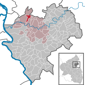
| Location of the local community of Kemmenau in the Rhein-Lahn district | ||
  |
||

Kemmenau is a local community and a state-approved resort in the Rhein-Lahn district in Rhineland-Palatinate . It belongs to the Bad Ems-Nassau community .
geography
The district of Kemmenau lies in the Nassau nature park , north of the Lahn valley in the Niederwesterwald natural area and extends at an altitude of approx. 330 to 486 m above sea level. NN ( First ) over an area of 3.76 km². Kemmenau is about 2.5 km from Bad Ems .
history
Kemmenau is located immediately to the east of the Upper German-Raetian Limes , which is still clearly visible in the municipality.
The place was first mentioned in 1320. In the late Middle Ages and in the early modern period, most of the town belonged to the Bailiwick of Ems and had its own mayor in this context by 1646 at the latest. A smaller part belonged to the court and the parish of Dausenau and was therefore mostly Nassau. In 1818 the place became an independent municipality, which in 1821 received parts of the district of Dausenaus. In 1819 173 inhabitants were counted in the place.
politics
Municipal council
The municipal council in Kemmenau consists of twelve council members, who were elected by a majority vote in the local elections on May 26, 2019 , and the honorary local mayor as chairman. In the 2009 to 2019 election periods, the municipal council had only eight council members. Until the 2014 election, a personalized proportional representation was used.
The distribution of seats in the municipal council:
| choice | SPD | CDU | WGR | DGW | total |
|---|---|---|---|---|---|
| 2019 | by majority vote | 12 seats | |||
| 2014 | 3 | 2 | 2 | 1 | 8 seats |
| 2009 | 2 | 3 | 2 | 1 | 8 seats |
| 2004 | 3 | 4th | 3 | 2 | 12 seats |
mayor
Local mayor of Kemmenau is Norbert Jachtenfuchs. In the direct election on May 26, 2019, he was re-elected with 90.94% of the vote.
Attractions
See also: List of cultural monuments in Kemmenau
Economy and Infrastructure
Kemmenau used to be dominated by agriculture and is now predominantly a residential community in the Bad Ems - Koblenz area .
The German Limes Cycle Path runs through Kemmenau . This follows the Upper German-Raetian Limes over 818 km from Bad Hönningen on the Rhine to Regensburg on the Danube .
literature
- Hellmuth Gensicke : Parish and court of Dausenau. In: Nassau Annals . Volume 78, 1967, pp. 235-255.
Web links
Individual evidence
- ↑ State Statistical Office of Rhineland-Palatinate - population status 2019, districts, communities, association communities ( help on this ).
- ↑ The Regional Returning Officer Rhineland-Palatinate: City Council Election 2019 Kemmenau. Retrieved November 3, 2019 .
- ^ The Regional Returning Officer Rhineland-Palatinate: Municipal elections 2014, city and municipal council elections
- ^ The State Returning Officer of Rhineland-Palatinate: direct elections 2019. see Bad Ems-Nassau, Verbandsgemeinde, twelfth line of results. Retrieved November 3, 2019 .

Allendorf | Altendiez | Arzbach | Attenhausen | Auel | Aull | Bad Ems | Balduinstein | Becheln | Mountain | Berghausen | Berndroth | Bettendorf | Biebrich | Birlenbach | Bogel | Bornich | Braubach | Bremberg | Book | Burgschwalbach | Charlottenberg | Cramberg | Dachsenhausen | Dahlheim | Dausenau | Dessighofen | Dienethal | Diethardt | Diez | Dörnberg | Dornholzhausen | Dörscheid | Dörsdorf | Ebertshausen | Honor | Eisighofen | Endlichhofen | Eppenrod | Ergeshausen | Eschbach | Fachbach | Filsen | Flat | Fruit | Geilnau | Geisig | Gemmerich | Gückingen | Gutenacker | Hahnstätten | Hainau | Hambach | Heistenbach | Herald | Himmighofen | Hirschberg | Holzappel | Holzhausen an der Haide | Holzheim | Hömberg | Horhausen | Hunzel | Isselbach | Kaltenholzhausen | Kamp-Bornhofen | Kasdorf | Katzenelnbogen | Kaub | Kehlbach | Kemmenau | Kestert | Klingelbach | Kördorf | Lahnstein | Langenscheid | Laurenburg | Lautert | Liiffer | Lipporn | Lohrheim | Lollschied | Lykershausen | Marienfels | Miehlen | Mielle | Misselberg | Mittelfischbach | Mudershausen | Nassau | Nasta | Netzbach | Niederbachheim | Niederneisen | Niedertiefenbach | Niederwallmenach | Never | Nochern | Oberbachheim | Oberfischbach | Oberneisen | Obernhof | Obertiefenbach | Oberwallmenach | Oberwies | Oelsberg | Osterspai | Patersberg | Pohl | Prath | Reckenroth | Reichenberg | Reitzenhain | Rescue Grove | Rescues | Roth | Ruppertshofen | Sankt Goarshausen | Sauerthal | Scheidt | Schiesheim | Schönborn | Schweighausen | Seelbach | Singhofen | Steinsberg | Strüth | Sulzbach | Wasenbach | Weidenbach | Weinähr | Weisel | World destruction | Weyer | Winches | Winter advertising | Room difference