
Horhausen (Nassau)
| coat of arms | Germany map | |
|---|---|---|

|
Coordinates: 50 ° 22 ' N , 7 ° 53' E |
|
| Basic data | ||
| State : | Rhineland-Palatinate | |
| County : | Rhein-Lahn district | |
| Association municipality : | Diez | |
| Height : | 310 m above sea level NHN | |
| Area : | 5.46 km 2 | |
| Residents: | 299 (Dec. 31, 2019) | |
| Population density : | 55 inhabitants per km 2 | |
| Postal code : | 56379 | |
| Area code : | 06439 | |
| License plate : | EMS, DIZ, GOH | |
| Community key : | 07 1 41 062 | |
| Association administration address: | Louise-Seher-Strasse 1 65582 Diez |
|
| Website : | ||
| Local Mayor : | Ralf Schmidt | |
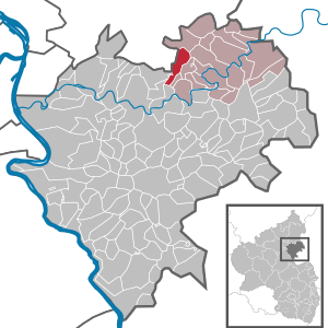
| Location of the local community Horhausen in the Rhein-Lahn district | ||
  |
||

Horhausen is a municipality in the Rhein-Lahn district in Rhineland-Palatinate . It belongs to the community of Diez .
geography
The municipality is located in the Nassau Nature Park in the Westerwald in the Esterau am Höchst . Horhausen is 9 km south of Montabaur , 8 km west of Diez and 11 km west of Limburg an der Lahn . Horhausen was originally a horseshoe village in terms of the type of settlement ; this original form of settlement can no longer be recognized today due to the new development areas.
history
Celtic barrows from 500 to 100 BC Chr. Testify to an early settlement in the area of the local community Horhausen. These are so-called cremation graves . Their designation " Roman nipple" testifies to the earlier erroneous assumption that they were Roman tombs. In 1896 a Celtic princely grave was excavated near Horhausen. Many of the finds made in the process can be seen today in the museum of Waldeck Castle . In 1962, during the construction of an oil pipeline, a hump grave was uncovered, which points to a settlement centuries before the "burn burial period".
The oldest known mention of Horhausen in a document goes back to 1345. The name Horhausen, originally Horhusen, means something like "houses on the swamp". The name is believed to be of Celtic origin.
Before the Holzappel mine was opened in the middle of the 18th century, the majority of the population worked in agriculture, as craftsmen or as forest workers. Mining has been a significant source of income since the "Holzappel Pit" was commissioned.
Temporarily occupied by the French in 1795, from 1806 the place was part of the Duchy of Nassau , which was annexed by Prussia in 1866 . Since 1946 the place has been part of the state of Rhineland-Palatinate .
In the area of the local community Horhausen lies the Billenstein desert . Billenstein had already become a desert before the Thirty Years War .
School lessons took place in Horhausen from 1867 to 1969, initially using rooms in the bakery before a school building was built in 1926. Horhausen has been part of the catchment area of the Esterauschule primary and secondary school in Holzappel since 1969 .
In 1962 Horhausen won first place at the district level in the competition “ Our village should be more beautiful ”.
The population developed as follows in the 19th and 20th centuries: 1843: 236 inhabitants, 1927: 269 inhabitants, 1964: 281 inhabitants.
religion
Horhausen is assigned to the Roman Catholic parish St. Bonifatius in Holzappel and belongs with it to the pastoral area Diez , which in turn is incorporated into the Limburg district in the Limburg diocese .
On the Protestant side, the place is parish Holzappel in the deanery Diez the provost South Nassau in the Evangelical Church in Hessen and Nassau (EKHN) belong.
politics
Municipal council
The local council in Horhausen consists of eight council members who were elected by a majority vote in the local elections on May 26, 2019 , and the honorary local mayor as chairman.
mayor
Local mayor of Horhausen is Ralf Schmidt. In the direct election on May 26, 2019, he was elected with a share of the vote of 83.96% and is thus the successor to Klaus Hennemann.
Attractions
- "Lindenborn" - 700 year old linden tree with a fountain
- old school house
Economy and Infrastructure
leisure
The bathing lake Herthasee is located about 1 km southeast of Horhausen, directly on the B 417 .
traffic
Horhausen is on the L 313 state road , which joins the B 417 1 km southeast of Horhausen. The Diez motorway junction on the A3 is 6 km away.
Horhausen is connected to local public transport by bus lines 540 and 458 of the Rhein-Mosel transport association .
The closest ICE long-distance train stations are Montabaur train station and Limburg Süd train station .
Web links
Individual evidence
- ↑ State Statistical Office of Rhineland-Palatinate - population status 2019, districts, communities, association communities ( help on this ).
- ↑ Peter Paul Schweitzer - Ancient names on the Lahn - From prehistory and early history and the Middle Ages; 2000 Hadamar 2004 ( Memento of the original from July 19, 2011 in the Internet Archive ) Info: The archive link was inserted automatically and has not yet been checked. Please check the original and archive link according to the instructions and then remove this notice. PDF 840 kB
- ^ The Regional Returning Officer Rhineland-Palatinate: Local elections 2019, city and municipal council elections
- ^ The State Returning Officer Rhineland-Palatinate: direct elections 2019. see Diez, Verbandsgemeinde, 16th line of results. Retrieved November 9, 2019 .

Altendiez | Aull | Balduinstein | Birlenbach | Charlottenberg | Cramberg | Diez | Dörnberg | Eppenrod | Geilnau | Gückingen | Hambach | Heistenbach | Hirschberg | Holzappel | Holzheim | Horhausen | Isselbach | Langenscheid | Laurenburg | Scheidt | Steinsberg | Wasenbach

Allendorf | Altendiez | Arzbach | Attenhausen | Auel | Aull | Bad Ems | Balduinstein | Becheln | Mountain | Berghausen | Berndroth | Bettendorf | Biebrich | Birlenbach | Bogel | Bornich | Braubach | Bremberg | Book | Burgschwalbach | Charlottenberg | Cramberg | Dachsenhausen | Dahlheim | Dausenau | Dessighofen | Dienethal | Diethardt | Diez | Dörnberg | Dornholzhausen | Dörscheid | Dörsdorf | Ebertshausen | Honor | Eisighofen | Endlichhofen | Eppenrod | Ergeshausen | Eschbach | Fachbach | Filsen | Flat | Fruit | Geilnau | Geisig | Gemmerich | Gückingen | Gutenacker | Hahnstätten | Hainau | Hambach | Heistenbach | Herald | Himmighofen | Hirschberg | Holzappel | Holzhausen an der Haide | Holzheim | Hömberg | Horhausen | Hunzel | Isselbach | Kaltenholzhausen | Kamp-Bornhofen | Kasdorf | Katzenelnbogen | Kaub | Kehlbach | Kemmenau | Kestert | Klingelbach | Kördorf | Lahnstein | Langenscheid | Laurenburg | Lautert | Liiffer | Lipporn | Lohrheim | Lollschied | Lykershausen | Marienfels | Miehlen | Mielle | Misselberg | Mittelfischbach | Mudershausen | Nassau | Nasta | Netzbach | Niederbachheim | Niederneisen | Niedertiefenbach | Niederwallmenach | Never | Nochern | Oberbachheim | Oberfischbach | Oberneisen | Obernhof | Obertiefenbach | Oberwallmenach | Oberwies | Oelsberg | Osterspai | Patersberg | Pohl | Prath | Reckenroth | Reichenberg | Reitzenhain | Rescue Grove | Rescues | Roth | Ruppertshofen | Sankt Goarshausen | Sauerthal | Scheidt | Schiesheim | Schönborn | Schweighausen | Seelbach | Singhofen | Steinsberg | Strüth | Sulzbach | Wasenbach | Weidenbach | Weinähr | Weisel | World destruction | Weyer | Winches | Winter advertising | Room difference