
Allendorf (Rhein-Lahn district)
| coat of arms | Germany map | |
|---|---|---|

|
Coordinates: 50 ° 16 ' N , 8 ° 0' E |
|
| Basic data | ||
| State : | Rhineland-Palatinate | |
| County : | Rhein-Lahn district | |
| Association municipality : | Aar facility | |
| Height : | 325 m above sea level NHN | |
| Area : | 3.03 km 2 | |
| Residents: | 613 (Dec. 31, 2019) | |
| Population density : | 202 inhabitants per km 2 | |
| Postal code : | 56370 | |
| Area code : | 06486 | |
| License plate : | EMS, DIZ, GOH | |
| Community key : | 07 1 41 001 | |
| Association administration address: | Burgstrasse 1 56368 Katzenelnbogen |
|
| Website : | ||
| Local Mayor : | Lars Denninghoff ( SPD ) | |
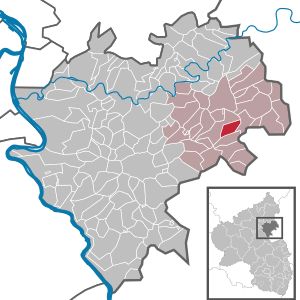
| Location of the local community Allendorf in the Rhein-Lahn district | ||
  |
||

Allendorf ( ) is a municipality in the Rhein-Lahn district in Rhineland-Palatinate . It belongs to the municipality of Aar-Einrich .
geography
Allendorf is about 1.6 km as the crow flies east of Katzenelnbogen in the western Hintertaunus . The route via Kreisstrasse 54 and Landesstrasse 322 is about 2 km long.
Half of the municipal area is used for agriculture, a third is forest.
history
The place was first mentioned in a document in 1259 and belonged to the Lower County of Katzenelnbogen until the beginning of the 19th century . In 1806 the village was assigned to the Duchy of Nassau . In 1847 the last remnants of the manor were removed by paying a severance payment. Allendorf was Prussian from 1866 and in 1946 came to the then newly formed state of Rhineland-Palatinate. In 1972, in the course of the Rhineland-Palatinate "functional and territorial reform ", the community of Katzenelnbogen was formed, to which the local community of Allendorf belonged until 2019 and which was then merged into the community of Aar-Einrich.
- Population development
The development of the population of Allendorf, the values from 1871 to 1987 are based on censuses:
|
|
Allendorf's
The noble von Allendorf family can be traced back to numerous functions in the extended region for more than 300 years. Her coat of arms showed a red heart shield in silver accompanied by a gold ring in the right upper corner. The oldest tangible member is Dietrich von Katzenelnbogen, who is first mentioned in 1258. His son Heinrich von Katzenelnbogen, called vom Turm, called himself "von Allendorf" for the first time in 1276. The last name bearer is mentioned for the last time in 1594. Important members were Henne (mentioned from 1422 to 1445), Burgrave of Rheinfels Castle , Kraft († October 4, 1474), Mayor of Mainz, Kraft († March 29, 1560), Electorate Steward , Heinrich († May 26, 1557) Canon of Mainz, and Hans Heinrich († 1576), Obervogt of Tuttlingen.
At first the house was closely connected to the Counts of Katzenelnbogen , later to Kurmainz and the House of Nassau . In accordance with the long existence of the house, the possessions were spread over the corresponding domains, with a focus on Katzenelnbogen.
politics
Municipal council
The municipal council in Allendorf consists of twelve council members, who were elected in a personalized proportional representation in the local elections on May 26, 2019 , and the honorary local mayor as chairman.
The distribution of seats in the municipal council:
| choice | SPD | WGR | total |
|---|---|---|---|
| 2019 | 7th | 5 | 12 seats |
| 2014 | 7th | 5 | 12 seats |
| 2009 | 5 | 7th | 12 seats |
| 2004 | 5 | 7th | 12 seats |
mayor
Lars Denninghoff (SPD) is the local mayor of Allendorf. In the direct election on May 26, 2019, he was re-elected with 84.24% of the vote.
coat of arms
|
|
Blazon : "A red shield in silver, covered with golden slanted hammers and mallets, accompanied in the upper right corner by a black-rimmed golden ring." |
| Justification of the coat of arms: hammer and mallet refer to earlier mining on the Eisensteinfeld and in the Zollhaus mine. The ring is taken from the coat of arms of the local low-nobility "von Allendorf". |
Culture and sights
In the northeast of the district lies part of the Hohlenfelsbachtal nature reserve .
See also: List of cultural monuments in Allendorf
Economy and Infrastructure
As of 2007 there are three farms with an average of 43 hectares of utilized agricultural area, in 1971 there were still 20 farms with an average of 7 hectares.
The place has a community center, a communal kindergarten and a volunteer fire department .
District road 54 runs through Allendorf .
literature
- Literature about Allendorf in the Rhineland-Palatinate state bibliography
- Hellmuth Gensicke : Allendorf's. In: Nassauische Annalen 85. 1974, pp. 208-219.
Web links
- Local community Allendorf on the website of the municipality of Aar-Einrich
Individual evidence
- ↑ a b State Statistical Office of Rhineland-Palatinate - population status 2019, districts, municipalities, association communities ( help on this ).
- ^ A b c State Statistical Office Rhineland-Palatinate - regional data
- ^ The Regional Returning Officer Rhineland-Palatinate: Local elections 2019, city and municipal council elections
- ^ The Regional Returning Officer Rhineland-Palatinate: direct elections 2019. see Aar-Einrich, Verbandsgemeinde, second line of results. Retrieved November 19, 2019 .

Allendorf | Altendiez | Arzbach | Attenhausen | Auel | Aull | Bad Ems | Balduinstein | Becheln | Mountain | Berghausen | Berndroth | Bettendorf | Biebrich | Birlenbach | Bogel | Bornich | Braubach | Bremberg | Book | Burgschwalbach | Charlottenberg | Cramberg | Dachsenhausen | Dahlheim | Dausenau | Dessighofen | Dienethal | Diethardt | Diez | Dörnberg | Dornholzhausen | Dörscheid | Dörsdorf | Ebertshausen | Honor | Eisighofen | Endlichhofen | Eppenrod | Ergeshausen | Eschbach | Fachbach | Filsen | Flat | Fruit | Geilnau | Geisig | Gemmerich | Gückingen | Gutenacker | Hahnstätten | Hainau | Hambach | Heistenbach | Herald | Himmighofen | Hirschberg | Holzappel | Holzhausen an der Haide | Holzheim | Hömberg | Horhausen | Hunzel | Isselbach | Kaltenholzhausen | Kamp-Bornhofen | Kasdorf | Katzenelnbogen | Kaub | Kehlbach | Kemmenau | Kestert | Klingelbach | Kördorf | Lahnstein | Langenscheid | Laurenburg | Lautert | Liiffer | Lipporn | Lohrheim | Lollschied | Lykershausen | Marienfels | Miehlen | Mielle | Misselberg | Mittelfischbach | Mudershausen | Nassau | Nasta | Netzbach | Niederbachheim | Niederneisen | Niedertiefenbach | Niederwallmenach | Never | Nochern | Oberbachheim | Oberfischbach | Oberneisen | Obernhof | Obertiefenbach | Oberwallmenach | Oberwies | Oelsberg | Osterspai | Patersberg | Pohl | Prath | Reckenroth | Reichenberg | Reitzenhain | Rescue Grove | Rescues | Roth | Ruppertshofen | Sankt Goarshausen | Sauerthal | Scheidt | Schiesheim | Schönborn | Schweighausen | Seelbach | Singhofen | Steinsberg | Strüth | Sulzbach | Wasenbach | Weidenbach | Weinähr | Weisel | World destruction | Weyer | Winches | Winter advertising | Room difference