
Holzappel
| coat of arms | Germany map | |
|---|---|---|

|
Coordinates: 50 ° 21 ' N , 7 ° 54' E |
|
| Basic data | ||
| State : | Rhineland-Palatinate | |
| County : | Rhein-Lahn district | |
| Association municipality : | Diez | |
| Height : | 297 m above sea level NHN | |
| Area : | 2.73 km 2 | |
| Residents: | 1009 (Dec. 31, 2019) | |
| Population density : | 370 inhabitants per km 2 | |
| Postal code : | 56379 | |
| Area code : | 06439 | |
| License plate : | EMS, DIZ, GOH | |
| Community key : | 07 1 41 059 | |
| Association administration address: | Louise-Seher-Strasse 1 65582 Diez |
|
| Website : | ||
| Local Mayor : | Harald Nöllge ( SPD ) | |
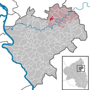
| Location of the local community Holzappel in the Rhein-Lahn district | ||
  |
||

Holzappel is a municipality west of Limburg an der Lahn in the Rhein-Lahn-Kreis in Rhineland-Palatinate . It belongs to the community of Diez . Holzappel ( Estonians until 1688 ) was once the seat of the county of Holzappel . According to state planning, Holzappel is designated as a basic center.
geography
Holzappel is located in the Esterau 8 km west of Diez , 10 km southeast of Montabaur and 11 km west of Limburg an der Lahn . The district of Holzappel is in the Nassau Nature Park .
history
Holzappel goes back to the county of Holzappel , which developed strongly with ore mining in the Esterau ( Holzappel pit ).
The place was first mentioned in a document in 959 as Astine . It became more important as Estonian / Astine in the Middle Ages , when it became the administrative and court seat for the surrounding towns. The Esterau ( Praedia Astine ) was then a small manor with 12 villages around today's Holzappel.
Count Peter Melander von Holzappel , who was promoted to field marshal of the imperial army in Germany during the Thirty Years' War , acquired Esterau in 1643. Emperor Ferdinand III. soon afterwards raised the small lordship to the "Free Imperial Immediate County of Holzappel".
After his death in the battle of Zusmarshausen near Augsburg (May 1648), Count Holzappel was buried in the prince's crypt ("Melander Crypt") of the Protestant St. John's Church in the then village of Esten (today's Holzappel). His widow , Countess Agnes, expanded the area of the county in 1656 by purchasing the Schaumburg castle and estate near Balduinstein . Her daughter, Elisabeth Charlotte, raised the village of Esten to the name of Holzappel in 1688 and allowed refugees from France ( Huguenots and Waldensians ) to settle there. In 1699 she founded the Waldensian village of Charlottenberg, named after her, not far from Holzappel .
After the elevation of the town, Holzappel experienced a significant economic boom through trade, craft and mining , especially in the 18th and 19th centuries . The profitable lead , silver and zinc mine (" Grube Holzappel "), which in 1815 also led Johann Wolfgang von Goethe into the walls of the town, contributed to this. The "Goethehaus" on the lower market square is named after him.
From 1806 the place was part of the Duchy of Nassau , which was annexed by Prussia in 1866 . In the course of the "Prussian district reform" in the province of Hessen-Nassau , Holzappel lost its town charter in 1885. Since 1946 the place has been part of the state of Rhineland-Palatinate .
The population developed as follows in the 19th and 20th centuries: 1843: 921 inhabitants, 1927: 771 inhabitants, 1964: 881 inhabitants.
religion
Holzappel is assigned to the Roman Catholic parish St. Bonifatius in Holzappel and belongs with it to the pastoral area Diez , which in turn is incorporated into the Limburg district in the Limburg diocese .
On the Protestant side, the place is parish Holzappel in the deanery Diez provost South Nassau in the Evangelical Church in Hessen and Nassau (EKHN) belong.
politics
Municipal council
The local council in Holzappel consists of 16 council members, who were elected in the local elections on May 26, 2019 in a personalized proportional representation, and the honorary local mayor as chairman.
The distribution of seats in the municipal council:
| choice | SPD | CDU | total |
|---|---|---|---|
| 2019 | 13 | 3 | 16 seats |
| 2014 | 11 | 5 | 16 seats |
| 2009 | 9 | 7th | 16 seats |
| 2004 | 7th | 9 | 16 seats |
mayor
Harald Nöllge (SPD) is the local mayor of Holzappel. In the direct election on May 26, 2019, he was re-elected with 81.46% of the vote.
coat of arms
The current coat of arms was officially approved in 1950, but has been used in this form by the municipality since the city was raised in 1688. The oldest seal in Estonia dates back to 1533 and shows John the Baptist with a book. Today's coat of arms shows a blue-armored, red griffin with a green-stemmed and gold-crowned apple in the right claw. The griffin comes from the coat of arms of the Melander family, the crowned apple symbolizes the empire.
Culture and sights
Museums
- Local history and mining museum with the Melander crypt in the Holzappel town hall
Buildings

The Goethehaus commemorates the visit of Johann Wolfgang von Goethe on July 23, 1815 in Holzappel.
The bear fountain was built as a “Heimat- und war memorial” in 1913 and was unveiled on July 19, 1913 after the original Holzappeler bear fountain from 1734 had become dilapidated. This stood on the upper market square, the reconstruction from 1913 is on the lower market square. The bear stands for the heraldic animal of the House of Anhalt to whose rule the County of Holzappel came through the marriage of a granddaughter of Count Peter Melander to Prince Lebrecht of Anhalt .
The Protestant Johanneskirche was built from 1824 to 1826 in place of a previous building, from which the princely crypt was preserved. Today's church is shaped by classicism . The vestibule was redesigned in 2000 by the Wiesbaden sculptor Wolf Spemann. Rudolf and Otto Linnemann from Frankfurt created glass windows for the church, as can be seen from a catalog raisonné from 1906.
.jpg)
See also: List of cultural monuments in Holzappel
Herthasee
About 1 km north of the village of Holzappel in the direction of Horhausen directly on the B 417 is Lake Herthasee .
Economy and Infrastructure
traffic
Holzappel is on the B 417, which here is identical to Lahn-Ferien-Straße and leads to Nassau in the southwest . In the west it leads to Diez and Limburg an der Lahn. The closest motorway junction is Diez on the A3 . The closest ICE long-distance train stations are Montabaur and Limburg Süd .
Holzappel is connected to the public transport network with the bus routes 458, 540 and 579 in the Rhein-Mosel transport association.
schools
Esterau elementary school
Personalities
Sons and daughters of the church
- Ernst Schwarz (1904–1941), politician
Personalities who have worked on site
- Peter Melander von Holzappel (born February 8, 1589 in Niederhadamar ; † May 17, 1648 in Augsburg ), general in the Thirty Years' War and founder of the Free Imperial County of Holzappel
- Elisabeth Charlotte von Nassau-Dillenburg-Schaumburg, widow of Count Adolf von Nassau-Dillenburg, daughter of Peter Melander
Web links
- Local community Holzappel on the website of the Verbandsgemeinde Diez
- Internet presence of the local community Holzappel am Herthasee
- geographer. Lage, Goethehaus ( Memento from August 24, 2007 in the Internet Archive )
- History, mining, picture of the Holzappel-Taler
Individual evidence
- ↑ State Statistical Office of Rhineland-Palatinate - population status 2019, districts, communities, association communities ( help on this ).
- ↑ State Statistical Office Rhineland-Palatinate - regional data
- ^ The Regional Returning Officer Rhineland-Palatinate: Local elections 2019, city and municipal council elections
- ^ The Regional Returning Officer Rhineland-Palatinate: direct elections 2019. see Diez, Verbandsgemeinde, 14th line of results. Retrieved November 9, 2019 .

Altendiez | Aull | Balduinstein | Birlenbach | Charlottenberg | Cramberg | Diez | Dörnberg | Eppenrod | Geilnau | Gückingen | Hambach | Heistenbach | Hirschberg | Holzappel | Holzheim | Horhausen | Isselbach | Langenscheid | Laurenburg | Scheidt | Steinsberg | Wasenbach

Allendorf | Altendiez | Arzbach | Attenhausen | Auel | Aull | Bad Ems | Balduinstein | Becheln | Mountain | Berghausen | Berndroth | Bettendorf | Biebrich | Birlenbach | Bogel | Bornich | Braubach | Bremberg | Book | Burgschwalbach | Charlottenberg | Cramberg | Dachsenhausen | Dahlheim | Dausenau | Dessighofen | Dienethal | Diethardt | Diez | Dörnberg | Dornholzhausen | Dörscheid | Dörsdorf | Ebertshausen | Honor | Eisighofen | Endlichhofen | Eppenrod | Ergeshausen | Eschbach | Fachbach | Filsen | Flat | Fruit | Geilnau | Geisig | Gemmerich | Gückingen | Gutenacker | Hahnstätten | Hainau | Hambach | Heistenbach | Herald | Himmighofen | Hirschberg | Holzappel | Holzhausen an der Haide | Holzheim | Hömberg | Horhausen | Hunzel | Isselbach | Kaltenholzhausen | Kamp-Bornhofen | Kasdorf | Katzenelnbogen | Kaub | Kehlbach | Kemmenau | Kestert | Klingelbach | Kördorf | Lahnstein | Langenscheid | Laurenburg | Lautert | Liiffer | Lipporn | Lohrheim | Lollschied | Lykershausen | Marienfels | Miehlen | Mielle | Misselberg | Mittelfischbach | Mudershausen | Nassau | Nasta | Netzbach | Niederbachheim | Niederneisen | Niedertiefenbach | Niederwallmenach | Never | Nochern | Oberbachheim | Oberfischbach | Oberneisen | Obernhof | Obertiefenbach | Oberwallmenach | Oberwies | Oelsberg | Osterspai | Patersberg | Pohl | Prath | Reckenroth | Reichenberg | Reitzenhain | Rescue Grove | Rescues | Roth | Ruppertshofen | Sankt Goarshausen | Sauerthal | Scheidt | Schiesheim | Schönborn | Schweighausen | Seelbach | Singhofen | Steinsberg | Strüth | Sulzbach | Wasenbach | Weidenbach | Weinähr | Weisel | World destruction | Weyer | Winches | Winter advertising | Room difference