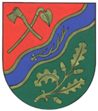
Roth (Rhein-Lahn district)
| coat of arms | Germany map | |
|---|---|---|

|
Coordinates: 50 ° 16 ' N , 7 ° 54' E |
|
| Basic data | ||
| State : | Rhineland-Palatinate | |
| County : | Rhein-Lahn district | |
| Association municipality : | Aar facility | |
| Height : | 330 m above sea level NHN | |
| Area : | 3.4 km 2 | |
| Residents: | 201 (Dec. 31, 2019) | |
| Population density : | 59 inhabitants per km 2 | |
| Postal code : | 56368 | |
| Area code : | 06772 | |
| License plate : | EMS, DIZ, GOH | |
| Community key : | 07 1 41 118 | |
| Association administration address: | Burgstrasse 1 56368 Katzenelnbogen |
|
| Website : | ||
| Local Mayor : | Reinhard Laux | |
| Location of the local community of Roth in the Rhein-Lahn district | ||
Roth is a municipality in the Rhein-Lahn district in Rhineland-Palatinate . It belongs to the municipality of Aar-Einrich .
geography
Roth is located in the Nassau Nature Park about six kilometers west of Katzenelnbogen . In the northeast the Dörsbach and in the southwest the Hasenbach form the municipal boundary .
The residential areas Hasenmühle, Mohrenhof and Neumühle also belong to Roth .
About half of the municipality is used for agriculture, 40% is forest.
history
The place is a medieval clearing. It was originally divided among three tithe lords, the monastery of Sankt Goar , the Arnstein Abbey and the parish of Niedertiefenbach .
Until the beginning of the 19th century, the place belonged to the Lower County of Katzenelnbogen , which was ruled by the Counts of Katzenelnbogen until 1479. After their extinction, the area came to the Landgraves of Hesse. Landgrave Philip I introduced the Reformation in 1527. After his death in 1567, the area came to Hessen-Rheinfels. In 1583 it fell to Hessen-Kassel.
During the 30-year war, the Niedergafschaft fell to Hessen-Darmstadt. In 1648 it came back to Hessen-Kassel.
Roth was under French administration ( pays réservé ) from 1806 to 1813 and came to the Duchy of Nassau in 1816 (after it briefly belonged again to Hessen-Kassel) , which in turn was annexed by the Kingdom of Prussia in 1866 as a result of the so-called German War . During the time of the duchy it belonged to the office of Nassau. From 1867 to 1969 Roth was part of the Unterlahn district .
After the First World War , the place was occupied until the French withdrew in 1929, after the Second World War it was also part of the French occupation zone and since 1946 has been part of the then newly formed state of Rhineland-Palatinate .
Roth has been part of the Rhein-Lahn district since 1969 , and in 1972, as part of the Rhineland-Palatinate “functional and territorial reform” , the community of Katzenelnbogen was formed , to which the local community of Roth belonged until 2019 and which then became part of the community of Aar-Einrich .
- Population development
The development of the population of Roth, the values from 1871 to 1987 are based on censuses:
|
|
politics
Municipal council
The council in Roth consists of six council members, who in the local elections on May 26, 2019 in a majority vote were elected, and the honorary mayor as chairman.
mayor
The local mayor of Roth is Reinhard Laux. In the direct election on May 26, 2019, there was no applicant. Laux was unanimously elected by the local council on June 26, 2019 and is the successor to Matthias Weis, who did not run again.
Economy and Infrastructure
As of 2007 there were still three farms with an average of 62 hectares of agricultural area, in 1971 there were still 20 farms with an average of 8 hectares.
District road 51 runs through the village.
See also
Web links
- Local municipality Roth on the website of the municipality of Aar-Einrich
Individual evidence
- ↑ State Statistical Office of Rhineland-Palatinate - population status 2019, districts, communities, association communities ( help on this ).
- ↑ State Statistical Office Rhineland-Palatinate (ed.): Official directory of the municipalities and parts of the municipality. Status: January 1, 2017 [ Version 2020 is available. ] . S. 43 (PDF; 1.9 MB).
- ^ A b c State Statistical Office Rhineland-Palatinate - regional data
- ^ The Regional Returning Officer Rhineland-Palatinate: Local elections 2019, city and municipal council elections
- ^ The Regional Returning Officer Rhineland-Palatinate: direct elections 2019. see Aar-Einrich, Verbandsgemeinde, 30th line of results. Retrieved November 23, 2019 .
- ↑ Dagmar Schweickert: Council elects mayor: Also as Hesse "worthy" for local chief posts. Rhein-Lahn-Zeitung, June 27, 2019, accessed on November 23, 2019 .


