
Isselbach
| coat of arms | Germany map | |
|---|---|---|

|
Coordinates: 50 ° 23 ' N , 7 ° 54' E |
|
| Basic data | ||
| State : | Rhineland-Palatinate | |
| County : | Rhein-Lahn district | |
| Association municipality : | Diez | |
| Height : | 165 m above sea level NHN | |
| Area : | 7.19 km 2 | |
| Residents: | 341 (Dec. 31, 2019) | |
| Population density : | 47 inhabitants per km 2 | |
| Postal code : | 65558 | |
| Area code : | 06439 | |
| License plate : | EMS, DIZ, GOH | |
| Community key : | 07 1 41 064 | |
| Community structure: | 3 districts | |
| Association administration address: | Louise-Seher-Strasse 1 65582 Diez |
|
| Website : | ||
| Local Mayor : | Ulrich Juergens | |
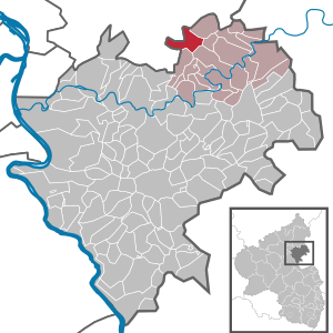
| Location of the local community Isselbach in the Rhein-Lahn district | ||
  |
||


Isselbach is a municipality in the Rhein-Lahn district in Rhineland-Palatinate . It belongs to the community of Diez .
geography
Geographical location
The local community of Isselbach is part of the Nassau nature park in the Westerwald and the Esterau . The Gelbach flows through Isselbach , the municipal area is traversed by the Isselbach stream of the same name . The local community is nine kilometers west of Diez , eleven kilometers west of Limburg an der Lahn and six kilometers southeast of Montabaur .
Community structure
The local community Isselbach consists of the districts Isselbach, Giershausen and Ruppenrod .
history
A Vogtei Isselbach was mentioned in 1355. The name Isselbach goes back to the local noble family von Usselbach.
The late Gothic - early Baroque style chapel was probably built around 1500. One of the bells came from the same time. This was melted down for weapons production during the First World War .
To the north-east of today's Isselbach was Oberisselbach , which fell desolately as a result of destruction in the Thirty Years' War and there is evidence that it still existed around 1573. Today's Isselbach goes back to the former village of Unterisselbach .
In 1643 Isselbach came under the control of Esten (today Holzappel ) through a purchase by Count Peter Melander von Holzappel , which in 1656 became the County of Holzappel-Schaumburg . Through this change of rule, the population of Isselbach became Protestant . Temporarily occupied by the French in 1795, from 1806 the place was part of the Duchy of Nassau , which was annexed by Prussia in 1866 . Since 1946 the place has been part of the state of Rhineland-Palatinate .
Evidently since 1718 there was a school in Isselbach. In 1824 a new school building was built in the Nassau classical style, which was taught until 1969. The localities of Giershausen and Ruppenrod also belonged to the catchment area of this so-called “New Elementary School ” . The building is now a listed building. Isselbach has been part of the catchment area of the Esterauschule primary and secondary school in Holzappel since 1969.
religion
Isselbach is assigned to the Roman Catholic parish St. Bonifatius in Holzappel and belongs with it to the pastoral area of Diez , which in turn is incorporated into the Limburg district in the Limburg diocese .
On the Protestant side of the place is the parish Eppenrod in the Dean's Office Nassau region in the provost Rheinhessen-Nassau region of the Evangelical Church in Hessen and Nassau belong (EKHN).
Incorporations
On December 31, 1972, the communities Isselbach, Giershausen and Ruppenrod merged.
Population development
In 1843 Isselbach had 192 inhabitants, in 1910 there were 199 inhabitants, in 1933 there were 179 inhabitants and in 1964 there were 196 inhabitants.
politics
Municipal council
The municipal council in Isselbach consists of eight council members, who were elected by a majority vote in the local elections on May 26, 2019 , and the honorary local mayor as chairman.
mayor
Ulrich Jürgens is the local mayor of Isselbach. In the direct election on May 26, 2019, he was re-elected with 69.71% of the vote.
coat of arms
The municipal coat of arms was officially introduced in 1973 and goes back to the family coat of arms of the noble von Usselbach family. The first proven seal of Isselbach comes from 1816, the blazon reads: "In gold a blue brook, in it three silver fish swimming to the left." The colors of the coat of arms go back to the house of Nassau .
traffic
Isselbach is on the state roads L 313 and L 325 and on the district road K 163 Nentershausen - Isselbach. The closest motorway junction is Diez on the A3 . Isselbach is connected to the public transport network with the number 540 of the Rhein-Mosel transport association . The closest ICE long-distance train stations are Montabaur train station and Limburg Süd train station .
See also
Web links
Individual evidence
- ↑ State Statistical Office of Rhineland-Palatinate - population status 2019, districts, communities, association communities ( help on this ).
- ↑ Official municipality directory (= State Statistical Office of Rhineland-Palatinate [Hrsg.]: Statistical volumes . Volume 407 ). Bad Ems February 2016, p. 167 (PDF; 2.8 MB).
- ^ The Regional Returning Officer Rhineland-Palatinate: Local elections 2019, city and municipal council elections
- ^ The Regional Returning Officer Rhineland-Palatinate: direct elections 2019. see Diez, Verbandsgemeinde, 17th line of results. Retrieved November 9, 2019 .
- ^ Elsbeth Andre (Hrsg.): Wappenbuch des Rhein-Lahn-Kreis (= publications of the Landesarchivverwaltung Rheinland-Pfalz. Volume 123). Verlag der Landesarchivverwaltung Rheinland-Pfalz, Koblenz 2017, ISBN 978-3-9818458-2-2 , p. 60.

Altendiez | Aull | Balduinstein | Birlenbach | Charlottenberg | Cramberg | Diez | Dörnberg | Eppenrod | Geilnau | Gückingen | Hambach | Heistenbach | Hirschberg | Holzappel | Holzheim | Horhausen | Isselbach | Langenscheid | Laurenburg | Scheidt | Steinsberg | Wasenbach

Allendorf | Altendiez | Arzbach | Attenhausen | Auel | Aull | Bad Ems | Balduinstein | Becheln | Mountain | Berghausen | Berndroth | Bettendorf | Biebrich | Birlenbach | Bogel | Bornich | Braubach | Bremberg | Book | Burgschwalbach | Charlottenberg | Cramberg | Dachsenhausen | Dahlheim | Dausenau | Dessighofen | Dienethal | Diethardt | Diez | Dörnberg | Dornholzhausen | Dörscheid | Dörsdorf | Ebertshausen | Honor | Eisighofen | Endlichhofen | Eppenrod | Ergeshausen | Eschbach | Fachbach | Filsen | Flat | Fruit | Geilnau | Geisig | Gemmerich | Gückingen | Gutenacker | Hahnstätten | Hainau | Hambach | Heistenbach | Herald | Himmighofen | Hirschberg | Holzappel | Holzhausen an der Haide | Holzheim | Hömberg | Horhausen | Hunzel | Isselbach | Kaltenholzhausen | Kamp-Bornhofen | Kasdorf | Katzenelnbogen | Kaub | Kehlbach | Kemmenau | Kestert | Klingelbach | Kördorf | Lahnstein | Langenscheid | Laurenburg | Lautert | Liiffer | Lipporn | Lohrheim | Lollschied | Lykershausen | Marienfels | Miehlen | Mielle | Misselberg | Mittelfischbach | Mudershausen | Nassau | Nasta | Netzbach | Niederbachheim | Niederneisen | Niedertiefenbach | Niederwallmenach | Never | Nochern | Oberbachheim | Oberfischbach | Oberneisen | Obernhof | Obertiefenbach | Oberwallmenach | Oberwies | Oelsberg | Osterspai | Patersberg | Pohl | Prath | Reckenroth | Reichenberg | Reitzenhain | Rescue Grove | Rescues | Roth | Ruppertshofen | Sankt Goarshausen | Sauerthal | Scheidt | Schiesheim | Schönborn | Schweighausen | Seelbach | Singhofen | Steinsberg | Strüth | Sulzbach | Wasenbach | Weidenbach | Weinähr | Weisel | World destruction | Weyer | Winches | Winter advertising | Room difference