
Buborn
| coat of arms | Germany map | |
|---|---|---|

|
Coordinates: 49 ° 38 ' N , 7 ° 32' E |
|
| Basic data | ||
| State : | Rhineland-Palatinate | |
| County : | Kusel | |
| Association municipality : | Lauterecken-Wolfstein | |
| Height : | 300 m above sea level NHN | |
| Area : | 2.86 km 2 | |
| Residents: | 142 (Dec 31, 2019) | |
| Population density : | 50 inhabitants per km 2 | |
| Postal code : | 67742 | |
| Area code : | 06382 | |
| License plate : | KUS | |
| Community key : | 07 3 36 012 | |
| LOCODE : | DE UOR | |
| Association administration address: | Schulstrasse 6a 67742 Lauterecken |
|
| Website : | ||
| Local Mayor : | Philipp Kreischer | |
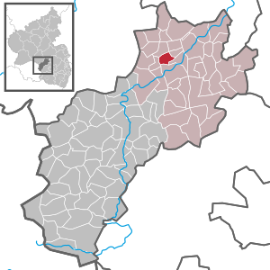
| Location of the local community of Buborn in the Kusel district | ||
  |
||

Buborn is a municipality in the Kusel district in Rhineland-Palatinate . It belongs to the Lauterecken-Wolfstein association.
geography

The place is located on a hill in the North Palatinate Uplands in the West Palatinate . Lauterecken is in the northeast and Offenbach-Hundheim in the south . Other direct neighboring communities are (clockwise from the north) Herren-Sulzbach , Hausweiler , Wiesweiler and Deimberg .
history
Even before Buborn was first mentioned by name, there was a deserted area of Guckenhausen in the area around the town, which a field name still bears witness to today .
Buborn goes back to several medieval farms.
The "Buborner Hof" belonged to the robber baron Albrecht von der Michelsburg on the Remigiusberg near Kusel. This was in 1126 Benedictine monk and gave provost St. Remigius the Hofgut Buppur on Buppurner Bach together 120 acre field. This donation also ensured the first documentary mention of the place on October 16, 1152 by Abbot Hugo von Rheims. In this document, Emperor Friedrich Barbarossa certified his possessions for the monastery. The Buborner Hof later became the property of the Kyrburger Wildgrafen . In the meantime, however, it was also owned by third parties, for example by Reinfried v. Reipoltskirchen and from 1431 to 1515 by Friedrich v. Rudesheim. The field name "am Galgen" suggests that the Wildgraves also maintained a court of complaints and an execution site in the district. This is said to have belonged to the Eicher court , half of which was awarded to the Kyrburger Wildgrafen in 1319.
The parcel name Kirchgarten goes back to the "Commenturhof", the administrative seat of the Order of St. John in the neighboring village of Herren-Sulzbach . In 1606 he was sold to the Wild and Rheingrafen in Grumbach and in the same year with Boso v. Strauss von Herren-Sulzbach exchanged for his share in the Schönborner Hof near Homberg .
Buborn and its people suffered greatly from the effects of the Thirty Years War. Like many others in the region, the place was almost completely extinct towards the end of the 17th century due to the conquest of the then French King Louis XIV .
In 1737, the trained miner Johannes Köhler from Nohfelden applied to Carl Walrad Wilhelm Wild- and Rheingraf zu Dhaun and Kyrburg, Rheingraf zum Stein, for permission to search for coal. This was contractually awarded to him, but the search was unsuccessful in 1745.
From 1798 to 1814 the place was under French rule. He was assigned to the arrondissement of Birkenfeld and the canton of Grumbach within the Saar department . In 1816 Buborn came to the Principality of Lichtenberg , founded after the Congress of Vienna , a newly created exclave of the Duchy of Saxe-Coburg-Saalfeld and, from 1826, of the Duchy of Saxe-Coburg and Gotha . With this it fell to the Kingdom of Prussia in 1834 , which created the district of Sankt Wendel in the administrative district of Trier in the Rhine province from this area . After the separation of the main part of the newly created Saar area , the remaining district of Sankt Wendel-Baumholder was created in 1920 , to which the place belonged until 1937, when it was incorporated into the district of Birkenfeld in the administrative district of Koblenz .
The village survived the two world wars almost undamaged. On March 19, 1945, however, soldiers of the Wehrmacht crossed the place on the retreat, closely followed by the US troops. Since they obviously expected resistance, they shot into several houses. As a result, fire broke out in at least two buildings. A Polish and a Ukrainian farm worker who wanted to help with the extinguishing work were shot dead by the Americans.
After the Second World War, Buborn came to Rhineland-Palatinate . Due to the regional and administrative reform of 1968, the Grumbach office was dissolved and the place was part of the Lauterecken association in 1972 and of the Kusel district in 1969. In 1972 the affiliation of the Koblenz administrative region to the Rheinhessen-Pfalz administrative region also changed . At the beginning of 2000, the administrative districts in Rhineland-Palatinate were dissolved. On July 1, 2014, the Lauterecken community merged with the Wolfstein community to form the new Lauterecken-Wolfstein community .
Origin of name
The place name has changed several times over the years. The following variants have been handed down:
| Surname | Period |
|---|---|
| Burbur | 1120 |
| Buhrbur | 1127 |
| Buppura | 1152 |
| Courtyard to Bopure | 1290 |
| Potbor | 1315 |
| Butbure | 1351 |
| Bob | second half of the 14th century |
| The dishes at Butburen | 1401 |
| Bopporn | 1431 |
| Alberthus de Botbor | 1434 |
| curica de Boppren | 1459 |
| Bopers | 1514 |
| Bopparn | 1515 |
| Buchborn | 1600 |
| Buborn | since 1797 |
Probably the first syllable goes back to an Old High German personal name. B. Burto or Burdo . The second syllable is derived from the Old High German term bur , which denotes a one-room building such as a shed or a barn (cf. also the English word barn for barn). The current name goes back to the designation Buchborn, which is probably a "translated" form of the previous spellings into official German. The colloquial term in the area is Bubble.
Archaeological finds
As early as 1914, a black, locked bowl with two urns and a coin were found in the Guckenhausen desert area. According to the then village teacher Hugo Böckel, these finds were given to the Landesmuseum Trier and later exhibited in the Historical Museum of the City of Speyer. In 1977 two amateur archaeologists from the town discovered a layer of fire several centimeters thick in the same area at a depth of approx. 30 cm . There they found several urn fragments and remains of bones. These were identified as parts of three urns and human remains in the Mainz Museum of Prehistory and Early History. The date was given around 5000 BC. They belong to the oldest finds in Rhineland-Palatinate.
politics
Municipal council
The council in Buborn consists of six council members, who in the local elections on May 26, 2019 in a majority vote were elected, and the honorary mayor as chairman.
mayor
Philipp Kreischer became the local mayor of Buborn on July 9, 2019. Since there was no candidate for the direct election on May 26, 2019, the upcoming election of the mayor was carried out by the council in accordance with the municipal regulations. He unanimously decided in favor of Philipp Kreischer. His predecessor Martin Henning held the office for ten years.
coat of arms
The coat of arms is divided obliquely to the left and shows a blue-armored red lion on a gold background on the right . This indicates the earlier affiliation to Wild and Rhine County. On the left is a silver Born on a blue background, this refers to an old community well. It may also be traced back to the fact that the Born part of the name was erroneously traced back to the origin source or well . The coat of arms was approved in 1964 by the Ministry of the Interior of the State of Rhineland-Palatinate .
Culture
Art in public space
The sculptor, graphic artist and painter Achim Ribbeck from Bad Kreuznach lived and worked in Buborn for several years. So he created u. a. an image of the Buborn beech , which played a major role in village life and which is often assumed to be the namesake of the place. This white marble sculpture was attached to the front of the parish hall, which was inaugurated in 1994. The artist also left several of his works around his former home and studio.

"Buborn Beech" at the village community center

"Buborn Beech" in marble by Achim Ribbeck (details)

Geometric shape by Achim Ribbeck

Sculpture by Achim Ribbeck


Regular events
- Every year on the weekend of the third Sunday in July, the fair (Kerb) takes place. This festival, organized by volunteers, lasts from Friday to the following Monday.
- Celebrations on April 30th ( Witches' Night ) and St. Martin are also held annually .
- A cap meeting for Carnival is also regularly organized.
Infrastructure
traffic
The district road 37 running through Buborn connects the place with the federal road 270 , in the southeast the federal road 420 runs . In Lauterecken there is a station of the Lautertalbahn . Buborn is integrated into public transport by buses and call taxis .
Public facilities

The parish hall, inaugurated in 1994, forms the center of the village together with a barbecue hut and the fire station with youth room. The fair and other festivals take place on the square in the center. There is also a pond used as a meeting point and a fire water pond .
education
The village school of Buborn was closed in 1952. In nearby Lauterecken there is the Veldenz- Gymnasium as well as a Realschule plus and a primary school . Another primary school is located in Sankt Julian . The closest university is the Technical University of Kaiserslautern .
- Village school and bell
The first village school was established around 1820 (according to other information around 1815) in the shepherd's house . This was so common in the region at the time, after the wars of freedom of 1813/1815 there was poverty and the shepherds' houses were often the only community-owned buildings. The school hall was only separated from the goat barn by a thin half-timbered wall, and the village teacher's sleeping quarters, popularly known as the "winter breath", could not be heated. In order to improve the teaching conditions, a new schoolhouse was built in the village center in 1861 and equipped with a bell on the roof in 1870. It called the school children to class and also served as a time signal at 11 a.m. and 6 p.m. The bell was also rung for the service that was held in the school building and for deaths in town. The first bell had to be delivered on July 31, 1917 due to the First World War ; it was only replaced by a new one in 1928. According to the inscription, it is dedicated to the victims of the First World War:
"Dedicated to the sons of the Buborn parish who died in the World War in honor of their fellow citizens"
The fact that the new bell did not have to be handed in during the Second World War is said to be due to the following inscription:
"Whoever takes me loses!"
After the village school was closed in 1952, it served as a parish hall until 1994. When the new parish hall was inaugurated, the bell also moved. The schoolhouse has been used as a private residence ever since.
Web links
- Local community Buborn on the website of the Verbandsgemeinde Lauterecken-Wolfstein
- Buborn at regionalgeschichte.net
Individual evidence
- ↑ State Statistical Office of Rhineland-Palatinate - population status 2019, districts, communities, association communities ( help on this ).
- ^ A b c d e f g h i Karl Theodor Grashof, Albrecht Guischard: Salisso: from the history of the parish of Herren-Sulzbach. Rheinland-Verl., Cologne 2000, ISBN 3-7927-1809-X , pp. 93-105.
- ↑ a b c d e Buborn in the Palatinate - Aileen Schröder . Institute for Historical Regional Studies at the University of Mainz e. V. Accessed November 21, 2014.
- ↑ Martin Dolch, Albrecht Greule: Historisches Siedlungsnamesbuch der Pfalz. Publishing house of the Palatinate Society for the Advancement of Science, Speyer 1991, ISBN 3-9321-5508-4 , p. 83
- ^ The Regional Returning Officer Rhineland-Palatinate: Local elections 2019, city and municipal council elections
- ↑ a b Markus Henz: Buborn: Philipp Kreischer elected as the new local mayor. Die Rheinpfalz, July 11, 2019, accessed on April 28, 2020 .
- ^ The Regional Returning Officer Rhineland-Palatinate: direct elections 2019. see Lauterecken-Wolfstein, Verbandsgemeinde, third line of results. Retrieved April 28, 2020 .
- ↑ https://www.rlp-buergerservice.de/bis/kv_kusel_bi/eintrag_details.jsf?id=160209

Adenbach | Albessen | Altenglan | Altenkirchen | Aschbach | Bedesbach | Blaubach | Börsborn | Bosenbach | Breitenbach | Bridges (Palatinate) | Buborn | Cronenberg | Deimberg | Dennweiler-Frohnbach | Dittweiler | Dunzweiler | Ehweiler | Oiling | Elzweiler | Erdesbach | Eßweiler | Etschberg | Föckelberg | Frohnhofen | Ginsweiler | Glan-Münchweiler | Glan bridges | Semolina | Grumbach | Haschbach am Remigiusberg | Hausweiler | Hefersweiler | Heinzenhausen | Henschtal | Herchweiler | Herren-Sulzbach | Herschweiler-Pettersheim | Hinzweiler | Hohenöllen | Homberg | Hoppstädten | Horschbach | Hüffler | Jettenbach | Kappeln | Kirrweiler | Konken | Körborn | Kreimbach-Kaulbach | Krottelbach | Kusel | Langenbach | Boring | Lauterecken | Lohnweiler | Matzenbach | Medard | Merzweiler | Nanzdietschweiler | Nerzweiler | Neunkirchen am Potzberg | Lower albums | Niederstaufenbach | Nussbach | Top albums | Oberstaufenbach | Oberweiler im Tal | Oberweiler-Tiefenbach | Odenbach | Offenbach-Hundheim | Ohmbach | Pfeffelbach | Quirnbach / Palatinate | Rammelsbach | Rathsweiler | Rehweiler | Reichweiler | Reipoltskirchen | Relsberg | Rothselberg | Ruthweiler | Rutsweiler am Glan | Rutsweiler an der Lauter | Saint Julian | Schellweiler | Schönenberg-Kübelberg | Selchenbach | Steinbach am Glan | Thallichtenberg | Theisbergstegen | Ulmet | Unterjeckenbach | Delusional | Forest black | Welchweiler | Wiesweiler | Wolfstein