Thallichtenberg
| coat of arms | Germany map | |
|---|---|---|

|
Coordinates: 49 ° 33 ' N , 7 ° 21' E |
|
| Basic data | ||
| State : | Rhineland-Palatinate | |
| County : | Kusel | |
| Association municipality : | Kusel-Altenglan | |
| Height : | 287 m above sea level NHN | |
| Area : | 5.72 km 2 | |
| Residents: | 541 (Dec. 31, 2019) | |
| Population density : | 95 inhabitants per km 2 | |
| Postal code : | 66871 | |
| Area code : | 06381 | |
| License plate : | KUS | |
| Community key : | 07 3 36 097 | |
| Association administration address: | Marktplatz 1 66869 Kusel |
|
| Website : | ||
| Mayoress : | Annika Süssel | |
| Location of the local community Thallichtenberg in the district of Kusel | ||
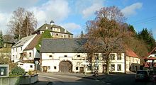
Thallichtenberg is a municipality in the Kusel district in Rhineland-Palatinate . It belongs to the Kusel-Altenglan community and is located in the Kuseler Musikantenland in the West Palatinate .
geography
location
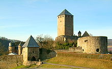
Thallichtenberg is located in a valley at around 300 m above sea level. NHN in the North Palatinate Bergland within the Kuseler Bergland sub-area . The town is in the southeast of the ruins of Lichtenberg Castle dominates, on a spur in 394 m above sea level. NHN lies. Neighboring communities are - clockwise - Körborn , Ruthweiler , Pfeffelbach , Berschweiler bei Baumholder , Mettweiler and Baumholder .
Surveys
To the northwest of the village rises the range of hills from Mittelberg ( 550 m above sea level ), Spitzeberg ( 578 m above sea level ) and Stolzberg ( 557 m above sea level ) in the south, directly on the border with Pfeffelbach, the 442.5 meter high rises Niederberg .
Waters
The place is traversed by the Bisterbach - alternatively called Hesselbach on some maps - which is not far south of the place at 285 m above sea level. NHN ( ) flows into the Pfeffelbach .
![]()
history
In 1816 Thallichtenberg and Burglichtenberg came to the Principality of Lichtenberg , a newly created exclave of the Duchy of Saxe-Coburg-Saalfeld and, from 1826, of the Duchy of Saxe-Coburg and Gotha . With this they fell to Prussia in 1834 , which created the district of Sankt Wendel from this area . In 1910 Burglichtenberg was incorporated into Thallichtenberg. After the separation of the main part of the district to the newly created Saar area , the remaining district of Sankt Wendel-Baumholder was created in 1920 , to which Thallichtenberg belonged until 1937, when it was incorporated into the Birkenfeld district.
After the Second World War , Thallichtenberg became part of the then newly formed state of Rhineland-Palatinate within the French occupation zone . In the course of the first administrative reform in Rhineland-Palatinate , the community was reclassified to the Kusel district on 1969 . Three years later, the place became part of the newly created association municipality Kusel , since 2018 Thallichtenberg belongs to the association municipality Kusel-Altenglan .
politics
Municipal council
The local council in Thallichtenberg consists of twelve council members, who were elected in the local elections on May 26, 2019 in a majority vote, and the honorary local mayor as chairman.
mayor
Annika Süssel became mayor of Thallichtenberg in June 2019. In the direct election on May 26, 2019, she was elected for five years with 59.70 percent of the vote.
Annika Süssel's predecessor was her father Heinz Süssel, who passed away in January 2020 and held the office from 2004 to 2019.
coat of arms
| Blazon : "In a divided shield above in silver a growing, red armored and tongued, blue lion, below divided three times by green and silver, five silver balls 3: 2 on the green bars." | |
Culture and sights
Cultural monuments
The Lichtenberg Castle , which is the largest with 425 meters long castle ruins in Germany , and the Jewish cemetery are a monument zones reported. The Musikantenland Museum and the Urweltmuseum GEOSKOP , which is a branch of the Bad Dürkheim Palatinate Museum for Natural History , are located at Lichtenberg Castle .
With the Protestant church there is also a single property that is under monument protection.
Other structures
Wadenau Castle was once located in the municipality's catchment area, its exact location has not yet been localized.
nature
A natural monument exists in the municipality with a spruce .
societies
TSG Burglichtenberg , which offers football, exists on site .
Economy and Infrastructure
traffic
State road 176 runs through the center of the village and joins State road 349 at the southern edge of the settlement . The circuit road 23 also provides a compound according to Oberalben forth. The A 62 runs to the south . The Türkismühle – Kusel railway was opened in 1936 ; Thallichtenberg got a train station here, but it was already on the suburbs of Pfeffelbach. Passenger traffic ended in 1964, freight traffic two years later. In 1971 the line was dismantled. In Kusel is located local train station on the route of Landstuhl . The bus route 292 provides a connection to Kusel and Freisen .
tourism
The Saar-Glan-Weg and the Fritz-Wunderlich-Weg run through Thallichtenberg . The long-distance hiking trail Franconia-Hessen-Kurpfalz and a hiking trail marked with a yellow-red bar begin at Lichtenberg Castle .
Personalities
Sons and daughters of the church
- Christian Dingert (* 1980), soccer referee
People who worked on site
- Anita Stangl (* 1966), entrepreneur and chess player, was runner-up at the German women's blitz championship in 1987
- Philipp Hoffmann (* 1992), soccer player, played in his youth for the local soccer club
- Anni Schummel, owner of the Freiherr vom Stein plaque since 2004
literature
- Literature about Thallichtenberg in the Rhineland-Palatinate state bibliography
Web links
- Local community Thallichtenberg on the website of the association community Kusel-Altenglan
- Thallichtenberg on regionalgeschichte.net
- Page at Musikantenland
- Homepage of the Urweltmuseum
Individual evidence
- ↑ State Statistical Office of Rhineland-Palatinate - population status 2019, districts, communities, association communities ( help on this ).
- ^ Community directory
- ^ The Regional Returning Officer Rhineland-Palatinate: Local elections 2019, city and municipal council elections
- ↑ Sabrina Wagner: Annika Süßel new town mayor in Thallichtenberg. Die Rheinpfalz, June 27, 2019, accessed on May 17, 2020 .
- ^ The Regional Returning Officer Rhineland-Palatinate: direct elections 2019. see Kusel-Altenglan, Verbandsgemeinde, 35th line of results. Retrieved May 17, 2020 .
- ↑ Susanne Cahn: Obituary: Thallichtenberg's former mayor Heinz Süssel has died. Die Rheinpfalz, January 23, 2020, accessed on May 17, 2020 .


