
Konken
| coat of arms | Germany map | |
|---|---|---|

|
Coordinates: 49 ° 31 ' N , 7 ° 21' E |
|
| Basic data | ||
| State : | Rhineland-Palatinate | |
| County : | Kusel | |
| Association municipality : | Kusel-Altenglan | |
| Height : | 334 m above sea level NHN | |
| Area : | 7.04 km 2 | |
| Residents: | 827 (Dec. 31, 2019) | |
| Population density : | 117 inhabitants per km 2 | |
| Postal code : | 66871 | |
| Area code : | 06384 | |
| License plate : | KUS | |
| Community key : | 07 3 36 052 | |
| LOCODE : | DE KOK | |
| Association administration address: | Marktplatz 1 66869 Kusel |
|
| Website : | ||
| Local Mayor : | Karl Knecht | |
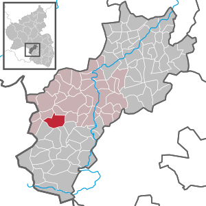
| Location of the local community Konken in the district of Kusel | ||
  |
||

Konken is a municipality in the Kusel district in Rhineland-Palatinate . It belongs to the community of Kusel-Altenglan .
geography
The old town center of Konken lies at a height of approx. 330 meters in a wide, shell-shaped valley basin that is formed by the Konker Bach and opens to the east. In a northerly direction, the terrain rises relatively steeply to approx. 350 meters, but the highest peaks are in the south of the district . Here the Rundwieshübel (404 m), the Harzhöhe (412 m) and the Konker Warte (414 m) cross the 400 meter mark. Above all, the east and the extreme west of the community area are forested.
The Hasenmühle and Rundwieserhof residential areas also belong to Konken .
Neighboring communities are - clockwise - Ehweiler , Schellweiler , Hüffler , Wahnwegen , Herschweiler-Pettersheim , Langenbach and Albessen . Herchweiler , located further to the west, already borders directly on the Saarland . The town of Kusel , the administrative seat of the Verbandsgemeinde and the district, is six kilometers to the northeast.
history
Konken was first mentioned in 1124 as "Chonchis", but is probably much older. In a tax book from the 9th century, which lists the taxes to the Reims monastery, a "Conchis" is already mentioned.
Initially belonging to the county of Veldenz , the place fell to the newly formed county of Pfalz-Zweibrücken , whose fate was now shared by Konken, when its male line was extinguished in 1444 .
In 1609 Konken had 127 inhabitants, making it the largest village in the area, but was abandoned by its inhabitants during the Thirty Years War . Most likely they fell victim to the massacre of 1635 by Croatian troops of the imperial army. After the war, it was resettled through immigration from Switzerland and Tyrol. During the Palatinate War of Succession towards the end of the 17th century, the troops of Louis XIV again plundered the area.
From 1801 to 1814, Konken belonged to France as part of the Saar department , Arrondissement Birkenfeld , and formed the center of a mairie . At the Congress of Vienna , the Palatinate on the left bank of the Rhine fell to Austria in 1815 and to the Kingdom of Bavaria in 1816 on the basis of an exchange contract . From 1818 Konken became the seat of a mayor's office that belonged to the Kusel Land Commissioner in the Bavarian Rhine District .
After the Second World War , Konken became part of the then newly formed state of Rhineland-Palatinate within the French occupation zone . In the course of the first administrative reform in Rhineland-Palatinate , the place was assigned to the Kusel association, which was merged into the Kusel-Altenglan association in 2018 .
politics
Municipal council
The local council in Konken consists of twelve council members, who were elected by a majority vote in the local elections on May 26, 2019 , and the honorary local mayor as chairman.
mayor
Karl Knecht became the local mayor of Konken on June 25, 2019. In the direct election on May 26, 2019, he was elected for five years with a voting share of 85.24%.
Knecht's predecessor Fritz Emrich (SPD) had held the office for ten years, but did not take up office again in 2019.
coat of arms
The blazon of the coat of arms reads: "Above a raised, silver shield river, inside a blue shell from which a red flame blazes, in black a red armored, -tungter and -crowned, golden lion".
Economy and Infrastructure
In Konken there is a kindergarten, a primary school and a multi-purpose hall. With its easily accessible commercial area, the place is one of the few larger industrial locations in the district (around 280 jobs in industry, craft and trade).
The B 420 runs through the village . In the north is the A 62 (with junction "Kusel" at the northern exit of the village). In Kusel there is a train station on the Landstuhl – Kusel railway line . A biogas-operated local heating network is being set up.
Personalities
Sons and daughters of the church
- Philipp Casimir Heintz (1771–1835), clergyman and historian
- Walther Stepp (1898–1972), lawyer, police officer and SS leader
People who have worked in the place
- Carl Friedrich Heman (1839–1919), Protestant theologian and philosophy professor at the University of Basel , 1871–1874 pastor in Konken
See also
literature
- Literature about Konken in the Rhineland-Palatinate state bibliography
Web links
- The official website of the local congregation Konken
- Local community Konken on the website of the association community Kusel-Altenglan
- Konken on regionalgeschichte.net
Individual evidence
- ↑ State Statistical Office of Rhineland-Palatinate - population status 2019, districts, communities, association communities ( help on this ).
- ↑ Ernst Schworm: Konken. Location. In: regionalgeschichte.net. Institute for Historical Regional Studies at the University of Mainz eV, accessed on May 17, 2020 .
- ↑ State Statistical Office Rhineland-Palatinate (ed.): Official directory of the municipalities and parts of the municipality. Status: January 2019 [ Version 2020 is available. ] . S. 157 (PDF; 3 MB).
- ↑ Ernst Schworm: Konken. Surname. In: regionalgeschichte.net. Institute for Historical Regional Studies at the University of Mainz eV, accessed on May 17, 2020 .
- ↑ a b c Ernst Schworm: Konken. Outline of the local history. In: regionalgeschichte.net. Institute for Historical Regional Studies at the University of Mainz eV, accessed on May 17, 2020 .
- ^ The Regional Returning Officer Rhineland-Palatinate: Local elections 2019, city and municipal council elections
- ↑ a b Susanne Cahn: Dilapidated telephone lines in Konken raise the fear of bad things. Constitution of the municipal council in 2019. The Rheinpfalz, June 26, 2019, accessed on May 17, 2020 .
- ^ The Regional Returning Officer Rhineland-Palatinate: direct elections 2019. see Kusel-Altenglan, Verbandsgemeinde, 18th line of results. Retrieved May 17, 2020 .

Adenbach | Albessen | Altenglan | Altenkirchen | Aschbach | Bedesbach | Blaubach | Börsborn | Bosenbach | Breitenbach | Bridges (Palatinate) | Buborn | Cronenberg | Deimberg | Dennweiler-Frohnbach | Dittweiler | Dunzweiler | Ehweiler | Oiling | Elzweiler | Erdesbach | Eßweiler | Etschberg | Föckelberg | Frohnhofen | Ginsweiler | Glan-Münchweiler | Glan bridges | Semolina | Grumbach | Haschbach am Remigiusberg | Hausweiler | Hefersweiler | Heinzenhausen | Henschtal | Herchweiler | Herren-Sulzbach | Herschweiler-Pettersheim | Hinzweiler | Hohenöllen | Homberg | Hoppstädten | Horschbach | Hüffler | Jettenbach | Kappeln | Kirrweiler | Konken | Körborn | Kreimbach-Kaulbach | Krottelbach | Kusel | Langenbach | Boring | Lauterecken | Lohnweiler | Matzenbach | Medard | Merzweiler | Nanzdietschweiler | Nerzweiler | Neunkirchen am Potzberg | Lower albums | Niederstaufenbach | Nussbach | Top albums | Oberstaufenbach | Oberweiler im Tal | Oberweiler-Tiefenbach | Odenbach | Offenbach-Hundheim | Ohmbach | Pfeffelbach | Quirnbach / Palatinate | Rammelsbach | Rathsweiler | Rehweiler | Reichweiler | Reipoltskirchen | Relsberg | Rothselberg | Ruthweiler | Rutsweiler am Glan | Rutsweiler an der Lauter | Saint Julian | Schellweiler | Schönenberg-Kübelberg | Selchenbach | Steinbach am Glan | Thallichtenberg | Theisbergstegen | Ulmet | Unterjeckenbach | Delusional | Forest black | Welchweiler | Wiesweiler | Wolfstein