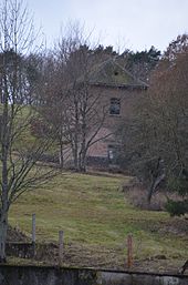
Zaubach (desert)
Zaubach was a village and a municipality in the Birkenfeld district in Rhineland-Palatinate , south of the Nahe near Dickesbach .
history
The first place Zaubach was probably founded in the 13th century and destroyed in the Thirty Years War . It was to the east of the town that was newly created in the 17th century and was later called Wüstauberach . In 1698 six families lived in Zaubach, which corresponds to a population of around 30 people. During the so-called French era , from 1798 onwards, the place belonged to the canton of Grumbach in the arrondissement de Birkenfeld in the Saar department . Due to the decisions made at the Congress of Vienna in 1815 , the region and with it Zaubach became part of the Principality of Lichtenberg in 1816 and belonged to the Schmidthachenbach mayor , and from 1823 to the Sien mayor . In 1815 there were 98 inhabitants in Zaubach.
In 1938 the Baumholder exercise area was laid out by the Wehrmacht , when a total of 14 villages were relocated. The place Zaubach was on the edge of the military area and was initially not affected by this.
In 1974 the emigration from the community of Zaubach began, which had 173 inhabitants that year. The last inhabitants left the place in 1981. After that the existing houses were demolished, only the cemetery remains today.
Administratively, the municipality of Zaubach has belonged to the Herrstein Association since 1968 and was dissolved on January 1, 1978. The community area was incorporated into the community-free " Guts Bezirk Baumholder ". This in turn was completely dissolved on January 1, 1994 and the area of the military training area was divided among the neighboring communities.
The former district Zaubach is now among the local churches Dickesbach and Mittelreidenbach .
Web links
- Ortschronik on Dickesbach's website ( memento from February 10, 2013 in the web archive archive.today )
Individual evidence
- ↑ a b c Village Chronicle Zaubach. ( Memento from February 10, 2013 in the web archive archive.today )
- ↑ Complete collection of the ordinances and resolutions of the citizen government commissioner and the central administrations of the four new departments on the left bank of the Rhine , Volume 2, Edition 3, Wirth, 1798, p. 270 ( online edition at Google Books )
- ↑ Friedrich August Lottner: Collection of the ducal Saxon-Coburg-Gothaic ordinances issued for the Principality of Lichtenberg from 1816 to 1834 , Sander, 1836, p. 30 ( online edition at Google Books )
- ^ History of the district of Birkenfeld at www.landkreis-birkenfeld.de
- ↑ Official municipality directory (= State Statistical Office of Rhineland-Palatinate [Hrsg.]: Statistical volumes . Volume 407 ). Bad Ems February 2016, p. 159 (PDF; 2.8 MB; see footnote 5).
Coordinates: 49 ° 42 ′ 15.7 " N , 7 ° 25 ′ 52" E

