Weingarten (Lichtenfels)
|
Vineyard
City of Lichtenfels
Coordinates: 50 ° 8 ′ 36 ″ N , 11 ° 0 ′ 44 ″ E
|
|
|---|---|
| Height : | 311 m above sea level NHN |
| Residents : | 86 (2015) |
| Incorporation : | July 1, 1972 |
| Postal code : | 96215 |
| Area code : | 09571 |
|
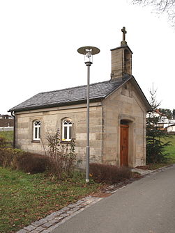
chapel
|
|
Weingarten is a district of the Upper Franconian town of Lichtenfels in the Lichtenfels district .
geography
The village is located about four kilometers west of Lichtenfels on a slope about 40 meters above the Main at kilometer 424.
history
Weingarten was first mentioned as "Wingardi" in the 9th century in the traditions of the Fulda Monastery , which are based on a copy in the Codex Eberhardi from the 12th century. The next mention is for 1065-1075 in the Domnekrolog from 1285-1287 as the anniversary foundation of the priests Appelin and Wizelin de Wingarten.
In 1801 the place in the rulership of the neighboring Banz Monastery had a parish hall, ten Lastsölden houses and barns and four drip houses . There were vineyards on the main slope. The high Zent belonged to the Lichtenfels Central Office of the Bamberg Monastery, the village, parish, fiefdom and bailiwick to the Banz monastery. The pastor from Altenbanz was responsible for the church.
In 1862 Weingarten was incorporated into the newly created Bavarian District Office Staffelstein . The rural community included the village of Weingarten and the places Schloss Banz , Hausen , Heinach , Neubanz and Voreichen . In 1871 Weingarten had 106 residents and 49 buildings. The Catholic Church was located in Banz Monastery, 2.2 kilometers away, and the school in Stetten, 1.5 kilometers away. In 1900 the rural community Weingarten comprised an area of 360.49 hectares, 293 inhabitants, of whom 265 were Catholic, and 39 residential buildings. 95 people lived in Weingarten in 17 residential buildings. In 1925, 82 people lived in 16 residential buildings. In 1950 there were 113 residents and 18 residential buildings, the desert forest house Banz also belonged to the community.
In 1970 Weingarten had 98 residents and in 1987 101 residents and 34 residential buildings.
On July 1, 1972, the Staffelstein district was dissolved and Weingarten was incorporated with the Heinach community into the town of Lichtenfels and the Lichtenfels district. The other districts came to the newly founded municipality of Banz .
Attractions
In the Bavarian list of monuments there are three monuments for Weingarten .
Web links
- Weingarten on the website of the city of Lichtenfels
- Weingarten in the local database of the Bavarian State Library Online . Bavarian State Library
Individual evidence
- ↑ Population figures November 2015
- ^ A b Dorothea Fastnacht: Staffelstein. Former district of Staffelstein. Historical book of place names of Bavaria. Upper Franconia. Volume 5: Staffelstein. Commission for Bavarian State History, Munich 2007, ISBN 978 3 7696 6861 2 . P. 403
- ↑ Kgl. Statistical Bureau (ed.): Complete list of localities of the Kingdom of Bavaria. According to districts, administrative districts, court districts and municipalities, including parish, school and post office affiliation ... with an alphabetical general register containing the population according to the results of the census of December 1, 1875 . Adolf Ackermann, Munich 1877, 2nd section (population figures from 1871, cattle figures from 1873), Sp. 1122 , urn : nbn: de: bvb: 12-bsb00052489-4 ( digital copy ).
- ↑ K. Bayer. Statistical Bureau (Ed.): Directory of localities of the Kingdom of Bavaria, with alphabetical register of places . LXV. Issue of the contributions to the statistics of the Kingdom of Bavaria. Munich 1904, Section II, Sp. 1120 ( digitized version ).
- ↑ Bavarian State Statistical Office (ed.): Localities directory for the Free State of Bavaria according to the census of June 16, 1925 and the territorial status of January 1, 1928 . Issue 109 of the articles on Bavaria's statistics. Munich 1928, Section II, Sp. 1157 ( digitized version ).
- ↑ Bavarian State Statistical Office (ed.): Official place directory for Bavaria - edited on the basis of the census of September 13, 1950 . Issue 169 of the articles on Bavaria's statistics. Munich 1952, DNB 453660975 , Section II, Sp. 1002 ( digitized version ).
- ^ Bavarian State Statistical Office (ed.): Official place directory for Bavaria . Issue 335 of the articles on Bavaria's statistics. Munich 1973, DNB 740801384 , p. 163 ( digitized version ).
- ↑ Bavarian State Office for Statistics and Data Processing (Ed.): Official local directory for Bavaria, territorial status: May 25, 1987 . Issue 450 of the articles on Bavaria's statistics. Munich November 1991, DNB 94240937X , p. 318 ( digitized version ).

