
Mergentheim district
| coat of arms | Germany map | |
|---|---|---|

|
Coordinates: 49 ° 25 ' N , 9 ° 50' E |
|
| Basic data (as of 1972) | ||
| Existing period: | 1938-1972 | |
| State : | Baden-Württemberg | |
| Administrative region : | North Württemberg | |
| Administrative headquarters : | Bad Mergentheim | |
| Area : | 474 km 2 | |
| Residents: | 42,888 (May 27, 1970) | |
| Population density : | 90 inhabitants per km 2 | |
| License plate : | MGH | |
| Circle key : | 08 1 42 | |
| Circle structure: | 51 municipalities | |
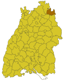
| Location of the Mergentheim district in Baden-Württemberg | ||
  |
||

The Mergentheim district was a district in Baden-Württemberg that was dissolved on January 1, 1973 as part of the Baden-Württemberg district reform .
geography
location
The Mergentheim district was in the northeast of Baden-Württemberg on the border with Bavaria .
Geographically, he had a share in the building land . The Tauber ran through the district with its tributaries.
Neighboring areas
Its neighboring districts were at the beginning of 1972 clockwise beginning in the north of Ochsenfurt , Uffenheim and Rothenburg ob der Tauber (in Bavaria) as well as Crailsheim , Künzelsau and Tauberbischofsheim .
history
Prehistory of the Mergentheim district
Before 1800, the area of the Mergentheim district belonged to various domains, including the Margraviate of Brandenburg-Ansbach , the Principality of Hohenlohe , the German Order and the imperial city of Rothenburg ob der Tauber . From 1803 to 1810 the area came to Württemberg , which formed the upper offices of Mergentheim and Gerabronn , which belonged to the Landvogtei an der Jagst. From 1818 they belonged to the Jagstkreis (which was dissolved in 1924), and in 1934 they were renamed to circles. On October 1, 1938, the Gerabronn district was dissolved. Some communities were incorporated into what is now the Mergentheim district.
The Mergentheim district in the post-war period
In the Mergentheim district after the Second World War, a total of 10,801 displaced persons from the areas beyond the Oder-Neisse line , Hungary and the Sudetenland found a new home.
After the formation of the state of Baden-Württemberg in 1952, the Mergentheim district belonged to the administrative district of North Württemberg . As a result of the municipal reform in 1970, the district area changed in one case. On January 1, 1972, the municipality of Deubach was incorporated into the city of Königshofen (today Lauda-Königshofen ) and thus became part of the Tauberbischofsheim district .
Dissolution of the district
With effect from January 1, 1973, the Mergentheim district was dissolved as part of the Baden-Württemberg district reform. Its communities were assigned to the newly formed Tauberkreis , which thus became the legal successor to the Mergentheim and Tauberbischofsheim districts . On January 1, 1974, the new district was given its current name Main-Tauber-Kreis .
Population development
All population figures are census results.
|
|
politics
District Administrator
The district councils of the district Mergentheim 1934-1972:
- 1934–1945: Fritz Wanner
- 1945: Eugen Kleih (acting)
- 1945–1946: Josef Brönner ( CDU )
- 1947–1952: Eugen Kleih
- 1952–1958: Walter Cantner
- 1958–1972: Kurt Nagel
The Oberamtmen of the former Oberamt are shown under Oberamt Mergentheim .
coat of arms
The coat of arms of the Mergentheim district showed a continuous black cross in silver, covered in the middle with a silver shield, in which two red-tongued, black lions looking over each other. The coat of arms was awarded to the Mergentheim district on June 20, 1955 by the Baden-Württemberg Ministry of the Interior .
The cross stands for the Teutonic Order, the lions come from the coat of arms of the Lords of Hohenlohe. The colors black and white also indicated the Margraviate Brandenburg-Ansbach.
Economy and Infrastructure
traffic
There was no federal motorway running through the district (the A 81 did not exist in this section at the time). Therefore, it was only opened up by federal highways 19 and 290 as well as several state and district roads.
Communities
From 1938 onwards, there were initially 51 municipalities in the Mergentheim district, of which 4 were towns.
On March 7, 1968, the state parliament of Baden-Württemberg set the course for a community reform . With the law to strengthen the administrative power of smaller municipalities , it was possible for smaller municipalities to voluntarily unite to form larger municipalities. The beginning in the Mergentheim district was made on January 1, 1972 by several communities that united with their larger neighboring communities, including Althausen, Apfelbach, Löffelstelzen, Markelsheim and Neunkirchen with the city of Bad Mergentheim . In the following years, the number of municipalities decreased steadily until the district Mergentheim finally on 1 January 1973 in the Main-Tauber-Kreis (initially called Tauber district ) came up.
The largest municipality in the district was the district town of Bad Mergentheim , while Simmringen was the smallest.
In the table, the municipalities of the Mergentheim district are before the municipal reform. Today they all belong to the Main-Tauber district. The population figures refer to the census results in 1961 and 1970.
License Plate
On July 1, 1956, the district was assigned the MGH distinctive sign when the vehicle registration number that is still valid today was introduced . It has been available in the Main-Tauber district since January 7, 2014 ( license plate liberalization ).
Web links
Individual evidence
- ↑ Main-Post : 18 square meters for six people. . Online at www.mainpost.de. April 11, 2006. Retrieved December 11, 2015.
- ↑ a b Federal Statistical Office (ed.): Historical municipality register for the Federal Republic of Germany. Name, border and key number changes in municipalities, counties and administrative districts from May 27, 1970 to December 31, 1982 . W. Kohlhammer, Stuttgart / Mainz 1983, ISBN 3-17-003263-1 , p. 453 f .
.svg)
Basking | Backnang | Baden-Baden | Balingen | Biberach | Boeblingen | Bruchsal | Book | Bühl | Calw | Crailsheim | Donaueschingen | Ehingen | Emmendingen | Esslingen | Freiburg (city) | Freiburg (State) | Freudenstadt | Friedrichshafen | Göppingen | Hechingen | Heidelberg (city) | Heidelberg (Country) | Heidenheim | Heilbronn (city) | Heilbronn (Land) | Black Forest | Horb | Karlsruhe (city) | Karlsruhe (State) | Throat | Constance (city) | Constance (Country) | Künzelsau | Lahr | Leonberg | Loerrach | Ludwigsburg | Mannheim (city) | Mannheim (State) | Mergentheim | Mosbach | Muellheim | Münsingen | Neustadt | Nürtingen | Offenburg | Öhringen | Pforzheim (city) | Pforzheim (Country) | Rastatt | Ravensburg | Reutlingen | Rottweil | Säckingen | Saulgau | Schwäbisch Gmünd | Schwäbisch Hall | Sigmaringen | Sinsheim | Stockach | Stuttgart | Tauberbischofsheim | Tettnang | Tübingen | Tuttlingen | Überlingen | Ulm (city) | Ulm (State) | Vaihingen | Villingen | Villingen-Schwenningen | Waiblingen | Waldshut | Cheeks | Wolfach