
District of Künzelsau
| coat of arms | Germany map | |
|---|---|---|

|
Coordinates: 49 ° 20 ' N , 9 ° 40' E |
|
| Basic data (as of 1972) | ||
| Existing period: | 1938-1972 | |
| State : | Baden-Württemberg | |
| Administrative region : | North Württemberg | |
| Administrative headquarters : | Künzelsau | |
| Area : | 342 km 2 | |
| Residents: | 33,659 (May 27, 1970) | |
| Population density : | 98 inhabitants per km 2 | |
| License plate : | KÜN | |
| Circle key : | 08 1 39 | |
| Circle structure: | 41 municipalities | |
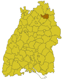
| Location of the district of Künzelsau in Baden-Württemberg | ||
  |
||

The district of Künzelsau was a district in Baden-Württemberg that was dissolved in the course of the district reform on January 1, 1973 .
geography
location
The district of Künzelsau was in the northeast of Baden-Württemberg .
Geographically, he had a share in the Hohenlohe plain . The two tributaries of the Neckar , Jagst and Kocher , ran through the district .
Neighboring areas
Its neighbors were 1972 in a clockwise direction starting in the northeast of Mergentheim , Crailsheim , Schwäbisch Hall , Öhringen , Heilbronn , Buchen and Tauberbischofsheim .
history
Before 1800, the area of the Künzelsau district belonged to various dominions, including the Principality of Hohenlohe , the Archdiocese of Mainz , the Diocese of Würzburg , the Teutonic Order and the Schöntal Abbey . Between 1803 and 1806 the area came to Württemberg , where it initially belonged to the Oberämter Neuenstein, Nitzenhausen and Schöntal in the district of Öhringen. In 1810/11 it became part of the Oberamt Künzelsau within the Landvogtei an der Jagst and from 1818 it belonged to the Jagstkreis (which was dissolved in 1924). In 1934 the Oberamt Künzelsau was renamed the Künzelsau district and in 1938 it was transferred to the Künzelsau district, which at that time gave some communities to the Schwäbisch Hall and Crailsheim districts .
After the formation of the state of Baden-Württemberg in 1952, the district of Künzelsau belonged to the administrative district of North Württemberg . As a result of the municipal reform in 1970, the district area changed in one case. On January 1, 1972, the municipality of Muthof was incorporated into the town of Forchtenberg and thus became part of the district of Öhringen .
With effect from January 1, 1973, the Künzelsau district was dissolved and its communities assigned to the newly formed Hohenlohe district , which became the legal successor to the Künzelsau district.
Population development
(Population figures are census results)
|
|
politics
District Administrator
The district administrators of the Oberamt or district of Künzelsau 1938–1972:
- 1936–1939: Gustav Stierle ( senior magistrate until 1938)
- 1939–1944: Wilhelm Wöhrle
- 1945–1945: Richard Franck (clerk)
- 1945–1946: Heinz Hohner
- 1946–1960: Otto Ehrler
- 1960–1972: Bernhard Vesenmayer
The Oberamtmen of the former Oberamt Künzelsau from 1809 to 1938 are shown in the article Oberamt Künzelsau .
coat of arms
The coat of arms of the Künzelsau district showed a standing, red-tongued black leopard in silver, accompanied at the top left by a red shield with a six-spoke silver wheel, at the bottom right by a red shield with three silver tips. The coat of arms was awarded to the Künzelsau district on May 9, 1956 by the Baden-Württemberg Ministry of the Interior .
The leopard comes from the coat of arms of the Lords of Hohenlohe , the wheel symbolizes the Archdiocese of Mainz and the Franconian Rake stands for the Diocese of Würzburg .
Economy and Infrastructure
traffic
There was no federal motorway running through the district (the A 6 did not exist in this section at the time). Therefore, it was only opened up by the federal highway 19 and several state and district roads.
Communities
From 1938 onwards, 41 municipalities initially belonged to the Künzelsau district, including 3 towns.
On March 7, 1968, the state parliament of Baden-Württemberg set the course for a community reform . With the law to strengthen the administrative power of smaller municipalities , it was possible for smaller municipalities to voluntarily unite to form larger municipalities. The beginning in the Künzelsau district was made on July 1, 1972 by the Jagstberg community, which merged with the Mulfingen community . In the period that followed, the number of municipalities steadily decreased until the Künzelsau district finally merged into the Hohenlohe district on January 1, 1973 .
The largest municipality in the district was the district town of Künzelsau , the smallest municipality was Meßbach.
In the table, the municipalities of the Künzelsau district are before the municipal reform. Today they all belong to the Hohenlohe district. The population figures refer to the census results in 1961 and 1970.
License Plate
On July 1, 1956, the district was assigned the distinctive sign KÜN when the vehicle registration number that is still valid today was introduced . It is issued in the Hohenlohekreis until today.
Web links
Individual evidence
- ↑ a b Federal Statistical Office (ed.): Historical municipality register for the Federal Republic of Germany. Name, border and key number changes in municipalities, counties and administrative districts from May 27, 1970 to December 31, 1982 . W. Kohlhammer, Stuttgart / Mainz 1983, ISBN 3-17-003263-1 , p. 451 f .
.svg)
Basking | Backnang | Baden-Baden | Balingen | Biberach | Boeblingen | Bruchsal | Book | Bühl | Calw | Crailsheim | Donaueschingen | Ehingen | Emmendingen | Esslingen | Freiburg (city) | Freiburg (State) | Freudenstadt | Friedrichshafen | Göppingen | Hechingen | Heidelberg (city) | Heidelberg (Country) | Heidenheim | Heilbronn (city) | Heilbronn (Land) | Black Forest | Horb | Karlsruhe (city) | Karlsruhe (State) | Throat | Constance (city) | Constance (Country) | Künzelsau | Lahr | Leonberg | Loerrach | Ludwigsburg | Mannheim (city) | Mannheim (State) | Mergentheim | Mosbach | Muellheim | Münsingen | Neustadt | Nürtingen | Offenburg | Öhringen | Pforzheim (city) | Pforzheim (Country) | Rastatt | Ravensburg | Reutlingen | Rottweil | Säckingen | Saulgau | Schwäbisch Gmünd | Schwäbisch Hall | Sigmaringen | Sinsheim | Stockach | Stuttgart | Tauberbischofsheim | Tettnang | Tübingen | Tuttlingen | Überlingen | Ulm (city) | Ulm (State) | Vaihingen | Villingen | Villingen-Schwenningen | Waiblingen | Waldshut | Cheeks | Wolfach