
District of Balingen
| coat of arms | Germany map | |
|---|---|---|

|
Coordinates: 48 ° 15 ' N , 8 ° 55' E |
|
| Basic data (as of 1972) | ||
| Existing period: | 1938-1972 | |
| State : | Baden-Württemberg | |
| Administrative region : | South Württemberg-Hohenzollern | |
| Administrative headquarters : | Balingen | |
| Area : | 478 km 2 | |
| Residents: | 112,516 (May 27, 1970) | |
| Population density : | 235 inhabitants per km 2 | |
| License plate : | BL | |
| Circle key : | 08 4 31 | |
| Circle structure: | 45 parishes | |
| District Administrator : | Erhard Lazi | |
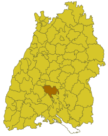
| Location of the Balingen district in Baden-Württemberg | ||
  |
||

The district of Balingen was a district in Baden-Württemberg that was dissolved in the course of district reform on January 1, 1973 .
geography
location
The district of Balingen was in the south of Baden-Württemberg. Geographically, he mainly had a share in the Swabian Alb .
Neighboring areas
Its neighbors were 1972, starting clockwise in the north, Hechingen , Sigmaringen , Stockach , Tuttlingen , Rottweil and Horb .
history
Most of the area in the Balingen district belonged to the Duchy of Württemberg even before 1800 . Therefore there was an Oberamt Balingen before 1800 . This was rewritten in 1806 and from 1810 belonged to the Landvogtei Am Oberen Neckar and from 1818 to the Black Forest District , which was dissolved in 1924. In 1934 the Oberamt was renamed the district of Balingen, in 1938 it was considerably enlarged to include some communities in the dissolved districts of Ebingen, Sulz and Spaichingen and some communities in the Rottweil district. After the Second World War, the district of Balingen became part of the new federal state of Württemberg-Hohenzollern and, after the reorganization of the federal states in 1952, became part of Baden-Württemberg in the southwest . After that he belonged to the administrative district of Südwürttemberg-Hohenzollern .
With effect from January 1, 1973, the district of Balingen was dissolved. His area was combined with the former Prussian district of Hechingen, which was also dissolved, and two communities in the dissolved Stockach district to form the new Zollernalb district , which became the legal successor of the Balingen district. The county seat of the new district was Balingen.
Population development
All population figures are census results.
|
|
politics
District Administrator
The district councils of the district Balingen since 1938:
- 1934–1939: Karl Sinn
- 1939–1945: Theodor Zeller
- 1945–1948: Robert Wahl
- 1948–1967: Friedrich Roemer
- 1968–1972: Erhard Lazi
The Oberamtmen of the former Oberamt are shown under Oberamt Balingen .
coat of arms
The coat of arms of the district of Balingen showed under a golden shield head, a lying black stag pole, in red a two-towered, silver castle with an open gate and a golden portcullis. The coat of arms was approved by the Württemberg Ministry of the Interior on May 25, 1928. It has been unofficially managed by the then Oberamt Balingen since 1926 and is therefore one of the oldest district coats of arms in Germany.
The deer sticks indicate Württemberg, to which the main part of the district belonged. The knights of Schalksburg and their successors, the Lords of Rosenfeld, had the silver castle with a red shield in their coat of arms. The Schalksburg was the center of the largest rule in the district and is the largest castle ruin in the district at that time.
Economy and Infrastructure
traffic
There was no federal motorway running through the district . It was opened up by federal highways 27 and 463 as well as by several state and district roads.
Communities
From 1938 onwards, 45 municipalities were initially part of the Balingen district, including 6 towns. Already in 1934 Truchtelfingen was incorporated into Tailfingen and Heselwangen to Balingen and in 1937 Dürrwangen was incorporated into Frommern.
On March 7, 1968, the state parliament of Baden-Württemberg set the course for a community reform . With the law to strengthen the administrative power of smaller municipalities , it was possible for smaller municipalities to voluntarily unite to form larger municipalities. The beginning in the district of Balingen was made on January 1, 1971 by the communities of Stockenhausen and Streichen, which united with the city of Balingen . In the period that followed, the number of communities steadily decreased until the Balingen district was finally dissolved in 1973.
The largest municipality in the district was the town of Ebingen, which had been a major district town since April 1, 1956 . The smallest community was Burgfelden.
In the table, the municipalities of the Balingen district are before the municipal reform. Today all communities belong to the Zollernalb district . The population figures refer to the census results in 1961 and 1970.
License Plate
On July 1, 1956, the district was assigned the distinctive sign BL when the vehicle license plates were introduced that are still valid today . It is issued throughout the Zollernalb district to this day.
literature
- Friedrich Roemer: The old district Balingen. In: Erhard Lazi (Ed.): The Zollernalbkreis . Konrad Theiss Verlag , Stuttgart 1979, ISBN 3-8062-0205-2 , pp. 149-158
Individual evidence
- ↑ a b Federal Statistical Office (ed.): Historical municipality register for the Federal Republic of Germany. Name, border and key number changes in municipalities, counties and administrative districts from May 27, 1970 to December 31, 1982 . W. Kohlhammer, Stuttgart / Mainz 1983, ISBN 3-17-003263-1 , p. 524 f .
- ^ The district of Balingen - Official district description . In: Statistisches Landesamt Baden-Württemberg in connection with the district of Balingen (ed.): The city and districts in Baden-Württemberg . tape 1 , 1960, p. II .
.svg)
Basking | Backnang | Baden-Baden | Balingen | Biberach | Boeblingen | Bruchsal | Book | Bühl | Calw | Crailsheim | Donaueschingen | Ehingen | Emmendingen | Esslingen | Freiburg (city) | Freiburg (State) | Freudenstadt | Friedrichshafen | Göppingen | Hechingen | Heidelberg (city) | Heidelberg (Country) | Heidenheim | Heilbronn (city) | Heilbronn (Land) | Black Forest | Horb | Karlsruhe (city) | Karlsruhe (State) | Throat | Constance (city) | Constance (Country) | Künzelsau | Lahr | Leonberg | Loerrach | Ludwigsburg | Mannheim (city) | Mannheim (State) | Mergentheim | Mosbach | Muellheim | Münsingen | Neustadt | Nürtingen | Offenburg | Öhringen | Pforzheim (city) | Pforzheim (Country) | Rastatt | Ravensburg | Reutlingen | Rottweil | Säckingen | Saulgau | Schwäbisch Gmünd | Schwäbisch Hall | Sigmaringen | Sinsheim | Stockach | Stuttgart | Tauberbischofsheim | Tettnang | Tübingen | Tuttlingen | Überlingen | Ulm (city) | Ulm (State) | Vaihingen | Villingen | Villingen-Schwenningen | Waiblingen | Waldshut | Cheeks | Wolfach