East village
|
East village
City of Balingen
|
|
|---|---|
| Coordinates: 48 ° 18 ′ 5 ″ N , 8 ° 50 ′ 31 ″ E | |
| Height : | 542 m |
| Area : | 6.55 km² |
| Residents : | 1526 (Dec. 31, 2010) |
| Population density : | 233 inhabitants / km² |
| Incorporation : | July 1, 1971 |
| Postal code : | 72336 |
| Area code : | 07433 |
|
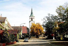
Center of Ostdorf
|
|
Until 1971, Ostdorf was a municipality in the Zollernalb district in Baden-Württemberg . Today it is a district with a local council of Balingen . Ostdorf is 75 kilometers south of Stuttgart.
geography
Geographical location
Ostdorf is located northwest of Balingen above the Eyach valley , a right tributary of the Neckar , on a plateau. This is cut all around by small streams.
The closest high point is the Warren , 606 m above sea level. NN. The dominant eye-catcher is the Hohenzollern mountain with the Hohenzollern castle . Ostdorf also offers a good view of the Zollernalb in the east behind Balingen.
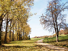
The area is covered with coniferous forest. Typical uncultivated areas are the juniper heather slopes with stone bars.
geology
Partly free-standing shell limestone with good, loamy soil. The agriculturally used soils of the marking are counted among the best soils in the old district of Balingen .
Neighboring communities
The municipalities are listed clockwise from the north and belong to the Zollernalb district :
Owingen (district of Haigerloch ), Engstlatt, Balingen, Geislingen .
history
The first settlement was probably founded in the 7th or 8th century. Ostdorf was first mentioned in documents in 1200. An Albert von Ostdorf sold a fiefdom of the place to the Salem monastery . Until 1287 the village belonged to the dukes of Teck . After several pledges, it finally came to the Counts of Württemberg under Eberhard I in 1317 , and a bailiff is mentioned for the first time. This makes Ostdorf Balingen's oldest municipality in Württemberg. Even in the late Middle Ages there was rural prosperity. It was not until 1949 that there was a modest settlement of industry. In 1971 it was incorporated into the city of Balingen. Ostdorf is the sub-municipality of Balingen that is still dominated by agriculture today.
From 1403 Ostdorf belonged to the newly formed Office Balingen , from which the Oberamt Balingen later emerged, in 1456 a local court was mentioned for the first time. A population census in 1525 showed around 500 inhabitants in 63 houses for Ostdorf. 48 peasants went into the peasant war . The plague raged in the area at the end of the 16th century . Of the 662 inhabitants in Ostdorf, 225 fell victim to this disease in 1592. In 1610 a schoolmaster was first mentioned in Ostdorf. Six years later, the ducal tithe barn , which was destroyed by a storm, was rebuilt. From 1690 Ostdorf had its own town hall .
Ten years after the establishment of the Kingdom of Württemberg and the oppressive period of the coalition wars, there was a great famine in 1816 due to unfavorable weather conditions and poor harvests . There was talk of the year without a summer .
In 1827 the school building opposite the church was consecrated, and in 1832 the church was expanded. After another crop failure, around 200 people emigrated to North America in 1852. The community set up a sewing school for girls and women as a source of income. In 1875 the new school building, which was used as the town hall after 1960, was inaugurated. In 1911 Ostdorf was connected to the electricity and water network. In 1922 the new school and the festival hall were built. In 1951 the 59 hectare Allmand was abolished and a swimming pool was set up.
On July 1, 1971, Ostdorf was incorporated into the city of Balingen. and became a district with a local council . In 1990 the tithe barn from 1616 burned down and was rebuilt.
Population development
| year | Residents |
|---|---|
| 1525 | 500 |
| 1592 | 438 |
| 1794 | 809 |
| 1820 | 975 |
| 1875 | 992 |
| 1900 | 945 |
| 1959 | 1098 |
| 1961 | 1109 |
| 1970 | 1235 |
| 1992 | 1516 |
| 2005 | 1599 |
religion
Evangelical Christians have predominated since the Reformation . Ostdorf has been part of the dean's office in Balingen since 1547 . The patron saint of the church is St. Medardus , as a weather saint typical for the farming community. The church tower has existed since 1843 in an octagonal shape with a copper helmet since 1861. For many decades the community maintained a community nurse ( deaconess ) for nursing the sick . She had her apartment in the Beck'schen Hof . Today the pastoral office or the parish consists of around 1,800 Protestant church members in Ostdorf and Geislingen. The parish council consists of seven elected members and two members by virtue of office (pastor and church carer). For more than 100 years, the Old Pietist Community (today: Apis - Evangelical Community Association of Württemberg) has been an integral part of religious life in Ostdorf.
Only after 1945 were there more Catholics in the village due to the influx of expellees .
Surname
A common misconception is that the name Ostdorf comes from the fact that it is in the east of Balingen . But that is wrong because the village is north of Balingen. In reality the name comes from "Austdorf".
politics
Mayor
Mayor Helmut Haug is the head of the Ostdorf local authority and chairman of the local council.
coat of arms
Blazon : Under a golden shield head, inside a black stag pole (Württemberg horns), golden plow pointing to the left on a black background. The coat of arms has been in official use since 1950. The following saying is common for this coat of arms: "The most beautiful coat of arms in the world is the plow in the field."
traffic
Ostdorf has a good connection to the federal motorway 81 via the Kreisstraße (junction Empfingen ). The Public transport is by the Verkehrsverbund Neckar-Alb-Donau guaranteed (NALDO). The community is located in honeycomb 331.
Buildings
See also: List of cultural monuments in Ostdorf
- Evangelical Medarduskirche, Gothic building with nave from 1832
media
The most important local newspapers are the Zollern-Alb-Kurier and the Schwarzwälder Bote .
Until 1960 the community still had a Schellschütt (official messenger with exclamation).
Public facilities
The Farmer's Museum in Ostdorf shows agricultural implements as well as rustic room and bedroom furniture. It was established in 1981 in the former village school. Another facility is the Protestant kindergarten on the village meadow with three groups.
Personalities
- Adam Friedrich Koch (1763–1835), educator, castle researcher and writer, born in Ostdorf
- Martin Haug (1827–1876), orientalist, born in Ostdorf
Individual evidence
- ^ Federal Statistical Office (ed.): Historical municipality directory for the Federal Republic of Germany. Name, border and key number changes in municipalities, counties and administrative districts from May 27, 1970 to December 31, 1982 . W. Kohlhammer, Stuttgart / Mainz 1983, ISBN 3-17-003263-1 , p. 524 .
literature
- Association of Ostdorf, City Administration Balingen (Ed.): 800 years of Ostdorf . SV Verlagsdruckerei, Balingen 2001.
- Friedrich Veit (Ed.): Festschrift for the Haug celebration in Ostdorf on August 29, 1909 . Schnürlen: Tübingen 1909.
- Friedrich Veit: Ostdorfer studies . Part 1–3. Schnürlen: Tübingen 1901–1902.
Web links
- District information on the website of the city of Balingen


