
Mannheim district
| coat of arms | Germany map | |
|---|---|---|

|
Coordinates: 49 ° 30 ' N , 8 ° 35' E |
|
| Basic data (as of 1972) | ||
| Existing period: | 1938-1972 | |
| State : | Baden-Württemberg | |
| Administrative region : | North Baden | |
| Administrative headquarters : | Mannheim | |
| Area : | 313 km 2 | |
| Residents: | 192.902 (May 27, 1970) | |
| Population density : | 616 inhabitants per km 2 | |
| License plate : | MA | |
| Circle key : | 08 2 35 | |
| Circle structure: | 27 municipalities | |
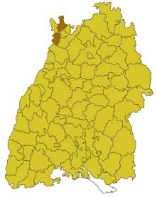
| Location of the Mannheim district in Baden-Württemberg | ||
  |
||

The district of Mannheim was a district in Baden-Württemberg , which was dissolved in the course of the district reform on January 1, 1973 .
geography
location
The Mannheim district was located in the northwest of Baden-Württemberg.
Geographically, the district predominantly had a share in the Upper Rhine Plain ; few communities were in the Odenwald . Mannheim as a district seat itself did not belong to the Mannheim district, but had been an urban district since 1939 . The city districts of Mannheim and Heidelberg divided the district area into two parts.
Neighboring areas
Its neighboring districts were in early 1969 clockwise starting in the north Bergstrasse in Hesse , Heidelberg , the Heidelberg district , the Bruchsal district and the Mannheim district in Baden-Württemberg. In the west, the Rhine formed the border with Rhineland-Palatinate with the Ludwigshafen am Rhein district there and the independent city of Speyer .
history

Before 1803, the area of the Mannheim district belonged mainly to the Electoral Palatinate . Then it came to the Electorate of Baden , which was elevated to a Grand Duchy in 1806 . The Mannheim city office and the offices and district offices of Ladenburg , Schwetzingen and Weinheim were established in the later district area . The district office of Ladenburg was dissolved in 1863 and its area was combined with the Mannheim city office to form the Mannheim district office. The Schwetzingen district office was merged with the Mannheim district office in 1924. In 1936 the Mannheim and Weinheim district offices were merged to form the Mannheim district office, and in 1939 the Mannheim district was created through the law on district self-government .
After the formation of the state of Baden-Württemberg in 1952, the district of Mannheim belonged to the administrative district of North Baden . As a result of the municipal reform in 1970, the district area changed in one case. On January 1, 1972, the Altenbach community , district of Heidelberg, was incorporated into the city of Schriesheim . The district of Mannheim thus expanded accordingly.
With effect from January 1, 1973, the Mannheim district was dissolved. His area was completely absorbed in the newly formed Rhein-Neckar district , which became the legal successor to the Mannheim district.
Population development
All population figures are census results.
|
|
politics
District Administrator
The senior officials or district administrators of the city office, district office or district of Mannheim 1803–1972:
|
|
coat of arms
The coat of arms of the district of Mannheim showed in blue a red armored, tongued and crowned silver lion, holding a golden key with the beard down in the front paws. The coat of arms was awarded to the district of Mannheim on March 9, 1970 by the Baden-Württemberg Ministry of the Interior.
The majority of the district (24 communities) belonged to the Electoral Palatinate. Therefore, the electoral-Bavarian lion is shown. The key is taken from the coat of arms of the former bishopric of Worms, which had some rights in the district, but exchanged them for the Electoral Palatinate at the end of the 18th century.
Economy and Infrastructure
traffic
The federal motorway 5 Frankfurt-Karlsruhe and the almost parallel A 6 run through the district from north to south . The federal highways 3 , 36 and 291 also run through the district.
Communities
From 1938 onwards, there were initially 27 municipalities in the Mannheim district, including 4 towns.
On March 7, 1968, the state parliament of Baden-Württemberg set the course for a community reform . With the law to strengthen the administrative power of smaller municipalities , it was possible for smaller municipalities to voluntarily unite to form larger municipalities. It all started with the municipality of Oberflockenbach in the Mannheim district, which merged with the city of Weinheim on May 1, 1972. In the period that followed, the number of municipalities steadily decreased until the Mannheim district became part of the Rhein-Neckar district on January 1, 1973.
The largest municipality in the district was the city of Weinheim, which has been a major district town since 1956 , the smallest municipality was Ritschweier.
In the table, the municipalities of the Mannheim district are before the municipal reform (all today's municipalities belong to the Rhein-Neckar district ). The population figures refer to the census results in 1961 and 1970.
License Plate
On July 1, 1956, the district was assigned the distinctive sign MA with the introduction of the license plates that are still valid today . It is still issued in the Mannheim district to this day.
literature
- State Archive administration Baden-Württemberg in connection with d. Cities and districts Heidelberg u. Mannheim (Hrsg.): The city and districts Heidelberg and Mannheim: Official district description .
- Vol. 1: General part . Karlsruhe 1966
- Vol. 3: The city of Mannheim and the municipalities of the Mannheim district . Karlsruhe 1970
- City and district of Mannheim. (= The city and rural districts of Baden-Württemberg in words and numbers; Issue 65/66) . Published by the Ministry of the Interior and Ministry of Economics in Baden-Württemberg, editing and printing of the State Statistical Office of Baden-Württemberg, Stuttgart, 1973. PDF file, 19.1 MB.
Individual evidence
- ↑ a b Federal Statistical Office (ed.): Historical municipality register for the Federal Republic of Germany. Name, border and key number changes in municipalities, counties and administrative districts from May 27, 1970 to December 31, 1982 . W. Kohlhammer, Stuttgart / Mainz 1983, ISBN 3-17-003263-1 , p. 477 .
.svg)
Basking | Backnang | Baden-Baden | Balingen | Biberach | Boeblingen | Bruchsal | Book | Bühl | Calw | Crailsheim | Donaueschingen | Ehingen | Emmendingen | Esslingen | Freiburg (city) | Freiburg (State) | Freudenstadt | Friedrichshafen | Göppingen | Hechingen | Heidelberg (city) | Heidelberg (Country) | Heidenheim | Heilbronn (city) | Heilbronn (Land) | Black Forest | Horb | Karlsruhe (city) | Karlsruhe (State) | Throat | Constance (city) | Constance (Country) | Künzelsau | Lahr | Leonberg | Loerrach | Ludwigsburg | Mannheim (city) | Mannheim (State) | Mergentheim | Mosbach | Muellheim | Münsingen | Neustadt | Nürtingen | Offenburg | Öhringen | Pforzheim (city) | Pforzheim (Country) | Rastatt | Ravensburg | Reutlingen | Rottweil | Säckingen | Saulgau | Schwäbisch Gmünd | Schwäbisch Hall | Sigmaringen | Sinsheim | Stockach | Stuttgart | Tauberbischofsheim | Tettnang | Tübingen | Tuttlingen | Überlingen | Ulm (city) | Ulm (State) | Vaihingen | Villingen | Villingen-Schwenningen | Waiblingen | Waldshut | Cheeks | Wolfach