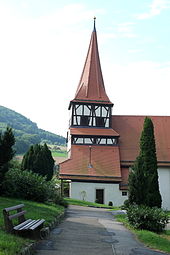
Kocherstetten
|
Kocherstetten
District town of Künzelsau
|
|
|---|---|
| Coordinates: 49 ° 15 ′ 58 " N , 9 ° 45 ′ 40" E | |
| Height : | 236 m |
| Residents : | 809 (December 31, 2011) |
| Incorporation : | January 1, 1972 |
|
View from the west of Kocherstetten with Stetten Castle (2013)
|
|
Kocherstetten is a district of the Baden-Württemberg district town of Künzelsau in the Hohenlohe district .
geography
Kocherstetten is about 5.5 km east-southeast of the town center of Künzelsau on the right bank and at the right foot of the slope of the deeply cut Kochertal at about 254 m above sea level. NN . A few hundred meters after passing the village, the river changes to a westerly direction after a long north course. In the local area lead at a distance of only about three hundred meters two blades brooks on the level of Hohenlohe plain in the east, the Erlesbach and then the Holy Bach , on the spur between them stands the hamlet of Castle Stetten about 170 meters above the river. Behind it, at a distance of three kilometers from the village, is the Bienenhof homestead, which also belongs to it, at the start of the spur on the eastern boundary of the district. Down the Kocher, on the western border of the Morsbach suburbs, the beech mill is located on a right-hand canal.
The suburbs mainly include the wide basin of the Kocher Valley and the incisions of the side blades up to the upper bend in the slope, as well as some forest on both sides of the valley on the adjacent plateau; the upper slopes are also mostly wooded. Only on the spur between the castle and the beehive, Kocherstetten has a share in the open plateau corridor.
The main traffic axis is the valley road L 1045, which follows the Kocher and changes to the left side from the village. From here the K 2383 branches off, which reaches the plateau via a path on the south side of the Erlesbach incision and there also creates a connection to the access road to the castle spur.
history
Kocherstetten, which used to be spelled Kochstetten , was formerly a Hohenlohe fiefdom of the Lords of Stetten , which today still sits at Stetten Castle above the village. Until 1366 the place belonged to Steinkirchen ecclesiastically four kilometers further up in the Kochertal, after that a pastor was resident in Stetten itself. In 1394 the cathedral chapter of Würzburg, in whose special estate Steinkirchen stood, approved the church separation from the mother church in Steinkirchen; the patronage was before and after with the Comburg monastery . In 1525 the Stetten farmers took part in the Peasants ' War . The Counts of Hohenlohe introduced the Reformation in 1566 ; the attempt of the Comburg, which has meanwhile become a canons' monastery, to counter-reformation failed. During the hegemonic wars of Louis XIV , the village experienced several passes by soldiers. In the late winter of 1784, a flood tore the Kocher Bridge away. In 1806 Kocherstetten fell to Württemberg .
On January 1, 1972, Kocherstetten was incorporated into the district town of Künzelsau.
politics
The mayor is (as of 2019) Frank Egner.
Attractions
Individual evidence
- ^ History based on the chapter on Kocherstetten in the description of the Oberamt Künzelsau from 1883.
- ^ Federal Statistical Office (ed.): Historical municipality directory for the Federal Republic of Germany. Name, border and key number changes in municipalities, counties and administrative districts from May 27, 1970 to December 31, 1982 . W. Kohlhammer, Stuttgart / Mainz 1983, ISBN 3-17-003263-1 , p. 451 .
Web links
- Kocherstetten and its area on the geodata viewer
- Kocherstetten on the Künzelsau website


