Your singing
| coat of arms | Germany map | |
|---|---|---|

|
Coordinates: 48 ° 3 ' N , 7 ° 39' E |
|
| Basic data | ||
| State : | Baden-Württemberg | |
| Administrative region : | Freiburg | |
| County : | Breisgau-Upper Black Forest | |
| Height : | 202 m above sea level NHN | |
| Area : | 23 km 2 | |
| Residents: | 6088 (December 31, 2018) | |
| Population density : | 265 inhabitants per km 2 | |
| Postal code : | 79241 | |
| Area code : | 07668 | |
| License plate : | FR | |
| Community key : | 08 3 15 059 | |
| LOCODE : | DE YOUR | |
| Community structure: | 2 districts | |
| Address of the municipal administration: |
Bachenstrasse 42 79241 Ihringen |
|
| Website : | ||
| Mayor : | Benedikt Eckerle (independent) | |
| Location of the community Ihringen in the district of Breisgau-Hochschwarzwald | ||
Ihringen is a municipality in the Breisgau-Hochschwarzwald district in south-west Baden-Württemberg .
geography
location
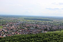
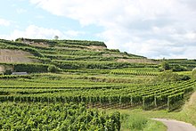
The community is located west of Freiburg im Breisgau , on the southern slope of the Kaiserstuhl . It is known as a wine growing place . The highest point of the Kaiserstuhl, the Totenkopf, is located in the immediate, geographical area of Ihringen .
climate
Due to the protected location on the Kaiserstuhl, the high number of hours of sunshine and the mild winters with few ice days, Ihringen reaches an annual mean temperature of around 12 ° C, making it one of the warmest places in Germany. These climatic conditions favor viticulture. Almond trees, various types of palm, cacti and tropical fruits thrive. Rare animals such as praying mantises , green lizards and bee-eaters also feel at home here.
The climate in this area borders on a Mediterranean climate and there is sufficient rainfall all year round. The Köppen climate type is the warm and humid temperate climate zone ( oceanic climate ) bordering a humid subtropical (Cfa) climate due to the mean temperatures in July and August just below 22 ° C.
| Ihringen measured at Mundingen near Emmendingen 2000–2008 | ||||||||||||||||||||||||||||||||||||||||||||||||
|---|---|---|---|---|---|---|---|---|---|---|---|---|---|---|---|---|---|---|---|---|---|---|---|---|---|---|---|---|---|---|---|---|---|---|---|---|---|---|---|---|---|---|---|---|---|---|---|---|
| Climate diagram | ||||||||||||||||||||||||||||||||||||||||||||||||
| ||||||||||||||||||||||||||||||||||||||||||||||||
|
Monthly average temperatures and precipitation for Ihringen measured at Mundingen near Emmendingen 2000–2008
Source: [2]
|
||||||||||||||||||||||||||||||||||||||||||||||||||||||||||||||||||||||||||||||||||||||||||||||||||||||||||||||||||||||||||||||||||||||||||||||||||||||
Neighboring communities
Ihringen borders the city of Vogtsburg in the north, Bötzingen in the northeast, Gottenheim in the east, Merdingen in the southeast and the city of Breisach am Rhein in the south and west . All neighboring communities belong to the Breisgau-Hochschwarzwald district.
Community structure
The community consists of the districts Ihringen and Wasenweiler. The districts are spatially identical to the communities of the same name before the Baden-Württemberg community reform in the 1970s. The official naming of the districts is made by prefixing the name of the municipality and followed by the name of the respective district connected with a hyphen. The two districts also form the residential districts of Ihringen (or residential district I ) and Wasenweiler (or residential district II ) within the meaning of the Baden-Württemberg municipal code . The district of Wasenweiler is a locality within the meaning of the Baden-Württemberg municipal code with its own local council and a local mayor as its chairman.
The Ihringen district includes the village of Ihringen, Liliental Castle and Farm (Lilienhof) and the Blankenhornsberg and Sauwasen residential areas. The Wasenweiler district includes the Wasenweiler village, the Neunkirch chapel and house and the Wasenweiler train station residential area. In the area of the district Ihringen are the dialed or risen in other places former villages Bachheim, Wyke, Brett Weiler, Brütheim, Güttisried, Kettingen, Nordheim, Ostheim , Riedheim, chess home's Willingen, Scherkofen, West Home and Wolptal whose existence but only suspected becomes.
Resettlements
In addition, Ihringen also includes the districts of Martinshöfe and Lilienhof (Liliental), where there is also a 25 hectare state test site for the forest ecology department of the Baden-Württemberg Forest Research Institute, which is open to the public. There are also the Lenzenberg resettlements , the Blankenhornsberg state winery and several Aussiedlerhöfe around Ihringen.
history
Ihringen is characterized by extensive settlement in prehistoric times. The largest Celtic group of burial mounds in the southern Baden Upper Rhine Plain is located on the lower terrace about 500 meters southwest of the village. Graves were found from the Middle Bronze Age, i.e. from approx. 1500 BC. However, the Celtic burial mounds from the period between approx. 850 and 250 BC predominate. Chr.
In 1974, during a land consolidation, a fortified Celtic hilltop settlement with numerous finds was excavated on a hilltop of the Kaiserstuhl protected on three sides by steep slopes, about 500 meters northwest of the village. It is used between 600 and 500 BC. Dated. There was most likely a connection between this settlement, which can be interpreted as a mansion, and the large burial mound field, which is within sight in the plain.
In addition to individual Roman settlements, Merovingian graves from the 7th century AD were discovered in various places in Ihringen, which point to the early founding of the place and its districts that disappeared in the Middle Ages.
Ihringen was first mentioned in a document in 962 as Uringa . The Grand Duchy of Baden came through the margraviate of Baden-Durlach . Wasenweiler was first mentioned in a document as Uuasenuuilara in 1000 AD . Its history is strongly determined by the Teutonic Order : From 1297/98 to 1806, as part of Upper Austria, the Teutonic Order Commander Freiburg held the upper bailiff's rights over the place. Both places have belonged to Baden-Württemberg since 1952 .
As part of the community reform , the community Wasenweiler was incorporated into the neighboring community of Ihringen to the west on July 1, 1974. The different rulers in the course of history (Baden-Durlach Protestant, German Order Catholic) explain the different confessional orientation of the two wine-growing communities.
see also Ihringen Castle
Religions
While Ihringen has been evangelical since the Reformation , the Wasenweiler district has always been Roman Catholic . That is why there is a corresponding church in each of the two districts. In Ihringen there is the Protestant church, rebuilt in 1874 . In Wasenweiler on the mountain is the Catholic Church of the Assumption of the Virgin , built in 1823 by the master builder Christoph Arnold in the style of Friedrich Weinbrenner . The Evangelical parish has approx. 3200, the Catholic parish approx. 1600 inhabitants from Ihringen and Wasenweiler.
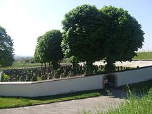
In Ihringen there was also a Jewish community until 1938 . In 1925 there were 125 members, 3.7% of the total population. The center of the community was a synagogue completed in 1864 , which replaced a previous building. As elsewhere, this building was destroyed by arson during the night of the pogrom . The naming of the Synagogenplatz reminds of this. The community also owned a cemetery , which still exists west of Ihringen today. He was violated in 1990 and again in 2007. Damage and National Socialist slogans and symbols suggested authors from neo-Nazi circles.
politics
Municipal council
In Ihringen the municipal council is elected according to the procedure of the false sub-district selection. The number of local councils can change due to overhang mandates . The municipal council in Ihringen has 20 members after the last election (previously 18). The local elections on May 26, 2019 led to the following preliminary final result. The municipal council consists of the elected voluntary councilors and the mayor as chairman. The mayor is entitled to vote in the municipal council.
| Parties and constituencies | % 2019 |
Seats 2019 |
% 2014 |
Seats 2014 |
||||
|---|---|---|---|---|---|---|---|---|
| CDU | Christian Democratic Union of Germany | 38.1 | 8th | 39.1 | 7th | |||
| SPD | Social Democratic Party of Germany | 31.2 | 6th | 35.5 | 7th | |||
| Green | Alliance 90 / The Greens | 30.7 | 6th | 25.5 | 4th | |||
| total | 100 | 20th | 100 | 18th | ||||
| voter turnout | 66.8% | 57.8% | ||||||
coat of arms
 Your singing |
Blazon of the Ihringen coat of arms : "In a split shield in front in gold (yellow) a red sloping bar, behind in red over a silver (white) pruning knife a fallen golden (yellow) grape on a stem." The red sloping bar in gold is an indication of the rule of the Margraves of Baden-Durlach.
The coat of arms of Wasenweiler shows corresponding elements: the black paw cross on a silver background refers to the centuries of local rule of the Teutonic Order . In the small heart shield, a blue grape in the green style on a gold background indicates the long winemaking tradition. |
 Wasenweiler |
Partnerships
- Munster (Haut-Rhin) in Alsace
- Ruhpolding
- Wattwiller in Alsace
Economy and Infrastructure
traffic
The sub-locations are both on the Breisacher Bahn . The stops are approached every half hour during the day. The Breisgau S-Bahn runs on the route with multiple units of the Stadler Regio-Shuttle RS1 type .
economy
A central role in the wine community plays the marketing of the wine , which is why in addition to the numerous districts in both wineries also each have their own wine cooperative is: the Kaiserstühler Winzergenossenschaft Ihringen eG and Wasenweiler Winzer eG. Wasenweiler Winzer eG has existed since 1935 and is an amalgamation of around 200 wine-growing families with 70 hectares of vineyards. The main grape variety is Pinot Noir.
The agricultural machinery manufacturer Sauerburger is also based in the Wasenweiler district .
Authorities
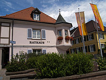
The town hall of the municipality with the registration office , registrar's office , Commercial Register and Information Center is located in Ihringen at the Bach street. The area of the municipality of Ihringen belongs to the district of the district court of Breisach .
education
With the Neunlindenschule there is a primary and community school in Ihringen . In the Wasenweiler district, the Mambergschule is a pure elementary school . In addition, there is also a special school with the Albert School . There are also three kindergartens, one of which is run by the Evangelical Church Community , another by the political community and the third by the Evangelical Community .
Culture and sights
Museums
The history of village life in the wine-growing community is shown in the Ihringen local history museum . It also has small finds from Roman times.
Memorials
A memorial stone not far from the former location of the Bachenstrasse 15/17 synagogue commemorates the Jewish church destroyed by SA men in the November pogrom in 1938 .
music
There are several orchestras, the Fanfarenzug Kaiserstühler Herolde Ihringen, the Musikverein Ihringen, the trombone choir of the Ev. Community and in the Wasenweiler district the winegrower's chapel. There is also a men's choir. The community is also involved in the youth music school Westlicher Kaiserstuhl-Tuniberg e. V.
Buildings
The oldest monumental building is the late Gothic St. Vitus cemetery chapel in the Wasenweiler district. She has murals of the apostles in the choir and murals in the nave with scenes from the life of St. Vitus . In the choir there is a sacrament house from 1507.
The Roman Catholic parish church of the Assumption of Mary in Wasenweiler was built in 1823 by Christoph Arnold in the Weinbrenner style, but contains older, mainly baroque, sculptures.
The Protestant church in the Ihringen district dates from 1874 to 1877 and was fitted out in 1975/76 by Valentin Peter Feuerstein from Neckarsteinach with glass windows reminiscent of Chagall . In the north aisle there are ten Old Testament themes from creation to the prophets, in the south aisle there are twelve gospel windows , in the eastern choir the Trinity window, on the western gallery two windows with representations from the Revelation of John . The organ allows the organist to look at the altar while playing by means of a complex mechanism of the pedals .
On the eastern outskirts of Wasenweiler stands the St. Anton Chapel, which commemorates the victims of the two world wars.
St. Vitus Chapel in Wasenweiler: medieval frescoes with the legend of Vitus
Church of the Assumption in Wasenweiler
Regular events
Ihringer Wine Days
The Ihringen Wine Days take place every early summer, always on the weekend after Corpus Christi . Since Ihringen itself is a predominantly Protestant place, Corpus Christi Day is used by the organizing associations to set up in the closed courtyards on Bachenstrasse, where the wine days take place every year.
Christmas concert
Every year on the last Sunday in Advent before Christmas Eve, the traditional concert of the Musikverein Ihringen e. V. takes place with the participation of the Protestant church choir .
Movie
- The end of autumn at the Kaiserstuhl. Documentary, Germany, 2014, 29:43 min., Book: Olaf Jahnke, Frank Müller, Frank Siemoneit, camera: Gerd Bleichert, Konrad Frick, Siegfried Maier, moderation: Eva Gnädig, production: SWR , series: Treffpunkt , first broadcast: 26 October 2014 at SWR, table of contents by ARD .
In September 2019, scenes from the Black Forest crime scene , which will be broadcast a year later, were filmed in and around Ihringen.
literature
- Bittel, Kimmig, Schiek: The Celts in Baden-Württemberg , p. 403 f., Local files and lists of the State Office for the Preservation of Monuments, Archaeological Preservation of Monuments, Freiburg Office.
Web links
- Website of the municipality of Ihringen
- Ihringen and the Kaiserstuhl
- Wasenweiler: Weinbrenner-style church (Arkadischer Kaiserstuhl)
Individual evidence
- ↑ State Statistical Office Baden-Württemberg - Population by nationality and gender on December 31, 2018 (CSV file) ( help on this ).
- ↑ Weather station Ihringen - measured values
- ↑ Main statute of the municipality Ihringen from June 19, 2000 (PDF; 10 kB)
- ^ The state of Baden-Württemberg. Official description by district and municipality. Volume IV: Freiburg administrative region . Kohlhammer, Stuttgart 1978, ISBN 3-17-007174-2 , pp. 76-78.
- ^ Federal Statistical Office (ed.): Historical municipality directory for the Federal Republic of Germany. Name, border and key number changes in municipalities, counties and administrative districts from May 27, 1970 to December 31, 1982 . W. Kohlhammer, Stuttgart / Mainz 1983, ISBN 3-17-003263-1 , p. 509 .
- ↑ Gerold Zink: Ihringen: Jewish cemetery desecrated. In: Badische Zeitung of August 12, 2007. Archived from the original on September 27, 2007 ; Retrieved March 6, 2011 .
- ↑ Wasenweiler Winzer eG: Wasenweiler wines and sparkling wine specialties. Leaflet, Wasenweiler, 2011
- ↑ Memorial sites for the victims of National Socialism. A documentation, Volume I, Bonn 1995, p. 49, ISBN 3-89331-208-0
- ↑ BZ editorial team: In and around Ihringen, filming for the new Black Forest crime scene is in progress. Badische Zeitung, September 21, 2019, accessed on August 8, 2020 .
- ^ Freiburger Stadtkurier Verlagsgesellschaft mbH in Freiburg - archive, issue 32/2020. Retrieved August 8, 2020 .


