
Nobility strike
| coat of arms | Germany map | |
|---|---|---|

|
Coordinates: 48 ° 50 ' N , 11 ° 13' E |
|
| Basic data | ||
| State : | Bavaria | |
| Administrative region : | Upper Bavaria | |
| County : | Eichstatt | |
| Management Community : | Nassenfels | |
| Height : | 435 m above sea level NHN | |
| Area : | 51.98 km 2 | |
| Residents: | 3020 (Dec. 31, 2019) | |
| Population density : | 58 inhabitants per km 2 | |
| Postal code : | 85111 | |
| Area code : | 08424 | |
| License plate : | EGG | |
| Community key : | 09 1 76 111 | |
| Community structure: | 13 parts of the community | |
| Association administration address: | Schulstr. 9 85128 Nassenfels |
|
| Website : | ||
| Mayor : | Andreas Birzer, First Mayor ( CSU ) | |
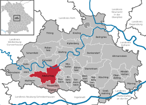
| Location of the municipality of Adelschlag in the Eichstätt district | ||
  |
||

Adelschlag ( Bavarian Olschlou ) is a municipality in the Upper Bavarian district of Eichstätt and a member of the Nassenfels administrative community .
geography
Adelschlag is located in the Ingolstadt planning region south of the Altmühltal on the plateau of the southern Franconian Alb in the Altmühltal Nature Park . As of January 1, 1999, the area was 51.98 km².
The municipality has 13 officially named municipality parts (the type of settlement is indicated in brackets ):
|
|
There are the districts Adelschlag, Möckenlohe, Ochsenfeld and Pietenfeld. Prielhof was first mentioned in a document in 1186 as "Brule" (after ahd. Bruil = swamp meadow).
history
Until the 19th century

In 893 the place was first mentioned under the name Adeloltesloh in the "Vita S. Walburgis" of the Eichstätter cathedral cleric Wolfhard von Herrieden . The name is composed of the Old High German lōh for grove and the personal name Adelolt . In the 12th century it was mentioned as Adelesloch and Adalsloch , in the 14th century as Adelsloh . Since 1544 the term Adelschlag has predominated. The church village - in 1313 the patronage right was given to the Augustinian canons Rebdorf by Prince Bishop Philipp von Rathsamhausen - was an office of the Eichstätt bishopric , which had been in the Franconian Empire since 1500 .
During the witch hunt in the Hochstift Eichstätt at least 14 women and four men from Pietenfeld , Landershofen, Adelschlag and Möckenlohe were charged with witchcraft and sentenced to death . Two of the executions took place in 1603, 14 in 1617 and 1618, and one each in 1622 and 1627.
In 1803 Adelschlag was in favor of the Archduke Ferdinand of Tuscany secularized . Since the Peace of Pressburg in 1805 the place has belonged to Bavaria and from 1817 to 1833 belonged to the Principality of Eichstätt of the Dukes of Leuchtenberg . At that time (1821) the place Adelschlag had 210 inhabitants. In the 1861 census, Adelschlag had 245 inhabitants and 74 buildings, and Wittenfeld had 20 inhabitants and 5 buildings.
Incorporations
With the regional reform on April 1, 1971, the amalgamation of Adelschlag, Möckenlohe and Ochsenfeld to form a unified municipality with a municipality seat in Adelschlag. Pietenfeld joined on May 1, 1978.
Population development
Between 1988 and 2018 the municipality grew from 2,340 to 3,006 by 666 inhabitants or by 28.5%.
Former municipality and current town of Adelschlag
- 1800: 200 inhabitants
- 1821: 210 inhabitants
- 1861: 265 inhabitants
- 1912: 381 inhabitants
- 1950: 599 inhabitants
- 1961: 516 inhabitants
- 1970: 502 inhabitants
- 2006: 630 inhabitants
- 2015: 660 inhabitants
Area of today's municipality of Adelschlag
- 1961: 2010 inhabitants
- 1970: 2051 inhabitants
- 1987: 2280 inhabitants
- 1991: 2460 inhabitants
- 1995: 2553 inhabitants
- 2000: 2604 inhabitants
- 2005: 2752 inhabitants
- 2010: 2784 inhabitants
- 2015: 2948 inhabitants
- 2020: 3048 inhabitants
Population distribution (as of April 30, 2020):
- 680
- Goddess 666
- 738
- Pietenfeld 970
politics
Municipal council
The municipal council consists of the First Mayor and 14 elected members:
- CSU 8 seats (56.05%)
- SPD 3 seats (19.97%)
- Free voters 3 seats (23.99%)
The turnout was 73.72%. (Status: local election on March 15, 2020)
mayor
Mayor has been Andreas Birzer from the CSU since May 1, 2014. He was confirmed in office on March 15, 2020 with a competitor with 80.42% of the votes.
coat of arms
The description of the coat of arms adopted in 1984 reads: "In gold, a continuous, curved red paw cross, topped by four red flowers, covered with a red shield, inside the silver curvature of a bishop's staff."
Buildings in Adelschlag

- The catholic branch church St. Andreas , in the Middle Ages parish church, was rebuilt in 1707 according to plans of the Eichstätter court architect Jakob Engel by his parlier Johann Baptist Camesino using older parts of the wall. The baroque altars were erected in 1717–1718; the Sebastian altar comes from the Eichstatt sculptor Christian Handschuher . The church tower, the basement of which comes from the Romanesque , was clapboard with its lantern-crowned dome. The baroque church was demolished in 1972 while retaining the tower and rebuilt the following year by the architect Karljosef Schattner . Parts of the baroque furnishings were taken over, such as the altars and the stucco pulpit by Franz Xaver Horneis (Horniss) from 1737. The main altarpiece painted in 1893 by Joseph Kiener was also reinstalled. A Rosary Madonna is a Baroque creation from 1700.
- A former Roman manor ( Villa rustica ) was found north of Adelschlag and rebuilt as a museum. Remnants of a Roman road have survived to the east of the village .
Architectural monuments
Economy and Infrastructure
Economy including agriculture and forestry
The municipal tax revenue amounted to the equivalent of 975,000 € in 1999, of which the trade tax income (net) amounted to the equivalent of 52,000 €. In 1998 there were four employees at the place of work in agriculture and forestry, 69 in manufacturing and 17 in trade and transport. In other economic sectors 22 people were employed at the place of work, with the unemployment rate at 23%. There were a total of 883 employees at the place of residence. There were none in manufacturing and five in the construction industry. In addition, in 1999 there were 79 farms with an agriculturally used area of 2500 ha. Of this, 2144 ha were arable land and 352 ha were permanent green areas.
education
There is a day care center and a general education school. In 2018/2019, a total of 106 students were taught by seven full-time teachers in the Adelschlag primary school .
Others
- In 1880 a volunteer fire brigade was founded in Adelschlag.
- The largest association in the community is the DJK Pietenfeld-Adelschlag, which has over 600 members and has table tennis, football, gymnastics, children's gymnastics and badminton.
- The municipality is covered by a wide network of cycle paths.
- In the municipality of Möckenlohe, a rebuilt Roman villa, called "Villa rustica", can be viewed in connection with a Roman pet park.
- Archenbrunn is a lost place in the community area.
Sons and daughters of the church
- Karl Göbel (1900–1945), officer, most recently major general
literature
- Johann Kaspar Bundschuh : Adelschlag . In: Geographical Statistical-Topographical Lexicon of Franconia . tape 1 : A-egg . Verlag der Stettinische Buchhandlung, Ulm 1799, DNB 790364298 , OCLC 833753073 , Sp. 17 ( digitized version ).
- Felix Mader (editor): The art monuments of Bavaria. Middle Franconia. II. Eichstätt District Office , Munich 1928 (Reprinted in Munich and Vienna 1982), pp. 23-25
- On the history of Adelschlag , in: Heimgarten 20 (1949), No. 4
- Theodor Neuhofer: Contributions to the history of art of the district of Eichstätt , in: Collective sheet of the historical association Eichstätt 59 (1961/62), p. 54 f.
- The Eichstätter Raum in past and present , Eichstätt: 2nd improved edition 1984, p. 149 (there detailed bibliography)
- Nobility strike . In: Historical Atlas of Bavaria. Franken series I issue 6: Eichstätt. In: Digital Library of the Bavarian State Library
Web links
- Homepage of the municipality of Adelschlag
- Homepage of Ochsenfeld - part of the municipality of Adelschlag
- Website of Möckenlohe - part of the municipality of Adelschlag
- Adelschlag: Official statistics of the LfStat
- Entry on the coat of arms of Adelschlag in the database of the House of Bavarian History
Individual evidence
- ↑ "Data 2" sheet, Statistical Report A1200C 202041 Population of the municipalities, districts and administrative districts 1st quarter 2020 (population based on the 2011 census) ( help ).
- ^ Community of Adelschlag: About Adelschlag | Adelschlag introduces itself. Retrieved May 9, 2020 .
- ^ Community Adelschlag in the local database of the Bavarian State Library Online . Bavarian State Library, accessed on September 14, 2019.
- ^ Joseph Heyberger, Chr. Schmitt, v. Wachter: Topographical-statistical manual of the Kingdom of Bavaria with an alphabetical local dictionary . In: K. Bayer. Statistical Bureau (Ed.): Bavaria. Regional and folklore of the Kingdom of Bavaria . tape 5 . Literary and artistic establishment of the JG Cotta'schen Buchhandlung, Munich 1867, Sp. 1008 , urn : nbn: de: bvb: 12-bsb10374496-4 ( digitized version ).
- ^ Wilhelm Volkert (ed.): Handbook of Bavarian offices, communities and courts 1799–1980 . CH Beck, Munich 1983, ISBN 3-406-09669-7 , p. 456 .
- ^ Federal Statistical Office (ed.): Historical municipality directory for the Federal Republic of Germany. Name, border and key number changes in municipalities, counties and administrative districts from May 27, 1970 to December 31, 1982 . W. Kohlhammer, Stuttgart / Mainz 1983, ISBN 3-17-003263-1 , p. 599 .
- ↑ a b Facts and Figures. Municipality of Adelschlag, April 30, 2020, accessed on May 9, 2020 (The division was probably made according to the districts within the municipality, not according to the parts of the municipality).
- ^ Primary school Adelschlag in the school database of the Bavarian State Ministry for Education and Culture , accessed on May 9, 2020.

Adelschlag | Altmannstein | Beilngries | Böhmfeld | Buxheim | Denkendorf | Dollnstein | Egweil | Eichstätt | Eitensheim | Gaimersheim | Großmehring | Hepberg | Hitzhofen | Kinding | Kipfenberg | Koesching | Lenting | Mindelstetten | Mörnsheim | Nassenfels | Oberdolling | Pförring | Pollen field | Schernfeld | Stammham | Titting | Walting | Wellheim | Wettstetten
Non-parish areas in the Eichstätt
Haunstetter Forst district
Adelschlag | Pheasantry | Möckenlohe | Moritzbrunn | Oxfield | Pietenfeld | Prielhof | Tempelhof | Untermöckenlohe | Forest hut | Weißenkirchen | Wittenfeld | Brick hut