
Schöngeising
| coat of arms | Germany map | |
|---|---|---|

|
Coordinates: 48 ° 8 ' N , 11 ° 12' E |
|
| Basic data | ||
| State : | Bavaria | |
| Administrative region : | Upper Bavaria | |
| County : | Fürstenfeldbruck | |
| Management Community : | Grafrath | |
| Height : | 530 m above sea level NHN | |
| Area : | 12.87 km 2 | |
| Residents: | 1907 (Dec. 31, 2019) | |
| Population density : | 148 inhabitants per km 2 | |
| Postal code : | 82296 | |
| Area code : | 08141 | |
| License plate : | FFB | |
| Community key : | 09 1 79 147 | |
| LOCODE : | DE ZFZ | |
| Community structure: | 3 parts of the community | |
| Address of the municipal administration: |
Amperstrasse 22 82296 Schöngeising |
|
| Website : | ||
| Mayor : | Thomas Totzauer | |
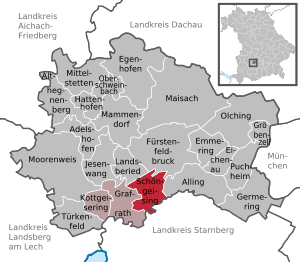
| Location of the municipality of Schöngeising in the Fürstenfeldbruck district | ||
  |
||


Schöngeising is a municipality in the Upper Bavarian district of Fürstenfeldbruck and a member of the Grafrath administrative community .
geography
location
Schöngeising is about seven kilometers southwest of Fürstenfeldbruck and 30 kilometers west of Munich .
Parish parts
The municipality has three officially named municipal parts (the type of settlement is indicated in brackets ):
- Jexhof ( wasteland )
- Schöngeising ( parish village )
- Zellhof ( hamlet )
Waters
climate
Schöngeising can - like practically all of Bavaria (except high mountain areas) - be assigned to the Central European transitional climate . Extreme weather extremes in the continental climate are rare, but it can be observed that the winters in particular are often more severe than in western Germany. Also, there is usually more snow falling than in many other German areas. One reason for this is the altitude of more than 500 meters above sea level. In summer, on the other hand, it can often be hotter than e.g. B. on the North Sea coast, since the cooling effect of a large body of water is missing. Other essential weather-determining factors are the Alps as a Central European and the Danube as a regional weather divide. Due to this constellation, the weather is relatively changeable. The foehn brings irregularly warm, dry air currents to Schöngeising from the south all year round. The small climate of the village is determined by the Amper.
history
Numerous finds, hill and cremation graves in the immediate vicinity, speak for a use of the area from the oldest Bronze Age to Hallstatt, Viereckschanzen have been preserved from the Laténe period. In Roman times there was a crossing point of Roman roads with a road station and a bridge over the Amper. It was located on a road from the north towards Kempten and Partenkirchen and a west-east connection, the archaeologically developed Via Julia from Augsburg to Salzburg. The identification of Schöngeising with the Ambra station at the junction of the Roman trunk road over the Amper (= Latin Ambra), which can be proven in the area, was described as "unlikely" in a controversial research article. Excavations and finds, however, indicate Roman settlement up to the 4th century. The first documentary mention of Schöngeising was in 763 as Kisingas , which means something like "among the people of Giso". The addition “beautiful” was added later to distinguish the place from the swampy Kottgeisering . The Jexhof was first mentioned in 1433, the Zellhof in 1314. In 1818 the community was formed from the current districts and Grafrath . The latter was added to the Unteralting community in 1849 .
Population development
Between 1988 and 2018, the community grew from 1,540 to 1,880 by 340 inhabitants or 22.1%.
archive
The archive of the community, which is located in the Scherrerhaus, was reorganized in 2014 by the archivist Harry Grünbeck.
politics
Municipal council

The community council of Schöngeising consists of twelve members with the following distribution of seats:
| Party / list | Be right % | Seats |
| Free voters | 50% | 6th |
| SPD | 25% | 3 |
| CSU | 25% | 3 |
mayor
The office of first mayor has been held by Thomas Totzauer (FW) since May 1, 2014. Hartmut Knobloch (FW) is the second mayor.
coat of arms
Six times framed by blue, silver, green, silver, green and silver, covered with a beam of silver and red in two rows; above a golden bar cross, below a red shamrock cross. The content of the emblem, adopted in 1967, is justified as follows: Schöngeising, whose history was closely related to the Cistercian monastery Fürstenfeld , became famous in the 16th century through the property given to the Bavarian court conductor Orlando di Lasso by Duke Wilhelm V , on which the famous Musician lived until his death in 1594. That is why the coat of arms of Orlando, the so-called stand change (i.e. multiple diagonal division, with the cross in the upper field, was used as the basis of the municipal coat of arms). The Cistercian bar recalls the relationship with the Fürstenfeld monastery. The four-leaf clover in the lower part of the coat of arms establishes the local reference to the church in Schöngeising or its patronage, St. Johannes Baptist.
Partner communities
traffic
Schoengeising is above the breakpoint Schoengeising on the line S4 Geltendorf- Trudering the train München connected. Via the federal highway 471 there is a connection to the federal autobahn A96 Munich-Lindau, junction Inning and to Fürstenfeldbruck as well as further to the A8 Munich-Stuttgart-Karlsruhe at the junction Dachau / Fürstenfeldbruck.
Special structures

- One of the first hydropower plants in Germany is located in Schöngeising . It was built in 1891/92 according to plans by Oskar von Miller and is a listed building. Today it is administered by the Fürstenfeldbrucker Stadtwerke . The Amper drives the three Francis turbines from 1911/22/27 and thus the two generators (1922/27) in continuous operation depending on the water level.

- At 48 ° 7 ′ 55 ″ N , 11 ° 13 ′ 27 ″ E there is a 144 meter high telecommunications tower belonging to Deutsche Telekom AG of the type FMT 12.
- The remains of the Sunderburg are located in the municipality .
- The Catholic parish church of St. Johann Baptist , consecrated in 1709, is located on the eastern edge of the village . The baroque hall building with a three-sided choir closure, attached two-storey sacristy and an onion dome on the north tower was rebuilt from 1683 to 1699. Before that, there was a baptistery, also consecrated to Saint John, in the Romanesque , later Gothic style, which was first mentioned in the 10th century. In 1861, the Munich painter G. Lachner designed the ceiling painting of John the Baptist on the Jordan , the Way of the Cross, the depiction of Saint Joseph and the image of the Immaculate Conception . A cemetery surrounds the sacred building. Opposite the church is the rectory built in 1993.

- Outside the town center, in an easterly direction, stands the small, originally Romanesque chapel of St. Vitus in Zellweg , which was first mentioned in the 13th century. The sacred building stands at the end of a narrow asphalt road, which continues as a gravel bike path along the Amper , past the animal shelter to Fürstenfeldbruck to the Fürstenfeld monastery . The later baroque building is surrounded by a low cemetery wall. There are numerous, in the meantime abandoned graves with wrought iron grave crosses. The chapel was completely renovated between 1971 and 1975 and finally in 1993.
Soil monuments
Web links
- Homepage of the community of Schöngeising
- Entry on the coat of arms of Schöngeising in the database of the House of Bavarian History
- Schöngeising: Official statistics of the LfStat (PDF; 1.66 MB)
Individual evidence
- ↑ "Data 2" sheet, Statistical Report A1200C 202041 Population of the municipalities, districts and administrative districts 1st quarter 2020 (population based on the 2011 census) ( help ).
- ^ Community Schöngeising in the local database of the Bavarian State Library Online . Bavarian State Library, accessed on September 10, 2019.
- ↑ Irmtraut Heitmeier: The Roman highways between Iller and Salzach according to the Itinerarium Antonini and the Tabula Peutingeriana. New research results on route guidance. In: Journal for Bavarian State History . Commission for Bavarian State History , January 12, 2009, archived from the original on March 12, 2017 ; accessed on November 7, 2017 (review).
- ↑ Hans Bauer: The Roman highways between Iller and Salzach according to the Itinerarium Antonini and the Tabula Peutingeriana. New research results on route guidance. Munich 2007, pp. 52ff and 103. And Artur Adam: Roman travel routes and station names in southeastern Germany, in: Contributions to name research. Neue Episode 11 (1976), pp. 1-59.
- ↑ Route maps by Hans Bauer, accessed on October 18, 2016
- ↑ see Ulrike Osman: He turns old files into a real archive , in: Münchner Merkur, weekend 26./27. April 2014

Adelshofen | Alling | Althegnenberg | Egenhofen | Eichenau | Emmering | Fürstenfeldbruck | Germering | Grafrath | Groebenzell | Hattenhofen | Jesenwang | Kottgeisering | Landsberied | Maisach | Mammendorf | Mittelstetten | Moorenweis | Oberschweinbach | Olching | Puchheim | Schöngeising | Turk field