Unterammergau
| coat of arms | Germany map | |
|---|---|---|

|
Coordinates: 47 ° 37 ' N , 11 ° 2' E |
|
| Basic data | ||
| State : | Bavaria | |
| Administrative region : | Upper Bavaria | |
| County : | Garmisch-Partenkirchen | |
| Management Community : | Unterammergau | |
| Height : | 836 m above sea level NHN | |
| Area : | 29.93 km 2 | |
| Residents: | 1585 (Dec. 31, 2019) | |
| Population density : | 53 inhabitants per km 2 | |
| Postal code : | 82497 | |
| Area code : | 08822 | |
| License plate : | Cap | |
| Community key : | 09 1 80 135 | |
| Community structure: | 3 parts of the community | |
| Address of the municipal administration: |
Dorfstrasse 23 82497 Unterammergau |
|
| Website : | ||
| Mayor : | Michael Gansler | |
| Location of the community Unterammergau in the district of Garmisch-Partenkirchen | ||
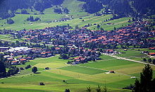
Unterammergau is a municipality in the Upper Bavarian district of Garmisch-Partenkirchen and the seat of the Unterammergau administrative community .
geography
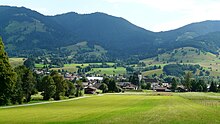
The main town of Unterammergau is located in the Ammertal on the Ammer River at an altitude of 836 m above sea level. NN .
The municipality also includes the municipality parts The municipality has three officially named municipality parts (the type of settlement is given in brackets ):
- Kappel right of the Ammer ( wasteland )
- Scherenau on the left of the Ammer ( hamlet )
- Unterammergau ( parish village )
Unterammergau itself essentially consists of three parts:
- the upper village, the oldest part of the village around the parish church of St. Nicholas
- the Hinterdorf , a listed ensemble north of Pürschlingstrasse
- Au right the bunting.
Neighboring communities in Unterammergau are Saulgrub in the north and west, Oberammergau in the south and east and Bad Kohlgrub in the northeast.
The municipality of Unterammergau has an area of 29.90 km² and 1585 inhabitants (as of December 31, 2019), i.e. 53 inhabitants per km². Together with the Ettal community, it forms the Unterammergau administrative community .
In addition to the Ammertal, the municipality also includes the surrounding mountains. The highest elevations are the Teufelstättkopf and the neighboring Laubeneck , both with a height of 1758 m . A forest road leads up to Unterammergau's local mountain, the Pürschling ( 1566 m ).
The streams that flow from the mountains down into the Ammer include the Ammer the Früllbach , the Schleifmühlenlaine and the Scherenauer Laine on the left and the Enge Laine , the Kappellaine and the Waldlaine on the right .
Unterammergau is located in the Ammergau Alps Nature Park .
history
The place Unterammergau was first mentioned in 1280 as "Nidernambergewe" and until 1803 belonged to the Hofmark Oberammergau , which was part of the Murnau rulership of the Ettal monastery . Oberammergau achieved its ecclesiastical independence in 1809.
In 1818, as part of the administrative reforms in the Kingdom of Bavaria, today's political municipality, which belonged to the Schongau district court , was established.
Two large local fires in 1777 and 1836 destroyed many of the old houses in Unterammergau. After the fire of 1836, the rear village was rebuilt using a uniform construction method; it is a listed building as an ensemble.
In addition to agriculture and the timber industry, whetstone making was an important source of income from the 15th to the middle of the 20th century . It was mainly operated as a sideline in the winter months when agriculture was idle.
Population development
Between 1988 and 2018 the municipality grew from 1,227 to 1,566 by 339 inhabitants or by 27.6%.
politics
The politics of Unterammergau is strongly determined by local civil associations. Of the Bavaria-wide parties, only the CSU is represented in the municipal council.
Mayor and City Council
In the local elections on March 15, 2020, Robert Stumpfecker from the FUZ (For Unterammergau's Future) was elected as First Mayor. He replaced Michael Gansler from the FDU, who had held the office since 2002.
The municipal council (excluding the first mayor) has twelve members.
Of these, 2 belong to the FDU, 4 to the FUZ (Free Voters' Community for Unterammergau's Future), 3 to the CSU and 3 to the FWU (Free Electoral Community of Unterammergau).
Michael Buchwieser from FWU is the second mayor.
coat of arms
Unterammergau has had its own coat of arms since 1953. The blazon reads: "In green to jump over obliquely crossed silver tools, whetstone and hammer with gold style, attached silver stag with gold reinforcement, hind feet on a silver base plate."
The green field tinging reflects the natural surroundings of the place, meadows and forests. The leaping deer indicates the abundance of game and hunting opportunities. The silver bottom is an indication of the plate layers with silica and quartz. They formed the starting material for the whetstone industry from the 15th century to 1950. The hammer was also introduced as a tool and the whetstone as a product, as the industry, which had flourished over centuries, made the place famous and prosperous.
traffic
Unterammergau is on federal highway 23 , which is part of the connection between Garmisch-Partenkirchen and Augsburg .
The community is connected to the Ammergau Railway via the Unterammergau train station , which runs between Oberammergau and Murnau am Staffelsee .
Culture and sights
Buildings
Despite the two village fires, some buildings from the 17th-18th centuries are still standing. Century preserved. As in the neighboring town of Oberammergau, some have facades with Lüftlmalerei . Around 35 buildings are under monument protection, they are listed in the list of architectural monuments in Unterammergau .
In addition to the main church of St. Nikolaus and the pilgrimage church of the Holy Blood, there are many smaller chapels and wayside shrines , which are considered land monuments in Unterammergau. Two chapel and martial paths were set up on both sides of the Ammer to make it accessible .
Industrial monument
On information boards at the entrance to the Schleifmühlklamm , hikers can find out important things from the time of the whetstone industry:
Whetstone making was an important handicraft branch in Unterammergau for 300 years. It formed the basis for prosperity in the place and found its way into the coat of arms. Probably during the search for the precious metals gold or silver between "blind rock" layers of plates were discovered, which were ideal for sharpening. The silica contained in this rock had the sharpening properties and the quartz content prevented breaking. Only ten percent of the mined material from the 52 quarries that existed in 1865 could be used for whetstone production. In the Schleifmühlklamm in particular, the valuable stone layers that had been extracted were processed into coveted grinding stones and exported to many countries. The craftsmen painstakingly produced around 200,000 whetstones by hand. This happened in the grinding mills, which used the available water power. In 1865, 40 families lived in 32 mills from grinding stones in addition to income from agriculture.
The decline of whetstone making came with the invention of synthetically manufactured whetstones and mowing machines. There was also a lack of sales areas after the Second World War .
societies
There are around 20 different clubs in Unterammergau.
The largest sports club is the WSV Unterammergau , which has produced several well-known tobogganers and skiers. In addition to the winter disciplines Alpine skiing , Nordic skiing and tobogganing , the club also has departments for football and gymnastics . Another sports club is the ice stock club EC Unterammergau.
The theater association and the music association with its brass band take care of the culture, the folk costume association and the Ammertaler shooting society maintain the customs. Voluntary fire brigade and mountain rescue service ensure safety.
The Unterammergau Historical Working Group keeps interest in history alive and offers tours and lectures on historical topics. The Unterammergau village museum was set up in-house and a former whetstone mill was put back into operation.
regional customs
The Leonhardiritt to the Kappelkirche takes place on the last Sunday in October . In festive clothing and with colorfully decorated horses, a procession goes to the pilgrimage church, accompanied by the sounds of the local music bands.
Since 1910, members of the Unterammergau brass band have been roaming the town to blow New Year's blows on December 30th, stopping again and again and serenading the residents to wish the residents a happy new year. As a reward, the players receive a donation.
Since 2000, past rural handicrafts have been recalled on a rural nostalgia day. The demonstrations include: buttering , haymaking , peening , mowing , threshing , etc. In addition, old devices or machines are shown and their use is demonstrated.
Nature and tourism
nature
Moors shape the landscape in the valleys of the Ammergau Alps. The powder moss between Unterammergau and Oberammergau has been under nature protection since 1982. It's a flat bog. Some high moor areas are easy to recognize for hikers. The Kochel-Filz between Unterammergau and Altenau has also been a nature reserve since 1987.
One of the hiking trails up to the Pürschling and Teufelstättkopf , the Pürschlingweg, begins at the southwestern exit of Unterammergau . Immediately to the west of it at the end of the village is the valley-side outlet of the Schleifmühlklamm , which you can walk through.
tourism
The municipality of Unterammergau is part of the Ammergau Alps tourist region. The region is represented in terms of tourism by the Ammergauer Alpen GmbH. In addition to Unterammergau, the Ammergau Alps nature park region includes Oberammergau , Bad Bayersoien , Bad Kohlgrub , Ettal / Graswang / Linderhof and Saulgrub / Altenau / Wurmansau.
In 2018, 24,000 guests stayed in Unterammergau with almost 4,500 arrivals.
Others
Unterammergau is mentioned in the song "Today Hans comes to me."
Web links
- Official website of the municipality of Unterammergau
- Entry on the coat of arms of Unterammergau in the database of the House of Bavarian History
Individual evidence
- ↑ "Data 2" sheet, Statistical Report A1200C 202041 Population of the municipalities, districts and administrative districts 1st quarter 2020 (population based on the 2011 census) ( help ).
- ^ Community Unterammergau in the local database of the Bavarian State Library Online . Bayerische Staatsbibliothek, accessed on September 5, 2019.
-
^ The municipal council of Unterammergau. In: Website of the community Unterammergau. Retrieved August 11, 2014 . Preliminary results for the 2014 municipal council elections in Unterammergau on March 16, 2014. (No longer available online.) In: Website of the Landratsamt Garmisch-Partenkirchen. Archived from the original on August 26, 2014 ; Retrieved August 25, 2014 . Info: The archive link was inserted automatically and has not yet been checked. Please check the original and archive link according to the instructions and then remove this notice.
- ^ Entry on the coat of arms of Unterammergau in the database of the House of Bavarian History
- ↑ a b c d Heinfried Barton: The Ammergau Alps . 2nd Edition. Franckh'sche Verlagshandlung W. Keller & Co., Stuttgart 1989, ISBN 3-440-04817-9 .
- ^ Associations in Unterammergau. In: Website of the community Unterammergau. Retrieved April 6, 2013 .
- ^ Website of the WSV Unterammergau. Retrieved April 6, 2013 .
- ^ Website of the Unterammergau brass band. Retrieved April 6, 2013 .
- ↑ Pages of the mountain rescue service Unterammergau. In: Website of Bergwacht Bayern. Retrieved April 6, 2013 .
- ^ The Historical Working Group Unterammergau eV Accessed on August 12, 2014 .
- ↑ New Years blowing of the brass band. Ammergauer Alpen GmbH, accessed on December 6, 2012 .
- ^ Rural nostalgia day in the Ammertal. Historical working group Unterammergau, accessed on August 11, 2014 .
- ↑ Unterammergau | Unterammergau . In: Unterammergau . ( ammergauer-alpen.de [accessed June 22, 2017]).
- ↑ Today Hans comes to me , www.volksliedsammlung.de


