Schleifmühlklamm
| Schleifmühlklamm
near Unterammergau
|
||
|---|---|---|
|
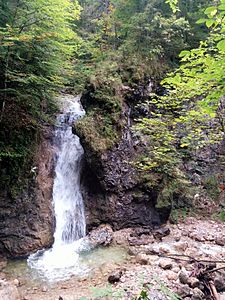
A waterfall of the Schleifmühlenlaine in the Schleifmühlklamm |
||
| location | Germany Bavaria | |
| part of | Ammer Mountains | |
|
|
||
| Coordinates | 47 ° 36 '26 " N , 11 ° 1' 2" E | |
| rock | lime | |
| surface | 0.05 km² | |
| particularities | accessible gorge | |
|
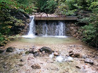
Water tap to the right for a mill |
||
|
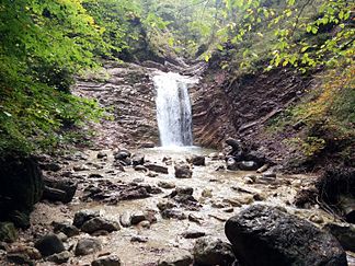
an easily accessible pool |
||
The Schleifmühlklamm is a short gorge , the exit of which is at the southwest end of Unterammergau .
geomorphology
The gorge lies at the foot of the Ammergau Alps . It is from the grinding mill Laine flows through that of the (North) eastern flanks of Pürschling , the Teufelstättkopf springing and Schartenköpfel streams is fed above Unterammergaus created the short gorge, west flowing to Unterammergau passing to the north and shortly thereafter in the Ammer flows . The gorge is about 500 meters long and has a height difference of about 60 meters. The brook forms some pools and waterfalls in the gorge .
The gorge is designated as geotope 180A015 by the Bavarian State Office for the Environment . See also the list of geotopes in the Garmisch-Partenkirchen district .
Economical meaning
In the lower part of the gorge, the water power of the Schleifmühlenlaine was used from the 15th century to the 20th century to drive mills in which whetstones were made. The raw material for this was silicate limestone, which was quarried a few 100 meters west of the gorge in the eastern flank of the Schartenköpfel. These whetstone quarries are now also designated as geotopes. A whetstone has therefore found its way into Unterammergau's municipal coat of arms. One of the mills was restored and is now operated as a grinding mill in Unterammergau as a museum. A restaurant near the exit of the gorge on the valley side runs a small museum on the subject.
Development
Even inexperienced people can easily hike through the gorge on a well-developed and secured path. The entrance to the valley is next to the Schleifmühl chapel and only 100 m away from the parking lot in the Zwickel Liftweg / Pürschlingstraße. The latter merges into the Pürschlingweg (forest path), which runs east of the gorge and parallel to it. The path through the gorge is connected to this forest path at the upper and lower ends. The path in the gorge has some bridges and metal footbridges. In the lower part of the gorge, the pools are accessible to hikers.
Web links
Individual evidence
- ↑ Schleifmühlklamm in the Bavarian geotope register
- ^ Whetstone quarries near Unterammergau in the Bavarian geotope cadastre
- ↑ Ammergau whetstone quarries in the directory of Bavaria's most beautiful geotopes
- ↑ Grinding Mill Unterammergau
- ↑ Schleifmühlmuseum ( Memento of the original from September 16, 2016 in the Internet Archive ) Info: The archive link was inserted automatically and has not yet been checked. Please check the original and archive link according to the instructions and then remove this notice.


