List of municipalities in the district of Miesbach
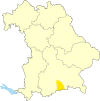
The list of municipalities in the Miesbach district gives an overview of the 17 smallest administrative units in the district . Two of the municipalities, Miesbach and Tegernsee are small towns , another two, Holzkirchen and Schliersee markets. There are no administrative communities in the Miesbach district .
In its current form, the district of Miesbach was created in the course of the Bavarian territorial reform carried out in 1972 , during which it was only enlarged by the municipality of Otterfing , which previously belonged to the district of Wolfratshausen . The current church structure was completed in 1979. In the case of the municipalities, it is noted to which district the main town of the municipality belonged before the regional reform. The year in which they joined the municipality is noted for the suburbs of the municipalities.
description
The district has a total area of 863.5 km 2 . The largest area within the district has the municipalities of Kreuth with 122.26 km 2 , Bayrischzell with 79.46 km 2 , Schliersee with 79.16 km 2 and Fischbachau with 75.91 km 2 . Three municipalities have an area larger than 50 km 2 , four an area of over 40 km 2 and three an area of over 30 km 2 , including the city of Miesbach . Two of the three smallest municipalities have an area of over 20 km 2 , that is the city of Tegernsee with 22.77 km 2 and the municipality of Hausham with 22.28 km 2 . The smallest municipality is Otterfing with 18.4 km 2 .
The Holzkirchen market with 16,640 residents has the largest share of the district's population of 100,010 , followed by the district town of Miesbach with 11,471 residents and the municipality of Hausham with 8,452 residents. Two communities have over 6,000 inhabitants, three over 5,000, two over 4,000 and five over 3,000, including the city of Tegernsee . The two smallest communities in terms of population are Valley with 3378 inhabitants and Bayrischzell with 1595 inhabitants.
The entire district of Miesbach has a population density of 116 inhabitants per km 2 . The largest population density within the district has the community Hausham with 379 inhabitants per km 2 , followed by the city Miesbach with 355 and the communities Holzkirchen with 344 and Otterfing with 263. In the four communities, including the city Tegernsee , which has a population density of over 100, the population density is higher than the district average of 116. The remaining nine communities have a population density of less than 100. The most sparsely populated communities are Irschenberg with 59, Kreuth with 30 and Bayrischzell with 20 inhabitants per km 2 .
Legend
- Municipality : Name of the municipality or city and information about the district to which the eponymous place of the municipality belonged before the regional reform
- Subsites : Enumerated are the formerly independent municipalities of the administrative unit. The year of incorporation is also given.
- Coat of arms : coat of arms of the municipality or city
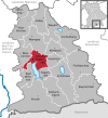
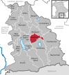
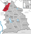
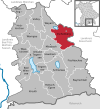
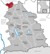
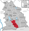
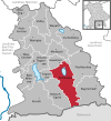
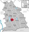
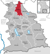
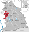
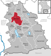
- Map : Shows the location of the municipality or city in the district
- Area : Area of the city or municipality, given in square kilometers
- Population : number of people living in the municipality or city (as of December 31, 2019)
- Population density : The population density is given, calculated on the area of the administrative unit, given in population per km 2 (as of December 31, 2019)
- Altitude : Altitude of the eponymous town or town in meters above sea level
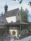
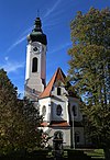
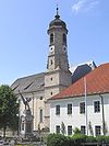
- Image : Image from the respective municipality or city
Communities
| local community | Sub-locations | coat of arms | map | surface | Residents | EW density |
height | image |
|---|---|---|---|---|---|---|---|---|
| Miesbach district |  |
 |
863.5 | 100.010 | 116 |

|
||
|
Bad Wiessee (belonged to the Miesbach district before the regional reform) |
Bad Wiessee |  |
 |
32.79 | 5,095 | 155 | 750 |
 
|
|
Bayrischzell (belonged to the Miesbach district before the regional reform) |
Bayrischzell |  |
 |
79.46 | 1,595 | 20th | 800 |

|
|
Fischbachau (belonged to the Miesbach district before the regional reform) |
Fischbachau Hundham (1976) southern parts of the municipality Niklasreuth (1978) Wörnsmühl (1976) |
 |
 |
75.91 | 5,631 | 74 | 772 |
|
|
Gmund a.Tegernsee (belonged to the Miesbach district before the regional reform) |
Gmund am Tegernsee Dürnbach (1978) |
 |
 |
34.4 | 6.114 | 178 | 740 |

|
|
Hausham (belonged to the Miesbach district before the regional reform) |
Hausham |  |
 |
22.28 | 8,452 | 379 | 766 |
|
|
Holzkirchen (Markt) (belonged to the Miesbach district before the regional reform) |
Holzkirchen Föching (1978) Hartpenning ( large and small hard penning) (1978) |
 |
 |
48.33 | 16,640 | 344 | 690 |

|
|
Irschenberg (belonged to the Miesbach district before the regional reform) |
Irschenberg Niklasreuth (1978) Parts of the municipality Parsberg (1978) Reichersdorf (1972) |
 |
 |
53.94 | 3,204 | 59 | 735 |

|
|
Kreuth (belonged to the Miesbach district before the regional reform) |
Kreuth |  |
 |
122.26 | 3,608 | 30th | 783 |
 
|
|
Miesbach (district town) (belonged to the Miesbach district before the regional reform) |
Miesbach Parsberg (1978) Wies (1978) |
 |
32.35 | 11,471 | 355 | 696 |

|
|
|
Otterfing (belonged to the Wolfratshausen district before the regional reform) |
Otterfing |  |
 |
21.47 | 4,831 | 225 | 673 |

|
|
Rottach-Egern (belonged to the Miesbach district before the regional reform) |
Rottach-Egern (was called Rottach until 1951) |  |
 |
59.1 | 5,803 | 98 | 735 |

|
|
Schliersee (Markt) (belonged to the Miesbach district before the regional reform) |
Schliersee |  |
 |
79.16 | 6,933 | 88 | 784 |
 
|
|
Tegernsee (town) (belonged to the Miesbach district before the regional reform) |
Tegernsee |  |
 |
22.77 | 3,682 | 162 | 747 |
 
|
|
Valley (belonged to the Miesbach district before the regional reform) |
Valley |  |
 |
42.18 | 3,378 | 80 | 650 |

|
|
Waakirchen (belonged to the Miesbach district before the regional reform) |
Waakirchen Schaftlach (1978) |
 |
42.31 | 5,809 | 137 | 759 |

|
|
|
Warngau (belonged to the Miesbach district before the regional reform) |
Warngau parts of the community of Gotzing (1978) Wall (1978) |
 |
 |
51.28 | 3,867 | 75 | 726 |

|
|
Weyarn (belonged to the Miesbach district before the regional reform) |
Gotzing Holzolling Wattersdorf parts of the Reichersdorf community (merger 1978) |
 |
 |
46.68 | 3,897 | 83 | 671 |
|
See also
Individual evidence
- ↑ "Data 2" sheet, Statistical Report A1200C 202041 Population of the municipalities, districts and administrative districts 1st quarter 2020 (population based on the 2011 census) ( help ).
- ↑ "Data 2" sheet, Statistical Report A1200C 202041 Population of the municipalities, districts and administrative districts 1st quarter 2020 (population based on the 2011 census) ( help ).
- ↑ BayernViewer of the Bavarian Surveying Administration
