List of municipalities in the district of Dachau
The list of municipalities in the district of Dachau gives an overview of the 17 smallest administrative units in the district . From the parishes are two markets . Apart from the large district town of Dachau , which is a medium-sized town , there is no other town in the district. Three municipalities ( Odelzhausen , Pfaffenhofen adGlonn and Sulzemoos ) had merged to form an administrative community between 1978 and their dissolution in 2016 . The administrative community of Vierkirchen und Weichs , founded in 1978, was dissolved in 1980.
In 1939, the district office , like all other district offices, was renamed Landkreis . In its current form, the district emerged after the Bavarian territorial reform in 1972. Some communities in the neighboring districts of Friedberg Aichach and Fürstenfeldbruck were added to the district area, the community of Fahrenzhausen was separated and added to the district of Freising . The municipalities marked 1972 in the table were dissolved and assigned to other municipalities. In essence, the district was oriented more west and now also includes parts of the previous district of Swabia and the historic Wittelsbacher Land .
The current church structure was completed in 1979. The year in which they joined the municipality is noted for the suburbs of the municipalities.
description
The district has a total area of 578.96 km 2 . The Altomünster market has the largest area within the district with 75.79 km 2 . This is followed by the Markt Indersdorf markets with 68.6 km 2 and the municipality of Bergkirchen with 59.99 km 2 . Another six municipalities have an area of over 30 km 2 , including the city of Dachau . Four municipalities have an area larger than 20 km 2 and four municipalities are over 10 km 2 . The smallest areas have the communities Sulzemoos with 19.04 km 2 , Weichs with 18.72 km 2 and Karlsfeld with 15.55 km 2 .
The large district town of Dachau has the largest share of the population of the district of 154,899 inhabitants with 47,721, followed by the municipality of Karlsfeld with 21,832 and Markt Indersdorf with 10,508. Two parishes have a population of over 7,000, three one of over 6,000, two one of over 5,000, three one of over 4,000, and two parishes have a population of over 3,000. Each municipality has over 2,000 or 1,000 residents. The fewest inhabitants have Weichs with 3527, Sulzemoos with 3090 and Pfaffenhofen adGlonn with 2246.
The entire district of Dachau has a population density of 268 inhabitants per km 2 . The highest population density within the district is found in the city of Dachau with 1,369 inhabitants per km 2 , and the municipality of Karlsfeld with 1,404. With the exception of the city of Dachau and Karlsfeld, the population density is everywhere lower than the district average. In three municipalities the population density is at or over 200, in ten municipalities over 100 and in two municipalities under 100. Hilgertshausen-Tandern has the lowest population density with 120, Altomünster with 105 and Pfaffenhofen adGlonn with 107.
Legend
- Municipality : Name of the municipality or city
- Subsites : Enumerated are the formerly independent municipalities of the administrative unit. If known, the year of incorporation is also given.
- VG : Shows membership of the administrative community Odelzhausen (VG Odelzhausen)
- Coat of arms : coat of arms of the municipality or city
- Map : Shows the location of the municipality or city in the district of Dachau
- Area : Area of the city or municipality, given in square kilometers
- Population : number of people living in the municipality or city (as of December 31, 2019)
- Population density : The population density is given, calculated on the area of the administrative unit, given in population per km 2 (as of December 31, 2019)
- Altitude : Altitude of the eponymous town or town in meters above sea level
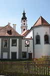
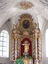
- Image : Image from the respective municipality or city
Communities
| local community | Sub-locations | VG | coat of arms | map | surface | Residents | EW density |
height | image |
|---|---|---|---|---|---|---|---|---|---|
| District of Dachau |  |
 |
578.96 | 154,899 | 268 |

|
|||
|
Altomünster (Markt) (belonged to the Aichach district before the regional reform, with the exception of Pipinsried, which belonged to the Dachau district) |
Altomünster Hohenzell Kiemertshofen Oberzeitlbach Pipinsried (belonged to the district of Dachau) Randelsried Stumpfenbach Thalhausen Wollomoos |
 |
 |
75.79 | 7,960 | 105 | 509 |

|
|
|
Bergkirchen (belonged to the district of Dachau before the regional reform) |
Bergkirchen Eisolzried Feldgeding Günding Kreuzholzhausen Lauterbach Oberbachern |
 |
 |
59.99 | 7,774 | 130 | 521 |

|
|
|
Large district town of Dachau (belonged to the district of Dachau before the regional reform) |
Dachau Augustenfeld Etzenhausen Pellheim |
 |
 |
34.85 | 47,721 | 1,369 | 500 |
|
|
|
Erdweg (before the regional reform it belonged partly to the district of Dachau, partly to the district of Aichach) |
Erdweg Eisenhofen Großberghofen Unterweikertshofen Welshofen Kleinberghofen (belonged to the Aichach district before the regional reform) |
 |
 |
36.03 | 6,100 | 169 | 500 |

|
|
|
Haimhausen (belonged to the district of Dachau before the regional reform) |
Haimhausen Amperpettenbach |
 |
 |
26.73 | 5,731 | 214 | 487 |

|
|
|
Hebertshausen (belonged to the district of Dachau before the regional reform) |
Hebertshausen Ampermoching (1972) Prittlbach (1972) Unterweilbach (1972) |
 |
 |
29.6 | 5,722 | 193 | 489 |
|
|
|
Hilgertshausen-Tandern (belonged to the Aichach district before the regional reform) |
Hilgertshausen , Tandern (1978) |  |
 |
28.64 | 3,427 | 120 | 507 | ||
|
Karlsfeld (belonged to the district of Dachau before the regional reform) |
Karlsfeld |  |
 |
15.55 | 21,832 | 1,404 | 491 |

|
|
|
Markt Indersdorf (Markt) (belonged to the district of Dachau before the regional reform) |
Market Indersdorf Ainhofen Eichhofen Frauenhofen Glonn Hirtlbach Langenpettenbach Niederroth Ried Westerholzhausen |
 |
 |
68.6 | 10,508 | 153 | 471 |

|
|
|
Odelzhausen (before the regional reform it belonged partly to the district of Dachau, partly to the district of Friedberg and partly to the district of Fürstenfeldbruck) |
Odelzhausen Ebertshausen (belonged to the district of Fürstenfeldbruck) Höfa (belonged to the district of Friedberg) Sittenbach (belonged to the district of Friedberg) Taxa |
VG Odelz- live |
 |
 |
30.48 | 5,127 | 168 | 499 |

|
|
Petershausen (belonged to the district of Dachau before the regional reform) |
Petershausen Asbach (1978) Kollbach (1978) Obermarbach (1972) |
 |
 |
32.82 | 6,540 | 199 | 460 |

|
|
|
Pfaffenhofen adGlonn (belonged to the Friedberg district before the regional reform) |
Pfaffenhofen ad Glonn Unterumbach Weitenried |
VG Odelz- live |
 |
 |
20.9 | 2,246 | 107 | 504 | |
|
Röhrmoos (belonged to the district of Dachau before the regional reform) |
Röhrmoos Biberbach Großinzemoos Schönbrunn Sigmertshausen |
 |
 |
31.74 | 6,451 | 203 | 505 |

|
|
|
Schwabhausen (belonged to the district of Dachau before the regional reform) |
Schwabhausen Arnbach Oberroth Puchschlag Rumeltshausen |
 |
 |
30.23 | 6,507 | 215 | 493 |

|
|
|
Sulzemoos (belonged to the district of Dachau before the regional reform) |
Sulzemoos Einsbach Wiedenzhausen |
VG Odelz- live |
 |
 |
19.04 | 3,090 | 162 | 504 |

|
|
Vierkirchen (belonged to the district of Dachau before the regional reform) |
Vierkirchen Giebing (1972) Pasenbach (1971) Districts Milbertshofen and Wiedenhöfe of the municipality of Biberbach |
 |
 |
19.39 | 4,636 | 239 | 490 | ||
|
Weichs (belonged to the district of Dachau before the regional reform) |
Soft |  |
 |
18.72 | 3,527 | 188 | 468 |

|
See also
Individual evidence
- ↑ Michael Rademacher: German administrative history from the unification of the empire in 1871 to the reunification in 1990. District of Dachau and the adjacent districts. (Online material for the dissertation, Osnabrück 2006).
- ↑ "Data 2" sheet, Statistical Report A1200C 202041 Population of the municipalities, districts and administrative districts 1st quarter 2020 (population based on the 2011 census) ( help ).
- ↑ "Data 2" sheet, Statistical Report A1200C 202041 Population of the municipalities, districts and administrative districts 1st quarter 2020 (population based on the 2011 census) ( help ).
- ↑ BayernViewer of the Bavarian Surveying Administration
