List of municipalities in the district of Coburg
The list of municipalities in the district of Coburg gives an overview of the 17 smallest administrative units in the district . Four of the parishes are small towns .
In its present form, the district of Coburg was created in the course of the Bavarian territorial reform carried out in 1972 . The district was formed from the main part of the district of Coburg , parts of the district of Staffelstein , two communities in the district of Ebern and the independent city of Neustadt b.Coburg . The district seat remained the independent city of Coburg , which was enlarged accordingly by incorporating some communities in the district of Coburg. The city of Neustadt b.Coburg was given the status of a large district town as a replacement for the loss of district freedom. The current church structure was completed in 1979. In the case of the municipalities, it is noted to which district the main town of the municipality belonged before the regional reform. The year in which they joined the municipality is noted for the suburbs of the municipalities. This is also noted for the suburbs that belonged to a different district than the main town of today's municipality before the regional reform. Except for the two communities Grub a.Forst and Niederfüllbach , which have merged to form VG Grub a.Forst , none of the towns and communities in the Coburg district is a member of an administrative association .
description
The district has a total area of 592 km 2 . The municipality of Meeder has the largest area within the district with 79.59 km 2 . This is followed by the cities of Bad Rodach with 77.65 km 2 and Seßlach with 72.51 km 2 . The cities of Neustadt near Coburg and Rödental have an area larger than 60 km 2 and 40 km 2, respectively . Four municipalities have an area larger than 30 km 2 , three municipalities have an area of over 20 km 2 , two municipalities are over 10 km 2 and three municipalities are less than 10 km 2 . The smallest areas have the communities Weidhausen b.Coburg with 9.61 km 2 , Dörfles-Esbach with 3.83 km 2 and Niederfüllbach with 2.59 km 2 . The unincorporated areas have an area of 6.02 km 2 .
The largest district town of Neustadt b.Coburg with 15,173 inhabitants, the cities of Rödental with 13,169 inhabitants and Bad Rodach with 6,418 inhabitants, followed by the municipality of Ebersdorf b. Coburg with 6009 inhabitants. Two communities have over 5,000 inhabitants, four over 4,000, including the city of Sesslach , four over 3,000, two over 2,000 and one over 1,000 inhabitants. The three smallest municipalities in terms of population are Großheirath with 2667 inhabitants, Itzgrund with 2292 and Niederfüllbach with 1524 inhabitants.
The entire district of Coburg has a population density of 147 inhabitants per km 2 . The largest population density within the district are the three smallest municipalities in terms of area Dörfles-Esbach with 930 inhabitants per km 2 , Niederfüllbach with 588 and Weidhausen b.Coburg with 325. Six communities have a population density of over 200, including the cities Rödental and Neustadt b. Coburg . All other communities have the same or a lower population density than the district average of 147. Four of these communities have a population density between 100 and 200 and in four communities the population density is below 100 inhabitants per km 2 , including the cities of Bad Rodach and Seßlach . The most sparsely populated communities are Itzgrund with 69, the city of Seßlach with 54 and Meeder with 46 inhabitants per km 2 .
Legend
- Municipality : Name of the municipality or city and information about the district to which the eponymous place of the municipality belonged before the regional reform
- Subsites : Enumerated are the formerly independent municipalities of the administrative unit. The year of incorporation is also given. This is also noted for the suburbs that belonged to a different district than the main town of today's municipality before the regional reform
- VG : Indicates membership of the administrative community
- Coat of arms : coat of arms of the municipality or city
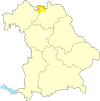
- Map : Shows the location of the municipality or city in the district
- Area : Area of the city or municipality, given in square kilometers
- Population : number of people living in the municipality or city (as of December 31, 2019)
- Population density : The population density is given, calculated on the area of the administrative unit, given in population per km 2 (as of December 31, 2019)
- Altitude : Altitude of the eponymous town or town in meters above sea level
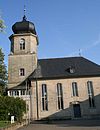
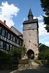
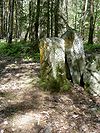
- Image : Image from the respective municipality or city
Communities
| local community | Sub-locations | VG | coat of arms | map | surface | Residents | EW density |
height | image |
|---|---|---|---|---|---|---|---|---|---|
| District of Coburg |  |
 |
592.0 | 86,747 | 147 |

|
|||
|
Ahorn (belonged to the district of Coburg before the regional reform) |
Ahorn Schafhof Schorkendorf Witzmannsberg (belonged to the Staffelstein district before the regional reform) Wohlbach |
 |
 |
19.85 | 4,226 | 213 | 333 |

|
|
|
Bad Rodach (town) (belonged to the district of Coburg before the regional reform) |
Bad Rodach Breitenau Elsa Gauerstadt Grattstadt Heldritt Lempertshausen Moraviahausen Oettingshausen Roßfeld Rudelsdorf Sülzfeld |
 |
 |
77.65 | 6,418 | 83 | 318 |

|
|
|
Dörfles-Esbach (belonged to the district of Coburg before the regional reform) |
Dörfles near Coburg Esbach merger in 1971 |
 |
 |
3.83 | 3,560 | 930 | 306 |

|
|
|
Ebersdorf b.Coburg (belonged to the district of Coburg before the regional reform) |
Ebersdorf near Coburg Friesendorf (1965) Frohnlach Großgarnstadt Kleingarnstadt Oberfüllbach |
 |
 |
26.5 | 6.009 | 227 | 310 |

|
|
|
Großheirath (belonged to the district of Coburg before the regional reform) |
Großheirath Buchenrod Goss Berg Neuses adEichen Rossach Watzendorf |
 |
 |
22.27 | 2,667 | 120 | 272 |

|
|
|
Grub a.Forst (belonged to the district of Coburg before the regional reform) |
Grub a.Forst Rohrbach (1971) Roth a.Forst (1970) Zeickhorn (1971) |
VG Grub a.Forst |
 |
 |
11.97 | 2,825 | 236 | 319 |

|
|
Itzgrund (belonged to the Staffelstein district before the regional reform) |
Kaltenbrunn Gleußen Herreth Lahm Schottenstein Welsberg |
 |
 |
33.08 | 2,292 | 69 | 269 |

|
|
|
Lautertal (belonged to the district of Coburg before the regional reform) |
Unterlauter Neukirchen Oberlauter Rottenbach Tiefenlauter Tremersdorf |
 |
 |
30.34 | 4,330 | 143 | 319 |

|
|
|
Meeder (belonged to the district of Coburg before the regional reform) |
Meeder Ahlstadt Beuerfeld Drossenhausen Großwalbur Herbartsdorf Kleinwalbur Kösfeld Mirsdorf Moggenbrunn Neida Ottowind Sulzdorf Wiesenfeld b.Coburg |
 |
 |
79.59 | 3,656 | 46 | 331 |

|
|
|
Neustadt b.Coburg (large district town) (was an independent town before the regional reform) |
Neustadt b.Coburg all unincorporated places were in front of the local government reform to Coburg: Aicha Birkig Boder village Brüx Ebersdorf b.Neustadt b.Coburg Fechheim Fürth A.Berg Hair bridges Hoehn Horb b.Fürth A.Berg Kemmaten Ketschenbach Meilschnitz means Wasungen Plesten Rüttmannsdorf Thann Under Wasungen Weimer village Wellmersdorf Wildenheid |
 |
 |
61.9 | 15.173 | 245 | 346 |

|
|
|
Niederfüllbach (belonged to the district of Coburg before the regional reform) |
Niederfüllbach | VG Grub a.Forst |
 |
 |
2.59 | 1,524 | 588 | 285 |

|
|
Rödental (city) (belonged to the district of Coburg before the regional reform) |
Oeslau (1971) Blumenrod (1977) Einberg (1971) Fischbach (1978) Fornbach (1978) Kipfendorf (1971) Mittelberg (1978) Mönchröden (1971) Oberwohlsbach (1972) Rothenhof (1971) Schönstädt (1978) Spittelstein (1977) Unterwohlsbach ( 1971) Waldsachsen (1971) Waltersdorf (1978) Weißenbrunn vorm Wald (1978) |
 |
 |
49.96 | 13,169 | 264 | 315 |

|
|
|
Seßlach (town) (belonged to the Staffelstein district before the regional reform) |
Seßlach Autenhausen Bischwind (belonged to the district of Ebern before the regional reform) Dietersdorf Gemünda i.OFr. Gleismuthhausen Hattersdorf Heilgersdorf (belonged to the district of Ebern before the regional reform) Lechenroth Merlach Oberelldorf Rothenberg Unterelldorf |
 |
 |
72.51 | 3,922 | 54 | 271 |

|
|
|
Sonnefeld (belonged to the district of Coburg before the regional reform) |
Sonnefeld Bieberbach Gestungshausen Hassenberg Neuses a.Brand Oberwasungen Weickenbach Weischau Wörlsdorf Zedersdorf |
 |
 |
34.69 | 4,622 | 133 | 323 |

|
|
|
Untersiemau (belonged to the district of Coburg before the regional reform) |
Untersiemau Birkach a.Forst (1978) Haarth (1978) Meschenbach (1978) Obersiemau (1978) Scherneck (1978) Stöppach (1978) Weißenbrunn a.Forst (1978) Ziegelsdorf (1978) |
 |
 |
20.49 | 4.155 | 203 | 299 |

|
|
|
Weidhausen near Coburg (belonged to the district of Coburg before the regional reform) |
Weidhausen near Coburg Trübenbach |
 |
 |
9.61 | 3.123 | 325 | 310 |

|
|
|
Weitramsdorf (belonged to the district of Coburg before the regional reform) |
Weitramsdorf Altenhof Neundorf (belonged to the district of Staffelstein before the regional reform) Weidach |
 |
 |
33.71 | 5,076 | 151 | 306 |

|
|
| Unregulated areas | Callenberger Forst-West (2.32 km 2 ) Köllnholz (0.90 km 2 ) Gellnhausen (2.80 km 2 ) |
 
|
6.02 |
See also
Individual evidence
- ^ Michael Rademacher: German administrative history from the unification of the empire in 1871 to the reunification in 1990. Districts of Coburg, Ebern and Staffelstein. (Online material for the dissertation, Osnabrück 2006).
- ↑ "Data 2" sheet, Statistical Report A1200C 202041 Population of the municipalities, districts and administrative districts 1st quarter 2020 (population based on the 2011 census) ( help ).
- ↑ "Data 2" sheet, Statistical Report A1200C 202041 Population of the municipalities, districts and administrative districts 1st quarter 2020 (population based on the 2011 census) ( help ).
- ↑ BayernViewer of the Bavarian Surveying Administration (accessed on June 30, 2010)
