List of municipalities in the district of Pfaffenhofen an der Ilm
The list of municipalities in the Pfaffenhofen an der Ilm district gives an overview of the 19 smallest administrative units in the Pfaffenhofen adIlm district . Three of the municipalities are cities . The district town of Pfaffenhofen adIlm is a medium- sized town , Geisenfeld and Vohburg adDonau are small towns . Four parishes are markets.
In its current form, the district of Pfaffenhofen adIlm was created in the course of the Bavarian territorial reform carried out in 1972 . The district was formed from the district of Pfaffenhofen adIlm and parts of the districts of Schrobenhausen , Ingolstadt and Mainburg . Today's parish structure was completed in 1984. In the case of the municipalities, it is noted to which district the main town of the municipality belonged before the regional reform. The year in which they joined the municipality is noted for the suburbs of the municipalities. This is also noted for the suburbs that belonged to a different district than the main town of today's municipality before the regional reform.
description
The district can be further divided into three administrative communities (VG):
- VG Geisenfeld : with the city of Geisenfeld and the municipality of Ernsgaden ;
- VG Ilmmünster : with the communities of Ilmmünster and Hettenshausen ;
- VG Reichertshofen : with the Reichertshofen marketand the municipality of Pörnbach ;
The towns of Pfaffenhofen adIlm and Vohburg adDonau , like the Hohenwart , Manching and Wolnzach markets and the communities of Baar-Ebenhausen , Gerolsbach , Jetzendorf , Münchsmünster , Reichertshausen , Rohrbach , Scheyern and Schweitenkirchen, are not members of an administrative community.
The district has a total area of 760.36 km 2 . The city of Pfaffenhofen adIlm has the largest area within the district with 92.39 km 2 . This is followed by the Wolnzach market with 91.62 km 2 and the city of Geisenfeld with 88.33 km 2 . Three communities each have an area larger than 50 or 30 km 2 and the city of Vohburg adDonau is over 40 km 2 . Four municipalities are each over 20 and 10 km 2 in size. The smallest municipality has an area of less than 10 km 2 . The smallest areas have the municipalities of Baar-Ebenhausen with 14.8 km 2 , Ilmmünster with 13.89 km 2 and Ernsgaden with 7.41 km 2 .
The district town of Pfaffenhofen adIlm with 26,124 inhabitants has the largest proportion of the district's population of 128,227 inhabitants, followed by the two markets of Manching with 12,639 inhabitants and Wolnzach with 11,658 inhabitants. The city of Geisenfeld has over 9,000 inhabitants, the city of Vohburg adDonau and the market town of Reichertshofen have over 7,000 inhabitants. Each municipality has over 5,000 or over 3,000 inhabitants, the Hohenwart market and four municipalities have over 4,000 inhabitants. Four municipalities have over 2,000 inhabitants and two over 1,000. The three smallest municipalities in terms of population are Pörnbach with 2175 inhabitants, Hettenshausen with 2088 and Ernsgaden with 1710 inhabitants.
The entire district of Pfaffenhofen adIlm has a population density of 169 inhabitants per km 2 . The largest population density within the district is in the municipality of Baar-Ebenhausen with 369 inhabitants per km 2 , followed by Markt Manching with 356 and the city of Pfaffenhofen adIlm with 283. Three other municipalities have a population density of over 200. The population density is in nine municipalities between 100 and 200. In three of these communities, including the city of Vohburg adDonau , the population density is higher than the district average of 169. In the four most sparsely populated communities, the population density is below 100. These are the communities of Pörnbach with 96, Schweitenkirchen with 100 , Hohenwart with 91 and Gerolsbach with 62 inhabitants per km 2 .
Legend
- Municipality : Name of the municipality or city and information about the district to which the eponymous place of the municipality belonged before the regional reform
- Subsites : Enumerated are the formerly independent municipalities of the administrative unit. The year of incorporation is also given. This is also noted for the suburbs that belonged to a different district than the main town of today's municipality before the regional reform
- VG : Indicates membership in one of the administrative communities
- Coat of arms : coat of arms of the municipality or city
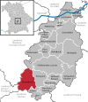
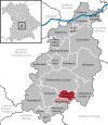
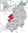
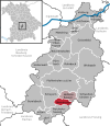
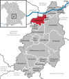
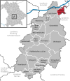
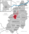
- Map : Shows the location of the municipality or city in the district
- Area : Area of the city or municipality, given in square kilometers
- Population : number of people living in the municipality or city (as of December 31, 2019)
- Population density : The population density is given, calculated on the area of the administrative unit, given in population per km 2 (as of December 31, 2019)
- Altitude : Altitude of the eponymous town or town in meters above sea level
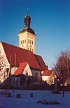
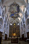
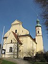
- Image : Image from the respective municipality or city
Communities
| local community | Sub-locations | VG | coat of arms | map | surface | Residents | EW density |
height | image |
|---|---|---|---|---|---|---|---|---|---|
| District of Pfaffenhofen adIlm |  |
 |
760.36 | 128,227 | 169 |
 
|
|||
|
Baar-Ebenhausen (belonged to the district of Ingolstadt before the regional reform) |
Baar Ebenhausen (merger: 1984; Baar and Ebenhausen formed an administrative partnership from 1978 to 1984) |
 |
 |
14.8 | 5,465 | 369 | 374 |
|
|
|
Ernsgaden (belonged to the district of Pfaffenhofen adIlm before the regional reform) |
Ernsgaden | VG Geisenfeld |
 |
 |
7.41 | 1,710 | 231 | 361 |

|
|
Geisenfeld (town) (belonged to the district of Pfaffenhofen adIlm before the regional reform) |
Geisenfeld Engelbrechtsmünster Gaden near Geisenfeld Geisenfeld winds Ilmendorf Nötting Parleiten Rottenegg Schillwitzried Untermettenbach Unterpindhart Zell |
VG Geisenfeld |
 |
 |
88.33 | 11,473 | 130 | 385 |

|
|
Gerolsbach (belonged to the district of Schrobenhausen before the regional reform) |
Gerolsbach Alber cell Klenau singing Bach Strobenried |
 |
 |
58.94 | 3,636 | 62 | 459 | ||
|
Hettenshausen (belonged to the district of Pfaffenhofen adIlm before the regional reform) |
Hettenshausen Entrischenbrunn (1978) |
VG Ilmmünster |
 |
 |
18.59 | 2,088 | 112 | 435 |

|
|
Hohenwart (market) (belonged to the district of Schrobenhausen before the regional reform) |
Hohenwart Deimhausen (1971) Freinhausen (1978) Klosterberg (1978) Koppenbach (1978) Seibersdorf (1972) Weichenried (1972) |
 |
 |
52.21 | 4,771 | 91 | 395 |
 
|
|
|
Ilmmünster (belonged to the district of Pfaffenhofen adIlm before the regional reform) |
Ilmmünster Ilmried |
VG Ilmmünster |
 |
 |
13.89 | 2,268 | 163 | 446 |

|
|
Jetzendorf (belonged to the district of Pfaffenhofen adIlm before the regional reform) |
Jetzendorf Hirschenhausen (belonged to the district of Schrobenhausen before the regional reform) Volkersdorf |
 |
 |
21.72 | 3.152 | 145 | 480 |

|
|
|
Manching (Markt) (belonged to the district of Ingolstadt before the regional reform) |
Manching Niederstimm Oberstimm Pichl Westenhausen (belonged to the district of Pfaffenhofen adIlm before the regional reform) |
 |
35.48 | 12,639 | 356 | 366 |
 
|
||
|
Münchsmünster (belonged to the district of Pfaffenhofen adIlm before the regional reform) |
Münchsmünster Wöhr (1978) |
 |
 |
15.81 | 3,071 | 194 | 356 |

|
|
|
Pfaffenhofen adIlm (district town) (belonged to the district of Pfaffenhofen adIlm before the regional reform) |
Pfaffenhofen adIlm Affalterbach Angkofen Eberstetten Ehrenberg Förnbach Gundamsried Haimpertshofen Niederscheyern Sulzbach Tegernbach Uttenhofen Walkersbach |
 |
 |
92.39 | 26,124 | 283 | 427 |
 
|
|
|
Pörnbach (belonged to the district of Pfaffenhofen adIlm before the regional reform) |
Pörnbach Puch Raitbach |
VG Reichertshofen |
 |
 |
22.64 | 2.175 | 96 | 397 |
 
|
|
Reichertshausen (belonged to the district of Pfaffenhofen adIlm before the regional reform) |
Reichertshausen Langwaid Paindorf Pischelsdorf Steinkirchen |
 |
 |
23.59 | 5,054 | 214 | 448 |

|
|
|
Reichertshofen (market) (belonged to the district of Ingolstadt before the regional reform) |
Reichertshofen all incorporated communities belonged to the district of Pfaffenhofen adIlm before the regional reform: Gotteshofen (1971) Hög (1972) Langenbruck (1972) Winden a.Aign (1972) |
VG Reichertshofen |
 |
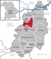 |
36.9 | 8,268 | 224 | 380 |

|
|
Rohrbach (belonged to the district of Pfaffenhofen adIlm before the regional reform) |
Rohrbach Fahlenbach Gambach Rohr Waal |
 |
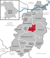 |
29.63 | 6.104 | 206 | 411 |

|
|
|
Scheyern (belonged to the district of Pfaffenhofen adIlm before the regional reform) |
Scheyern Euernbach (1974) Mitterscheyern (1974) Vieth (1973) Winden near Scheyern (1975) Triefing (1971) |
 |
 |
38.28 | 4,867 | 127 | 477 |
|
|
|
Schweitenkirchen (belonged to the district of Pfaffenhofen adIlm before the regional reform) |
Schweitenkirchen Aufham (1978) Dürnzhausen (1971) Geisenhausen (1978) Sünzhausen (1978) |
 |
 |
53.01 | 5,305 | 100 | 533 |
|
|
|
Vohburg adDonau (city) (belonged to the district of Pfaffenhofen adIlm before the regional reform) |
Vohburg adDonau Dünzing (belonged to the district of Ingolstadt before the regional reform) Hartacker Irsching Menning (belonged to the district of Ingolstadt before the regional reform) Oberhartheim (belonged to the district of Ingolstadt before the regional reform) Rockolding |
 |
 |
45.19 | 8,399 | 186 | 371 |
 
|
|
|
Wolnzach (Markt) (belonged to the district of Pfaffenhofen adIlm before the regional reform) |
Wolnzach Burgstall (1971) Eschelbach adIlm (1978) Gebrontshausen (1971) Geroldshausen idHallertau (1978) Gosseltshausen (1971) Haushausen (1971) Larsbach (1978; belonged to the district of Mainburg before the regional reform) Königsfeld (1971) Niederlauterbach (1971) Oberlauterbach (1978 ) |
 |
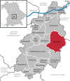 |
91.62 | 11,658 | 127 | 415 |
|
See also
Individual evidence
- ↑ "Data 2" sheet, Statistical Report A1200C 202041 Population of the municipalities, districts and administrative districts 1st quarter 2020 (population based on the 2011 census) ( help ).
- ↑ "Data 2" sheet, Statistical Report A1200C 202041 Population of the municipalities, districts and administrative districts 1st quarter 2020 (population based on the 2011 census) ( help ).
- ↑ BayernViewer of the Bavarian Surveying Administration
