List of municipalities in the district of Munich
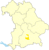
The list of municipalities in the district of Munich gives an overview of the 29 smallest administrative units in the district . Two of the communities are cities , Unterschleißheim is a medium- sized town , Garching near Munich is a small town .
In its current form, the district of Munich was created in the course of the Bavarian territorial reform carried out in 1972 . The district was formed from the district of Munich and parts of the districts of Bad Aibling and Wolfratshausen . The current church structure was completed in 1979. However, there has been a change since then, the 11.83 km 2 community-free area Deisenhofener Forst was dissolved on January 1, 2010 and divided between the communities of Oberhaching and Sauerlach .
In the case of the municipalities, it is noted to which district the main town of the municipality belonged before the regional reform. The year in which they joined the municipality is noted for the suburbs of the municipalities. This is also noted for the suburbs that belonged to a different district than the main town of today's municipality before the regional reform.
description
There are no administrative communities in the Munich district. The seat of the district administration is in the city of Munich, which does not belong to the district .
The district has a total area of 667.27 km 2 . Sauerlach has the largest area within the district with 53.87 km 2 , Aying with 44.98 km 2 and Ismaning with 40.19 km 2 . Two municipalities have an area larger than 30 km 2 , six municipalities have an area of over 20 km 2 and nine municipalities each are over or under 10 km 2 in size. The smallest areas have the municipalities of Feldkirchen with 6.41 km 2 , Neubiberg with 5.77 km 2 and Ottobrunn with 5.23 km 2 . The five community-free areas together have an area of 111.52 km 2 , which corresponds to over 15% of the district area.
With 350,473 inhabitants, the district of Munich is the largest in Bavaria in terms of population. The city of Unterschleißheim has the largest share of the population with 28,950 inhabitants, followed by the municipalities Unterhaching with 25,285 inhabitants, Ottobrunn with 21,694 inhabitants and Haar with 21,476 inhabitants. Three other communities, including the city of Garching near Munich, have over 15,000 inhabitants. Seven municipalities have over 10,000 and eleven over 5,000 inhabitants. The remaining four communities have less than 5,000 inhabitants, namely Brunnthal with 5527 inhabitants, Aying with 5420 inhabitants, Straßlach-Dingharting with 3254 and Baierbrunn with 3269 inhabitants.
The entire district of Munich has a population density of 525 inhabitants per km 2 . The largest population density within the district has the smallest municipality in terms of area, Ottobrunn with 4148 inhabitants per km 2 , followed by the municipalities Unterhaching with 2896 and Neubiberg with 2562 inhabitants per km 2 . Five municipalities have a population density of over 1,000 inhabitants per km 2 , including the city of Unterschleißheim , and another ten, including the city of Garching near Munich, with over 500 inhabitants per km 2 . All other municipalities have a population density lower than the district average of 525. Seven of these municipalities have a population density above and four below 200 inhabitants per km 2 . These four most sparsely populated communities are Brunnthal with 205, Sauerlach with 153, Straßlach-Dingharting with 115 and Aying with 120 inhabitants per km 2 .
Legend
- Municipality : Name of the municipality or city and information about the district to which the eponymous place of the municipality belonged before the regional reform
- Subsites : Enumerated are the formerly independent municipalities of the administrative unit. The year of incorporation is also given. This is also noted for the suburbs that belonged to a different district than the main town of today's municipality before the regional reform
- Coat of arms : coat of arms of the municipality or city
- Map : Shows the location of the municipality or city in the district
- Area : Area of the city or municipality, given in square kilometers
- Population : number of people living in the municipality or city (as of December 31, 2019)
- Population density : The population density is given, calculated on the area of the administrative unit, given in population per km 2 (as of December 31, 2019)
- Altitude : Altitude of the eponymous town or town in meters above sea level
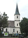
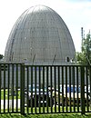
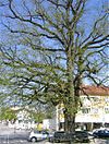
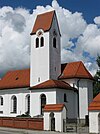
- Image : Image from the respective municipality or city
Communities
| local community | Sub-locations | coat of arms | map | surface | Residents | EW density |
height | image |
|---|---|---|---|---|---|---|---|---|
| District of Munich |  |
 |
667.27 | 350,473 | 525 |

|
||
|
Aschheim (belonged to the district of Munich before the regional reform) |
Aschheim Dornach (1978) |
 |
 |
28.04 | 9,306 | 332 | 512 |

|
| Aying |
Peiß (belonged to the district of Munich before the regional reform) Helfendorf (belonged to the district of Bad Aibling before the regional reform) (merged: 1978) |
 |
 |
54.98 | 5,420 | 99 | 610 |

|
|
Baierbrunn (belonged to the Wolfratshausen district before the regional reform) |
Baierbrunn |  |
 |
7.21 | 3,269 | 453 | 638 |

|
|
Brunnthal (belonged to the district of Munich before the regional reform) |
Brunnthal Hofolding (1978) |
 |
 |
38.03 | 5,527 | 145 | 592 |
|
|
Feldkirchen (belonged to the district of Munich before the regional reform) |
Feldkirchen |  |
 |
6.41 | 7,552 | 1,178 | 523 |

|
|
Garching bei München (city) (belonged to the district of Munich before the regional reform) |
Garching near Munich |  |
 |
28.16 | 17,760 | 631 | 484 |
|
|
Graefelfing (belonged to the district of Munich before the regional reform) |
Graefelfing |  |
 |
9.58 | 13,766 | 1,437 | 540 |

|
|
Grasbrunn (belonged to the district of Munich before the regional reform) |
Grasbrunn Harthausen (1978) |
 |
 |
23.59 | 6,927 | 294 | 556 |

|
|
Grünwald (belonged to the district of Munich before the regional reform) |
Grünwald |  |
 |
7.63 | 11,270 | 1,477 | 547 |
 |
|
Haar (belonged to the district of Munich before the regional reform) |
hair |  |
 |
12.9 | 21,476 | 1,665 | 542 |

|
|
Hohenbrunn (belonged to the district of Munich before the regional reform) |
Hohenbrunn |  |
 |
16.82 | 8,786 | 522 | 570 |

|
|
Höhenkirchen-Siegertsbrunn (belonged to the district of Munich before the regional reform) |
Höhenkirchen Siegertsbrunn (merger: 1978) |
 |
 |
15.19 | 10,880 | 716 | 586 |

|
|
Ismaning (belonged to the district of Munich before the regional reform) |
Ismaning |  |
 |
40.19 | 17,376 | 432 | 490 |

|
|
Kirchheim near Munich (belonged to the district of Munich before the regional reform) |
Kirchheim near Munich Heimstetten (1976) |
 |
 |
15.51 | 12,811 | 826 | 511 |

|
|
Neubiberg (belonged to the district of Munich before the regional reform) |
Unterbiberg |  |
 |
5.77 | 14,785 | 2,562 | 552 |

|
|
Neuried (belonged to the district of Munich before the regional reform) |
Neuried |  |
 |
9.63 | 8,623 | 895 | 561 |

|
|
Oberhaching (belonged to the district of Munich before the regional reform) |
Oberhaching Oberbiberg (1978; belonged to the Wolfratshausen district before the regional reform) |
 |
 |
33.05 | 13,745 | 416 | 575 |
 
|
|
Oberschleißheim (belonged to the district of Munich before the regional reform) |
Oberschleissheim |  |
 |
30.6 | 11,833 | 387 | 484 |
 
|
|
Ottobrunn (belonged to the district of Munich before the regional reform) |
Ottobrunn |  |
 |
5.23 | 21,694 | 4.148 | 555 |

|
|
Planegg (belonged to the district of Munich before the regional reform) |
Planegg |  |
 |
10.68 | 11,100 | 1,039 | 547 |

|
|
Pullach im Isartal (belonged to the district of Munich before the regional reform) |
Pullach in the Isar Valley |  |
 |
7.41 | 9,030 | 1,219 | 583 |

|
|
Putzbrunn (belonged to the district of Munich before the regional reform) |
Cleaning well |  |
 |
11.17 | 6,689 | 599 | 555 |
|
|
Sauerlach (belonged to the Wolfratshausen district before the regional reform) |
Sauerlach Arget (1978) Eichenhausen (1978) |
 |
 |
56.94 | 8,228 | 147 | 618 |

|
|
Schäftlarn (belonged to the Wolfratshausen district before the regional reform) |
Schäftlarn |  |
 |
16.71 | 5,846 | 350 | 692 |

|
|
Straßlach-Dingharting (belonged to the Wolfratshausen district before the regional reform) |
Straßlach Dingharting (merger: 1978) |
 |
 |
28.34 | 3,254 | 115 | 635 |

|
|
Taufkirchen (belonged to the district of Munich before the regional reform) |
Taufkirchen |  |
 |
22.02 | 18.001 | 817 | 562 |
 
|
|
Unterföhring (belonged to the district of Munich before the regional reform) |
Unterföhring |  |
 |
12.8 | 11,284 | 882 | 507 |

|
|
Unterhaching (belonged to the district of Munich before the regional reform) |
Unterhaching |  |
 |
8.73 | 25,285 | 2,896 | 556 |

|
|
Unterschleißheim (city) (belonged to the district of Munich before the regional reform) |
Unterschleissheim |  |
 |
14.93 | 28,950 | 1.939 | 474 |

|
| Unregulated areas |
Forstenrieder Park (37.08 km 2 ) Grünwalder Forest (19.53 km 2 ) Perlacher Forest (13.36 km 2 ) |
  
|
69.97 |
  
|
See also
Individual evidence
- ↑ "Data 2" sheet, Statistical Report A1200C 202041 Population of the municipalities, districts and administrative districts 1st quarter 2020 (population based on the 2011 census) ( help ).
- ↑ "Data 2" sheet, Statistical Report A1200C 202041 Population of the municipalities, districts and administrative districts 1st quarter 2020 (population based on the 2011 census) ( help ).
- ↑ BayernViewer of the Bavarian Surveying Administration

