List of municipalities in the district of Starnberg
The list of municipalities in the district of Starnberg gives an overview of the 14 smallest administrative units in the district . Starnberg , the only town in the district, is a medium-sized town .
In its current form, the district of Starnberg was created in the course of the Bavarian territorial reform carried out in 1972 . The district was formed from the Starnberg district and two communities in the Wolfratshausen district. The current church structure was completed in 1979. The year in which they joined the municipality is noted for the suburbs of the municipalities. This is also noted for the two sub-towns that did not belong to the Starnberg district before the regional reform. There are no administrative communities in the Starnberg district .
description
The district has a total area of 488.01 km 2 . The city of Starnberg has the largest area within the district with 61.77 km 2 . This is followed by the municipalities of Gauting with 50.38 km 2 and Andechs with 40.44 km 2 . Four municipalities have an area larger than 30 km 2 and five municipalities have an area of over 20 km 2 . Each municipality is over or under 10 km 2 in size. The smallest areas have the municipalities of Wörthsee with 20.42 km 2 , Krailling with 16.0 km 2 and Feldafing with 9.15 km 2 . The area of the two community-free areas is 62.36 km 2 larger than the area of the largest community.
The city of Starnberg with 23,488 inhabitants has the largest share of the population of the district of 136,667 inhabitants , followed by the municipalities Gauting with 20,764 inhabitants, Gilching with 19,159 inhabitants and Herrsching am Ammersee with 10,711 inhabitants. Each municipality has over 9,000 or 8,000 inhabitants and two municipalities have over 7,000 or 5,000 inhabitants. Three parishes have over 4,000 inhabitants and the smallest parish has over 3,000 inhabitants. The three smallest communities in terms of population are Inning a.Ammersee with 4830 inhabitants, Feldafing with 4241 and Andechs with 3781 inhabitants.
The entire district of Starnberg has a population density of 280 inhabitants per km 2 . The largest population density within the district have the communities Gilching with 608 inhabitants per km 2 , Herrsching a.Ammersee with 513, Krailling with 492 and Feldafing with 463. Two communities have a population density of over 300, including the city of Starnberg , another six of over 200. In two of these six municipalities, the population density is above or exactly on the district average of 280. Each municipality has a population density of above or below 100 inhabitants per km 2 . The most sparsely populated communities are Seefeld with 217, Inning a.Ammersee with 198 and Andechs with 93 inhabitants per km 2 .
Legend
- Municipality : Name of the municipality or city and information about the district to which the eponymous place of the municipality belonged before the regional reform
- Subsites : Enumerated are the formerly independent municipalities of the administrative unit. The year of incorporation is also given. This is also noted for the two sub-locations that belonged to the Wolfratshausen district before the regional reform.
- Coat of arms : coat of arms of the municipality or city
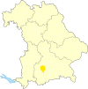
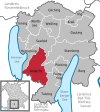
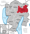
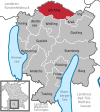
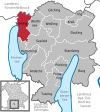
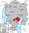
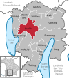
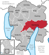
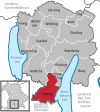
- Map : Shows the location of the municipality or city in the district
- Area : Area of the city or municipality, given in square kilometers
- Population : number of people living in the municipality or city (as of December 31, 2019)
- Population density : The population density is given, calculated on the area of the administrative unit, given in population per km 2 (as of December 31, 2019)
- Altitude : Altitude of the eponymous town or town in meters above sea level
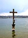
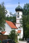
- Image : Image from the respective municipality or city
Communities
| local community | Sub-locations | coat of arms | map | surface | Residents | EW density |
height | image |
|---|---|---|---|---|---|---|---|---|
| Starnberg district |  |
 |
488.01 | 136,667 | 280 |

|
||
| Andechs |
Erling Frieding Machtlfing (merger 1978) |
 |
 |
40.44 | 3,781 | 93 | 690 |

|
| mountain |
Berg Bachhausen (1975; belonged to the Wolfratshausen district before the regional reform) Höhenrain (1975; belonged to the Wolfratshausen district before the regional reform) |
 |
 |
36.63 | 8,301 | 227 | 640 |
|
| Feldafing | Feldafing |  |
 |
9.15 | 4,241 | 463 | 645 |
 
|
| Gauting |
Gauting Buchendorf (1978) Oberbrunn (1978) Unterbrunn (1978) |
 |
 |
50.38 | 20,764 | 412 | 564 |

|
| Gilching |
Gilching Argelsried (1978) |
 |
 |
31.49 | 19,159 | 608 | 559 |

|
| Herrsching am Ammersee |
Herrsching a.Ammersee Breitbrunn a.Ammersee (1978) Widdersberg |
 |
 |
20.88 | 10,711 | 513 | 547 |
 
|
| Inning a.Ammersee |
Inning a.Ammersee Buch a.Ammersee (1975) |
 |
24.43 | 4,830 | 198 | 553 |

|
|
| Krailling | Krailling |  |
16.0 | 7,867 | 492 | 548 |
|
|
| Poecking |
Pöcking Aschering (1972) Maising (1978) |
 |
 |
20.96 | 5,598 | 267 | 669 |

|
| Seefeld |
Oberalting-Seefeld Drößling (1972) Hechendorf a.Pilsensee (1978) Meiling (1978) Unering (1972) |
 |
 |
34.87 | 7,553 | 217 | 570 |
|
| Starnberg (city) |
Starnberg Hadorf (1978) Hanfeld (1972) Landstetten (1978) Leutstetten (1978) Percha (1978) Perchting (1978) Söcking (1978) Wangen (1978) |
 |
 |
61.77 | 23,488 | 380 | 587 |
 |
| Tutzing |
Tutzing Traubing (1978) |
 |
 |
35.63 | 9,918 | 278 | 603 |

|
| Weßling |
Weßling Hochstadt (1972) Oberpfaffenhofen (1972) |
 |
 |
22.6 | 5,485 | 243 | 596 |

|
| Woerthsee | Etterschlag Steinebach a.Wörthsee (merger 1972) |
 |
 |
20.42 | 4,971 | 243 | 562 |

|
| Unregulated areas | Starnberger See (57.16 km 2 ) |  |
57.16 |

|
See also
Individual evidence
- ↑ "Data 2" sheet, Statistical Report A1200C 202041 Population of the municipalities, districts and administrative districts 1st quarter 2020 (population based on the 2011 census) ( help ).
- ↑ "Data 2" sheet, Statistical Report A1200C 202041 Population of the municipalities, districts and administrative districts 1st quarter 2020 (population based on the 2011 census) ( help ).
- ↑ BayernViewer of the Bavarian Surveying Administration (accessed on July 31, 2010)
