Salzberg (Berchtesgaden)
|
Salt mountain
Berchtesgaden market
|
|
|---|---|
| Coordinates: 47 ° 38 '28 " N , 13 ° 1' 4" E | |
| Height : | 530-950 m |
| Area : | 13.82 km² |
| Residents : | 1988 (May 25, 1987) |
| Population density : | 144 inhabitants / km² |
| Incorporation : | January 1, 1972 |
| Postal code : | 83471 |
| Area code : | 08652 |
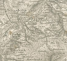
Salzberg is a district of the market Berchtesgaden in Upper Bavarian district of Berchtesgaden and until 31 December 1971, a separate parish, located in the Gnotschaft Untersalzberg II .
At the same time, Salzberg also refers to a foothill of the Kehlstein rising to an altitude of approx. 1000 meters "with the settlements of Unter- and Obersalzberg".
Location and structure
The municipality of Salzberg, which was independent before 1972, had an area of 1,381.87 hectares and comprised the Gnotschaft or districts: Anzenbach , Metzenleiten , Mitterbach , Obersalzberg , Untersalzberg I and Untersalzberg II . Their area was enclosed in a wide arc from Mitterbach and the Gerer Bach to the Hilgerkapelle from the old market core of Berchtesgaden . In the south it bordered on a community-free area in the Roßfeld area , in the west on Königssee (today part of Schönau am Königssee ), in the north on Maria Gern and in the east on the Au (both at the time also independent communities that are now incorporated into Berchtesgaden) .
For the census of May 25, 1987, the six Gnotships belonging to the former community had a total of 1988 inhabitants, who were distributed as follows:
- Untersalzberg II (240)
- Anzenbach (123)
- Metzenleiten (174)
- Mitterbach (681)
- Obersalzberg (267)
- Untersalzberg I (503)
history
In the course of the Landbrief issued by Provost Ulrich Wulp in 1377 , Pherg or Berg (from 1818: "Salzberg") with the six "Gnotschaftsbezirken" (unnamed until 1817) Anzenbach, Metzenleiten, Mitterbach, Obersalzberg, Untersalzberg I and Untersalzberg II were presumably already from the end of the 14th century "Ur to one of the eight gnotschaften " of the Berchtesgaden country . From 1155 onwards, the area of the Berchtesgadener Land corresponded to the heartland of the Berchtesgaden monastery , which in 1380 had been elevated to the status of the Imperial Prelature of Berchtesgaden and in 1559 to the imperial provost of Berchtesgaden . Berg is first mentioned in writing as a Gnotschaft in the first tax book of the Berchtesgadener Land from 1456.
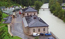
Already from 1194 salt was dug in the Pherg am Gollnbach and in 1517 the Berchtesgaden salt mine was founded by Prince Provost Gregor Rainer with the construction of the "Petersberg-Stollen" .
→ See also the section on these paragraphs: History in Fürstpropstei Berchtesgaden
After the secularization of 1803, the Berchtesgadener Land lost its political independence as a prince provost , which was followed by three changes of rule in quick succession. In 1810, the Berchtesgadener Land was finally annexed to the Kingdom of Bavaria , and Berg became a municipality that is referred to for the first time in a listing of its mayors by name from 1818 as the municipality "Salzberg". The previous Gnotschaft districts have been referred to as "Gnotships" since then to this day. The Gnotschaft Anzenbach and Metzenleiten were districts of the municipality of Gern for one year in 1817 and connected again with Salzberg from 1818.
→ See also the section on this paragraph: After the secularization in the Fürstpropstei Berchtesgaden
Between the market in Berchtesgaden and the municipality of Salzberg there had been tensions since the 19th century, which among other things also offered young people the pretext to fight, just because some were "marketers" and the others were "Salzbergers".
During the Nazi era , Salzberg was supposed to be incorporated into a then “Large Market Community of Berchtesgaden” as part of the establishment of the “ Führer's restricted area ” in the Obersalzberg district , but this was not carried out until the end of the war. When, after liberation from National Socialism, the American occupying power stuck to the plans for incorporation and did not want to set up a separate mayor for Salzberg, this was confirmed by the population in a letter dated May 12, 1945 to District Administrator Jacob u. a. With reference to the National Socialist roots, this endeavor was violently rejected and successfully fended off.
In the course of administrative reform in Bavaria , the church lost its independence on 1 January 1972 and has since become a district of the market Berchtesgaden .
On January 1, 1984, the community-free area of Forst Königsee was dissolved, and a smaller part with an area of 309.19 hectares became part of the Salzweg district. The large remainder of 4574.69 hectares came to the community of Schönau am Königssee as a separate area.
The underground pipe system in which the Gollenbach , which rises on Obersalzberg, flows into the Berchtesgadener Ache at the so-called "Gollenbachbrücke" , had to be rebuilt in June 2013 after a flood-related blockage.
coat of arms
| Blazon : “In the blue field the figure of St. Rupertus in episcopal regalia, red robe with silver (white) undergarment, red miter and golden (yellow) nimbus, in his right hand the golden (yellow) bishop's staff, in the left holding a golden (yellow) book, on which a silver (white) ) Salt vat rests. " | |
| Founding of the coat of arms: Salzberg had its own coat of arms from 1925 to 1972. Based on a design by Otto Hupp , it shows Rupert von Salzburg , who is also considered the patron saint of the salt industry . |
Local politics
Mayor of the municipality after the Second World War:
- 1945–1952 Josef Hallinger (bricklayer loan)
- 1952–1971 Anton Brandner (Bergwald House)
Facilities / buildings
- With the affiliation to Bavaria from 1810, special schools were set up on November 16, 1811 as part of the compulsory schooling that had existed in Bavaria since 1802 . Until 1906 the children from Salzberg attended school in Markt Berchtesgaden (house no. 103, the former toll building near the Neuhausbogen ). In 1906, a separate elementary school was built on Schießstättstrasse for the children from Salzberg, but its premises were used again with the Berchtesgaden market school from 1942 to 1984 as part of a cooperation agreement. In the former "elementary school Salzberg" there is now a kindergarten.
- In 1903, a "district hospital" was opened in the former Salzberg Gnotschaft Anzenbach , which was renamed "District Hospital" in 1919 and inaugurated in 1962 with a new building as "District Hospital Berchtesgaden". (Refurbished again after the incorporation, this hospital has been operating as part of the Südostbayern Clinics Association since 1997, now as the "District Clinic Berchtesgaden".) It is thanks to the location of this hospital that the Salzberg became the officially registered birthplace of most of the residents of Berchtesgaden until it was incorporated Basin became.
- Between 1929 and 1932, Franz Brandner built the small church Maria am Berg on a slope of Kiliansberg in Metzenleiten, not far from the Seimler youth hostel, which opened in 1921, at his own expense and with the help of relatives .
Sons and daughters of the church
- Peter Öttl (* 1965), German motorcycle racer
- Alf Schuler (* 1945), artist (sculpture, objects, wall pieces, floor work, drawings, minimalist forms)
literature
- A. Helm , Hellmut Schöner (ed.): Berchtesgaden in the course of time . Verlag Berchtesgadener Anzeiger 1973. P. 286, 323
- Hellmut Beautiful (Ed.): Berchtesgaden through the ages - Supplementary Volume I . Berchtesgadener Anzeiger publishing house, 1974. pp. 196-198
Individual evidence
- ↑ Volker Dahm : The Obersalzberg near Berchtesgaden. Perpetrator location, tourist attraction, learning location , historical essay as press information from the Obersalzberg documentation from November 1, 2001, online at obersalzberg.de
- ^ Official register of places for Bavaria, territorial status on October 1, 1964 with statistical information from d. 1961 census, Munich, 1964 , column 54.
- ↑ Official directory for Bavaria, territorial status: May 25, 1987, Munich, 1991 , p. 70
- ↑ Joseph Ernst von Koch-Sternfeld: History of the Principality of Berchtesgaden and its salt works . Volume 2, from p. 27 f.
- ↑ For the tax book see Manfred Feulner: Maria Gern - Gnotschaft and community on behalf of the Maria Gern brass band . Literature and sources: berchtesgadeninfo.de, Market Archive Berchtesgaden, Dept. Maria Gern.
- ↑ Dieter Albrecht : Fürstpropstei Berchtesgaden - Statistical overview based on the status of 1698. I. District and Nursing Court Berchtesgaden. Chapter: Gnotschaft Gern In: Historical Atlas of Bavaria . Part Altbayern, Heft 7, Munich 1954, p. 25 u. 26th
- ↑ A. Helm , Hellmut Schöner (ed.): Berchtesgaden in the course of time - supplementary volume I , p. 196; According to a letter in it dated May 12, 1945 to District Administrator Jacob to preserve the communal independence, salt was dug here from 1190 onwards.
- ^ History - The beginnings of salt mining in Berchtesgaden ; Salt production on the Tuval in neighboring Schellenberg is also mentioned here as early as 1193 , online at salzbergwerk.de .
- ↑ Joseph Ernst von Koch-Sternfeld: History of the Principality of Berchtesgaden and its salt works . Volume 3, from p. 121 f.
- ^ For the list of mayors see A. Helm, Hellmut Schöner (ed.): Berchtesgaden im Wandel der Zeit , p. 286; A. Helm also cites a population statistic in which the municipality is still listed in 1812 under the place name "Berg".
- ↑ see A. Helm, Hellmut Schöner (ed.): Berchtesgaden im Wandel der Zeit , pp. 197–198
- ↑ See Hellmut Schöner: Berchtesgaden through the ages - supplementary volume I , p. 198
- ^ Wilhelm Volkert (ed.): Handbook of Bavarian offices, communities and courts 1799–1980 . CH Beck, Munich 1983, ISBN 3-406-09669-7 , p. 434 .
- ↑ Berchtesgaden: Underground pipe system built for Gollenbach , report from March 22, 2014, online at salzburg24.at
- ↑ On the coat of arms - Berchtesgaden through the ages , p. 286
- ↑ On going to school from 1811 - Berchtesgaden through the ages , p. 323 above
- ↑ On attending school until 1906 - Berchtesgaden through the ages , p. 323, keyword school building
- ↑ mittelschule-berchtesgaden.de chronicle of Berchtesgaden middle school to school Salzberg
- ↑ On attending school from 1906 - Berchtesgaden in the course of time , p. 323, keyword schools
- ↑ kliniken-suedostbayern.de Chronicle of the " District Hospital Berchtesgaden" once located in Salzberg
- ↑ Hellmut Schöner: Berchtesgaden through the ages. Supplementary Volume I, 1982, p. 318.


