Obermeitingen
| coat of arms | Germany map | |
|---|---|---|

|
Coordinates: 48 ° 9 ' N , 10 ° 48' E |
|
| Basic data | ||
| State : | Bavaria | |
| Administrative region : | Upper Bavaria | |
| County : | Landsberg am Lech | |
| Management Community : | Iging | |
| Height : | 575 m above sea level NHN | |
| Area : | 9.93 km 2 | |
| Residents: | 1755 (Dec. 31, 2019) | |
| Population density : | 177 inhabitants per km 2 | |
| Postal code : | 86836 | |
| Area code : | 08232 | |
| License plate : | LL | |
| Community key : | 09 1 81 131 | |
| Community structure: | 3 parts of the community | |
| Address of the municipal administration: |
Main street 23 86836 Obermeitingen |
|
| Website : | ||
| Mayor : | Erwin Losert ( CSU ) | |
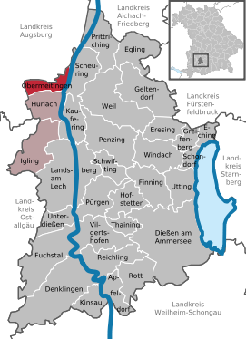
| Location of the municipality of Obermeitingen in the Landsberg am Lech district | ||
Obermeitingen is a municipality in the Upper Bavarian district of Landsberg am Lech and a member of the Igling administrative community .
Community structure
The municipality has three officially named municipal parts (the type of settlement is indicated in brackets ):
- Obermeitingen ( parish village )
- Obermeitingen (colony)
- Schwabstadl ( village )
There is only the Obermeitingen district .
history
Until the church is planted
Obermeitingen belonged to the Rottenbuch monastery . The place was part of the Electorate of Bavaria and formed a closed Hofmark , which was abolished with the monastery in 1803 during the secularization . In the course of the administrative reforms in the Kingdom of Bavaria , today's municipality was created with the municipal edict of 1818 .
From the 20th century
Camp IX of the Landsberg / Kaufering subcamp group of the Dachau concentration camp was located in Obermeitingen from August 1944 until the death march called “evacuation” in April 1945 .
Population development
- 1970: 1161 inhabitants
- 1987: 1265 inhabitants
- 1991: 1368 inhabitants
- 1995: 1514 inhabitants
- 2005: 1563 inhabitants
- 2010: 1571 inhabitants
- 2015: 1669 inhabitants
- 2018: 1759 inhabitants
- 2019: 1755 inhabitants
Between 1988 and 2019 the community grew by 417 inhabitants or by 31.2% from 1338 to 1755.
politics
mayor
Erwin Losert (CSU) has been mayor since May 2014. The predecessor Clemens Weihmayer (CSU) was in office for 36 years.
Municipal council
| year | CSU | SPD | FW | UBL | total | Voter turnout in% |
|---|---|---|---|---|---|---|
| 2014 | 5 | 0 | 3 | 4th | 12 | 64.1 |
| 2008 | 6th | 1 | 5 | 0 | 12 | 56.6 |
| 2002 | 7th | 2 | 3 | 0 | 12 | 56.9 |
coat of arms
The description of the coat of arms reads: Split of red and silver; in front a floating golden paw cross, behind a red beech tree with roots; in the base of the shield a continuous beam in the form of road plates split by silver and black.
Architectural and ground monuments
See: List of architectural monuments in Obermeitingen and List of ground monuments in Obermeitingen
Economy and Infrastructure
Economy including agriculture and forestry
In 1998, according to official statistics, there were no employees in the manufacturing sector and no employees in the trade and transport sector at the place of work. In other economic sectors, 292 people were employed at the place of work subject to social security contributions. There were a total of 454 employees at the place of residence subject to social security contributions. There were four companies in the manufacturing sector and five in the construction sector. In addition, in 1999 there were 22 agricultural holdings with an agriculturally used area of 432 ha, of which 319 ha were arable land and 113 ha were permanent green space.
education
There are the following institutions (status: 2014):
- Day care center with 67 places
Web links
- Entry on the coat of arms of Obermeitingen in the database of the House of Bavarian History
Individual evidence
- ↑ "Data 2" sheet, Statistical Report A1200C 202041 Population of the municipalities, districts and administrative districts 1st quarter 2020 (population based on the 2011 census) ( help ).
- ^ Municipality of Obermeitingen in the local database of the Bavarian State Library Online . Bavarian State Library, accessed on September 7, 2019.
- ↑ http://www.augsburger-allgemeine.de/landsberg/Losert-tritt-in-Weihmayers-Fussstapfen-id29220772.html


