
Wildenberg
| coat of arms | Germany map | |
|---|---|---|

|
Coordinates: 48 ° 44 ' N , 11 ° 55' E |
|
| Basic data | ||
| State : | Bavaria | |
| Administrative region : | Lower Bavaria | |
| County : | Kelheim | |
| Management Community : | Siegenburg | |
| Height : | 430 m above sea level NHN | |
| Area : | 18.16 km 2 | |
| Residents: | 1391 (Dec. 31, 2019) | |
| Population density : | 77 inhabitants per km 2 | |
| Postal code : | 93359 | |
| Area code : | 09444 | |
| License plate : | KEH, MAY , PAR , RID, ROL | |
| Community key : | 09 2 73 181 | |
| Association administration address: | Marienplatz 13 93354 Siegenburg |
|
| Website : | ||
| Mayor : | Winfried Rossbauer ( CSU ) | |
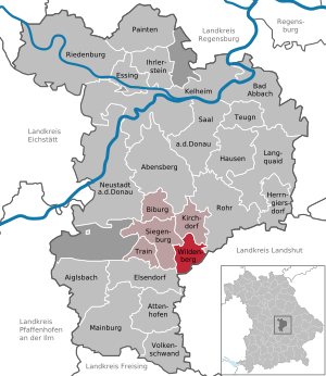
| Location of the community of Wildenberg in the Kelheim district | ||
  |
||

Wildenberg is a municipality in the Lower Bavarian district of Kelheim and a member of the Siegenburg administrative community .
geography
Wildenberg is located in the Regensburg region. There is only the Wildenberg district . Villages are Wildenberg, Pürkwang , Schweinbach , Irlach, Willersdorf and Eschenhart. The municipality is traversed by the Siegbach , a tributary of the Abens .
history
Until the church is planted
Hänslin Ebran von Lauterbach built Wildenberg Castle from 1272 onwards. With the inclusion of the Pürkwang estate, he formed the extensive rule that later came to the Regensburg Monastery as a closed Hofmark . After Heinrich Ebran von Wildenberg died as the last of his line, in 1607 the Hofmark Wildenberg including the castle fell to the Regensburg canon Christoph von Stinglheim zu Thürnthenning and Karpfenstein for use. With the secularization of 1803 the goods complex came to Bavaria. In the course of the administrative reforms in the Kingdom of Bavaria , today's municipality was created with the municipal edict of 1818 .
Incorporations
In 1945 or 1946 the previously independent community of Schweinbach was incorporated.
Population development
In the period from 1988 to 2018, the population increased from 1,100 to 1,343 by 243 inhabitants or 22.1%.
- 1961: 1082 inhabitants
- 1970: 1158 inhabitants
- 1987: 1068 inhabitants
- 1991: 1153 inhabitants
- 1995: 1223 inhabitants
- 2000: 1306 inhabitants
- 2005: 1373 inhabitants
- 2010: 1331 inhabitants
- 2015: 1388 inhabitants
politics
mayor
In the local elections on March 15, 2020, none of the four candidates could achieve an absolute majority. As a result, on March 29, 2020, there was a runoff between Wolfgang Brich (Young List) and Winfried Roßbauer (CSU). Winfried Roßbauer was elected the new mayor with 50.52% of the vote. His predecessor was Marion Schwenzl (community welfare / free voters).
Municipal council
After the local elections on March 15, 2020, the municipal council has 12 members, the 13th member is the mayor.
coat of arms
The description of the coat of arms reads: In tin cut diagonally divided by silver and blue; below is a silver label with a continuous blue St. Andrew's cross.
Architectural monuments
Economy and Infrastructure

Economy including agriculture and forestry
In 1998, according to official statistics, there were 56 employees at the place of work in the manufacturing sector and ten in the trade and transport sector. In other economic sectors 37 people were employed at the place of work subject to social security contributions. There were a total of 406 employees at the place of residence subject to social security contributions. There was one company each in manufacturing and construction. In addition, there were 59 farms in 1999 with an agricultural area of 812 hectares, of which 782 hectares were arable land.
education
The following institutions exist (as of: 1999):
- Kindergarten: 50 kindergarten places with 47 children
- Primary school: with three teachers and 71 students
Personalities
- Hans-Christian Dietrich (1869–1950), bank manager and university professor born in Wildenberg
- Manfred Weber (* 1972), resident in Wildenberg, CSU politician and member of the European Parliament
literature
- The knight's Hans Ebran von Wildenberg chronicle of the princes of Bavaria. Rieger, Munich 1905. Digitized edition of the University and State Library Düsseldorf
Individual evidence
- ↑ "Data 2" sheet, Statistical Report A1200C 202041 Population of the municipalities, districts and administrative districts 1st quarter 2020 (population based on the 2011 census) ( help ).
- ^ Dieter Schwaiger, Karpfenstein | A former moated castle near Mühlhausen, p. 38, self-published 2018.
- ^ Wilhelm Volkert (ed.): Handbook of Bavarian offices, communities and courts 1799–1980 . CH Beck, Munich 1983, ISBN 3-406-09669-7 , p. 563 .
- ↑ https://www.landkreis-kelheim.de/wahlen/live/Kommunalwahl2020/09273181/html5/Buergermeisterwahl_Bayern_57_Gemeinde_Gemeinde_Wildenberg.html
- ↑ https://www.landkreis-kelheim.de/wahlen/live/Kommunalwahl2020/09273181/html5/BuergermeisterStichwahl_Bayern_65_Gemeinde_Gemeinde_Wildenberg.html
- ↑ https://www.landkreis-kelheim.de/wahlen/live/Kommunalwahl2020/09273181/html5/Gemeinderatswahl_Bayern_59_Gemeinde_Gemeinde_Wildenberg.html
Web links
- Homepage of the community Wildenberg
- Entry on the coat of arms of Wildenberg in the database of the House of Bavarian History

Abensberg | Aiglsbach | Attenhofen | Bad Abbach | Biburg | Elsendorf | Essing | Hausen | Herrngiersdorf | Ihrlerstein | Kelheim | Kirchdorf | Langquaid | Mainburg | Neustadt an der Donau | Painten | Riedenburg | Rohr in Lower Bavaria | Hall on the Danube | Siegenburg | Teugn | Train | Volkenschwand | Wildenberg
Unregulated areas: Dürnbucher Forst | Frauenforst | Hacklberg | Hienheim Forest