Riedenburg
| coat of arms | Germany map | |
|---|---|---|

|
Coordinates: 48 ° 58 ' N , 11 ° 41' E |
|
| Basic data | ||
| State : | Bavaria | |
| Administrative region : | Lower Bavaria | |
| County : | Kelheim | |
| Height : | 360 m above sea level NHN | |
| Area : | 100.45 km 2 | |
| Residents: | 6066 (Dec. 31, 2019) | |
| Population density : | 60 inhabitants per km 2 | |
| Postal code : | 93339 | |
| Area code : | 09442 | |
| License plate : | KEH, MAY , PAR , RID, ROL | |
| Community key : | 09 2 73 164 | |
| LOCODE : | DE VO9 | |
City administration address : |
St.-Anna-Platz 2 93339 Riedenburg |
|
| Website : | ||
| Mayor : | Thomas Zehetbauer (CWG) | |
| Location of the city of Riedenburg in the Kelheim district | ||

Riedenburg is a town in the Lower Bavarian district of Kelheim and is located in the Altmühltal at the foot of the Rosenburg and the two castle ruins Rabenstein and Tachenstein .
geography
City structure
The city of Riedenburg is divided into 44 districts.
landscape
A large area is a nature reserve. A large number of rare plants grow on dry grass . The forests around Riedenburg are predominantly mixed forest .
There is no longer a typical farmer in Riedenburg, only a shepherd grazes the Jura areas . This cultivation also serves to maintain the dry grass with its typical juniper bushes .
In Riedenburg, the Schambach flows into the city pond with two arms and via a rock staircase with a waterfall of over five meters, this is - on the right bank - several short links with the Altmühl, which is also the Rhine-Main-Danube Canal.
Riedenburg is the westernmost municipality in the administrative district of Lower Bavaria .
history
Until the 19th century
The earliest written mention of the place name "Ritenburg" comes from the year 1111. The place first appeared as a market after 1231 and was first mentioned in 1329 as a city. As counts of the western Danube floodplains, the dynasty of the Counts of Riedenburg ( Babonen ) ruled from around 970. In addition, as imperial burgraves, they commanded the imperial fortress of Regensburg . Two Counts von Riedenburg are depicted as minstrels in the Codex Manesse .
Even if they weren't the founders, they will have been the first historically known protectors and promoters of the place. Under their care, it was hidden within the defensive walls of their castle hill and, after they died out in 1196, developed into a modest bloom under the Wittelsbach family . According to the oldest land register from 1224, Riedenburg was the official seat ("Amt ze Ritenburc").
In 1333 a Riedenburger first appeared in a deed as a citizen. The seal with today's city arms (of the former Lords of Riedenburg) appeared as early as 1336. In the Peasants' War in 1525, the keeper of Riedenburg, Erhard von Muggenthaler, stood out and was taken prisoner. Riedenburg was hit hard by the Swedes in the Thirty Years War from 1632 to 1634 and 1648. The old town hall, today the tourist office (Haus des Gastes), in the middle of the old town, dates from 1731.
In the War of the Spanish Succession in 1703 the market and fortress were looted by the Austrians and in 1745 General Graf Bärenklau set up his winter quarters there. In 1796 Archduke Karl made his way across the Tachenstein with his man, horse and car .
20th century
The iron arch bridge leading over the Altmühl was blown up by the retreating German units in 1945 before the American troops marched in . Otherwise the First and Second World Wars passed the city without any direct consequences.
The remains of Eggersberg Castle are on the church rock north of the Obereggersberg district .
In 1952, Riedenburg was elevated to the status of town under District Administrator Franz Lang. Until 1972 Riedenburg was the district town of the Riedenburg district in the Bavarian administrative district of Upper Palatinate .
The district (license plate RID ) had 49 municipalities before the dissolution. The largest places were the district town of Riedenburg, the city of Dietfurt as well as Altmannstein and Mindelstetten . Franz Lang was the district administrator until the regional reform .
On July 1, 1972, the town of Riedenburg and its surroundings were added to the Kelheim district as part of the regional reform in Bavaria with parts of the Altland districts of Mainburg , Parsberg and Rottenburg an der Laaber .
The other communities of the former district came to the districts of Neumarkt in der Oberpfalz and Eichstätt .
Incorporations
On January 1, 1972, the previously independent municipalities of Buch (with Echendorf, which was incorporated on April 1, 1949), Eggersberg, Hattenhausen, Otterzhofen, Perletzhofen, Schaitdorf and Thann were incorporated. Jachenhausen followed on January 1, 1976. Meihern was added on January 1, 1978 with Deising, which was incorporated in 1945 or 1946, and Altmühlmünster, which was incorporated on April 1, 1971. The round of incorporations was completed with the incorporation of the previously independent municipalities of Baiersdorf and Prunn on May 1, 1978.
Population development
In the period from 1988 to 2018, the population increased by 1119 from 4911 to 6030 or by 22.8%.
politics
City council
The city council with its 20 members was last elected on March 15, 2020 and is composed as follows:
- Christian Social Union in Bavaria (CSU) 32.4%, 6 seats
- Social Democratic Party of Germany (SPD) 7.6%, 2 seats
- Christian voter community Riedenburg (CWG) 28.25%, 6 seats
- Free electorate Riedenburg (FW) 11.55%, 2 seats
- Citizens' list of the large community of Riedenburg (BGR) 20.20%, 4 seats
mayor
In the runoff election on March 29, 2020, Thomas Zehetbauer (CWG) was elected First Mayor with 50.21 percent of the vote. His rival, the previous mayor Siegfried Lösch (CSU), received 49.79 percent of the vote.
coat of arms
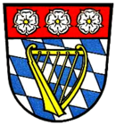
Blazon : "In gold, a red oblique left-hand bar, topped with three silver heraldic roses with golden lugs."
The coat of arms is derived from the coat of arms of the dynasty of the Counts of Riedenburg (Barbonen), who lived in the Donaugau in the 11th and 12th centuries.
For the history of the coat of arms see web links.
Culture and sights
- Riedenburg-Haidhof grave mound
- Parish Church of St. Johann Baptist (Riedenburg)
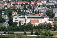
- St. Anna Monastery Church
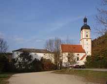
- Pilgrimage church of the Visitation of the Virgin Mary in the Schambach district
- Catholic Church of St. Peter in Otterzhofen (with an original gallery support)
- Falkenhof Rosenburg Castle
- Prunn Castle . A manuscript of the Nibelungenlied , the so-called “Prunner Codex”, comes from there .
Museums
- Crystal Museum with the largest rock crystal group in the world (7.6 t). This also includes the "Fasslwirtschaft" - you can choose from 42 types of beer from all over the world and drink while sitting in huge beer barrels that are more than 100 years old - as well as a Wilde Kerle playground and a mini golf course.
- There is a farm museum in Echendorf, between Riedenburg and Altmannstein. There old agricultural tools and machines are exhibited, which the museum director also demonstrates. There are also cows, goats and a horse. There is a large play barn for the children with lots of play equipment, for example a trampoline, billiards, table football, table tennis, mini golf, swings, bowling alley and a balancing rope.
Regular festivals and events
- Antique and flea market: every third Sunday of the month on the grounds of the Riedenburger brewery beer garden
- Medieval Festival: every two years in the old town and at the town pond
- Midsummer celebrations in the Altmühltal every year on the third Saturday in June
Economy, infrastructure and resident companies
Crafts and trades used to flourish here: red and white tanners, cloth makers, dyers, weavers and linen weavers and rope makers still appear in large numbers in old documents alongside “Pierbreuwen” (beer brewers). Today there is particular
- two breweries, the Riedenburger Brauhaus (specializing in ecological beers such as Emmerbier ) and the Friedrich Riemhofer brewery and
- a malt factory
An industrial area was created in Haidhof, and in autumn 2006 another one directly next to Aicholding Castle or next to Staatsstraße 2230. It was opened in spring 2007 when several companies opened and is called a "trade park".
Many people from Riedenburg commute to work in Ingolstadt and Kelheim .
tourism
Riedenburg is a recognized climatic health resort and is visited by numerous holidaymakers in summer. Developed hiking trails, bike paths, campsites and the central location in Bavaria are well received. A bathing lake and a summer toboggan run in Haidhof (St. Agatha) are available. Hang gliding is possible for authorized persons on weekends above St. Agatha on the other side of the canal in Jachenhausen.
traffic
Connection to the motorway network
Riedenburg is located near three main traffic arteries:
- via exits 58 ( Altmühltal ) and 59 ( Denkendorf ) of the A 9
- via exit 94 ( Parsberg ) of the A3
- via exit 49 ( Abensberg ) of the A 93
Shipping
The Ludwig-Danube-Main Canal , which runs through Riedenburg , was built between 1835 and 1846 to connect the Main with the Danube . The barges, made of wood and hauled by horses , continued on the waterway until 1950. In Riedenburg there was a loading point (annex) for cargo handling . In the municipality there were partly disposed of, and (if received) under monument protection standing locks 5 to 11 .
In 1987, the expansion of the Altmühl into the Main-Danube Canal began in the urban area . Since its completion in 1993 there has been a modest uneconomical shipping traffic. The Rhein-Main-Donau Wasserstraßen GmbH is to be taken over by the state of Bavaria for a symbolic euro because of its engineering capacities for flood protection, according to a resolution from the beginning of January 2020
Rail transport
Between 1904 and 1972 Riedenburg was the terminus of the Ingolstadt – Riedenburg railway line .
education
- Elementary and middle school
- Johann-Simon-Mayr-Realschule (mixed-sex)
- St. Anna Girls' Secondary School ( St. Anna Riedenburg Monastery )
- School camp Riedenburg
sons and daughters of the town
- Otto von Riedenburg († July 6, 1089) was the 17th bishop of Regensburg
- Adelheid von Riedenburg was Queen of Hungary in the 12th century
- Josef Graf (* 1957), Roman Catholic theologian and auxiliary bishop in the diocese of Regensburg
- Josef Schweiger * 1936, prelate, holder of the Federal Cross of Merit, 1st class
Web links
- Homepage of the city of Riedenburg
- Entry on the coat of arms of Riedenburg in the database of the House of Bavarian History
Individual evidence
- ↑ "Data 2" sheet, Statistical Report A1200C 202041 Population of the municipalities, districts and administrative districts 1st quarter 2020 (population based on the 2011 census) ( help ).
- ^ Riedenburg in the local database of the Bavarian State Library Online
- ↑ Eichstätter Kurier of December 13, 2017, p. 29
- ^ Wilhelm Volkert (ed.): Handbook of Bavarian offices, communities and courts 1799–1980 . CH Beck, Munich 1983, ISBN 3-406-09669-7 , p. 557 .
- ^ Federal Statistical Office (ed.): Historical municipality directory for the Federal Republic of Germany. Name, border and key number changes in municipalities, counties and administrative districts from May 27, 1970 to December 31, 1982 . W. Kohlhammer GmbH, Stuttgart / Mainz 1983, ISBN 3-17-003263-1 , p. 610 .
- ^ Federal Statistical Office (ed.): Historical municipality directory for the Federal Republic of Germany. Name, border and key number changes in municipalities, counties and administrative districts from May 27, 1970 to December 31, 1982 . W. Kohlhammer GmbH, Stuttgart / Mainz 1983, ISBN 3-17-003263-1 , p. 611 .


