
Lintlhof
|
Lintlhof
City of Riedenburg
Coordinates: 48 ° 57 ′ 19 ″ N , 11 ° 41 ′ 18 ″ E
|
|
|---|---|
| Height : | 462 m above sea level NN |
| Postal code : | 93339 |
| Area code : | 09442 |
 Lintlhof
|
|
geography
Lintlhof is a district of Riedenburg in the Lower Bavarian district of Kelheim and is located in the Altmühltal Nature Park . Lintlhof is located south of the main town.
history
Two full-time farms were in operation here until 1980. One yard area is leased, the other has meanwhile been sold.
Signposted hiking trails from the Altmühltal into the Schambachtal can be used via the village of Lintlhof . A hiking trail for those with good hiking boots and a head for heights can be walked between Lintlhof and Riedenburg over the Kreuzfelsen. Particularly noteworthy is the Jura dry grassland on the slopes of the Lintlberg and on the hill, with some very rare and protected flora and fauna. A shepherd is currently grazing the land several times a year to avoid wild growth. In 1816 a field chapel was built in the small hamlet . This chapel, which was externally prepared by pilgrims, has been the central starting point for pilgrims from the Riedenburg area to Altötting since 1836 . The chapel was robbed in the 1970s. The Lintlhof chapel and the two hundred-year-old linden trees are on urban land and are owned and owned by the city of Riedenburg. This "Lintlhof Chapel" is in the list of monuments under file number D-2-73-164-166

Chapel at Lintlhof

Interior of the Lintlhof Chapel (around 1960)

Starting point for the pilgrimage to Altötting

Resident of Lintlhof (around 1935)
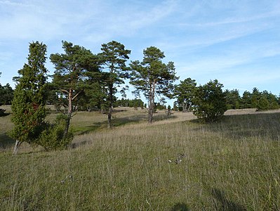
Meager lawn at Lintlhof

Kreuzfelsen in Schambachtal, Rosenburg at the top right


Aicholding | Altmühlmünster | Baiersdorf | Book | Deising | Dieterzhofen | Echendorf | Echenried | Eggmühl | Einthal | Emmerthal | Flügelsberg | Frauenberghausen | Georgenbuch | Gleislhof | Grub | Gundlfing | Haidhof | Harlanden | Hattenhausen | Hattenhofen | Jachenhausen | Wedge Village | Cabbage mill | Laubhof | Lintlhof | Flour | Neuenkehrsdorf | Nusshausen | Obereggersberg | Oberhofen | Otterzhofen | Perletzhofen | Pillhausen | Prunn | Ried | Riedenburg | Saint Gregory | Saint Ursula | Schaitdorf | Schambach | Schloßprunn | Thann | Untereggersberg