List of FFH areas in the Upper Palatinate
The list of FFH areas in the Upper Palatinate includes the following lists of FFH areas in Upper Palatinate districts and cities from the article namespace:
- List of FFH areas in the district of Amberg-Sulzbach
- List of FFH areas in the city of Amberg
- List of FFH areas in the Cham district
- List of FFH areas in the Neumarkt district in the Upper Palatinate
- List of FFH areas in the Neustadt an der Waldnaab district
- List of FFH areas in the city of Regensburg
- List of FFH areas in the district of Regensburg
- List of FFH areas in the Schwandorf district
- List of FFH areas in the Tirschenreuth district
The selection corresponds to the Upper Palatinate . There are 95 FFH areas in the administrative district (as of April 2016).
| Surname | image | Identifier
|
circle | details | position | Area hectares |
date
|
|||
|---|---|---|---|---|---|---|---|---|---|---|
|
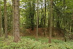
Beech forests near Sitzambuch |
|
6438-301 WDPA: 555521550 |
Amberg-Sulzbach district | ⊙ | 144.00 | |||||
| Bat quarters around Hohenburg |
6636-301 WDPA: 555521649 |
Amberg-Sulzbach , district Neumarkt in der Oberpfalz | ⊙ | 0.01 | ||||||
|
Caves of the northern Franconian Alb |

|
6335-305 WDPA: 555521476 |
District of Nürnberger Land , District of Bayreuth , District of Amberg-Sulzbach | Winter quarters for the great mouse-eared mouse and other bat species in natural karst caves. | ⊙ | 0.01 | ||||
|
Johannisberg |

|
6537-372 WDPA: 555521597 |
Amberg-Sulzbach district | ⊙ | 381.41 | |||||
|
Lauterachtal |

|
6636-371 WDPA: 555521650 |
Amberg-Sulzbach , district Neumarkt in der Oberpfalz | ⊙ | 822.10 | |||||
|
Nature reserve 'Grubenfelder Leonie' |

|
6235-301 WDPA: 555521425 |
Amberg-Sulzbach district | ⊙ | 87.00 | |||||
| Nature reserve 'Unteres Pfistertal north of Vilshofen' |
6637-301 WDPA: 555521651 |
Amberg-Sulzbach district | ⊙ | 14.00 | ||||||
|
Pegnitz between Michelfeld and Hersbruck |

|
6335-371 WDPA: 555521478 |
District of Nürnberger Land , District of Amberg-Sulzbach , District of Bayreuth | ⊙ | 310.54 | |||||
| Sand pit and ponds south of Auerbach id Opf. |
6335-373 WDPA: 555521480 |
Amberg-Sulzbach district | ⊙ | 5.83 | ||||||
| Pond east of Oberreinbach |
6435-372 WDPA: 555521548 |
Amberg-Sulzbach district | ⊙ | 2.20 | ||||||
|
Eaves slopes of the Hersbrucker Alb |

|
6434-301 WDPA: 555521544 |
District of Nürnberger Land , District of Amberg-Sulzbach | ⊙ | 1,472.00 | |||||
|
US military training area Grafenwoehr |

|
6336-301 WDPA: 555537766 |
Amberg-Sulzbach , Neustadt an der Waldnaab | ⊙ | 19,279.00 | |||||
| Vilsecker Mulde with the valleys of the Schmalnohe and Wiesenohe |
6337-371 WDPA: 555521481 |
Amberg-Sulzbach district | ⊙ | 939.27 | ||||||
|
Forests in the Upper Palatinate Jura |

|
6535-371 WDPA: 555521595 |
District of Nürnberger Land , District of Amberg-Sulzbach , District of Neumarkt in the Upper Palatinate | ⊙ | 803.73 | |||||
|
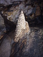
Wellucker Forest north of Koenigstein |
|
6335-302 WDPA: 555521475 |
District of Nürnberger Land , District of Amberg-Sulzbach | ⊙ | 899.00 | |||||
| Meadows and sand pit near Gaßenhof |
6436-371 WDPA: 555521549 |
Amberg-Sulzbach district | ⊙ | 24.65 |
|
|||||
|
Amphibian occurrence on the pile near Ried am Pfahl |

|
6841-372 WDPA: 555521733 |
Cham district | ⊙ | 37.13 | |||||
|
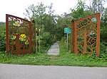
Arracher Moor |
|
6844-301 WDPA: 555521739 |
Cham district | ⊙ | 19.00 |
|
||||
| Beech forest east of Perlhütte |
6642-371 WDPA: 555521657 |
Cham district | ⊙ | 177.19 | ||||||
| Beech forests near Althütte |
6642-302 WDPA: 555521656 |
Cham district | ⊙ | 216.00 | ||||||
|
Big and Small Arber with Arber lakes |

|
6844-373 WDPA: 555521742 |
District of Cham , District of Regen | ⊙ | 2,295.20 | |||||
|
High arch |

|
6743-301 WDPA: 555521701 |
Cham district | ⊙ | 498.00 | |||||
|
Kaitersberg rock slopes |

|
6843-371 WDPA: 555521738 |
Cham district | ⊙ | 20.21 | |||||
|
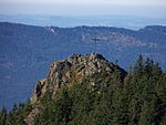
Kleiner and Großer Osser, Zwercheck and Schwarzeck |
|
6844-372 WDPA: 555521741 |
Cham district | ⊙ | 392.92 | |||||
|
Neubäuer pond |

|
6740-301 WDPA: 555521698 |
Cham district | ⊙ | 34.00 | |||||
|
NSG 'Regental slopes between Kirchenrohrbach and Zenzing' |

|
6840-301 WDPA: 555521731 |
Cham district | ⊙ | 22.00 | |||||
|
Upper course of the White Rain to Kötzting with Kaitersbachaue |

|
6844-371 WDPA: 555521740 |
District of Cham , District of Regen | ⊙ | 637.87 | |||||
|
Sand pit near Schachendorf |

|
6842-371 WDPA: 555521735 |
Cham district | ⊙ | 8.95 | |||||
|
Schwarzachtal between Hocha and Schönthal |

|
6641-371 WDPA: 555521655 |
Cham district | ⊙ | 221.79 | |||||
|
Schwarzwihrberg near Rötz |

|
6640-371 WDPA: 555521654 |
District of Schwandorf , District of Cham | ⊙ | 209.68 | |||||
| Roding training area |
6841-371 WDPA: 555521732 |
Cham district | ⊙ | 163.19 | ||||||
| Mooring southwest of Falkenstein |
6940-371 WDPA: 555521765 |
Cham district | ⊙ | 9.13 | ||||||
|
Winter roosts for the pug bat in the Upper Palatinate Forest |

|
6843-301 WDPA: 555521736 |
Cham district | ⊙ | 0.00 | |||||
|
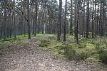
Inland dunes and Albtrauf near Neumarkt |
|
6734-371 WDPA: 555521692 |
District of Neumarkt in the Upper Palatinate | ⊙ | 734.35 | |||||
|
Beech and mixed forests around Deusmauer |

|
6735-371 WDPA: 555521694 |
District of Neumarkt in the Upper Palatinate | ⊙ | 256.41 | |||||
|
Wet biotopes near Oberhembach |

|
6633-372 WDPA: 555521647 |
District of Neumarkt in the Upper Palatinate | ⊙ | 48.46 | |||||
| Cave southwest of Markstetten |
6837-302 WDPA: 555521729 |
District of Neumarkt in the Upper Palatinate | ⊙ | 0.01 | ||||||
| Höllberg |
6634-371 WDPA: 555521648 |
District of Neumarkt in the Upper Palatinate | ⊙ | 66.14 |
|
|||||
|
Moosgraben and Dennenloher Weiher |

|
6733-371 WDPA: 555521690 |
District of Neumarkt in the Upper Palatinate | ⊙ | 321.59 | |||||
|
Schloßberg, Wolfgangshöhle and Hohllochberggruppe near Velburg |

|
6736-301 WDPA: 555521695 |
District of Neumarkt in the Upper Palatinate | ⊙ | 160.00 | |||||
| Schwarzach from the Main-Danube Canal to Obermässing |
6833-372 WDPA: 555521726 |
District of Neumarkt in the Upper Palatinate , District of Roth | ⊙ | 206.46 | ||||||
|
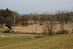
Valley moors on the Schwarzen Laaber |
|
6735-301 WDPA: 555521693 |
District of Neumarkt in the Upper Palatinate | ⊙ | 229.00 | |||||
|
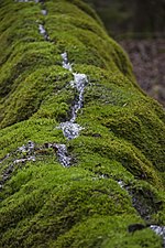
Eaves of the middle Franconian Alb in the Sulztal |
|
6834-301 WDPA: 555521727 |
District of Neumarkt in the Upper Palatinate | ⊙ | 1,224.00 | |||||
|
Dry slopes in the lower Altmühltal with Laaberleiten and Galgental |

|
7036-371 WDPA: 555521791 |
District of Neumarkt in the Upper Palatinate , District of Kelheim | ⊙ | 2,720.05 | |||||
|
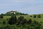
Hohenfels military training area |
|
6736-302 WDPA: 555537833 |
District of Neumarkt in the Upper Palatinate | ⊙ | 14,902.00 | |||||
| Moorings south of Allersberg and at Seligenporten |
6733-372 WDPA: 555521691 |
District of Roth , District of Neumarkt in the Upper Palatinate | ⊙ | 11.88 | ||||||
|
Weisse, Wissinger, Breitenbrunner Laaber u. Kreuzberg near Dietfurt |

|
6935-371 WDPA: 555521759 |
District of Neumarkt in the Upper Palatinate | ⊙ | 2,323.23 | |||||
|
Basalt domes in the Kemnath area |

|
6137-302 WDPA: 555521381 |
District Neustadt an der Waldnaab , District Tirschenreuth | ⊙ | 81.00 | |||||
| Rubble forests on the Pleysteiner Sulzberg |
6340-301 WDPA: 555521483 |
Neustadt an der Waldnaab district | ⊙ | 109.00 | ||||||
|
Fahrbachtal |

|
6441-301 WDPA: 555521552 |
Neustadt an der Waldnaab district | ⊙ | 444.00 | |||||
|
Heidenaab, Creussenaue and pond area northwest of Eschenbach |
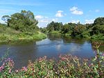
|
6237-371 WDPA: 555521426 |
Neustadt an der Waldnaab district | ⊙ | 1,866.05 | |||||
| Lohen in the Manteler forest with Schießlweiher and Straßweiher chain |
6338-301 WDPA: 555521482 |
Neustadt an der Waldnaab district | ⊙ | 772.00 | ||||||
| Stückstein natural forest reserve |
6441-302 WDPA: 555521553 |
Neustadt an der Waldnaab district | ⊙ | 83.00 | ||||||
|
Park stone |
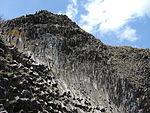
|
6238-301 WDPA: 555521427 |
Neustadt an der Waldnaab district | ⊙ | 2.00 | |||||
|
Pfreimd and Lois-Bach |

|
6340-371 WDPA: 555521484 |
Neustadt an der Waldnaab district | ⊙ | 242.58 |
|
||||
| Peat fleas |
6341-301 WDPA: 555537769 |
Neustadt an der Waldnaab district | ⊙ | 173.00 | ||||||
|
Waldnaabtal between Tirschenreuth and Windisch-Eschenbach |

|
6139-371 WDPA: 555521384 |
District Neustadt an der Waldnaab , District Tirschenreuth | ⊙ | 2,618.33 |
|
||||
|
Naab below Schwarzenfeld and Danube from Poikam to Regensburg |
|
6937-371 WDPA: 555521761 |
Regensburg , District of Regensburg , District of Kelheim | also in the district of Schwandorf | ⊙ | 1,114.77 |
|
|||
| Mussel streams south of Thalmassing |
7138-371 WDPA: 555521829 |
District of Regensburg , Kelheim | ⊙ | 45.56 | ||||||
|
Stream valleys in the Falkensteiner Vorwald |

|
6939-302 WDPA: 555521763 |
District of Regensburg , the district of Cham , district of Straubing-Bogen | ⊙ | 1,387.00 | |||||
|
Danube and oxbow lakes between Regensburg and Straubing |

|
7040-371 WDPA: 555521795 |
Regensburg district , Straubing , Straubing-Bogen district | ⊙ | 2,193.76 | |||||
| Flanks of the Naab breakthrough valley between Kallmünz and Mariaort |
6937-301 WDPA: 555521760 |
Regensburg district | ⊙ | 1,441.00 | ||||||
| Frauenforst east of Ihrlerstein and west of Dürnstetten |
7037-371 WDPA: 555521793 |
District of Regensburg , Kelheim | ⊙ | 334.53 | ||||||
|
Mausohrwochenstuben in the Upper Palatinate Jura |

|
6435-306 WDPA: 555521547 |
District of Regensburg , the district of Neumarkt in the Upper Palatinate , Amberg-Sulzbach | ⊙ | 0.00 |
|
||||
|
Black Laaber |

|
6836-371 WDPA: 555521728 |
District of Regensburg , the district of Neumarkt in the Upper Palatinate | ⊙ | 1,158.75 | |||||
| Oberhinkofen training area |
7038-371 WDPA: 555521794 |
Regensburg district | ⊙ | 526.75 | ||||||
| Valley of the Große Laaber between Sandsbach and Unterdeggenbach |
7138-372 WDPA: 555521830 |
District of Regensburg , Kelheim | ⊙ | 682.25 | ||||||
|
Dry slopes on the edge of the Danube |

|
6939-371 WDPA: 555521764 |
District of Regensburg , the district of Straubing-Bogen | Dry mixed oak forests on granite, silicate grasslands and silicate rock vegetation, on the steep southern slopes of the Danube valley. | ⊙ | 521.43 | ||||
|
Dry slopes near Kallmünz |

|
6838-301 WDPA: 555521730 |
Regensburg district | ⊙ | 280.00 | |||||
|
Dry slopes near Regensburg |

|
6938-301 WDPA: 555521762 |
Regensburg district , Regensburg , Kelheim district | ⊙ | 377.00 | |||||
|
Forests in the Danube Valley |

|
7040-302 WDPA: 555579395 |
District of Regensburg , the district of Straubing-Bogen | ⊙ | 1,289.00 | |||||
| Amphibian habitats around Etsdorf |
6538-371 WDPA: 555521598 |
County Schwandorf , Amberg-Sulzbach | ⊙ | 34.11 | ||||||
| Bavarian Schwarzach and Biberbach |
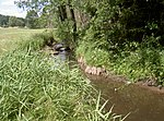
|
6541-371 WDPA: 555521601 |
District of Schwandorf , District of Cham | ⊙ | 530.40 | |||||
|
Chamb, Regentalaue and Regen between Roding and the mouth of the Danube |

|
6741-371 WDPA: 555521700 |
County Schwandorf , district of Regensburg , the district of Cham | also in Regensburg | ⊙ | 3,193.53 | ||||
|
Charlottenhofer Weihergebiet, Hirtlohweiher and Langwiedteiche |

|
6639-372 WDPA: 555537819 |
Schwandorf district | ⊙ | 930.68 | |||||
|
Kulzer moss |

|
6640-301 WDPA: 555521653 |
Schwandorf district | ⊙ | 83.00 | |||||
|
Mouse-eared colonies in the Upper Palatinate-Bavarian Forest natural area |

|
6540-302 WDPA: 555521599 |
County Schwandorf , district of Regensburg , the district of Cham | also in the district of Deggendorf, district of Freyung-Grafenau | ⊙ | 0.00 | ||||
|
Münchshofener Berg |

|
6738-371 WDPA: 555521696 |
Schwandorf district | ⊙ | 180.57 | |||||
|
Pfreimdtal and Kainzbachtal |

|
6439-371 WDPA: 555521551 |
County Schwandorf , Neustadt an der Waldnaab | ⊙ | 334.43 | |||||
| Rain valley slopes near Hirschling |
6739-301 WDPA: 555521697 |
District of Schwandorf , District of Regensburg | ⊙ | 352.00 | ||||||
|
Serpentine sites in the northern Upper Palatinate |
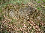
|
6138-372 WDPA: 555521383 |
County Schwandorf , Neustadt an der Waldnaab , Tirschenreuth | ⊙ | 119.19 | |||||
| Training area in Oberviechtach |
6540-371 WDPA: 555521600 |
Schwandorf district | ⊙ | 240.38 | ||||||
|
Schwarzach, Auerbach and Ascha valley system |

|
6639-371 WDPA: 555521652 |
Schwandorf district | ⊙ | 784.25 | |||||
|
Vils from Vilseck to the confluence with the Naab |

|
6537-371 WDPA: 555521596 |
County Schwandorf , Amberg-Sulzbach , Amberg | also in the district of Regensburg | ⊙ | 621.95 | ||||
| Forest pond area in the Postloher Forest |
6740-302 WDPA: 555521699 |
District of Schwandorf , District of Cham | ⊙ | 418.00 |
|
|||||
| Basalt hilltops in the Northern Upper Palatinate |
6039-301 WDPA: 555521329 |
Tirschenreuth district | ⊙ | 224.00 | ||||||
| Altglashütte mountain meadow area |
6240-301 WDPA: 555521428 |
Tirschenreuth district | ⊙ | 72.00 | ||||||
| Grenzbach and Heinbach im Steinwald |
6138-371 WDPA: 555521382 |
Tirschenreuth district | ⊙ | 165.80 | ||||||
|
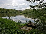
Haidenaabtal and Gabellohe |
|
6137-301 WDPA: 555521380 |
County Bayreuth , Tirschenreuth | ⊙ | 112.00 | |||||
|
Moor area near Bärnau |

|
6240-302 WDPA: 555521429 |
Tirschenreuth district | ⊙ | 53.00 | |||||
| Disk meadow near Ebnath |
6037-372 WDPA: 555521328 |
Tirschenreuth district | ⊙ | 3.41 | ||||||
| Seibertsbachtal |
6039-372 WDPA: 555521331 |
Tirschenreuth district | ⊙ | 39.56 | ||||||
| Spirkenmoor near Griesbach |
6141-301 WDPA: 555521385 |
Tirschenreuth district | ⊙ | 67.00 | ||||||
| Wondreb between Leonberg and Waldsassen |
6039-371 WDPA: 555521330 |
Tirschenreuth district | ⊙ | 95.09 | ||||||
| Wondrebaue and adjacent pond areas |
6040-371 WDPA: 555521332 |
Tirschenreuth district | ⊙ | 235.52 | ||||||
| Legend for fauna-flora-habitat | ||||||||||
See also
- List of nature reserves in the Upper Palatinate
- List of landscape protection areas in the Upper Palatinate
- List of EU bird sanctuaries in the Upper Palatinate
- List of geotopes in the Upper Palatinate
Web links
Commons : FFH areas in the Upper Palatinate - collection of images, videos and audio files