List of FFH areas in Upper Franconia
The list of FFH areas in Upper Franconia includes the following lists of FFH areas in Upper Franconian counties and cities from the article namespace:
- List of FFH areas in the Bamberg district
- List of FFH areas in the city of Bamberg
- List of FFH areas in the Bayreuth district
- List of FFH areas in the city of Bayreuth
- List of FFH areas in the district of Coburg
- List of FFH areas in the city of Coburg
- List of FFH areas in the Forchheim district
- List of FFH areas in the district of Hof
- List of FFH areas in the district of Kronach
- List of FFH areas in the district of Kulmbach
- List of FFH areas in the Lichtenfels district
- List of FFH areas in the Wunsiedel district
The selection corresponds to the administrative region of Upper Franconia . There are 113 FFH areas in the administrative district (as of March 2016).
| Surname | image | Identifier
|
circle | details | position | Area hectares |
date
|
|||
|---|---|---|---|---|---|---|---|---|---|---|
| Albtrauf from the Friesener Warte to the Long Mile |
6132-371 WDPA: 555521375 |
Bamberg district , the district of Forchheim | ⊙ | 1,886.41 | ||||||
|
Albtrauf from Dörnwasserlos to Zeegendorf |

|
6032-371 WDPA: 555521318 |
Bamberg district | ⊙ | 3,063.17 | |||||
| Baunachtal between Reckendorf and Baunach |
5931-373 WDPA: 555521245 |
Bamberg district | ⊙ | 94.02 | ||||||
|
Beech forests and meadow valleys of the Nordsteigerwald |

|
6029-371 WDPA: 555521310 |
Bamberg district , district Haßberge , district of Schweinfurt | ⊙ | 15,876.84 | |||||
| Daschendorfer Forest |
5931-371 WDPA: 555521243 |
Bamberg district | ⊙ | 820.41 | ||||||
|
Slopes on the Kraiberg |

|
5931-372 WDPA: 555521244 |
Bamberg district | ⊙ | 94.80 | |||||
| Main valley from Staffelstein to Hallstadt |
5931-374 WDPA: 555521246 |
Bamberg district , district Lichtenfels | ⊙ | 717.14 | ||||||
|
Main valley slopes around Viereth-Trunstadt and Oberhaid |

|
6030-371 WDPA: 555521315 |
Bamberg district | ⊙ | 245.07 | |||||
| Mouse-ear colonies in Lohndorf, Ehrl and Amlingstadt |
6032-301 WDPA: 555521317 |
Bamberg district | ⊙ | 0.00 | ||||||
|
Middle Aurach valley from Priesendorf to Walsdorf |

|
6030-303 WDPA: 555521314 |
Bamberg district | ⊙ | 122.00 | |||||
|
Dry grass, meadows and forests around Weismain |
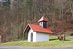
|
5933-371 WDPA: 555521250 |
Bamberg district , district Lichtenfels | ⊙ | 1,990.05 | |||||
|
Wiesent valley with side valleys |
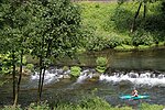
|
6233-371 WDPA: 555521422 |
Bamberg district , the district of Bayreuth , the district of Forchheim | ⊙ | 6,934.41 |
|
||||
|
Backwaters at the Regnitz estuary near Bamberg and Viereth |

|
6031-371 WDPA: 555521316 |
Bamberg , Bamberg district | ⊙ | 150.97 | |||||
|
Bruderwald with natural forest reserve Wolfsruhe |

|
6131-302 WDPA: 555521372 |
Bamberg | ⊙ | 462.00 | |||||
|
Regnitz, Stocksee and sandy areas from Neuses to Hallstadt |

|
6131-371 WDPA: 555521373 |
Bamberg , Bamberg district , the district of Forchheim | ⊙ | 259.35 | |||||
|
Meadows around the Altenburg near Bamberg |
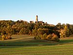
|
6131-372 WDPA: 555521374 |
Bamberg , Bamberg district | ⊙ | 56.75 |
|
||||
| Maple Valley |
6134-371 WDPA: 555521377 |
Bayreuth district | ⊙ | 314.27 | ||||||
| Mountain and moor meadows near Kornbach |
5936-302 WDPA: 555521256 |
Bayreuth district | ⊙ | 41.00 | ||||||
|
Mountain meadows in the southern Fichtel Mountains |
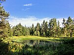
|
6037-371 WDPA: 555521327 |
District of Bayreuth , the district Wunsiedel | ⊙ | 384.87 | |||||
| Bernecker cliffs |
5936-301 WDPA: 555521255 |
Bayreuth district | ⊙ | 115.00 | ||||||
| Blumenau near Bad Berneck |
5935-303 WDPA: 555521254 |
County Bayreuth , district of Kulmbach | ⊙ | 71.00 | ||||||
| Ehrlichbachaue near Obernsees |
6034-302 WDPA: 555521320 |
Bayreuth district | ⊙ | 7.00 | ||||||
| Wetlands in the Limmersdorfer Forest |
5934-302 WDPA: 555521251 |
County Bayreuth , district of Kulmbach | ⊙ | 135.00 | ||||||
| Haidenaab spring moors |
6036-301 WDPA: 555521326 |
Bayreuth district | ⊙ | 11.00 | ||||||
| Haidenaabtal and Gabellohe |
6137-301 WDPA: 555521380 |
County Bayreuth , Tirschenreuth | ⊙ | 112.00 | ||||||
| Heinersreuther Bach |
5936-371 WDPA: 555521258 |
Bayreuth district | ⊙ | 44.30 | ||||||
|
Caves of the northern Franconian Alb |

|
6335-305 WDPA: 555521476 |
District of Nürnberger Land , District of Bayreuth , District of Amberg-Sulzbach | Winter quarters for the great mouse-eared mouse and other bat species in natural karst caves. | ⊙ | 0.01 | ||||
| Kalktufmoorwiese near Wohnsdorf |
6034-303 WDPA: 555521321 |
Bayreuth district | ⊙ | 14.00 | ||||||
| Landscape component 'Niederwald bei Kosbrunn' |
6234-301 WDPA: 555521424 |
Bayreuth district | ⊙ | 14.00 | ||||||
| Mouse-eared colonies in the Upper Main Hills natural area |
5733-302 WDPA: 555521096 |
County Bayreuth , County Kulmbach , County Kronach | ⊙ | 0.00 | ||||||
| Mouse-ear colonies in Franconian Switzerland |
6134-301 WDPA: 555521376 |
Bayreuth district | ⊙ | 2.00 | ||||||
|
Shell limestone slopes northeast of Bayreuth |

|
6035-371 WDPA: 555521323 |
Bayreuth district , Bayreuth | ⊙ | 375.54 | |||||
|
Nature reserve 'Craimoosweiher' |

|
6135-301 WDPA: 555521378 |
Bayreuth district | ⊙ | 19.00 | |||||
|
Eastern Vogelherd in the Veldenstein Forest |

|
6335-372 WDPA: 555521479 |
District of Nürnberger Land , District of Bayreuth | ⊙ | 248.52 | |||||
|
Pegnitz between Michelfeld and Hersbruck |

|
6335-371 WDPA: 555521478 |
District of Nürnberger Land , District of Amberg-Sulzbach , District of Bayreuth | ⊙ | 310.54 | |||||
|
Rhätschluchten west of Bayreuth |

|
6034-301 WDPA: 555521319 |
Bayreuth district , Bayreuth | ⊙ | 37.00 | |||||
| Rotmain, Mistelbach and Ölschnitztal around Bayreuth |
6035-372 WDPA: 555521324 |
Bayreuth district , Bayreuth , Kulmbach district | ⊙ | 705.21 | ||||||
|
Schneeberg massif with Fichtelseemoor |
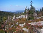
|
5937-371 WDPA: 555521261 |
District of Bayreuth , the district Wunsiedel | ⊙ | 3,047.79 | |||||
| Forests southwest of Betzenstein |
6334-371 WDPA: 555521474 |
Bayreuth district | ⊙ | 62.60 | ||||||
| Intermediate moors north of Creußen |
6135-302 WDPA: 555521379 |
Bayreuth district | ⊙ | 3.00 |
|
|||||
|
Buchstein |

|
6035-302 WDPA: 555521322 |
Bayreuth | ⊙ | 13.00 | |||||
| Hermitage in Bayreuth |
Bayreuth WDPA: 555521325 |
Bayreuth | ⊙ | 38.72 |
|
|||||
| Alster floodplain from the state border to the mouth |
5830-301 WDPA: 555521167 |
District of Haßberge , District of Coburg | ⊙ | 132.00 | ||||||
| Broken clods in the Coburg district |
5732-371 WDPA: 555521093 |
District of Coburg | ⊙ | 99.84 | ||||||
| Eierberge near Banz and parts of the Banz forest |
5831-372 WDPA: 555521169 |
Coburg , district of Lichtenfels | ⊙ | 651.89 | ||||||
|
Wetlands around Rottenbach |

|
5631-372 WDPA: 555521024 |
District of Coburg | ⊙ | 31.31 | |||||
| Bat winter quarters in the Coburg region |
5732-372 WDPA: 555521094 |
District of Coburg | ⊙ | 3.50 | ||||||
| 'Heiligenwiese and Heiligenleite' and 'Althellinger Grund' |
5730-301 WDPA: 555521084 |
District of Coburg | ⊙ | 138.00 | ||||||
| Itztal from Coburg to Baunach |
5831-373 WDPA: 555521170 |
District of Coburg , District of Haßberge , Coburg | ⊙ | 1,452.01 | ||||||
| Lauterburg |
5632-303 WDPA: 555521027 |
District of Coburg | ⊙ | 0.00 | ||||||
| Habitat of the Wiesenknopf blue flies south of Coburg |
5731-305 WDPA: 555521092 |
Coburg , district of Lichtenfels | ⊙ | 26.00 | ||||||
|
Muggenbach clay pits |

|
5730-302 WDPA: 555521085 |
District of Coburg | ⊙ | 23.00 | |||||
|
Muschelkalkzug from the Long Mountains to Weißenbrunn v. Forest |

|
5631-371 WDPA: 555521023 |
District of Coburg , Coburg | ⊙ | 1,975.74 | |||||
| Nature reserve 'Großer Teich and Tambachaue' |
5731-303 WDPA: 555521091 |
District of Coburg | ⊙ | 19.00 | ||||||
| Nature reserve 'bird sanctuary Glender Wiesen' |
5731-301 WDPA: 555521089 |
District of Coburg , Coburg | ⊙ | 169.00 | ||||||
| Eastern Mönchrödener forest |
5632-371 WDPA: 555521029 |
District of Coburg | ⊙ | 215.82 | ||||||
|
Rodachaue with Bischofsaue west of Bad Rodach |

|
5630-371 WDPA: 555521019 |
District of Coburg | ⊙ | 264.91 | |||||
| Rodacher forest with rest hill |
5630-372 WDPA: 555521020 |
District of Coburg | ⊙ | 708.08 | ||||||
| Röderbach, Biberbach and Schneybach valleys |
5732-373 WDPA: 555521095 |
Coburg , district of Lichtenfels | ⊙ | 126.02 | ||||||
| Steinach and Föritztal and Rodach from Fürth aB to Marktzeuln |
5733-371 WDPA: 555521098 |
District of Coburg , District of Lichtenfels , District of Kronach | ⊙ | 585.74 | ||||||
| Valley of the Upper Itz |
5632-302 WDPA: 555521026 |
District of Coburg | ⊙ | 228.00 | ||||||
| Veste Coburg, Bausenberger and Callenberger Forst |
5731-302 WDPA: 555521090 |
District of Coburg , Coburg | ⊙ | 247.00 | ||||||
| Meadows east and west of Unterlauter b. Coburg |
5631-373 WDPA: 555521025 |
District of Coburg | ⊙ | 65.41 |
|
|||||
| Buchenberg |
6233-303 WDPA: 555521421 |
Forchheim district | ⊙ | 210.00 | ||||||
|
Büg near Eggolsheim |

|
6232-371 WDPA: 555521420 |
Forchheim district | ⊙ | 67.18 | |||||
| Eglofsteiner pond |
6232-304 WDPA: 555521419 |
Forchheim district | ⊙ | 17.00 | ||||||
|
Honorary title and cats heads |

|
6233-372 WDPA: 555521423 |
Forchheim district | ⊙ | 905.67 | |||||
| Flat moors near Kunreuth |
6332-372 WDPA: 555521470 |
Forchheim district | ⊙ | 14.28 | ||||||
| Landscape component 'Kröttental' |
6332-301 WDPA: 555521467 |
Forchheim district | ⊙ | 17.00 | ||||||
|
Langenbachgrund and Haarweiherkette |

|
6230-371 WDPA: 555521415 |
Forchheim district | ⊙ | 151.60 | |||||
| Lias pit at Unterstürmig |
6232-301 WDPA: 555521417 |
Forchheim district | ⊙ | 12.00 | ||||||
|
Lillinger Forest |

|
6333-372 WDPA: 555521473 |
Forchheim district | ⊙ | 174.78 | |||||
|
Markwald near Baiersdorf |

|
6332-371 WDPA: 555537764 |
Erlangen-Höchstadt , Forchheim district | ⊙ | 308.09 | |||||
| Örtlbergweiher with Örtlberg |
6232-303 WDPA: 555521418 |
Forchheim district , Amberg-Sulzbach | ⊙ | 217.00 | ||||||
|
Orchards, head oaks and springs on the Hetzleser Berg |

|
6333-371 WDPA: 555521472 |
Forchheim district | ⊙ | 1,438.49 | |||||
| Untere Mark forest area |
6231-371 WDPA: 555521416 |
Forchheim district | ⊙ | 815.65 |
|
|||||
| Hammerleite natural forest reserve |
5735-301 WDPA: 555521103 |
Hof district | ⊙ | 53.00 | ||||||
|
Waldstein natural forest reserve |

|
5837-301 WDPA: 555521178 |
Hof district | ⊙ | 22.00 | |||||
| North-east Bavarian stream valleys around Rehau |
5738-371 WDPA: 555521105 |
District of Hof , District of Wunsiedel in the Fichtel Mountains | ⊙ | 470.53 | ||||||
| Saaletal v. Joditz to Blankenstein u. NSG Tannbach b. Mödlareuth |
5536-371 WDPA: 555520917 |
Hof district | ⊙ | 337.69 | ||||||
|
Selbitz, Muschwitz and Höllental |

|
5636-371 WDPA: 555521033 |
District of Hof , District of Kronach | ⊙ | 436.66 | |||||
|
Serpentine locations on Haidberg southwest of Zell |

|
5836-371 WDPA: 555521177 |
Hof district | ⊙ | 61.02 | |||||
| Quarry area east of Selbitz |
5636-302 WDPA: 555521032 |
Hof district | ⊙ | 35.00 | ||||||
| Valleys and clearing islands in the Franconian Forest with Geroldsgrüner Forest |
5634-371 WDPA: 555521031 |
District of Hof , District of Kronach | ⊙ | 1,883.67 | ||||||
|
Woja- and Haidleite |

|
5737-371 WDPA: 555521104 |
Hof district | ⊙ | 42.36 |
|
||||
| Rosenberg Fortress and Plassenburg |
5733-303 WDPA: 555521097 |
District of Kronach , District of Kulmbach | ⊙ | 0.00 | ||||||
| Haderholz |
5533-302 WDPA: 555520913 |
District of Kronach | ⊙ | 23.00 | ||||||
| Lean lime lawn between Vogtendorf and Wötzelsdorf |
5734-304 WDPA: 555521102 |
District of Kronach | ⊙ | 89.00 | ||||||
| Mausohrwochenstube in Steinwiesen |
5734-301 WDPA: 555521099 |
District of Kronach | ⊙ | 0.00 | ||||||
|
Rabensteiner Höhe with the Zeyerner wall |

|
5734-302 WDPA: 555521100 |
District of Kronach | ⊙ | 13.00 |
|
||||
| Zeyerner reason |
5734-303 WDPA: 555521101 |
District of Kronach | ⊙ | 203.00 |
|
|||||
|
Alb eaves slopes between Görau and Thurnau |

|
5934-371 WDPA: 555521252 |
County Kulmbach , County Lichtenfels | ⊙ | 303.10 |
|
||||
| Wetland with bog south of Hohenberg |
5835-371 WDPA: 555521175 |
District of Kulmbach | ⊙ | 56.86 | ||||||
| Landscape component 'Peterleinstein' |
5835-302 WDPA: 555521174 |
District of Kulmbach | ⊙ | 12.00 | ||||||
| Lindau Moor |
5935-302 WDPA: 555521253 |
District of Kulmbach | ⊙ | 27.00 | ||||||
| Main meadow and limestone slopes between Kauerndorf and Trebgast |
5835-372 WDPA: 555521176 |
District of Kulmbach | ⊙ | 397.66 |
|
|||||
| Schwalbenstein |
5933-302 WDPA: 555521249 |
District of Kulmbach | ⊙ | 14.00 | ||||||
|
Steinachtal with the Kühberg natural forest reserve |

|
5835-301 WDPA: 555521173 |
District of Kulmbach | ⊙ | 85.00 |
|
||||
|
Albtrauf in the Lichtenfels district |

|
5932-371 WDPA: 555521247 |
Lichtenfels district | ⊙ | 1,852.97 |
|
||||
| Main valley from Theisau to Lichtenfels |
5833-371 WDPA: 555521172 |
Lichtenfels district | ⊙ | 871.71 | ||||||
| Mouse-ear colonies in the Haßberge and in the Itz-Baunach hill country |
5929-302 WDPA: 555521236 |
County Haßberge , district of Lichtenfels | ⊙ | 0.00 |
|
|||||
| Southern State Forest Langheim |
5832-371 WDPA: 555521171 |
Lichtenfels district | ⊙ | 185.50 | ||||||
| Forest areas Buchrangen and Spendweg |
5932-372 WDPA: 555521248 |
Lichtenfels district | ⊙ | 651.11 |
|
|||||
| Buchberg near Reicholdsgrün |
5837-302 WDPA: 555521179 |
District of Wunsiedel in the Fichtel Mountains | ⊙ | 23.00 | ||||||
|
Eger and Röslautal |
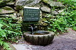
|
5838-302 WDPA: 555521181 |
District of Wunsiedel in the Fichtel Mountains | ⊙ | 941.00 | |||||
|
Wetlands around Selb and Großwendern |

|
5838-372 WDPA: 555521183 |
District of Wunsiedel in the Fichtel Mountains | ⊙ | 195.58 | |||||
| Habitat of the scabiosa pied butterfly near Selb |
5838-371 WDPA: 555521182 |
District of Wunsiedel in the Fichtel Mountains | ⊙ | 21.25 | ||||||
| Kösseinetal |
5938-301 WDPA: 555521262 |
District of Wunsiedel in the Fichtel Mountains | ⊙ | 23.00 | ||||||
|
Luisenburg, the summit of the Große Köseine and the Kleines Labyrinth |

|
5937-304 WDPA: 555521260 |
District of Wunsiedel in the Fichtel Mountains | ⊙ | 62.00 | |||||
| Nature reserve 'Naturwaldreservat Hengstberg' |
5839-302 WDPA: 555521184 |
District of Wunsiedel in the Fichtel Mountains | ⊙ | 40.00 | ||||||
| Paradise ponds |
5837-303 WDPA: 555521180 |
District of Wunsiedel in the Fichtel Mountains | ⊙ | 14.00 | ||||||
| Peat bog hell |
5936-303 WDPA: 555521257 |
District of Wunsiedel in the Fichtel Mountains | ⊙ | 125.00 | ||||||
|
Zeitelmoos near Wunsiedel |
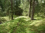
|
5937-301 WDPA: 555521259 |
District of Wunsiedel in the Fichtel Mountains | ⊙ | 398.00 | |||||
| Legend for fauna-flora-habitat | ||||||||||
See also
- List of nature reserves in Upper Franconia
- List of landscape protection areas in Upper Franconia
- List of EU bird protection areas in Upper Franconia
- List of geotopes in Upper Franconia
Web links
Commons : FFH areas in Upper Franconia - collection of images, videos and audio files